All Activity
- Past hour
-
Thread explaining why I think chances for tropical development in the NW Caribbean and Gulf of Mexico ramp up significantly around Jun 4-10. https://x.com/yconsor/status/1926690131181731976
-
After the great success of the Chester County Facebook Weather page with now over 11k followers I am starting a new Jersey Shore focused weather and observation page for all of those interested in Jersey Shore and beach weather insights - come join us ! Thanks to all!! https://www.facebook.com/groups/jerseyshoreweather/
-

E PA/NJ/DE Spring 2025 Obs/Discussion
ChescoWx replied to PhiEaglesfan712's topic in Philadelphia Region
After the great success of the Chester County Facebook Weather page with now over 11k followers I am starting a new Jersey Shore focused weather and observation page for all of those interested in Jersey Shore and beach weather insights - come join us ! Thanks to all!! https://www.facebook.com/groups/jerseyshoreweather/ -
Finally sun. Looks like some dry air is advecting in from the N-NE.

-
It's becoming more difficult to bet on the change to warmer/hotter weather. The pattern of the cold cyclonic flow aloft keeps repeating itself to the point that I think it's going to be very hard to get out of this. Each time a curly cue upper low develops it helps the trough deepen along the coast allowing for more of them. Meanwhile the height rises/warmth and heat are well over the top and staying to our west. As I see it now this could be the story through a good part of June even. We may be waiting until the last week of June or first half of July to see our first 90+ degree day. For now it looks as though rainfall continues to be near to above average with mainly cooler than normal temps, maybe a few isolated warm days here and there but no warmer than normal pattern. WX/PT
-
We’re about to get blasted with a strong thunderstorm. The CTG lightning is bad.
-
In Calvert we've gotten enough rain to be close to average but definitely not the excess some areas have seen to really reverse the long term drought. Hopefully it'll get whittled away though.
-
Going down to Ocean City Tues to Fri and of course the forecast is garbage.
-
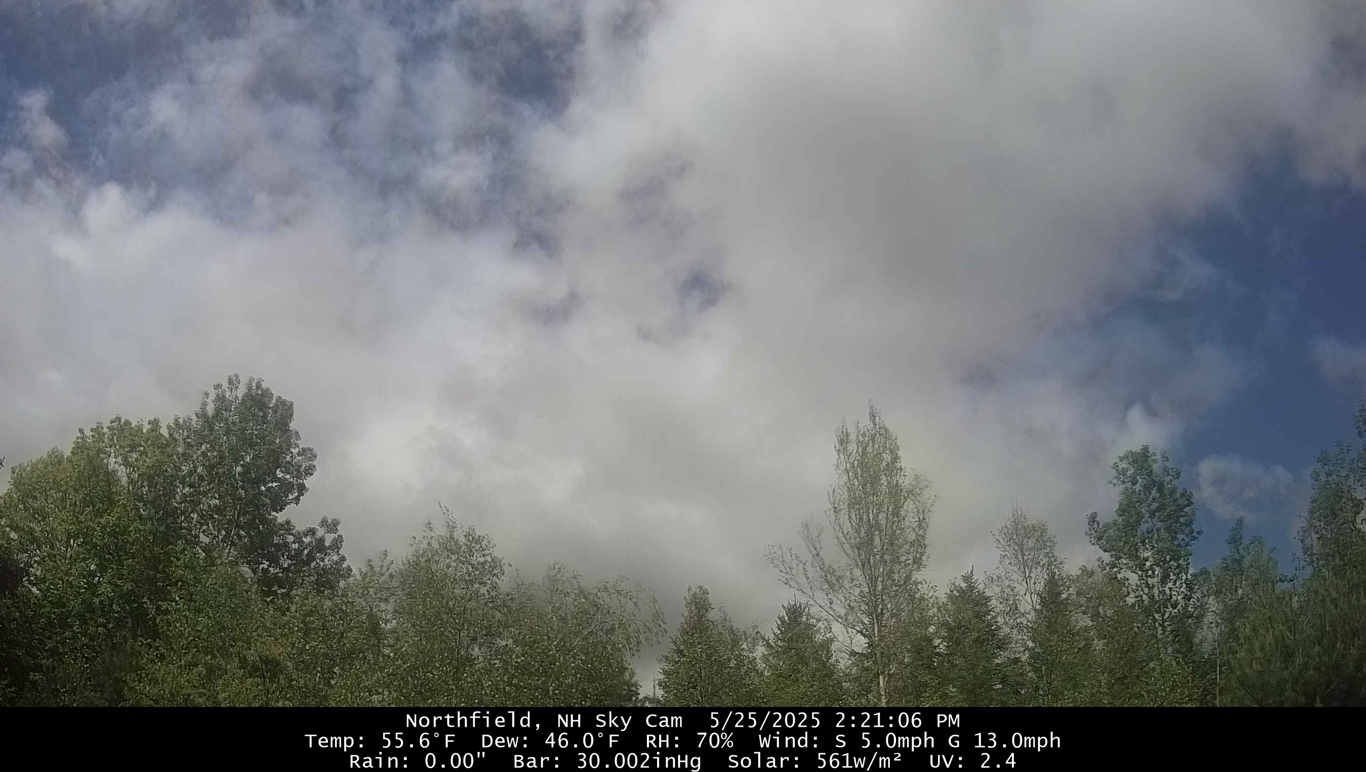
Kind of meh with all these clouds. Figured the clouds would win today but was hoping it would be more of a mix
-
Enjoyed last evening once it was clear, felt better. Then first thing this morning walked quite a bit while it was sunny with the green everywhere established. Now back to overcast as of 10:30, this is unreal. Still feels chilly too.
-
Take the nearest rooftop thermo and add 5.
-
NE
- Today
-
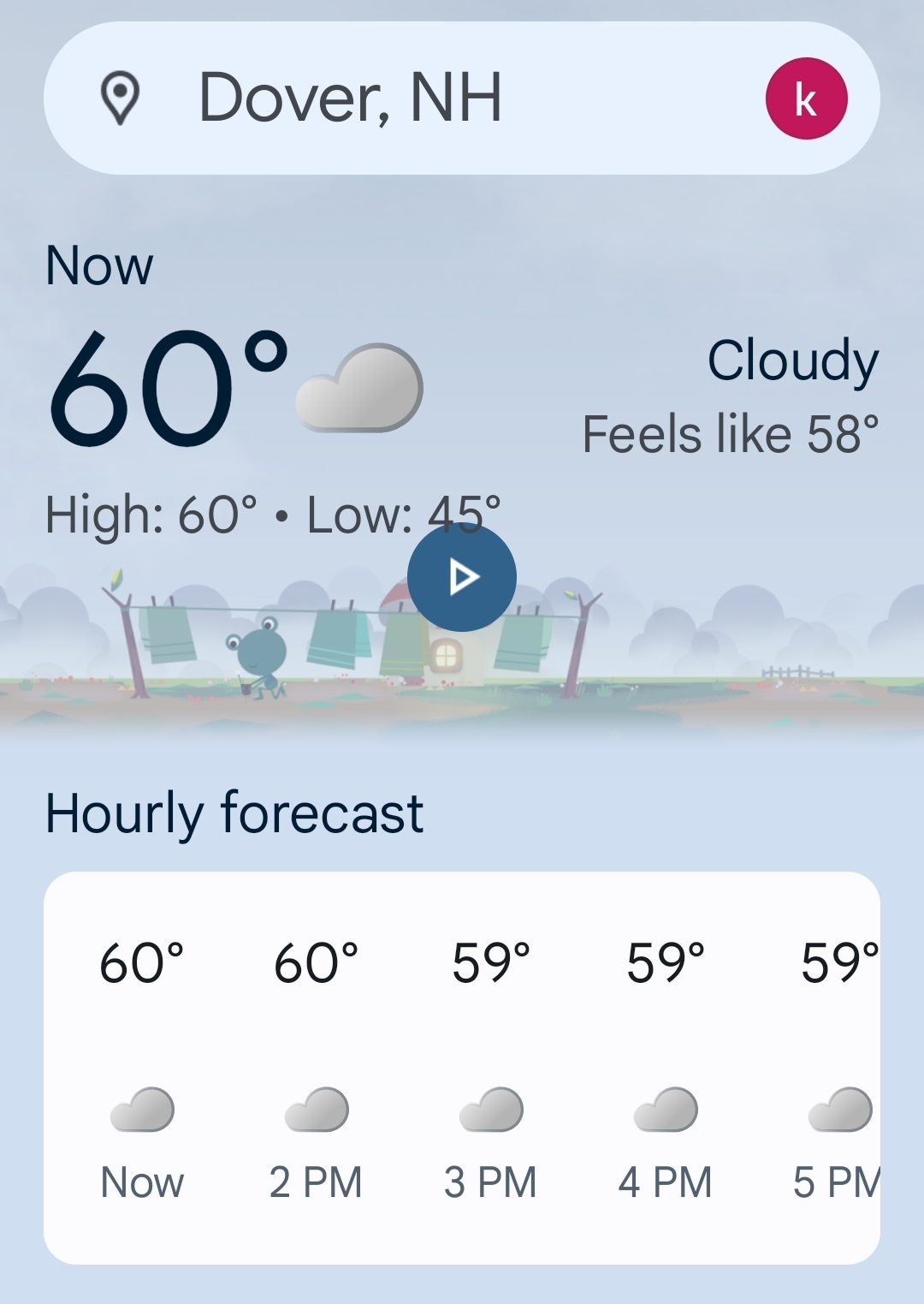
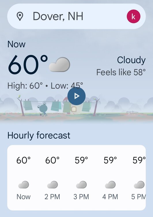
Sunny and 68.
-
it might be decades before we get another long beautiful stretch of cool pleasant temps in mid to late may..
-
Yes, the skies are getting brighter and the sun just came out here again just now!
-
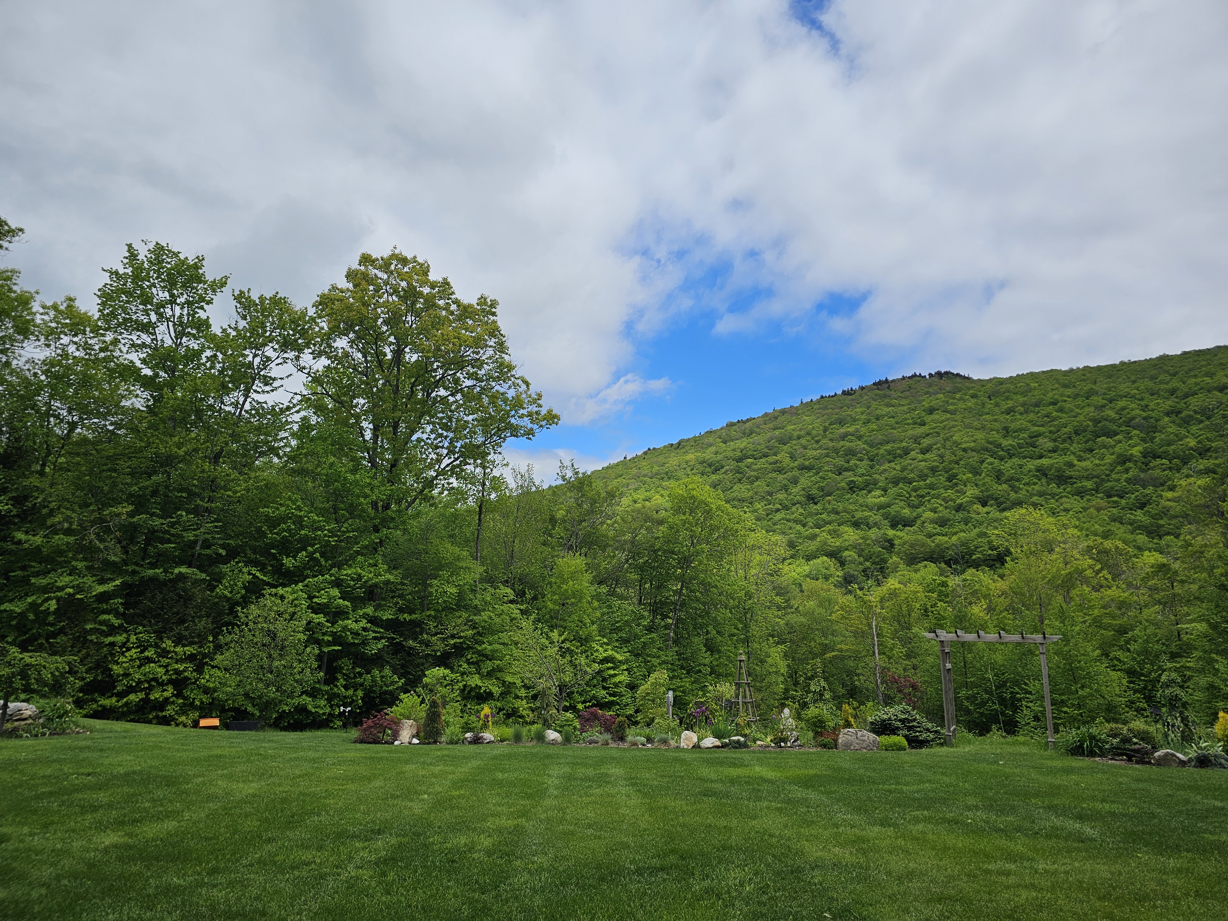
What direction is that looking? I love that view.
-
This is the most blue sky I have seen in 8-9 days.. even bright overcast has been a win.

-
59 at the Vatican. Pope-A-Wheelie kind of day.
-
Not even sure it’s that humid.
-
 Halbel76 joined the community
 -
It’s a WAN look with dews. Call it what you want. It’s coming
-
ULL always are pesky to clear out with the cold air aloft, was always weary of the partly - mostly sunny forecasts till monday. THink we go back to partly sunny later this afternoon.
-
It’s not a hot look
-
what exactly is keeping that pesky low from moving, Tony? it moved enough to get the rain out of here after Friday but then it stopped again?
-
it was sunny all morning, the clouds only came in the last hour or two.
-
Southern regions were better because we were further away from that pesky low. We had sunshine in the morning and later in the day, the period of cloud cover was 2-3 hours between 11 am and 2 pm.