All Activity
- Past hour
-

Feb 10-11 Mid Week Minor Event - Ride the hot hand?
Damage In Tolland replied to HoarfrostHubb's topic in New England
2-4 -
Feb 10-11 Mid Week Minor Event - Ride the hot hand?
Snowcrazed71 replied to HoarfrostHubb's topic in New England
Where... For north of Ct? -

Feb 10-11 Mid Week Minor Event - Ride the hot hand?
Ginx snewx replied to HoarfrostHubb's topic in New England
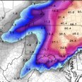
HRRR did absolutely fantastic in my hood last storm. Yea you should be good for wsw level snow -

Feb 10-11 Mid Week Minor Event - Ride the hot hand?
CoastalWx replied to HoarfrostHubb's topic in New England
00z hrrr juiced up a tad. -
must have missed nj altogether.. i remember a few slushy inches around that time....perhaps that was the one?
-
How are your palm trees holding up in this cold winter?
-

Central PA Winter 25/26 Discussion and Obs
mahantango#1 replied to MAG5035's topic in Upstate New York/Pennsylvania
Some tv mets. are writing the storm off. -

Feb 10-11 Mid Week Minor Event - Ride the hot hand?
WinterWolf replied to HoarfrostHubb's topic in New England
Ehhh…wasn’t it the only one showing the Feb 1st storm after everything else jumped ship? It was on an island by itself, and then caved in. In its hay day for sure. Not anymore unfortunately. When it’s alone now, it seems to cave more often than not. But oh well. -

Feb 10-11 Mid Week Minor Event - Ride the hot hand?
dendrite replied to HoarfrostHubb's topic in New England
I still think this is a little precarious of a setup south of the Pike, but we’ll see how it goes. The leading edge WAA precip is a little too far north and then you’re relying on the mid level cold front delivering…there’s a little low level dry air to start too. It may end up like a wild 1-2 hour line of snow with mixed graupel initially. -
Today's EWR: 33 / 11 (-12) NYC: 31 / 10 (-15) Mid 30s Tuesday - 40 or above Wed
-

Feb 10-11 Mid Week Minor Event - Ride the hot hand?
Damage In Tolland replied to HoarfrostHubb's topic in New England
Is turning into a WSW? -

Feb 10-11 Mid Week Minor Event - Ride the hot hand?
WinterWolf replied to HoarfrostHubb's topic in New England
I agree. If we can pick up a few more systems over the next 5-6 weeks that can produce…it’ll be a great one for me too. I said the other day that I’m feeling upper B+right now. -

Feb 10-11 Mid Week Minor Event - Ride the hot hand?
dendrite replied to HoarfrostHubb's topic in New England
HRRR is almost a half inch of liquid here. -
Central PA Winter 25/26 Discussion and Obs
Blizzard of 93 replied to MAG5035's topic in Upstate New York/Pennsylvania
Here are CTP’s thoughts on the Sunday Winter storm chance. KEY MESSAGE 2: Risk managing potential for Valentine`s Day weekend storm Aside from the 09/12Z GFS to some extent, an ensemble consensus including ECMWF, CMC, NBM, and AI runs would lean toward an increasing potential for wintry weather arriving by the second half of Valentine`s Day weekend. That said, there is still plenty of time and space between now and then. Wintry weather/impacts, particularly details surrounding how much and what ptypes, are uncertain/unclear. Confidence right now is on low side, but the potential certainly exists and will need to be monitored in the coming days. -

Is we back? February discussion thread
RUNNAWAYICEBERG replied to mahk_webstah's topic in New England
Puke -

Feb 10-11 Mid Week Minor Event - Ride the hot hand?
ORH_wxman replied to HoarfrostHubb's topic in New England
Yeah it is still the best model. But as we’ve said so many times, it isn’t just the utterly dominant force relative to other guidance that it was in the 2000s/2010s. The gap has been closed some. The way you know deep down it’s still the best is that every single person here if they had to pick a model to be on an island showing the solution they want, they’d still pick the euro. Nobody is picking any other global model to be on an island in the medium range. -
Is we back? February discussion thread
Great Snow 1717 replied to mahk_webstah's topic in New England
Nah man not the snow but the scent from the palm trees in Billerica -
Feb 10-11 Mid Week Minor Event - Ride the hot hand?
Kitz Craver replied to HoarfrostHubb's topic in New England
All joking aside, the nearly constant cold, snowpack and overall tenor, I’m close to an A grade at my location as it stands. -

Feb 10-11 Mid Week Minor Event - Ride the hot hand?
dendrite replied to HoarfrostHubb's topic in New England
I had birch seeds blow onto my fresh snow…need to cover that up. -
Actually hit 72-78 throughout the region
-
That’s gotta be it, fully saturated column but no lift generating freezing fog… suddenly the model thinks there’s lift once it sees the terrain
-
Just saw on the memories in my Iphone, today in 2017 was a blizzard for many of us. Was in the 60s the day before, 2/8/17, with a winter storm watch for 8-12" of snow for the next day. I remember how many people in my inner circle couldn't believe it would snow the next day. Precip started out as rain around 40 degrees around 4 am, and then temps crashed and it was snowing by 5:30 or so. Very heavy snow all morning, 9-12" here in NYC, and a blizzard just to the east of us. Great storm, followed by deep cold.
-

Central PA Winter 25/26 Discussion and Obs
pawatch replied to MAG5035's topic in Upstate New York/Pennsylvania
Tuesday night a chance of freezing rain…yuck. It was a nice day today but never got above freezing. 26 degrees was the high.


.thumb.png.f06c8cd5dd6d6262ea965faec9fc2e10.png)

