All Activity
- Past hour
-
Got 0.28" from the line. Hoping for more tonight
-
anyone over 45 with sufficient financial resources won't need to worry too much, those folks will be able to deploy financial resources to adequately cope with the increasing effects of AGW long enough until their mortal time on earth concludes
-

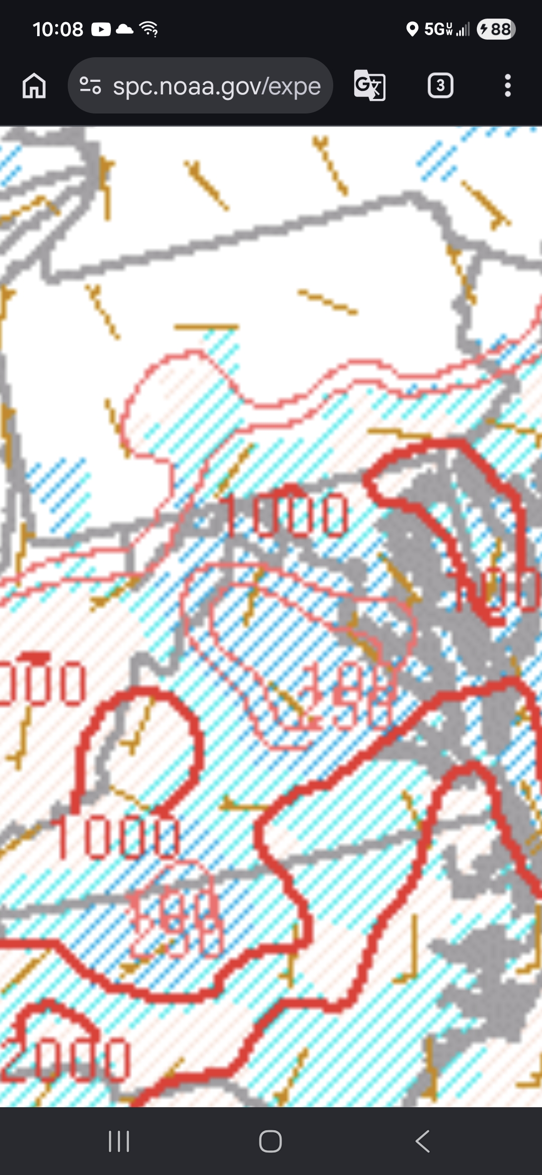
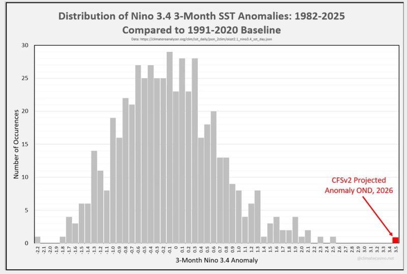
2026-2027 Super El Nino
PhiEaglesfan712 replied to Stormchaserchuck1's topic in Weather Forecasting and Discussion
-
Wife said it was pouring at the house fir a while. Rain guage looks filled up. Will check in am.
-
"kdxwinter" acatt
-
looks like a good patch of showers developing and heading this way
-

Junorch obs and discussion 2026
CT Valley Snowman replied to Damage In Tolland's topic in New England
About .8 here. Thinking I should get to 1" or a bit over with the activity overnight. -
This is awesome footage dude… catching that on a game cam, love to see it.
-

E PA/NJ/DE Summer 2026 Obs/Discussion
Chief83 replied to PhiEaglesfan712's topic in Philadelphia Region
Worcester, PA got .22 for the storms. Most of the closest one went to our south. -

Central PA Summer 2026 Discussion/Obs Thread
canderson replied to Voyager's topic in Upstate New York/Pennsylvania
The humidity surge didn’t win out quick enough so no clearing around here. Almost like a negative CAD event to me. I am more disappointed in the total lack of rain. I never expected severe here today but thought we’d get at least .25”. Depressing! -
windy here. FRG gusts to 30 from the south. hello warm front
-
deep moisture, been a minute since one of these climate max PWAT events.
-
Enabling America https://www.instagram.com/reel/DZ4fnMWsA9k/?igsh=MTdudWJkZWQ3NTFjZA==
-
.thumb.jpg.6a4895b2a43f87359e4e7d04a6fa0d14.jpg)
Central PA Summer 2026 Discussion/Obs Thread
Yardstickgozinya replied to Voyager's topic in Upstate New York/Pennsylvania
We had more than enough cape around today to spark off storms and still do. Looks like an inversion problem to me.
-
Fog is quite dense here. About 1/4 mile visibility.
-
radar estimate is way off. has me at nearly 2". cannot go by that today
-
Central PA Summer 2026 Discussion/Obs Thread
canderson replied to Voyager's topic in Upstate New York/Pennsylvania
I thought it popped past the county. mea coupa I am more surprised MD didn’t see more severe today. -
68 degrees with a dewpoint of about 67.9999 lightning flashing in the cell over union county
-
This is great!
-

Central PA Summer 2026 Discussion/Obs Thread
Itstrainingtime replied to Voyager's topic in Upstate New York/Pennsylvania
Really? Huge storm that spawned a TOR warning in Chester County formed right over Lancaster city. -
Central PA Summer 2026 Discussion/Obs Thread
canderson replied to Voyager's topic in Upstate New York/Pennsylvania
I never saw a cell in LanCo that looked remotely severe. Weird. Not doubting you at all, but I never saw anything remotely sketchy. -
Looks like a quick line coming soon for you
-
It fizzled in Durham county before it got to Wake County. Most impressive part of the storms tonight at work was the outflow boundary gusts were impressive. other than that, NEXT
-
Rainfall was 0.13” east side Columbia. A bit of l&t but nbd. The shrubs seem nicely watered, at least at the ground level.
-
That's weird I never noticed . It must be from the light being on.


.thumb.gif.f92b16c631a1d15d405ed77b33f0710d.gif)