All Activity
- Past hour
-
.31 which is good because we really needed it after four dry days…
-
Let me rephrase for the ones that aren’t following. I didn’t get where the CT valley north and east were being discussed . NW CT is the southern Berks. And you just don’t include them in the other 95% of CT
-
Cell didn’t miss. Severe heavy rain. My goodness. No hail. Just some of the heaviest rain I’ve ever seen
-
-
Flash Flood Warning for Allegheny County Issued by National Weather Service Pittsburgh, PA 5:29 PM EDT Fri, Jun 6, 2025 The National Weather Service in Pittsburgh has issued a * Flash Flood Warning for... Southeastern Allegheny County in southwestern Pennsylvania... North Central Fayette County in southwestern Pennsylvania... East Central Washington County in southwestern Pennsylvania... Southwestern Westmoreland County in southwestern Pennsylvania... * Until 830 PM EDT. * At 529 PM EDT, Doppler radar indicated thunderstorms producing heavy rain across the warned area. Between 0.5 and 1.5 inches of rain have fallen. Additional rainfall amounts of 1 to 2 inches are possible in the warned area. Flash flooding is ongoing or expected to begin shortly. HAZARD...Flash flooding caused by thunderstorms. SOURCE...Radar indicated. IMPACT...Flash flooding of small creeks and streams, urban areas, highways, streets and underpasses as well as other poor drainage and low-lying areas. * Some locations that will experience flash flooding include... Greensburg, McKeesport, Jeannette, Jefferson Hills, White Oak, Monessen, Donora, Mount Pleasant, Scottdale, Monongahela, Charleroi, Irwin, Manor, Youngwood, West Newton, Liberty, Lawson Heights, New Stanton, Port Vue and New Eagle. PRECAUTIONARY/PREPAREDNESS ACTIONS... Turn around, don't drown when encountering flooded roads. Most flood deaths occur in vehicles. In hilly terrain there are hundreds of low water crossings which are potentially dangerous in heavy rain. Do not attempt to cross flooded roads. Find an alternate route. && FLASH FLOOD...RADAR INDICATED
-
I think they do pretty good. They had two tornadoes two years ago. I’ve seen them do well.
-
All it does is rain there during the warm season and snow during winter. Amazing climo lol. It looked like it wanted to rain here around 4:30 but it vanished as usual.
-
I think it was more the idea of some scattered stuff. NW CT could be in for a nice one.
-
Fucking Henniker
-
At Narragansett school now wind and rain is insane.. and dark as night
-
Some decent lightning between JC and Hoboken.
-
All HAIL golf-balls falling from the heavens.
-
Any Mets want to chime in on if those storms entering VA will hold together through fx county? Want to know how swim practice will go tonight.
-
2.75" in 60min per PWS, however, it tends to read a little high. Eyeballing closer to 2.4-2.5" in the stratus.
-
We bang loudly and frequently. unlike prom night.
-
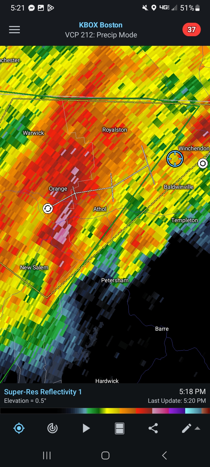
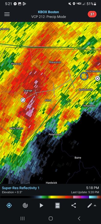
Decent training setting up from the Pike in Blandford to Athol
-
Looked good for a bit. This was back about 15 mins ago

-
I'd probably go to 116 and Meadow St on the north side of town in the fields. Really good visibility over there.
-
Even tomorrow looks like most is hit / shower . Stein kind of sneaking in our back door while we sleep . First it’s just the tip.. before you know it.. all the way
-
At lake dennison hoping the storm keeps its strength.. I can go north or south from here pretty quick
-
.1” was my total lol
-
I didn’t get where the CT idea was coming from. Aside from the HRRR for a run or two everything had storms all pike north
-
Picked up 0.15" from the showers that spun in from the southeast. I don't think there was anything in the forecast for here today.
-
Couldn’t get it done down here. Hate to see it.
-
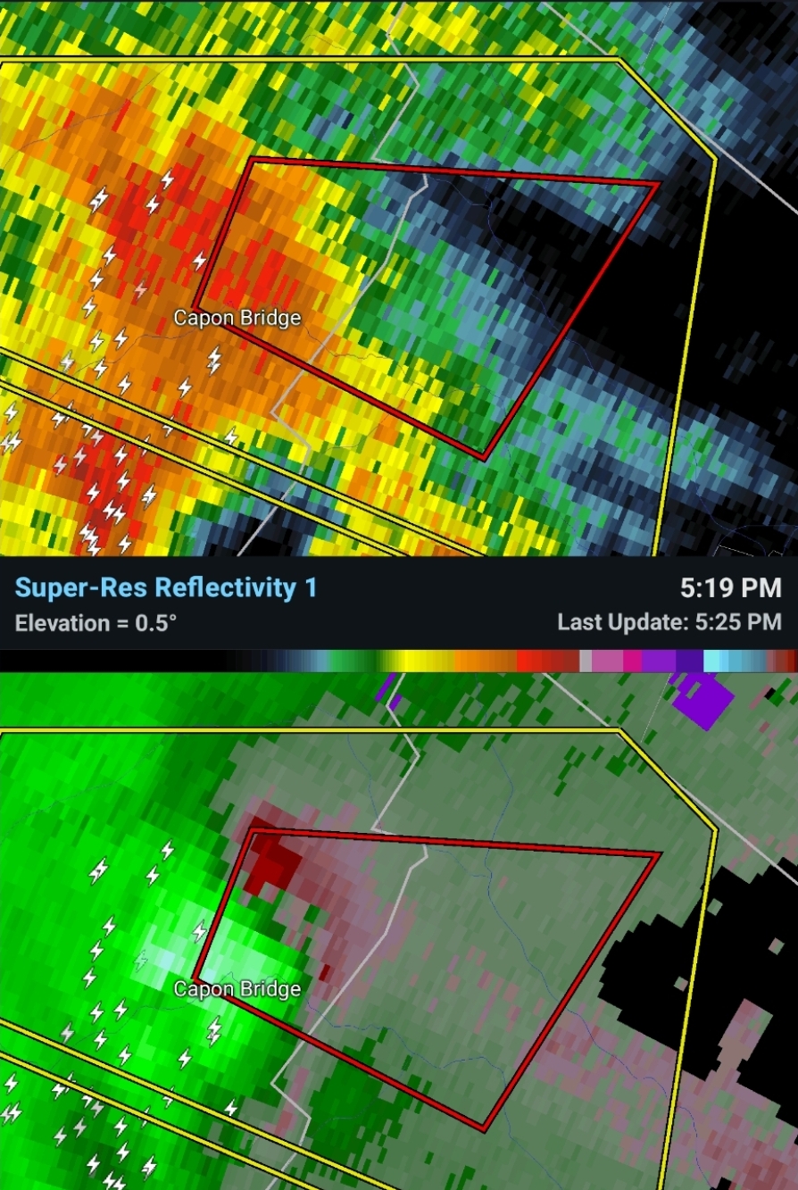
Tor warning NW of Winchester