All Activity
- Past hour
-
ya we will get some torch days.. but overall pretty normal I think
-
I think it will be warmer than normal. The predominant pattern will likely develop in late June and then lock into place with some brief cooler periods.
-
Usually big heat summers show up in May.
-
June 2025 is playing out in a similar fashion as June 2024 so far, cool and wet.
-
It’ll flex in at times as it always does. The midwest and plains always torch.
-
There is no cold available for months:) W
-
Radar is lighting up now.
-
Tornado warning for state college
-
Lots on here mentioned the wind this spring. Truthfully it didn't seem out of the ordinary to me.
-
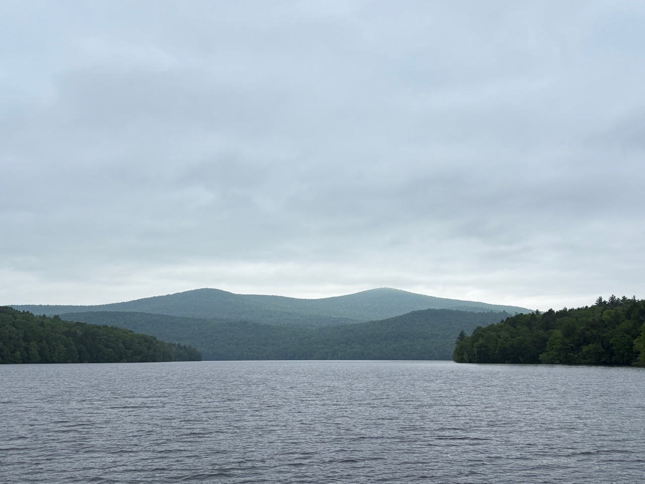
Despite the cloudy, misty day, managed to get a group of graduating eighth graders, out on Harriman reservoir this afternoon.

-
It smells like the sea
-
Midwest and West this year.. we meh
-
Am I forgetting major events, or have the past 18 months or so been painfully boring? No extended or way above normal heat. Ordinary winter temperatues - no cold snaps or even unusual warmth. Some snow but nothing that much. No real hurricane threats nor dramatic thunderstorms, nor hail. No icing. I'm fine with it, and I should be careful what I wish for, but it is boring.
-
Definitely doesn't have the feel of a super hot Summer.
-
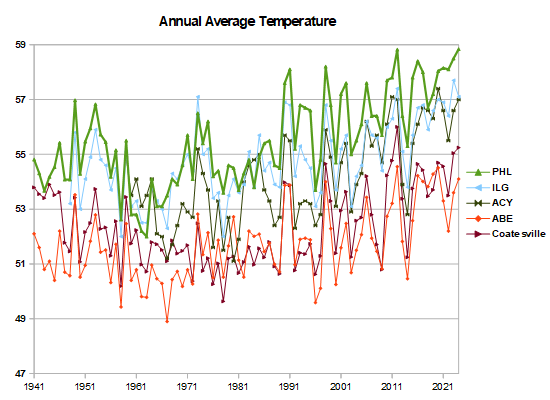
You have Chester County as warm as Philadelphia in 1942. That's your UHI problem. Other local data warms in line with Philadelphia. including Coatesville after its 1946+47 station moves. Chester County only had 3 stations in the 1930s, 40s and 50s. Two of them, Coatesville in 1946+47 and West Chester in 1970, had station moves from town---> rural that produced roughly 2F cooling. Since you aren't correcting for station moves and network changes you are baking a reverse heat island effect into your calculations. Surprised a heat island expert like yourself, can't understand that.
- Today
-
Summer is settled in by then . We are close now . Very evident on long range maps
-
Jk, unless I wasn’t.
- 989 replies
-
- 1
-

-
- severe
- thunderstorms
- (and 2 more)
-
I actually enjoy this wx. Scotland/UK type eve. Take
-
Unfortunately, all I can do is live in fantasy land but the Euro and GFS hint at some big severe potential the weekend of June 20th.
-
12dBZ and a drenching rain right now. The time we live in.
-
Still think summer will be a very hot ?
- Yesterday
-
Extreme heat covers the entire PAC NW and BC region, highs close to 100 F in many locations inland. Cloudless over the region, visible satellite making it easy to find remnant snow cover on mountain ranges.
-
Right? One a week's plenty.
-
Tomorrow will be variably cloudy and warmer. Temperatures will top out in the middle 70s. Some showers or a thundershower are possible, especially during tomorrow afternoon or tomorrow night as a warm front moves across the region. Some of the thunderstorms have the potential to bring heavy downpours. Afterward, it will turn warmer for several days with temperatures rising into the 80s. Thursday will likely be the warmest day of the week with the mercury rising into at least the middle 80s. It will turn cooler for the weekend. No exceptional heat appears likely through mid-month. The ENSO Region 1+2 anomaly was +0.8°C and the Region 3.4 anomaly was -0.1°C for the week centered around May 28. For the past six weeks, the ENSO Region 1+2 anomaly has averaged +0.17°C and the ENSO Region 3.4 anomaly has averaged -0.07°C. Neutral ENSO conditions will likely continue through at least mid summer. The SOI was -5.62 today. The preliminary Arctic Oscillation (AO) was +1.466 today. Based on sensitivity analysis applied to the latest guidance, there is an implied 61% probability that New York City will have a warmer than normal June (1991-2020 normal). June will likely finish with a mean temperature near 73.2° (1.2° above normal).
-
Yeah, I was thrilled for afternoon showers. Why would anyone want two dry days in a row?


.thumb.png.4150b06c63a21f61052e47a612bf1818.png)