All Activity
- Past hour
-
New around here? We'll be back in 70's by Thanksgiving lol
-

2025-2026 ENSO
40/70 Benchmark replied to 40/70 Benchmark's topic in Weather Forecasting and Discussion
Agreed....I was just saying. -
Models are waffling about how much rain will fall Monday-Wednesday of next week. They are starting to trend further south with the initial upper low leaving some areas mostly dry Monday-Tuesday
-
I feel like there is a bit too much focus on the NAO anyway...the EPO is a significantly larger factor for driving cold into the CONUS and generating widespread snowfall.
-
Second morning in a row with heavy frost. Yesterday morning was much colder than expected. Today was cold but was expected.
-
12zEuro AI and CMC have a coastal
-

Spooky Season (October Disco Thread)
jbenedet replied to Prismshine Productions's topic in New England
Nothing is “quick” / fast flow as in the teleconnections at the end of the month. This seems like a hiccup in the recent op runs advertising this. There’s a deeply -AO incoming coupled with +PNA and further -NAO conditions. I’m expecting much more northern stream interaction; arctic involvement. When we start seeing snow showing up in guidance for next week in PA and western upstate NY, we’re getting close to the actual outcome… -
I am going to be updating my winter ideas over the next few weeks. Normally, I put them out during June and don't change them. But...I think they are going to need adjusting this year! Here are the revisions which I am leaning towards. December - warm Jan - starts warm / ends cold Feb - starts cold / ? Why the change? Well, we are going to likely see a mean trough west of the Rockies through much of November. That immediately resets my thinking IF the occurs. That likely means most of December is warm if we take a 4-6 week weather cycle. That leaves room for a big pattern change again around mid January if not just before. For there to be a cold December, we normally want the pattern flip to occur mid to late November AFTER being warm prior to that. I have toyed with the idea that the entire winter will be warm. I have immense respect for Don Sutherland. To go against him usually means I am left looking foolish, but that hasn't stopped me before! Ha! Weak La Ninas rarely are wall-to-wall warm in E TN. I think there are a small bank of analogs in which that occurred. Almost all cold analog packages for Tenn have some warm outliers - welcome to the Upper South where we live in the sub-tropics -> base pattern in the valleys (below 2500') is rain with the exception of about four weeks of climatology. I would suggest that we see at least one very cold air mass west of the Apps if not more. With the QBO in a favorable state and trajectory...lots of factors point to some very cold weather over portions of the Tenn Valley. We also know that La Nina winters tend to be dry w/ extended periods of warms and crazy cold interludes. I suspect we see that pattern evolve at some point this winter as the base pattern. I started to rethink my winter ideas after reading Larry Cosgrove's ideas that the winter would be backloaded. At first I thought that was completely wrong. Then the Weeklies flipped cold at an earlier time than I was expecting. He may be right.
-
Only down to low 40’s last night.
-
What do all the other models do? The Euro? Canadian? UKMET? ICON? JMA? KMA?
-
I am thinking the same unfortunately, possibly one of the defining natural disasters of the year.
-
29.7 this morning. Oneida was 29 as well. Tazwell in Claiborne County was 30 and Tri-Cities was 31 and so was Maynardville, Norris was 32. I assume that MRX just decided not to do the frost/freeze protocol this year. JKL and Greenville had appropriate freeze/frost warnings out overnight.
-
This pattern would translate to a brutally cold, wall to wall winter. Unfortunately, we’re kinda due for it. Gotta get the outdoor activities in while I can.
-

Spooky Season (October Disco Thread)
Prismshine Productions replied to Prismshine Productions's topic in New England
Who the hell let Ineedsnow hack the GFS Sent from my SM-S166V using Tapatalk -
Spooky Season (October Disco Thread)
Snowcrazed71 replied to Prismshine Productions's topic in New England
Bob Maxon from NBC 4 posted about 1 hour ago both the GFS and the Euro with very similar tracks for next week's storm. They said it is coming in a little quicker and it might salvage Halloween -
Pittsburgh PA Fall 2025 Thread
Gordo74 replied to TheClimateChanger's topic in Upstate New York/Pennsylvania
Another freeze warning here in Westmoreland. I thought after the first one they consider the growing season "over" and then no more until next growing season? Can someone educate? -
35 for my low which is coldest of season
-
I just did an AI google search regarding the American Weather models and this Gov't shut down - any comments ? That 12Z GFS run might not be correct ??? AI Overview As of the October 2025 government shutdown, American weather models are not getting full data due to cuts to federal weather programs, staffing shortages, and the disruption of key data streams . This has led to concerns about the accuracy of weather forecasts, particularly during the ongoing hurricane season. Key reasons for the data shortfalls: Government Shutdown The latest federal government shutdown, beginning October 1, 2025, has halted "non-essential" operations, which affects weather forecasting and data distribution. While critical functions like watches and warnings from the National Weather Service (NWS) continue, many other activities, such as research, computer model upgrades, and certain data streams, have been impacted. Staffing Reductions Deep cuts to the National Oceanic and Atmospheric Administration (NOAA) earlier in 2025, implemented by the Department of Government Efficiency (DOGE), have resulted in significant staff losses. Some NWS offices were already critically understaffed, with some meteorologists being laid off. Weather Balloon Launches Suspended Some NWS offices have suspended or reduced their daily weather balloon launches due to these staffing shortages. This eliminates crucial, real-time "sounding" data that is vital for forecasting severe weather, winter storms, and overall model accuracy. Loss of Defense Satellite Data A separate issue earlier in 2025 involved the Department of Defense (DoD) temporarily cutting off access to data from its Defense Meteorological Satellite Program (DMSP). Although this decision was later reversed after concerns were raised by forecasters, it created a period where hurricane models were running with reduced data. Impact on forecasts The combination of these factors has raised alarm among meteorologists and researchers, who worry about the degradation of forecast accuracy. Potential consequences include: Increased uncertainty and inconsistency in model runs. Weaker forecasting of severe weather events like tornadoes and thunderstorms. More difficulty tracking winter storms and identifying their precise transitions from snow to ice or rain. Reduced accuracy in hurricane intensity forecasts. What is still operating? Despite the disruptions, essential weather services are still functioning: National Weather Service Operations: The NWS is deemed "essential" and will continue to issue critical watches and warnings to protect life and property. Daily Forecasts: The production of daily forecasts and outlooks continues. Satellite Data: While the Defense Meteorological Satellite data was temporarily at risk, data from other sources, including other weather satellites, is still being used.
-

Spooky Season (October Disco Thread)
tamarack replied to Prismshine Productions's topic in New England
When I worked in the northern tip of Maine, I would always be sitting on my snowshoes when riding - several times had to use them as shovels to unstick the machine - usually the nose-heavy '73 Everest. (Never had to use them to walk out from a paunched snowmobile - fortunately. Before my 1st ride there, an experienced co-worker noted that one could ride in one hour farther than one could walk out in a day.) -
experience shows that humanity as a collective is not capable of (or interested in) managing the fallout from our current CO2 geoengineering experiment hard pass on any more geoengineering experiments, until we get the CO2 one figured out
- Today
-
And holy hell…plants rely on a certain expected amount of solar radiation. What are we doing trying to reduce that?
-
000 WTNT63 KNHC 241630 TCUAT3 Tropical Storm Melissa Tropical Cyclone Update NWS National Hurricane Center Miami FL AL132025 1230 PM EDT Fri Oct 24 2025 ...AIRCRAFT DATA INDICATES THAT MELISSA IS STRENGTHENING... Air Force Reserve reconnaissance aircraft data indicates that Melissa is strengthening, and maximum sustained winds are now estimated to be 60 mph (95 km/h) with higher gusts. The minimum pressure from aircraft dropsonde data has dropped to 999 mb (29.50 inches). SUMMARY OF 1230 PM EDT...1630 UTC...INFORMATION --------------------------------------------------- LOCATION...15.6N 74.5W ABOUT 220 MI...355 KM SE OF KINGSTON JAMAICA ABOUT 250 MI...405 KM SW OF PORT AU PRINCE HAITI MAXIMUM SUSTAINED WINDS...60 MPH...95 KM/H PRESENT MOVEMENT...ESE OR 105 DEGREES AT 2 MPH...4 KM/H MINIMUM CENTRAL PRESSURE...999 MB...29.50 INCHES $$ Forecaster Papin
-
lol Typical of people to try to fix a problem by treating the symptoms rather than getting to the root of the issue. Just get the CO2 back down to where it should be. The atmosphere has the ability release excess heat out to space…trapping it in the troposphere is the problem.
-
The NAO is correlated with changes in the AMO at about 0.4, or 70% of the time. +NAO cools the AMO, we saw this in Hurricane season 2024 when there was a lull of activity mid-season during record +NAO. Now since October is -NAO, and the NAO looks to be negative a good 4 weeks, they are saying the AMO is changing. A better way to do that, is just roll forward October NAO, which does not actually have a positive correlation with Winter NAO. Every October has been -NAO since 2019.
-

Spooky Season (October Disco Thread)
powderfreak replied to Prismshine Productions's topic in New England


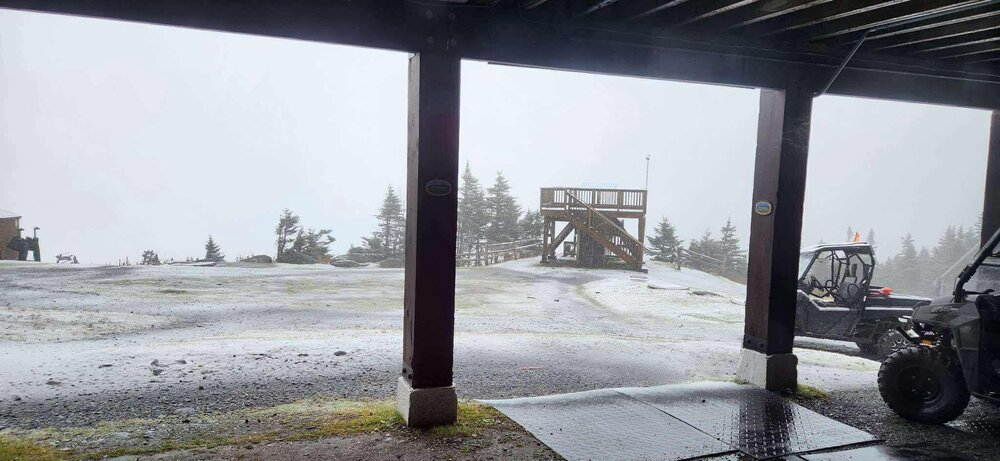
.thumb.png.a4febf9ae93e3350f8265e74ba665f31.png)


