All Activity
- Past hour
-
Also, @uofmiami dewpoint is also 42, so im going with 42...
-
Does Freedom Fuel sell home heating oil?

-
the 5 closest Davis weather stations and my own are all at 42. i guess all 6 could be wrong...
-

2026-2027 Fall/Winter Mountain Thread
Met1985 replied to BlueRidgeFolklore's topic in Southeastern States
Yeah no kidding. These microclimates around here are fun to watch. - Yesterday
-
Great photo. What's the snow level....4,500 ish?
-

2026-2027 Fall/Winter Mountain Thread
Tyler Penland replied to BlueRidgeFolklore's topic in Southeastern States
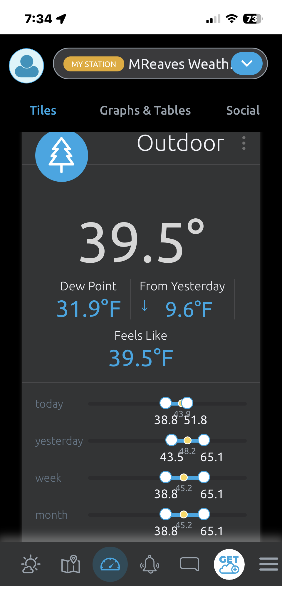
We had our first 30s of the season at 39. Was 38 down on the river below me and 45 a few hundred yards up the hill. Wild how big a swing you can get with radiational cooling in the valleys this time of year. -
As strong as that Nino may have been, one would assume that the implied RONI was off the charts compared to the upcoming winter.
-
New York City will see the temperature again dip below 50° tonight. Lows should fall to the middle and upper 40s in New York City early tomorrow morning. Some distant suburbs could again see lows bottom out in the 30s with some scattered frost. Thursday and Friday will be milder days with the mercury returning to the lower 70s across much of the region. The week will be dry. The next chance for precipitation could be Sunday or the following Monday. The ENSO Region 1+2 anomaly was +5.3°C and the Region 3.4 anomaly was +3.2°C for the week centered around September 30. For the past six weeks, the ENSO Region 1+2 anomaly has averaged +4.63°C and the ENSO Region 3.4 anomaly has averaged +2.92°C. Both ENSO regions have set new all-time records. The ongoing strong El Niño, will continue to strengthen through the mid-fall. The SOI was -12.51 yesterday. The preliminary Arctic Oscillation (AO) was +2.195 today.
-
I am so sorry for your loss. Praying for you and your family, it's so hard to lose a parent.
-
I’ll take my vitamin D while I can. Low stratus and 30s will be here soon enough.
-
Islip is 37 and FRG at 34 last I checked.
-
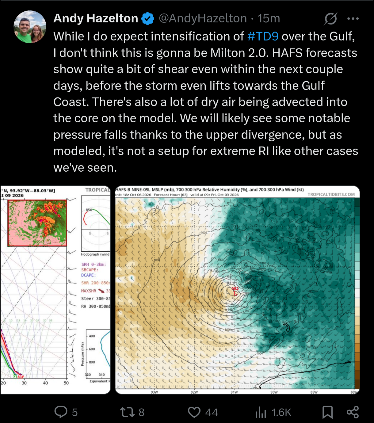
The first runs of the HAFS suites since classification are not impressive, to say the least. The TC gets walloped around 70'ish hours out and becomes very assymetric with advected dry air doing its thing. Something to keep in mind. Is the window there for a strong hurricane? Sure. But the TC needs to come together rapidly over the next 48 hours.
-
Nope. Retired. No longer have an active law license.
-
-
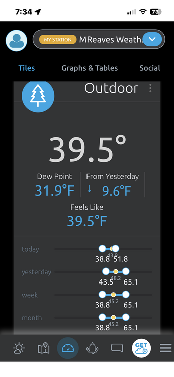
Td is 43, so I doubt it
-
Glad I don't live there.
-
Even if it weakens, the intensity offshore could have huge implications on potential storm surge.
-
I’m not going to over analyze individual model runs but if it takes a track like the GFS shows that’s really bad for surge at the mouth of the Mississippi, bay St. Louis, biloxi bay, and possibly mobile bay. Landfall intensity is important but if this peaks maybe 6-8 hours before landfall any weakening would not affect surge potential at all. That’s a very bad track in that regard
-
2026-2027 Fall/Winter Mountain Thread
Met1985 replied to BlueRidgeFolklore's topic in Southeastern States
My low was 41 degrees and my high was 74 today. Beautiful. -
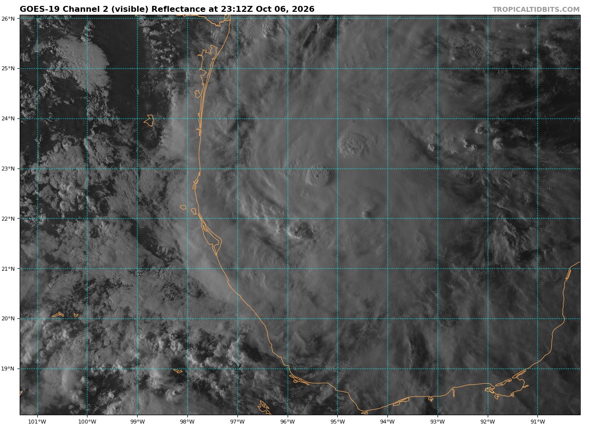
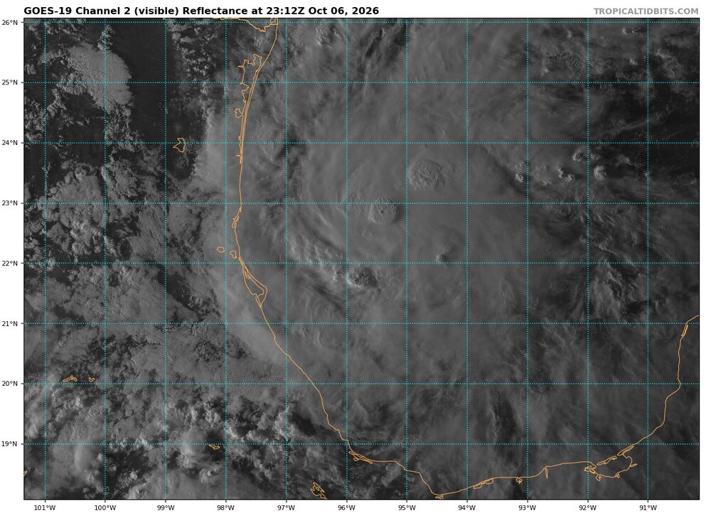
Look at all those hot towers Would agree on a C1 landfall being most likely right now. Reaching C3+ over the open ocean beforehand looks very attainable.
-
Right now is the slowest motion we will see. The westerly steering flow in interaction with the mid-to-upper trough will push the TC towards the east and then begin to turn it poleward. At that point, it should be gaining forward motion into landfall.
-
47 and dropping like a rock
-
I think this gets up to a major before it gets closer to the coast. The gulf has so much heat in it... just jet fuel for it. And if it slows down at all?
-
Hopefully it hits the wall of shear and gets eaten up by dry air which is probably the most likely outcome. But there’s jet fuel in its path before that happens. The SE still needs the rain so a weakening TS with heavy rain would be beneficial.