All Activity
- Past hour
-
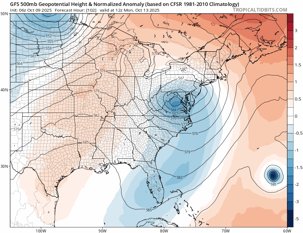
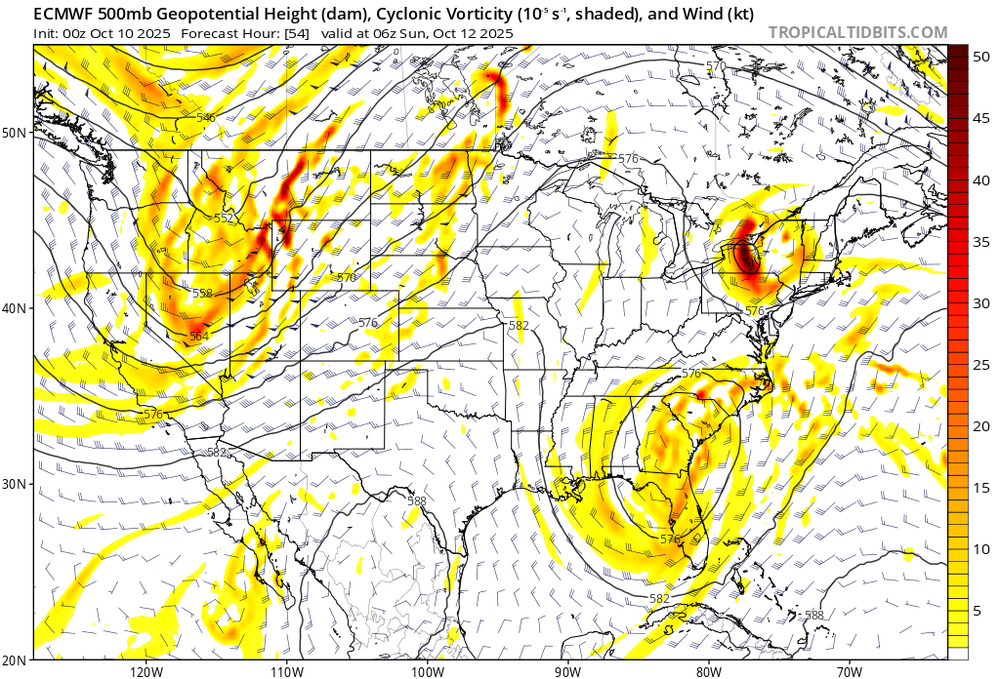
Also euro guidance takes that s/w over the lakes and moves it over us which blocks how far north it can get. My gut says that the main issue is keeping this further south and helping to reduce impacts, but still time i guess.
-
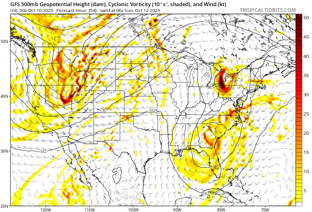
Gfs is a good hit. Not sure why everyone said it’s south. Euro and AI and NAM redevelop it south of New England and then rip it back west like some guidance showed yesterday. Definitely not in agreement with the interaction of a piece of moisture NW of Jerry. Need to get euro and AI more north for anything real meaningful I think. NAM is high impact, but when is it not lol.
-
5am temp here is 37 on top of the hill. Pequest, Sandyston and Walpack up in NW Sussex 28, 28 and 25 respectively. Mid 30’s down in the Pine Barrens. Ideal radiational cooling with low lying rural locations cashing in on coldest temperatures.
-

The return of the elusive Nor'easter. Drought buster or bust?
CAPE replied to dailylurker's topic in Mid Atlantic
There are differences in timing/location of the northern stream vorticity digging southeastward from the GLs. GFS involves it more and sooner than the Euro. Seems to capture the southern piece of energy, encouraging a more consolidated surface low with a track more westward.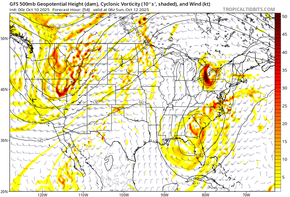
-

The return of the elusive Nor'easter. Drought buster or bust?
Weather Will replied to dailylurker's topic in Mid Atlantic
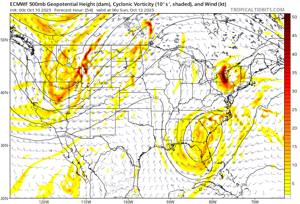
Well, the Euro remains the King....
- Today
-
Montgomery: 28.
-

Spooky Season (October Disco Thread)
ineedsnow replied to Prismshine Productions's topic in New England
Down to 25 we take! -
The mid-month cool shot is basically up in smoke now. Relentless AN with a deeply BN west looks like it's going to be the basic pattern for at least a few more weeks.
-

The return of the elusive Nor'easter. Drought buster or bust?
MillvilleWx replied to dailylurker's topic in Mid Atlantic
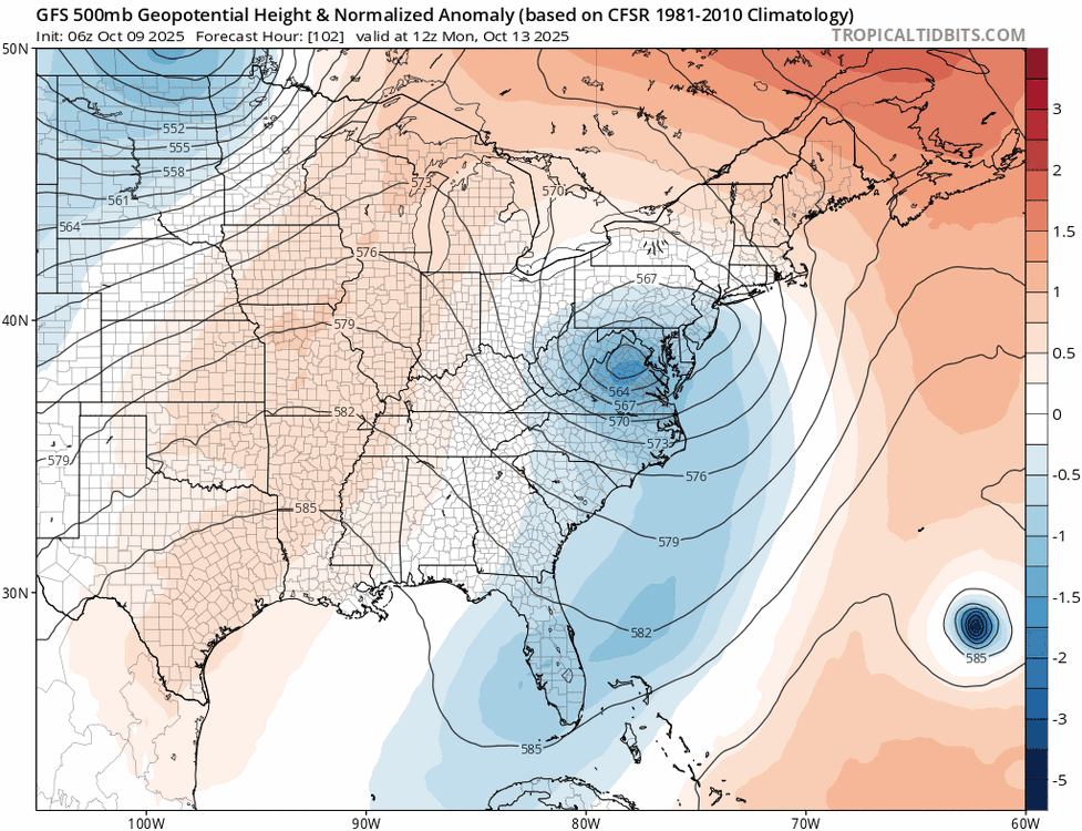
This is becoming a legit option on the table. Doing the QPF tonight, that was evident. AIFS continues to have a theme of a split SLP with a primary near NC with a secondary to the northeast over the Gulf stream, occluding moving westward before weakening. There could be a QPF min between the evolution, so something to monitor closely. Winds are going to be there regardless, so the coast will get battered no matter the evolution. -
32 in Nazareth PA (75 miles west of NYC).
-
"I'd like to speak to the moderator"
-
I thought i taught you better than this. You’re like the kid who goes back to the hot oven. Congratulations though.
-
Do you have a special NFL schedule that has the Ravens playing at 8:00 pm Monday night?
-
Central Park down to 48
-
Down to 46 here
-
39F now. First 30s and coldest since like April. To think we had our AC on a couple days ago
-

E PA/NJ/DE Autumn 2025 Obs/Discussion
LVblizzard replied to PhiEaglesfan712's topic in Philadelphia Region
There looks to be agreement among the models that 1-2” of rain will fall Saturday night into Monday, possibly more in localized areas. The details are still being ironed out as there are some differences in when the most impactful rain and wind will be. That could come anytime between Sunday afternoon and Monday afternoon. -
Surprise! Karen is here. Jerry is struggling and MH is looking unlikely, but H is still in the forecast. Peak Season Forecast (Aug 20-Oct 20) Named Storms: 10 (6) Hurricanes: 6 (3) Major Hurricanes: 3 (2) Fernand, Gabrielle (MH), Humberto (MH), Imelda (H), Jerry, Karen
-
-
 I meant in terms of wind and rain.
 -
GFS pretty significantly further south with the low lol
-
 Gfs wind field, wave period and significant wave height are higher this run for long Island especially out east
 -
The return of the elusive Nor'easter. Drought buster or bust?
Weather Will replied to dailylurker's topic in Mid Atlantic
WB 0Z GFS; trending toward Euro camp.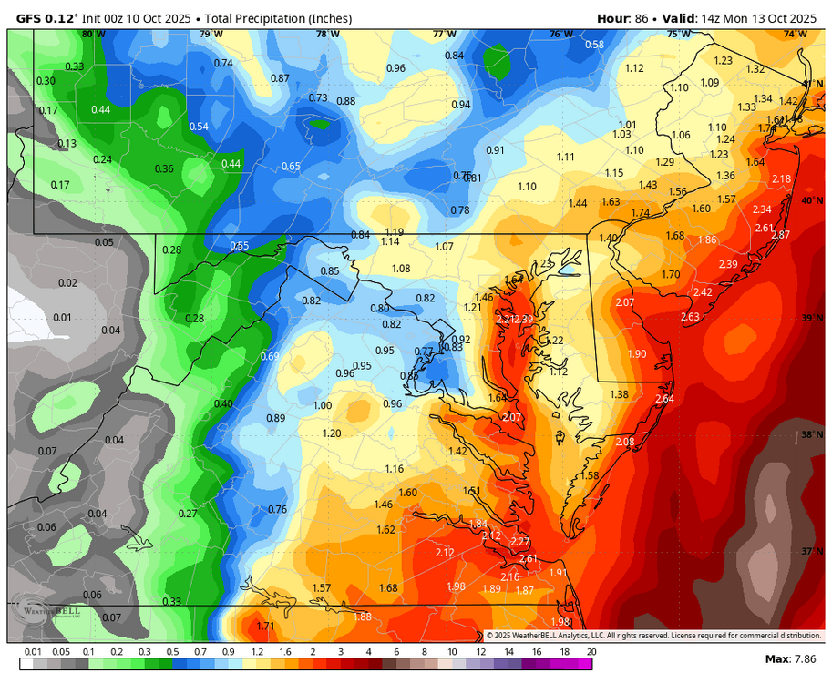
-
Montauk early forecast, if it's nearly moderate at montauk it's going be way worse further west.