All Activity
- Past hour
-
As far as the the SPV, it looks like there is going to be a rather fast recovery and rapid strengthening next month, as you predicted
-
@40/70 Benchmark Paul still expecting a -PNA/SE ridge to develop by mid-December based on the low frequency forcing:
-
There are some really strange people on this board.
- Today
-
0.28 from the rain. looking forward to some sunny skies
-

Mountain West Discussion
mayjawintastawm replied to mayjawintastawm's topic in Central/Western States
Wild… NWS discussion and forecast doesn’t have the faintest hint (though officially it only goes through 11/30) -
.thumb.png.4150b06c63a21f61052e47a612bf1818.png)
November 2025 general discussions and probable topic derailings ...
HIPPYVALLEY replied to Typhoon Tip's topic in New England
They are coming. I think we both have a fun winter relative to the last few. -
Two days. Two records. Yay? RECORD EVENT REPORT NATIONAL WEATHER SERVICE PEACHTREE CITY GA 0834 PM EST SAT NOV 22 2025 ...RECORD HIGH TEMPERATURE SET AT ATLANTA... A RECORD HIGH TEMPERATURE OF 82 DEGREES WAS SET AT ATLANTA TODAY. THIS BREAKS THE OLD RECORD OF 77 DEGREES SET IN 2011.
-

Fall 2025 Medium/Long Range Discussion
migratingwx replied to Chicago Storm's topic in Lakes/Ohio Valley
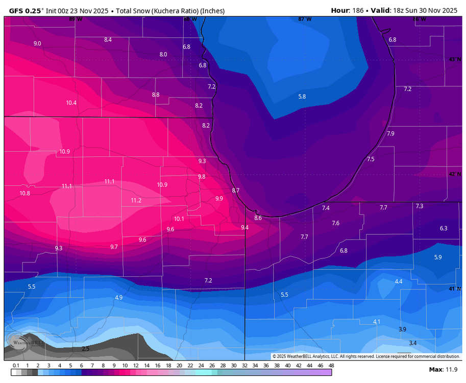
Big change on the 00z GFS for Chicagoland Thanksgiving weekend, something to watch. 18Z run posted below.
-
 Early rains froze up tonight. Everything frozen
 -
Typical La Nina look bro. You cooked already?
-
I was in Japan for two weeks ending yesterday - no rain or storms at all for the entire two week period. Was interesting to see as Tokyo gets 3-4 inches of rain in an average November. Temps in the mid-50s to 70 each day. Even Mt. Fuji (12,000+ peak) didn't have any snow on the peak visually by the time I was going back to Tokyo on the Shinkansen from Hirishoma. December should have some cold but I've never expected a particularly brutal month overall. Part of it should be pretty cold and part of it pretty warm that is why I never emphasized it a month or so ago. Longer term, you see predominantly high pressure showing south of Kamchatka right now. So the storms that were flagged by that late Oct-Nov for the time frame now (lot of lows there, back then) will stop and reverse in about two weeks and the pattern should see a whole sale change for a bit. The CPC 6-10 and 8-14 outlooks show the pattern I expect in the "good parts" of the winter - pretty wet. Widespread cold. But it won't do that each week. I always assumed one part of Nov would be pretty cold in the East and another part much colder in the West, as that's what the blend of 2013 and 2024 implied - you can see that's played out a bit to some extent with a much colder pattern in the SW recently then at the start of the month. But the month will finish pretty warm nationally.
-

November 2025 general discussions and probable topic derailings ...
Torch Tiger replied to Typhoon Tip's topic in New England
"perfect"? -
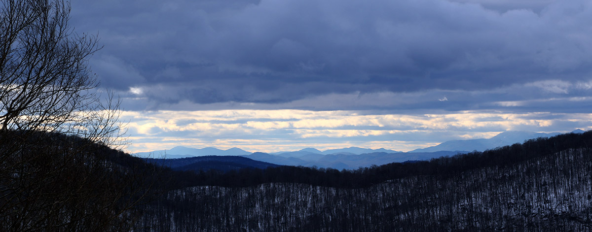
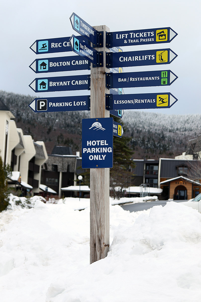
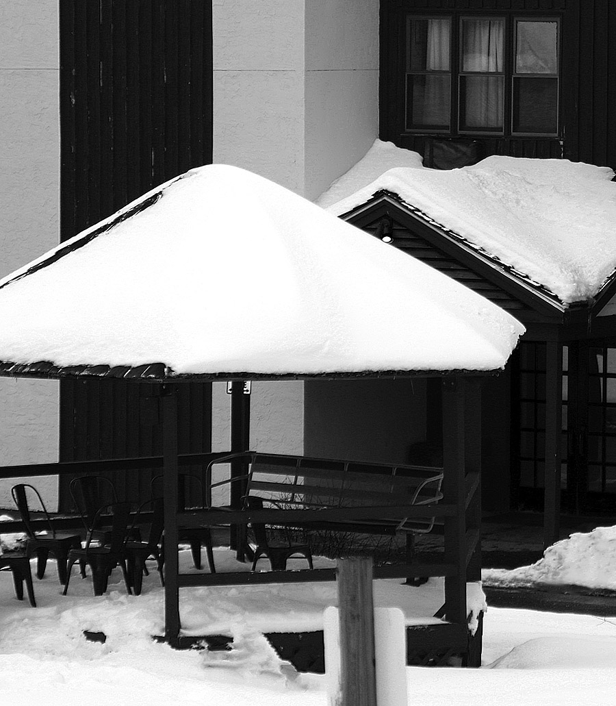
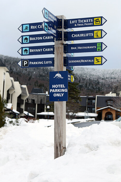
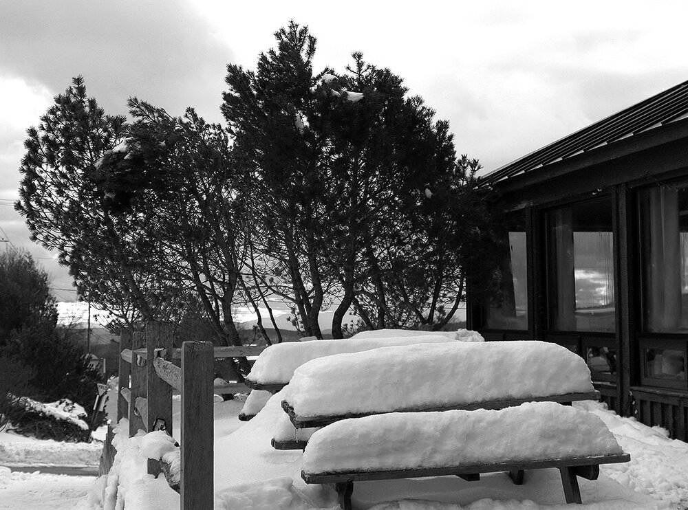
I was last out on the mountain for turns on Thursday, and the powder from our early week storm was holding up well. There had certainly been some consolidation of the snowpack, with sunny areas seeing the effects more than shaded areas, but the general consistency of the snow was dry, and there was no melt layer or melt crust. A couple days have passed now, and we haven’t had much in terms of new snowfall. High temperatures in the mountain valleys have remained in the 30s F, but the lower elevations have definitely been above freezing, and the snow has seen some thaw-freeze cycles. I didn’t know how high the freezing line had gone and how the snow quality might have been affected in the mountains, but I figured I’d head up for a ski tour today and check it out. I decided to tour at Timberline as I’d done on Thursday, which would give me a good point of comparison with respect to changes in the snow. From today’s tour I can say that the freezing line has definitely been above 1,500’ on the western slopes, and even above 2,000’. The snow hasn’t consolidated much more from where it was on Thursday, but the above-freezing temperatures have definitely degraded the quality of the snow. Even shaded areas have a melt layer in the top few inches of the snowpack, so you’re not dealing with fluffy, right-side-up powder skiing. Thankfully the humidity has been relatively low, so the melt layer has a spongey consistency instead of being a refrozen aggregate. I’d still recommend alpine fat skis with some decent rocker or a snowboard as the best riding tools. The powder is a bit upside down now with that melt layer on top and drier snow below, but shaded snow is still reasonably surfy if you’re on a nice big platform that can ride up in the higher areas of the snowpack. I was on my 115 mm Telemark boards, but I made only a few Telemark turns – I stuck with alpine turns for the most part because the more consolidated platform and tighter stance was a much better fit for those snow conditions. As long as you have the appropriate tools on your feet and stick to untracked areas of snow, you can get some decently surfy turns. Tracked or packed areas of snow aren’t offering up great turns right now – the snow there has consolidated enough that it’s just bumpy terrain and you’ll get tossed around for a much rougher ride. At least in those lower elevations, we’ll need a decent storm to get back to fluffy powder conditions. Today was supposed to be fairly benign with respect to the weather, but in true Northern Greens form, as soon as I started gearing up at the Timberline Base, a snow squall moved in and pounded us with heavy snow/graupel and reduced visibility for several minutes. It was nothing that resulted in substantial accumulations, but it was a definite reminder from Mother Nature that she’s there. In their early morning forecast discussion, the BTV NWS mentioned two areas of weather interest for today passing to our north and south, leaving us in “no man`s land” with no active weather, but in later updates they noted that there was going to be plentiful cloud cover across much of the region in the afternoon as an upper-level shortwave passed through and supported cold air advection and snow showers. We even picked up accumulating snow down at our place in the valley, so there was definitely some wintry weather out there, even during this relative snowfall lull. Bolton’s planned opening day was the 28th, but in the spirit of all the November snow we’re received, they started the lift-served season today. Lift Operations Manager Scott Beasley and President/CEO Lindsay DesLauriers made a fun social media post on Thursday to break the news to the community. They’re only running the Mid Mountain Chair and the Mighty Mite at this point, but since I was up at the mountain anyway and had to hit the main base to take care of some passholder stuff, I figured I’d stop in for a few lift-served turns. Conditions were fine, with a mix of manmade and natural snow, but with manmade snow in the mix, there were certainly some firmer areas. You can tell it was a bit of an impromptu opening since they hadn’t full groomed the Bear Run route, but that left some fun contours on the terrain and made it even more interesting. The highest elevation I reached today was up to Mid Mountain at 2,500’, but even at that elevation, you could see that the snow had been affected by the temperatures, so you really have to go higher than that to find pristine winter snow at this point. The resort was bustling though, so it’s great to see them get off to a great start. I heard that they expect to open the Vista Quad Chair for next weekend, which is their original planned opening date.


-
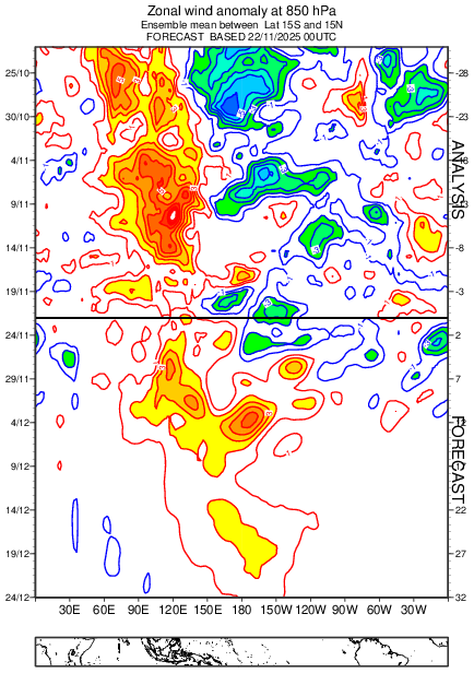
In light of the current weak Niña numbers, if correct, today's progged 850 wind anomalies off the Eps should spell the demise of the Niña before the end of December.
-
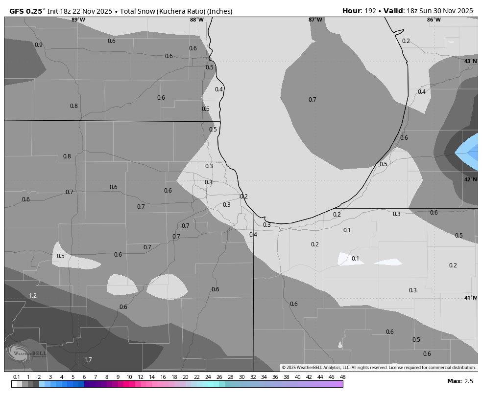
No surprise to me, a trend already showing today that the storm near 12/1 in the Plains/MW may not be as strong. Solutions were just unrealistically amped the previous 2 days which is why I said be wary of bridge jumping over the SER 12/1-12/4 because if we went the way we've gone most recent winters, those types of bombs, even in that part of the country have been hard to come by. Weaker or more strung out system there that SER won't pump anywhere near that strong
-
Picked up .12" yesterday morning. Another .12" this morning and then had a surprise thunderstorm this evening drop .39". This puts me at 1.44" for the month.
-

November 2025 general discussions and probable topic derailings ...
George001 replied to Typhoon Tip's topic in New England
It could get icy at times. That’s the bigger risk than suppression. -
November 2025 general discussions and probable topic derailings ...
George001 replied to Typhoon Tip's topic in New England
It looks like 07-08. I will take my chances with this look ANY DAY over any strong or super Nino December. -

Central PA Fall Discussions and Obs
Itstrainingtime replied to ChescoWx's topic in Upstate New York/Pennsylvania
Yes we are!!! -
Central PA Fall Discussions and Obs
Itstrainingtime replied to ChescoWx's topic in Upstate New York/Pennsylvania
"It’s my locker room." This team...for this team to drop 6 straight and play like this in response? Give it to him. @Mount Joy SnowmanI think you make a valid point, but I don't know how you look past him right now. -

Central PA Fall Discussions and Obs
WmsptWx replied to ChescoWx's topic in Upstate New York/Pennsylvania
That'll do it. The entire country just saw players endorse the guy. The search is over. -

Winter 2025-2026 Offers Return to Normalcy
40/70 Benchmark replied to 40/70 Benchmark's topic in New England
Yea, I wasn't trying to insinuate that you should take that particular rin verbatim, but rather my point was that that the overall pattern matched my composite qualitatively speaking. -
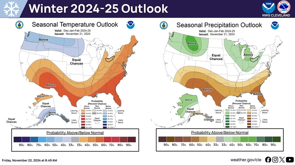
This was last year's outlook.
-
Central PA Fall Discussions and Obs
WmsptWx replied to ChescoWx's topic in Upstate New York/Pennsylvania
Okay so let's remove the emotion. 1) Gateway was one of the best programs in the state when he ran it. So Smith is known throughout the WPIAL as a program builder and a winner. 2) He is already known as a great recruiter. Penn State recruits well in Philadelphia and Jersey suburbs, DC/NOVA, and the Hampton Roads. Where they seem to struggle a little bit is in Western PA, where the best football is played in the state. Perhaps some kids from Farrell, Aliquippa, Pine-Richland, and other places start to sniff around a little more instead of going straight to Pitt, West Virginia, and Ohio State when they're wanted. 3) He once obliterated his team after a 27-0 win for lack of effort. Players seem to respond to somebody who is going to provide you with the tools to be the best but then expects you to do so. Look at the list of candidates. Who do you think is automatically a better long term plan? Kalen DeBoer? Maybe but that's an expensive "What if?" Lane Kiffin isn't the least bit interested, Mike Elko is getting paid by the Cult, Eli Drinkwitz absolutely STINKS, Matt Rhule STINKS, Bob Chesney from James Madison is an absolute unknown based on the Chaos of Cignetti, which, if Indiana doesn't win a playoff game or two, that dude starts feeling heat fast. Joe Brady is likely staying in the league, Brian Hartline will probably get paid to wait out Ryan Day, so who is left? Remove the tag. Give him two years. If it doesn't work, in two years you go after the shiniest new hire. The fans are chanting "Terry" as I type this. -
Looks pretty much standard La Nina. Not surprising from Them.