All Activity
- Past hour
-
blessed
-
As soon as I logged in I heard the crickets lol. I'm tracking a lonely storm west of DC that's moving in my general direction. I'm sure the forcefield will vaporizer it.
-
anddd it continues
-
Best will be near Cape. Clouds and chilly for you.
-
-
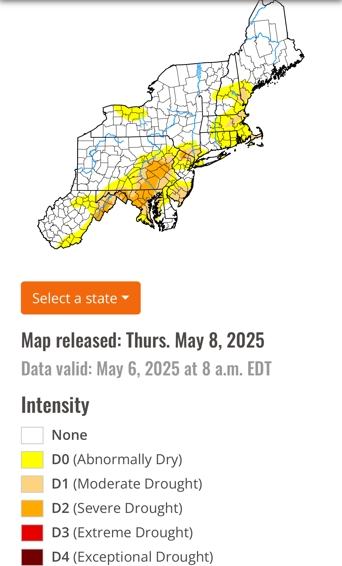
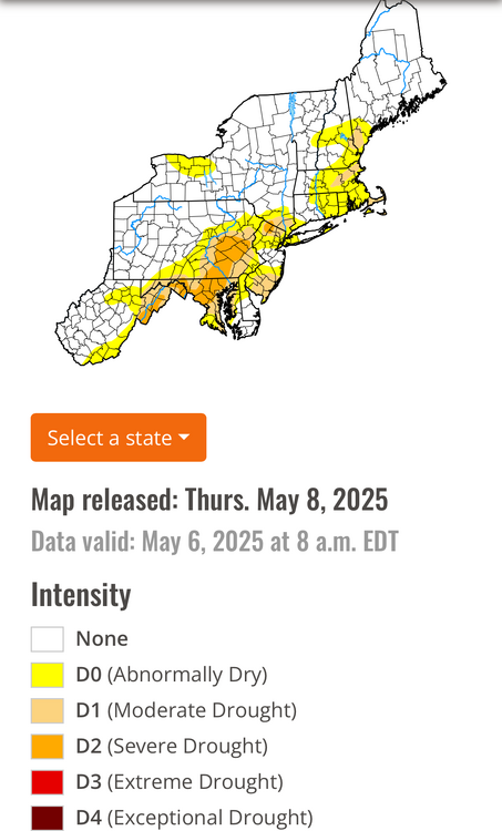
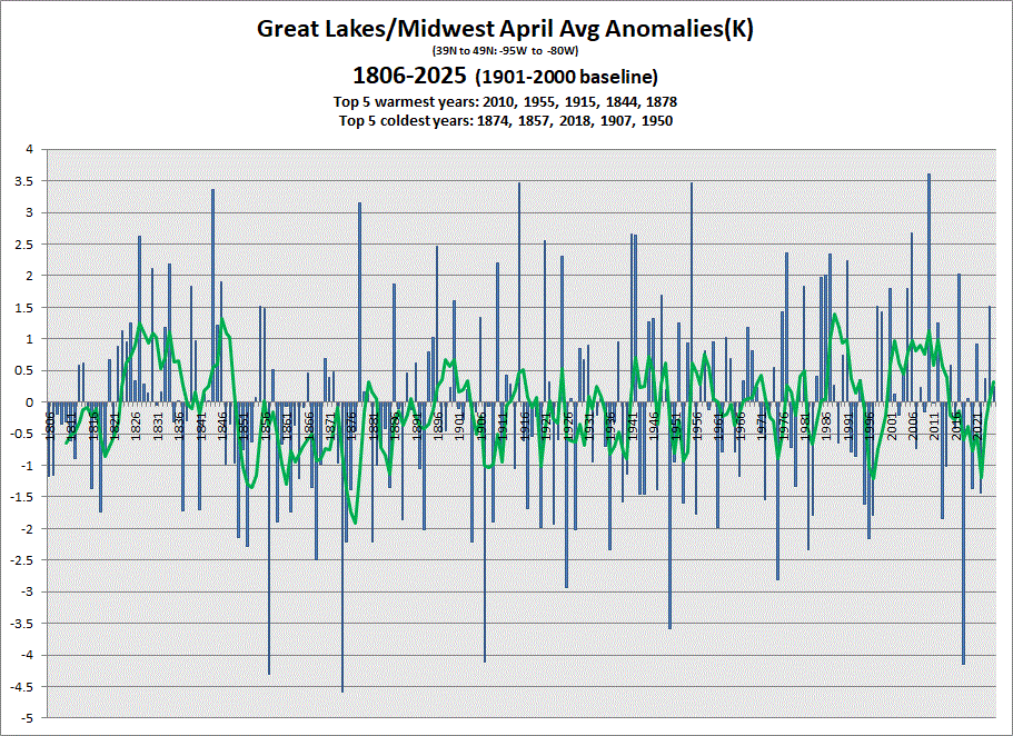
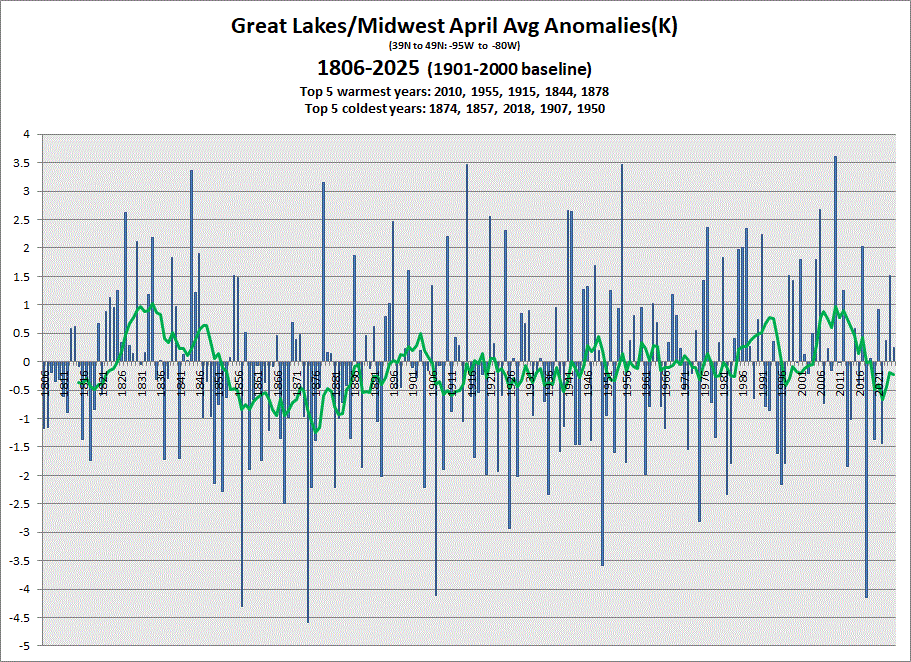
Early data in showing an avg April. 5 & 10 yr trend charts shown respectively.
-
Saturday looks fine in CT and most C and W Mass clearing and mild mid morning on
-
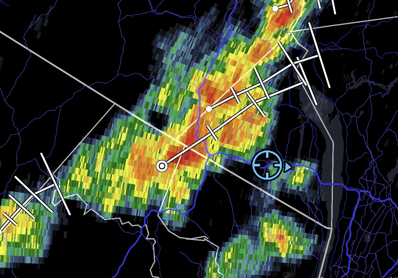
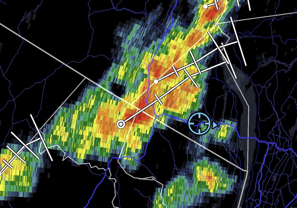
Special Weather Statement National Weather Service New York NY 305 PM EDT Thu May 8 2025 NYZ067-081930- Orange NY- 305 PM EDT Thu May 8 2025 ...A STRONG THUNDERSTORM WILL IMPACT NORTHEASTERN ORANGE COUNTY THROUGH 330 PM EDT... At 303 PM EDT, trained weather spotters reported a strong thunderstorm producing pea size hail near New Windsor, or near Newburgh, moving northeast at 10 mph. HAZARD...Winds in excess of 30 mph and pea size hail. SOURCE...Trained weather spotters. IMPACT...Gusty winds could knock down tree limbs and blow around unsecured objects. Minor hail damage to outdoor objects is possible. Locations impacted include... Newburgh, New Windsor, Gardnertown, Orange Lake, Washingtonville, Firthcliffe, Vails Gate, Balmville, and Cornwall On Hudson.
-
Not feeling so good about the second half of May anymore
-
-
And Flood Watches have been hoisted.
- Today
-
It's faster going downhill. Day started with ~2 hours of PC, then the clouds closed back in with a few spritzes. At least it's low 60s.
-
@wdragI-84 watch dropped
-
Wantage NJ 8 s High Point. 0.41" 125P-2P in my stratus (0.45 on my AWN). So the .41 matches the OHP,THP,STP seen at 220PM this afternoon off DIX. No thread at this time... if NWS drops a watch on I84 I lmght add a thread...that seems where iso 4" reports should occur between today-12z Sat. Unlikely thread at this time.
-
wow Ocean County Airport-89- is that Toms River?
-
I remember this was the case in summer 1995, it's why the Mississippi River valley was so wet with the ring of fire surrounding us, August 1995 was historically dry because of it.
-
Yeah, the Southeast Ridge or WAR has been very strong this month. So the heaviest rains were pushed up further north than the I-78 to I-80 corridor. Looks like a repeat performance for the next few days.
-
Straight shot on 89 to 93. Draw a line from like BOS to Stowe and the interstates are pretty close to that. Takes me a solid 4 to get to your hood at the Woodstock/Southbridge line. Gotta go 89 to 91 down to Springfield at the Pike then over.
-
That's fine, but recent forecasts haven't really been reflective of that fact.
-
Been steady with that. Still some models differing, but should be another soaker.
-
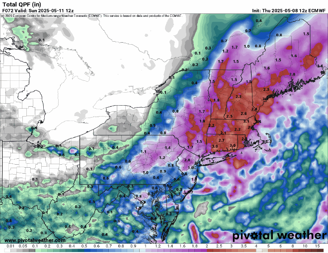
Euro is 2 to 3 for most except far eastern areas and the cape with showers into Saturday afternoon.. Sunday looks really good though
-
Made it to 80 ahead of the clouds now down to 77 / 55
-
Storms popping
-
The rain is thankfully. We mow we sun