All Activity
- Past hour
-

September 2025 OBS-Discussion centered NYC subforum
Intensewind002 replied to wdrag's topic in New York City Metro
Only 0.3" here since Tuesday morning, dew point up to 73 here makes it feel like mid July -
Pretty cool trends...unfortunately gets stuck in SC

-

Invest 94L—70% 2 day and 90% seven day odds of development
MJO812 replied to WxWatcher007's topic in Tropical Headquarters
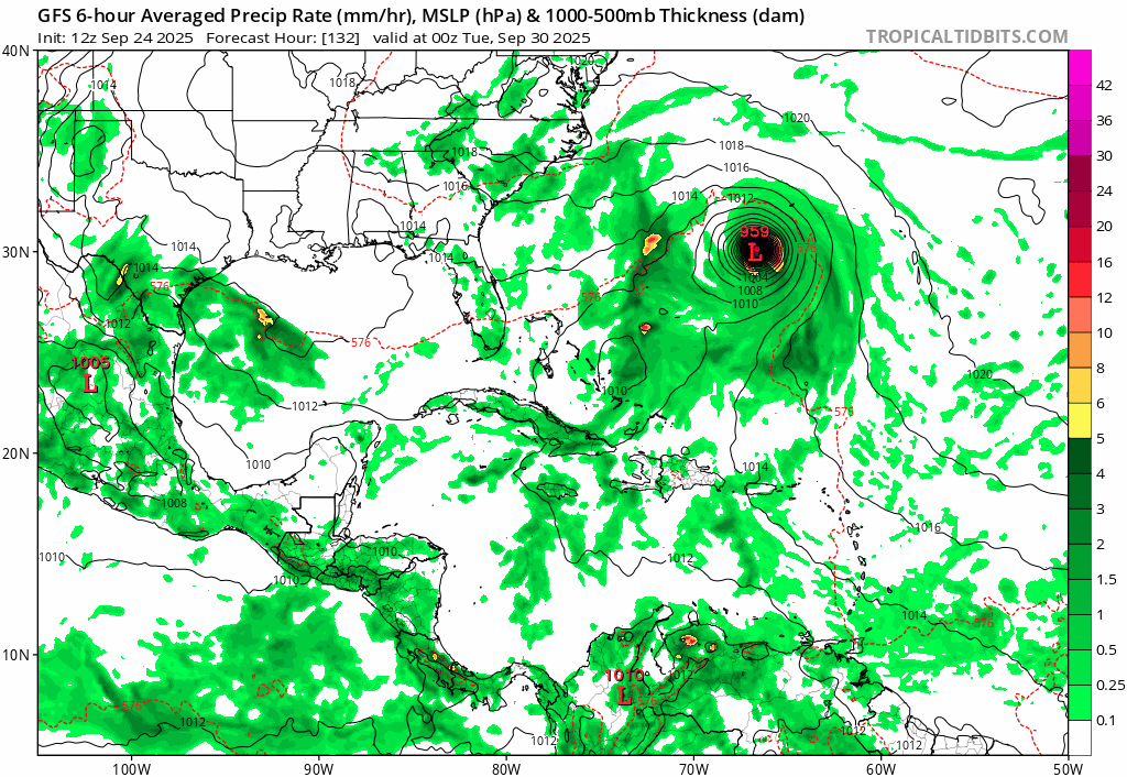
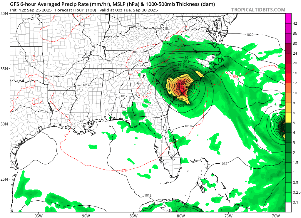
SC landfall on gfs
-
-

September 2025 OBS-Discussion centered NYC subforum
bluewave replied to wdrag's topic in New York City Metro
Yeah, it was just something that you got used to living in Long Beach being right under the approach to JFK. The planes ultimately will have to flyover someone’s neighborhood with how busy JFK and LGA are. I hope they can change things up a bit to make the noise a little lower in your area. -
Invest 94L—70% 2 day and 90% seven day odds of development
MJO812 replied to WxWatcher007's topic in Tropical Headquarters
Gfs rolling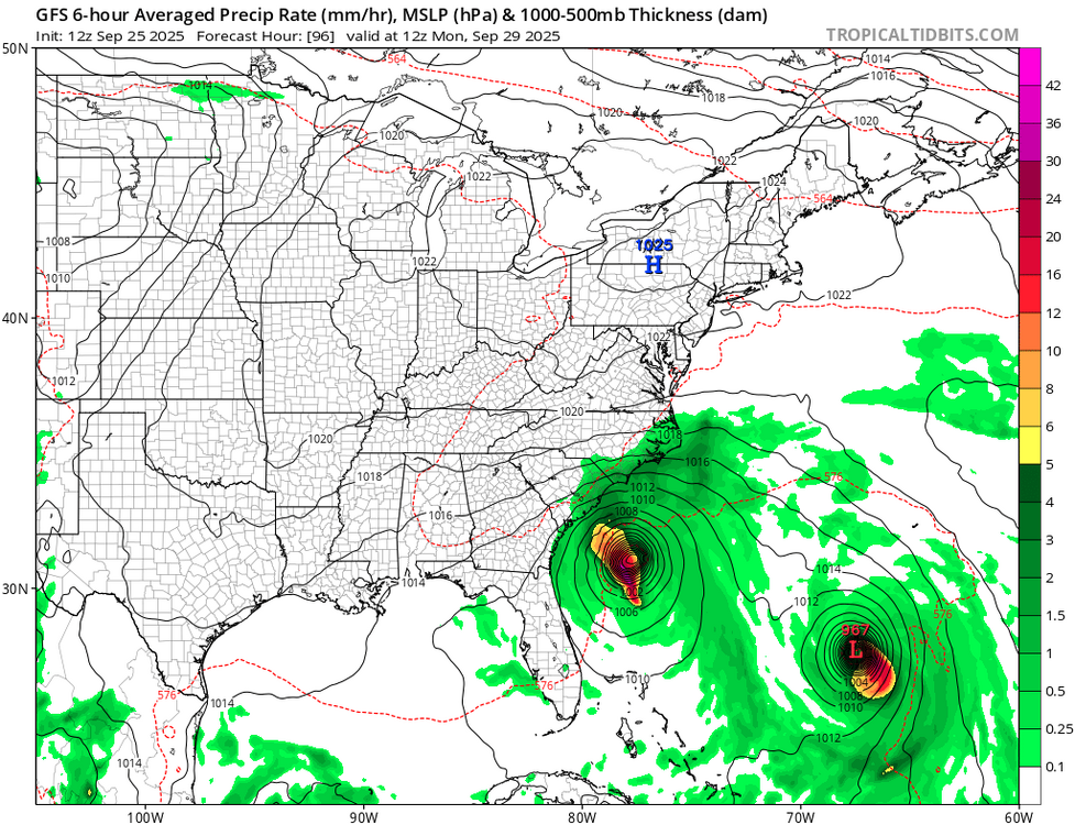
-
3rd straight cloudy day - hadn't seen that since mid June. First 2 produced only 0.13", today should bring considerably more.
-
Tornado box NW of Monticello
-
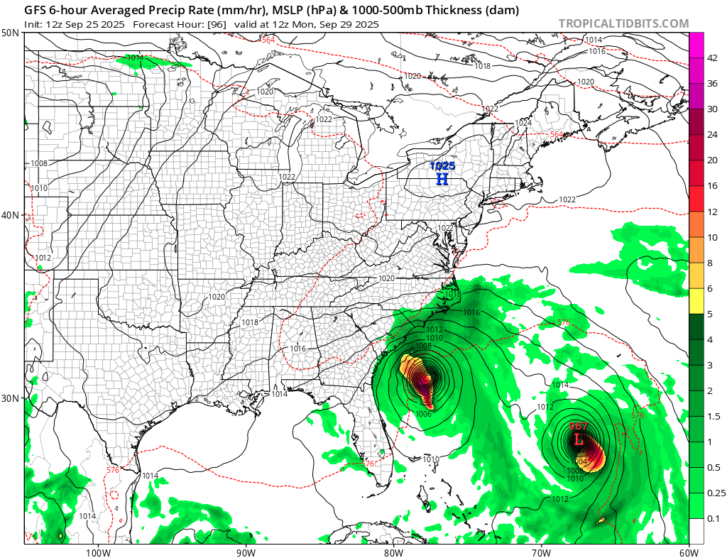
12z GFS shows a weaker Umberto and stronger future Imelda through 72. Has more rain Saturday Night into Sunday than 6z...
-
for sure most models did not show this but 12z HREF yesterday went wild and did
-
Tornado warning northeast PA .
-
There is a very weird obsession with the HREF...ever since it nailed some event a few years back (forgot what it was). But that's what forecasting is evolving into...pick a model and output source that displays beautiful visuals and construct what its showing into a "forecast".
-
Too early, plus there is a thread in the Tropics section.
-
The gfs holds. It insists 94L swamps the SE while we smoke cirrus. Come on Euro!
-
It’s all BOX uses
-

Fall 2025 Medium/Long Range Discussion
SchaumburgStormer replied to Chicago Storm's topic in Lakes/Ohio Valley
Dont hate WAD october, but start to get concerned that we roll right into WAD winter. Pretty damn boring locally, and the gulf is recurve city. -
I wouldn't call that excellent.
-
.04" here. 72/71. disgusting out.
-
I think the HREF is kind of meh overall. I mean there are times it does great but there are many times it way overdoes things
-
HREF had it
-
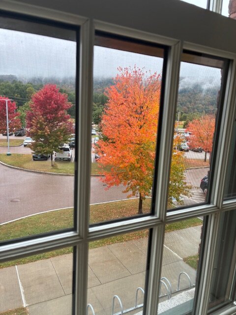
Even in a blah foliage year, there are still pops of color.
-
We might do medians better than mean.
-
Amen brother!! I'll take some wind and a nice deluge!!!!
-
In regards to Invest 94. NWS is waiting on NHC which is in a wait and see mode... Latest from Charleston S Carolina. NWS.. The forecast becomes exponentially uncertain into early next week as a complicated set up begins to take shape over the southeastern states and adjacent western Atlantic waters. The National Hurricane Center continues to monitor invests 94L in the western Atlantic for potential tropical development over the next 7 days. TS Humberto formed in the late afternoon hours Wednesday, with models struggling to agree on track/intensity, especially as majority of guidance has it interacting with invest 94L which further complicates the forecast. For now, The extended forecast will remain closely monitored over the next several days.
-

September 2025 OBS-Discussion centered NYC subforum
steve392 replied to wdrag's topic in New York City Metro
Just had some nice downpours!


(002).thumb.png.6e3d9d46bca5fe41aab7a74871dd8af8.png)