All Activity
- Past hour
-
Car is getting Powerwashed
-
Gonna uninstall those ACs for you?
-
Windy here now too
-
Wind is nuts car rocking
-
Wind kicking up
-
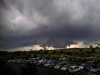
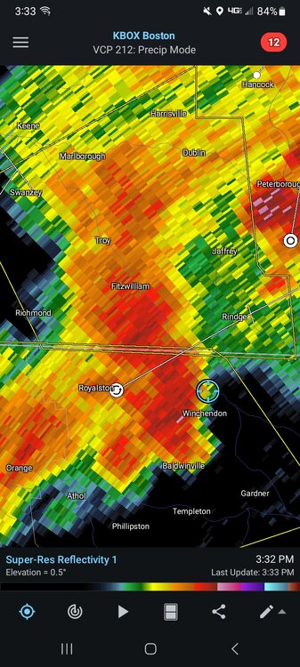
LFG just saw a crazy cloud to ground strike!! In winchendon
-
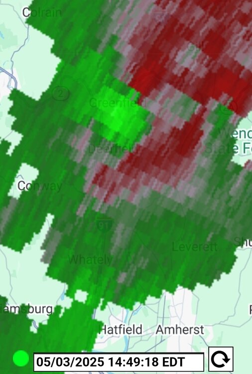
Looks like a nice bow west of Hotford
-

Mountain West Discussion
mayjawintastawm replied to mayjawintastawm's topic in Central/Western States
600 passengers... that's called flying a building, not an airplane. Seen a couple up close at Dulles on the shuttle between terminals, wow. Missed this one's landing by an hour and a half on Wednesday, but seen quite a few take off and land at other airports. They actually don't seem to take as long to get off the ground and climb out as the 747s do. -
Watching that storm to my SW out of Leesburg. Right now looks to go just to my South but am hearing thunder off of it. After last night’s surprise pop up I may just bring in the catio just in case.
-
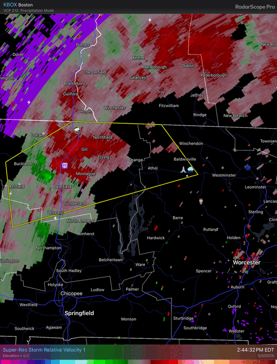
Helicity values over MDT and LNS are off the charts.
-
Oh no! Am I too far east?
-
So many did, expecting a weekend washout
-
Euro not good at times. I have not looked at the latest run. Meanwhil,e the WPC has trimmed back rainfall totals even more in its latest update, especially the Tidewater region. when you look at your local forecast and see odds of rain at 70 % equaling a tenth of an inch, pretty sad.
.gif.678c16dbcedb6c9296d3e88108d72361.gif)
-
Where's hippie? He should be getting some pictures.
-
Didn't stop the cliff jumpers though.
-
Nice little storm moving through Loudoun. Bit of wind, some pea sized hail, heavy rain, and a few claps of thunder. Hopefully just the start of a stormy stretch for the area.
-
Go get it!
-
Nah, we’re pretty good at humid and pop up cells. Not sure about an organized line or anything, but this is the pattern we need.
-

E PA/NJ/DE Spring 2025 Obs/Discussion
LVLion77 replied to PhiEaglesfan712's topic in Philadelphia Region
Unfortunately, it looks like a lot of the action has stayed to the north and west today. I thought the sunshine would be stabilize us enough to see some action popping. There may be something looking to form in Maryland at this point, so we shall see. -
The other thread is calling today a dud. I saw through it though, it's not over yet.
-
Today’s weather is pure gold. Some cells are starting to fire up now, too. I wish this was our weather 8 months out of the year.
-
It did briefly ramp up off the ground in Turners Otherwise the trailing discrete cells are yielding to the line in W CT and that looks to be the dominant feature here
-
The front ended up further north-hence the forcing up that way....
-
Let’s tighten that up
-
Storm in Central Loudoun is showing some hail reflectivity