All Activity
- Past hour
-
I knew they weren’t getting 3 feet of snow. That like never happens. Usually ends up over us or north
-
not to go off topic but this is going to be a fun webcam to watch in a few minutes
-
E PA/NJ/DE Winter 2025-26 Obs/Discussion
Chadzachadam replied to LVblizzard's topic in Philadelphia Region
the melting of last weekend's snow is well underway in Philly, but if we can make it through this afternoon we should lock in 2+ weeks of snow cover -

Possible Record Breaking Cold + Snow Sunday 1/25 - Tuesday 1/27
weathermedic replied to TriPol's topic in New York City Metro
That is only through 7pm Sunday -
I was at UMCP at the time and don't even remember that one, which is weird. Just looked at an accumulation map for that one and it does look like CP got shafted, which wasn’t unusual. Temps always seemed to run warm there to me. I may vaguely remember this one now. I think it was a really heavy, wet snow that we probably got about eight inches out of but probably got less on paved surfaces and melted very quickly. Just surprised Baltimore got hit so hard and I don’t remember being disappointed I missed out. I guess I had other things on my mind at the time.
-
Tomer Burg posted elsewhere that it apparently is a know euro problem with ZR vs sleet. I think very little ZR for the metro areas. Maybe FZDZ at the very end.
-
watches up from ALY, 12-16"
-
Usually is the last 48hrs it will shift nw if it’s going to.
-
Never dance on the grave of a snow lover. It invites back luck for you. Really impressive temp drop over the next 24 hours. It's amazing to realize that today might be the warmest day for the rest of the month.
-
I get that, but I still think you're being overly pessimistic. We usually don't have this kind of setup leading into a storm. We'll make at least 7, mark my words!
-

Possible Record Breaking Cold + Snow Sunday 1/25 - Tuesday 1/27
psv88 replied to TriPol's topic in New York City Metro
My Holly is storm total map, Upton is until 7 pm Sunday...apples and oranges -
Possible Record Breaking Cold + Snow Sunday 1/25 - Tuesday 1/27
OrangeCTWX replied to TriPol's topic in New York City Metro
Again that is through 7pm Sunday lol. More to come after that. -
Possible Record Breaking Cold + Snow Sunday 1/25 - Tuesday 1/27
wxman replied to TriPol's topic in New York City Metro
This will be a true test of forecasting skills versus just accepting what models spit out. There is definitely support for this projected outcome, just outside what we view as the consensus of the better models. -
Texas 2026 Discussion/Observations
aggiegeog replied to Stx_Thunder's topic in Central/Western States
Sub 0F temps early next week cannot be discounted at this point. I do not expect to break the 2021 records but could approach some of them. -
Pittsburgh/Western PA WINTER ‘25/‘26
TheClimateChanger replied to Burghblizz's topic in Upstate New York/Pennsylvania
40 is a bit exaggerated, no? All of the official temps are like 33-34 right now. -
January 25-26 Winter Storm Potential
dizzy9479 replied to Ralph Wiggum's topic in Philadelphia Region
URGENT - WINTER WEATHER MESSAGE National Weather Service Mount Holly NJ 145 PM EST Thu Jan 22 2026 DEZ001>004-MDZ012-015-019-020-NJZ016>019-021>025-027-PAZ070-071-101- 102-104-231100- /O.CON.KPHI.WS.A.0001.260125T0000Z-260126T1800Z/ New Castle-Kent-Inland Sussex-Delaware Beaches-Kent MD-Queen Annes-Talbot-Caroline-Salem-Gloucester-Camden-Northwestern Burlington-Cumberland-Atlantic-Cape May-Atlantic Coastal Cape May- Coastal Atlantic-Southeastern Burlington-Delaware-Philadelphia- Western Chester-Eastern Chester-Eastern Montgomery- Including the cities of Lansdale, Wharton State Forest, West Chester, Cape May Court House, Norristown, Moorestown, Camden, Mount Holly, Oxford, Georgetown, Ocean City, Philadelphia, Millville, Rehoboth Beach, Pennsville, Cherry Hill, Wilmington, Chestertown, Atlantic City, Easton, Honey Brook, Dover, Centreville, Kennett Square, Denton, Media, Glassboro, and Hammonton 145 PM EST Thu Jan 22 2026 ...WINTER STORM WATCH REMAINS IN EFFECT FROM SATURDAY EVENING THROUGH MONDAY AFTERNOON... * WHAT...Heavy snow with sleet and freezing rain possible. Total snow accumulations between 11 and 15 inches and ice accumulations up to two tenths of an inch possible. * WHERE...Portions of Delaware, northeast Maryland, southern New Jersey, and southeast Pennsylvania. * WHEN...From Saturday evening through Monday afternoon. * IMPACTS...Travel could be very difficult to impossible. The hazardous conditions could impact the Monday morning commute. PRECAUTIONARY/PREPAREDNESS ACTIONS... Monitor the latest forecasts for updates on this situation. && $$ NJZ001-007>010-012>015-020-026-PAZ054-055-060>062-103-105-106-231100- /O.CON.KPHI.WS.A.0001.260125T0600Z-260126T1800Z/ Sussex-Warren-Morris-Hunterdon-Somerset-Middlesex-Western Monmouth-Eastern Monmouth-Mercer-Ocean-Coastal Ocean-Carbon- Monroe-Berks-Lehigh-Northampton-Western Montgomery-Upper Bucks- Lower Bucks- Including the cities of Somerville, Chalfont, Freehold, Newton, Washington, Stroudsburg, Reading, Jackson, Trenton, Perkasie, Jim Thorpe, Pottstown, Long Beach Island, Allentown, Sandy Hook, Easton, Morrisville, Bethlehem, New Brunswick, Doylestown, Morristown, Collegeville, and Flemington 145 PM EST Thu Jan 22 2026 ...WINTER STORM WATCH REMAINS IN EFFECT FROM LATE SATURDAY NIGHT THROUGH MONDAY AFTERNOON... * WHAT...Heavy snow with mixed precipitation possible. Total snow accumulations between 12 and 16 inches and ice accumulations around one tenth of an inch possible. * WHERE...Portions of northern New Jersey and southeast Pennsylvania. * WHEN...From late Saturday night through Monday afternoon. * IMPACTS...Travel could be very difficult to impossible. The hazardous conditions could impact the Monday morning commute. PRECAUTIONARY/PREPAREDNESS ACTIONS... Monitor the latest forecasts for updates on this situation. && $$ -
That's still in play from some of the responses I got.
-
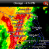
1/24-1/25 Major Winter Storm - S. IL, IN, MI and OH
TimChgo9 replied to A-L-E-K's topic in Lakes/Ohio Valley
That's what it looks like. First snowstorm for me in a couple of years. (I was in TX for the Feb '21 debacle.) Nebraska winters were boring when I was out there. My wife is from the Dayton area, we moved out here to be as close as possible to her father. NE of Cincy here. Currently on leave from work, so I get to just sit and watch the snow as it comes down. BTW - KILN calling for 7"-11" -
I would really not be worrying at all about freezing rain in this system, outside of some freezing drizzle as the storm departs and we get the dry slot. When you look at the soundings, there's a barely above freezing warm nose at 750-700mb. Sleet will be the concern if we flip. I think some of the website model algorithms are off.
-
Honestly they've had it too good for too long. It's their turn to get a screw job.
-
Listen I wasn't even looking for two feet. But I sure as heck wanted to least try to make a run at double digits for the first time--it sucks because you'd think a simple SS wave coming right at us would deliver...but then we get unlucky with a NS complication, and you wonder if it continues to get trimmed back over the next 48 hours.
-
January 25-26 Winter Storm Potential
Chadzachadam replied to Ralph Wiggum's topic in Philadelphia Region
I'm conflicted because warm noses are always under-modeled but the NAM is always over-amped. at this point I'll just forget watching individual models and roll with the NWS forecast. sign me up for 13.5" lol -
Possible Record Breaking Cold + Snow Sunday 1/25 - Tuesday 1/27
SnoSki14 replied to TriPol's topic in New York City Metro
Is that snow + sleet since technically sleet counts for totals. -

Possible Record Breaking Cold + Snow Sunday 1/25 - Tuesday 1/27
psv88 replied to TriPol's topic in New York City Metro
FWIW the Icon and GFS dont get above 25, and the Ukie also doesnt get above 30. Nice cold storm!


