All Activity
- Past hour
-
Front seems to be moving at a fast pace....could it go through earlier than forecasted? Does this mean the worst effects may be further east?
-
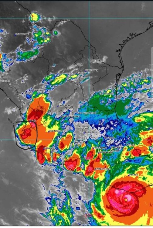
It is very weird being in a region without radar. Thank God for GOES. Anyways, Erick is 400 miles away still, CAT 3. Will make landfall early AM east of Acapulco. Here a monsoon trough is putting a squeeze play here with lightning and rain past 4 hours. The forecast is 3-6". Sent from my SM-G970U1 using Tapatalk
-
On this note fireflies do best in this type of weather so they are out in full force tonight. Highly recommend walking to a nearby wet wooded area.
-
All Clouds All The Time
-
No, not like that. Imho- record breakers are more likely than less likely. Something will line up just right and put down insane totals before long. Juice is real and prolific qpf makers in general are on the increase. Bread butter frequency is what is worrisome. The punch of the northern jet seems to be retreating on avg and south of the M/D never had a lot of room to spare even in the better times of decades past. Lack of clippers is a good example of what I'm talking about among other things. 2014-15 was 10 years ago already. Seems nearly impossible to get a run of clippers and overrunners since. The 4 decades before that had plenty.
-
You be comin’ at em’ like a stiff blow messin’ up their program!
-
They got off at the exit....
-
85° today... Plenty of days with rain but has only added up to 1.05" for the month.
-
Probably already had the hottest day of the year here. Some of the characters change, but the message is always the same, hype up mundane weather. You hate to see Scott reduced to hyping meh heat.
-
1.99” for the day
-
I'm not disputing, anything you're saying. I have no doubts that all happened. Just adding my two cents.
-
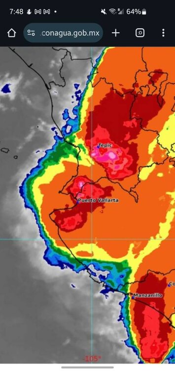
120mph/953mb
-
83 today. beautiful night. Lightning way off in the distance
-
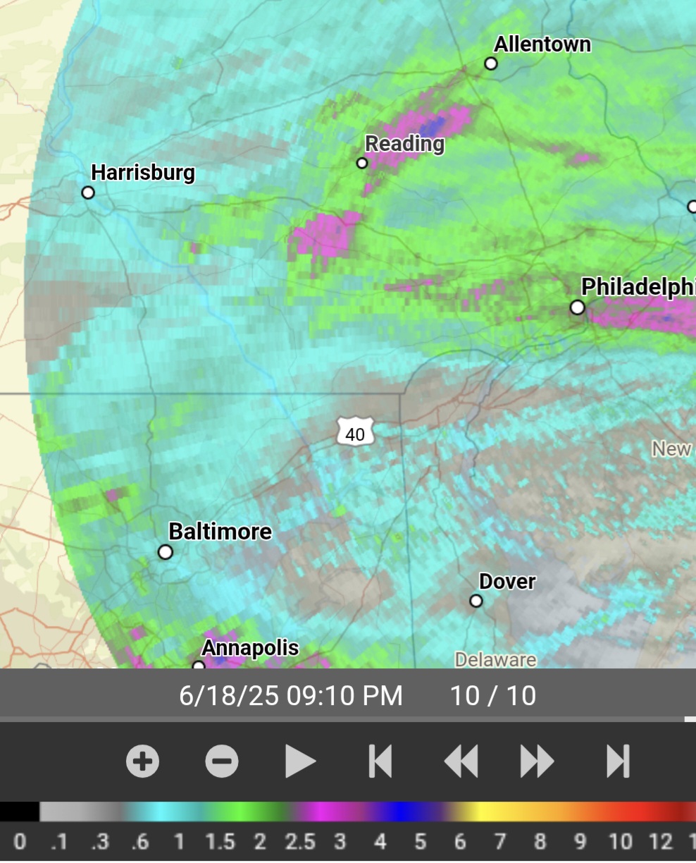
Radar estimations give a few spots well over 3" approaching or at 4" NE of Reading.
-
Prob gonna end up with 7+ inches of rain today. Been awhile I seen flooding like I've seen today around here.
-

-
Thunder is non stop, I assume for those storms 25 miles away in Rockland/NJ border. Sounds like its right here though
-
Beautiful view of distant cumulus nimbus and lightning off to the NW at the moment.
-
87/72 so far for the hi/low 1.52" of rain today Quite a summer afternoon with those storms earlier. It feels like late June out there and the heat will not be ceasing anytime soon.
-
pouring here.
-
Yeah its bad, and last time I pass by there it was considerably worse than this. You can walk right past it but its so hidden now you may no idea anything is there unless you are really trying to find it. Just standing there compared to being out and about where people actually live and its undeniable that it is an absurd representation of NYC.
-
This was such a low risk, high reward signing given the details of the contract. This only adds to a pretty solid secondary for starting sense with some of the depth pieces reputable and likely to learn over time from the people ahead on the depth chart. Considering our schedule this season, this is a huge pickup in a scheme sense. Need to stay healthy, and the rotation should help Alexander in that regard. I am stoked for this one.
-
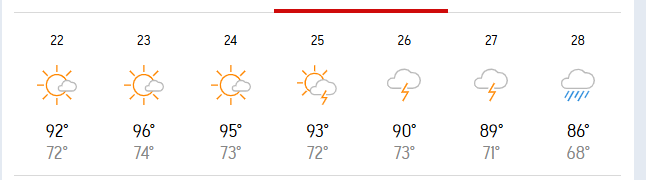
Accuweather for the Carnot-Moon area.
-
The National Weather Service in Cleveland has issued a * Severe Thunderstorm Warning for... Cuyahoga County in northeastern Ohio... Northeastern Lorain County in north central Ohio... * Until 945 PM EDT. * At 858 PM EDT, severe thunderstorms were located along a line extending from near Avon Lake to near Grafton, moving northeast at 60 mph. THESE ARE DESTRUCTIVE STORMS FOR NORTHEAST LORAIN AND NORTHERN CUYAHOGA. HAZARD...80 mph wind gusts. SOURCE...Radar indicated. IMPACT...Flying debris will be dangerous to those caught without shelter. Mobile homes will be heavily damaged. Expect considerable damage to roofs, windows, and vehicles. Extensive tree damage and power outages are likely. * Locations impacted include... Cleveland, Lorain, Elyria, Parma, Lakewood, Euclid, Cleveland Heights, Strongsville, Westlake, North Royalton, North Ridgeville, Avon Lake, Warrensville Heights, Grafton, Highland Hills, North Olmsted, Garfield Heights, Shaker Heights, Maple Heights, and South Euclid.
- Today
-
Unfortunately, window units have 10 to 12 year lifespan in my experience.


.thumb.png.4150b06c63a21f61052e47a612bf1818.png)


.thumb.jpg.6a4895b2a43f87359e4e7d04a6fa0d14.jpg)