All Activity
- Past hour
-

Ice Ice Baby December 28-29 Storm Discussion
TheMainer replied to Baroclinic Zone's topic in New England
20 F and snow leaving the house on the way to Auburn area, should be an exciting drive... 1.1" of snow, hope we can hang on longer to snow like some of the Hi-res stuff is showing. -

Ice Ice Baby December 28-29 Storm Discussion
ineedsnow replied to Baroclinic Zone's topic in New England
Yup meh as we thought -
I posted the maps for both models. The numbers are from the maps. Nothing is derived. Bufkit computes snow using 4 algorithms and uses 1:1 for sleet.
-
Yup, even down here I had a hard glaze of snow topped ice that persisted since Fri night until the warm up began yesterday. Lasted all Saturday instead of instantly vanishing. If we can get an event, even small, not tied to an extreme warm up this seems like a good winter for retention even at the CP. The last such for me was 14-15. My Dec average temp is 32.9 which is wild, coldest Dec by a mile since I installed my Tempest.
-

Ice Ice Baby December 28-29 Storm Discussion
dendrite replied to Baroclinic Zone's topic in New England
This is going to end up being a major nothingburger. WTTTE -
High wind watch issued.. should be meh as usual
-

Ice Ice Baby December 28-29 Storm Discussion
Sugarloaf1989 replied to Baroclinic Zone's topic in New England
Still at 32F. -
Ice Ice Baby December 28-29 Storm Discussion
dendrite replied to Baroclinic Zone's topic in New England
Already 32° -
Some of you guys really are
-

Ice Ice Baby December 28-29 Storm Discussion
moneypitmike replied to Baroclinic Zone's topic in New England
Thermometer here in PVD is reading 36. Snow on the deck has already taken a beating (that's actually a win). Pit2 is showing 33. My p/c up there is calling for 1-2 inches of rain......seems high. With a forecast high of 42, that will do some pack damage. -

January 2026 regional war/obs/disco thread
Snowcrazed71 replied to Baroclinic Zone's topic in New England
What you're saying makes no sense whatsoever. Nothing is showing this kind of pattern in the upcoming several weeks? - Today
-
Apparently fantasy is now only thing we can post or hope for.
-
Front passing through with downpour. Temp hit 59 before the crash. Wind is already ripping on the ridge.
-

December 2025 regional war/obs/disco thread
Ginx snewx replied to Torch Tiger's topic in New England
BDL normal rest of big 4 -2 to -4 inches meh -

Ice Ice Baby December 28-29 Storm Discussion
Modfan2 replied to Baroclinic Zone's topic in New England
That’s not fun, we just hit 35F and the. area around me with elevation is mid 30’s to 40F -
I’ll be up there in mid Feb for snowmobiling as well
-

Texas 2025 Discussion/Observations
Stx_Thunder replied to Stx_Thunder's topic in Central/Western States
Why am I not too surprised about completely uncalled for "mistakes" like this from NWS anymore..: The nut "forecaster" who posted that must've been on 'you know what'. Possibly even more so when they learned the Christmas in July pattern would be in the grids this year.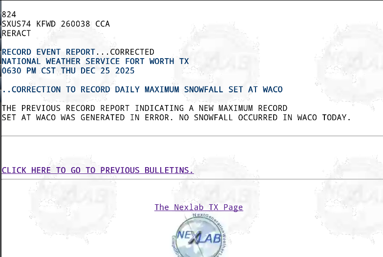
-

E PA/NJ/DE Winter 2025-26 Obs/Discussion
RedSky replied to LVblizzard's topic in Philadelphia Region
32.5F The cold refuses to lose -
Ice Ice Baby December 28-29 Storm Discussion
Ginx snewx replied to Baroclinic Zone's topic in New England
Not so fun drive to bring my wife, daughter and granddaughter to PVD 33⁰ when I left icy as all heck until Warwick 37⁰ way home was much better above freezing entire way until my hill which is now 40⁰ with heavy heavy fog. -
Ice Ice Baby December 28-29 Storm Discussion
Modfan2 replied to Baroclinic Zone's topic in New England
32F here at 3am, a little shocked we haven’t gone above freezing -
I have this link saved to my phone as well. Almost forgot I had it favorited lol. It’s just a compilation of some of the music used during those golden years of the weather channel. I’m sure you’ll recognize quite a few of these pretty quickly. Enjoy! https://twcclassics.com/audio/years-2001.html
-
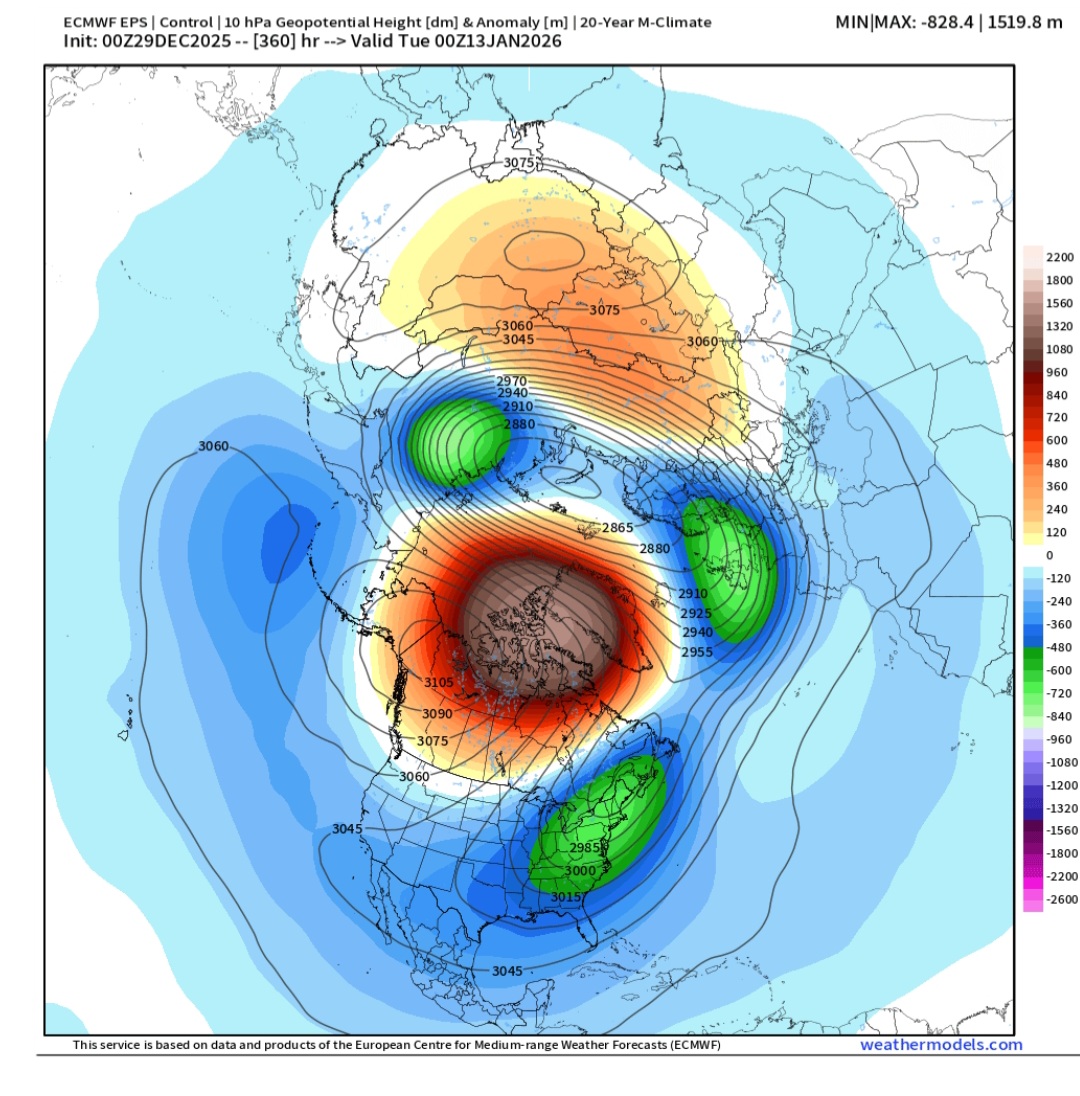
Carver/Met, I happen to already be knowledgeable about what BAMwx is trying to say. I don’t know why BAMwx is calling it 43 “points” gained for the GEFS. That throws off this tweet and makes it confusing. It’s actually 43 heating degree days gained for the period 12/28-1/3 vs what the run had 7 days ago (12/21 run). This means that the 12/21 run was much warmer for that period than the 12/28 run mainly because it largely was still missing the oncoming E US cold period. OTOH, the 12/21 EPS wasn’t nearly as far off because it was significantly colder than the GEFS in the E US due to already figuring it out much earlier than the GEFS. So, it only needed to gain 12 HDDs to fully see the light. The blues represent colder changes since 12/21 while the red/yellow means warmer changes.
-

-
At 384…. Looks like we have more coming…. [emoji102][emoji102] .
-
Whatever that is on the GFS at the backend…. Ill take 3 of em back to back to back. .