All Activity
- Past hour
-
-

“Cory’s in NYC! Let’s HECS!” Feb. 22-24 Disco
deathstar9 replied to TheSnowman's topic in New England
Only storm I can find in the KU book with a gradient approaching 78-80MB is the March 1914 hyper bomb. 952 MB low (strongest non tropical ever recorded in the NE). Roughly a 1028-30 high centered over Iowa. NYC recorded an 84mph gust in that storm. Are there any other people can think of? -

Feb 22nd/23rd "There's no way..." Obs Thread
SnowGolfBro replied to Maestrobjwa's topic in Mid Atlantic
Temp dropped faster tonight than i thought it would. Just stepped out back with the dog and it feels like snow is coming. Didnt feel that way at 5pm. Hoping the NAM had this one sniffed out -
Lived in McLean for 62 years. The difference between totals on MCLEAN and DCA is significant and real. However, the difference has gone down over years and we are unfortunately now closer to DCA‘s totals then we are IAD’s. That’s happened in the last 10 years and it sucks.
-
Richmond Metro/Hampton Roads Area Discussion
Berlin1926 replied to RIC Airport's topic in Mid Atlantic
21z is 4pm isn't it ? -

“Cory’s in NYC! Let’s HECS!” Feb. 22-24 Disco
40/70 Benchmark replied to TheSnowman's topic in New England
Problem is tomorrow will have the input from mesos RE banding... -
Just got back home from dinner and drinks. This is all I needed to read. LFG
-
That would be a huge let down
-
Can’t believe I’m missing this one. Shame
-

Feb 22nd/23rd "There's no way..." Obs Thread
Ralph Wiggum replied to Maestrobjwa's topic in Mid Atlantic
-
RGEM is ummm, concerning
-
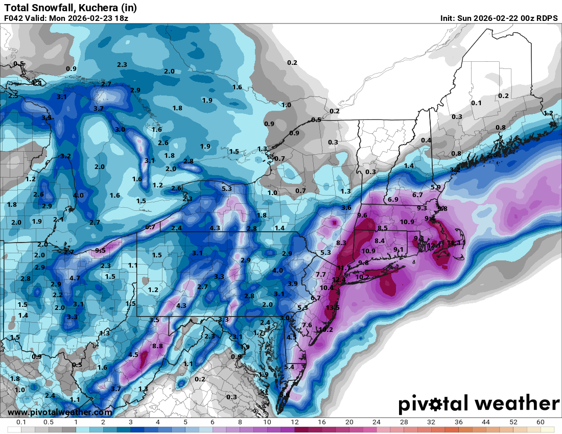
2/22 00z RGEM Total QPF 2/22-2/23-24 10:1 Snow
-
FV3 never verifies well. I'm more annoyed that the 00Z RGEM sucked for all of us. Never get into sustained mod-hvy rates for a while and the precip is gone before 12Z Mon. Looks to progressive with the coastal low.
-
Is it definitely going to be better than the January storm? Seems unlikely for most. And people getting clobbered up the street is depressing.
-

Feb 22nd/23rd "There's no way..." Obs Thread
Interstate replied to Maestrobjwa's topic in Mid Atlantic
I am west of 95 and I am getting 12+ inches of course my windows trays say I am getting 1 inch of rain tomorrow. I must be where Gray Hat is located -
Feb 22nd/23rd "There's no way..." Obs Thread
Interstate replied to Maestrobjwa's topic in Mid Atlantic
Yeah it is crazy the spread that still exist between models with only 12 hours to go -
Does my sick weenie mind still want it to verify...absolutely
-
-

Central PA Winter 25/26 Discussion and Obs
canderson replied to MAG5035's topic in Upstate New York/Pennsylvania
Sand is not pleasant in particular regions, so I’ve been told -

“Cory’s in NYC! Let’s HECS!” Feb. 22-24 Disco
moneypitmike replied to TheSnowman's topic in New England
ICON way less qpf than the NAM's. -
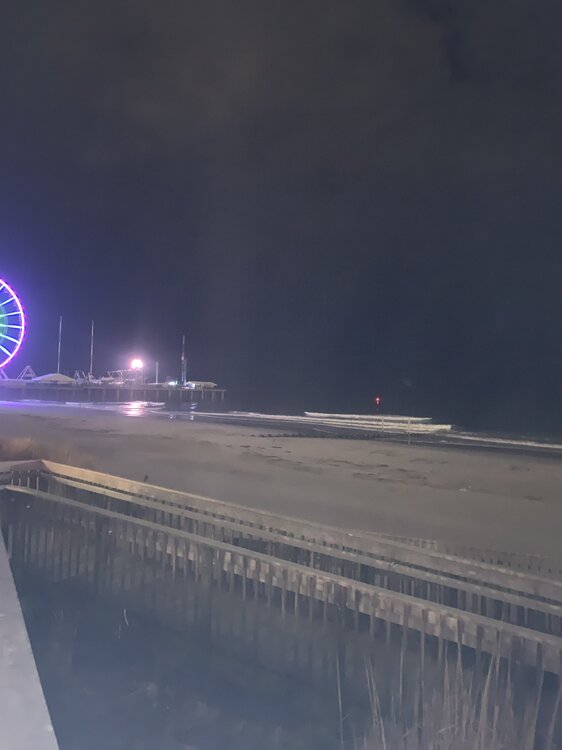
Calm before the storm (ACY). 38/32.
-

“Cory’s in NYC! Let’s HECS!” Feb. 22-24 Disco
Typhoon Tip replied to TheSnowman's topic in New England
Yeah Ray I’m a little suspicious of the back off in the local QPF with the NAM actually being closer, while at consistent relative intensity/deep layer structural aspects I’ve seen this before where a model just blanks out a quadrant. It’s not usually real… If the 06z pulls the same track and intensity, I’d be surprised if it didn’t repaint larger QPF up here. -

Feb 22nd/23rd "There's no way..." Obs Thread
winter_warlock replied to Maestrobjwa's topic in Mid Atlantic
Will be best storm since 2016 for only people to the east of i95 ,not everyone -
Rgem just hates this storm.
-
Updated ICON