All Activity
- Past hour
-

First Winter Storm to kickoff 2025-26 Winter season
40/70 Benchmark replied to Baroclinic Zone's topic in New England
Me, neither. -

First Winter Storm to kickoff 2025-26 Winter season
Snowcrazed71 replied to Baroclinic Zone's topic in New England
Or does it? -

First Winter Storm to kickoff 2025-26 Winter season
dryslot replied to Baroclinic Zone's topic in New England
Were not seeing 2" qpf, Probably 0.5-1.0" would be more realistic, 18z GEFS looks nothing like the OP, Its SE of it. -
41/29 today east side of Columbia
-
Yeah I don't understand...y'all just won the SB LAST YEAR and you're still leading your division for crying out loud! I really don't get this level of angst...
-
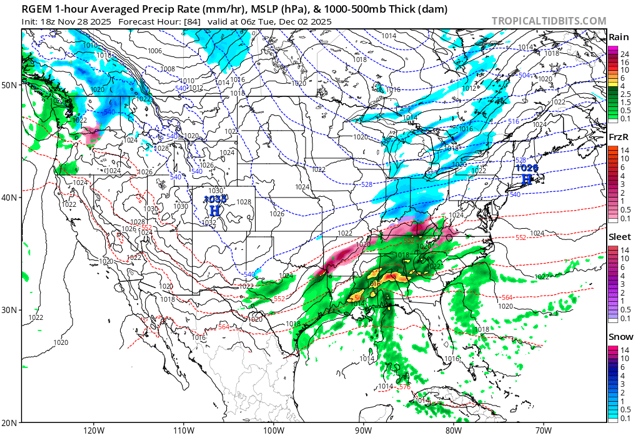
 Everything looks relatively encouraging for I-95 NW except the GFS. It's insistent on a packet of vorticity and associated sharp shortwave tracking from MO through OH through northern NY. Most other guidance is AR through KY through PA or SNJ. If a shortwave tracks that far NW it will be very hard to keep snow anywhere along the coastal plain. From memory I feel like if any model sees this kind of shortwave tracking near the Lakes with a coastal SLP, it ends up verifying.
 -

First Winter Storm to kickoff 2025-26 Winter season
bristolri_wx replied to Baroclinic Zone's topic in New England
I feel like the weighted blend right now would be 75% Euro, 25% GFS, only because there's more modeling supporting the Euro right now. -

Nov 28-30th Post Turkey Day Winter Storm
homedis replied to Chicago Storm's topic in Lakes/Ohio Valley
Interesting, they even mention lake enhancement. Doesn’t match up with LOT at all. Edit: looking at it again, its actually matches up. Just a really odd look to the LOT map with the 5-9” stripe in the heart of Cook County. -
38 for a high
-

First Winter Storm to kickoff 2025-26 Winter season
dendrite replied to Baroclinic Zone's topic in New England
Sell’em all. 2” interior QPF runs? Not buying it. -
First Winter Storm to kickoff 2025-26 Winter season
dryslot replied to Baroclinic Zone's topic in New England
Sell that GFS run. -

First Winter Storm to kickoff 2025-26 Winter season
WxWatcher007 replied to Baroclinic Zone's topic in New England
Don't worry, you have backup now, quietly cheering you on. Yeah, I think that's way overdone. -

First Winter Storm to kickoff 2025-26 Winter season
Damage In Tolland replied to Baroclinic Zone's topic in New England
One of those deals where the Euro caves? -
First Winter Storm to kickoff 2025-26 Winter season
Damage In Tolland replied to Baroclinic Zone's topic in New England
Are we losing it? -

Nov 28-30th Post Turkey Day Winter Storm
A-L-E-K replied to Chicago Storm's topic in Lakes/Ohio Valley
Brutal -
Tomorrow will be unseasonably cold. There is potential for New York City's Central Park to experience its first freeze of 2025 tomorrow morning. The 1991-2020 normal first date is November 21. The 1961-1990 baseline was November 11. Last winter's first freeze occurred on November 30. Saturday and Sunday will see a snowstorm blanket parts of the Great Lakes Region. Chicago and Milwaukee could see 6"-12" of snow. Detroit could pick up 4"-8". Toronto could see 3"-6". Sunday and Monday will be somewhat milder. Showers are possible on Monday as a cold front moves across the region. Generally colder than normal conditions could then continue into or through the second week of December. Severe cold appears unlikely through at least the first 10 days of December. Nevertheless, December 1-10 will be a solidly colder than normal period. Moreover, a storm could affect the region on Tuesday into Wednesday, bringing 0.50"-1.50" precipitation to the region. There is a distinct possibility that New York City could see its first measurable snowfall of the season. Interior sections have the highest probability of seeing accumulations of snow. The ENSO Region 1+2 anomaly was -0.7°C and the Region 3.4 anomaly was -0.7°C for the week centered around November 12. For the past six weeks, the ENSO Region 1+2 anomaly has averaged -0.16°C and the ENSO Region 3.4 anomaly has averaged -0.65°C. La Niña conditions will likely continue through at least mid-winter. The SOI was -3.12 today. The preliminary Arctic Oscillation (AO) was +0.081 today. Based on sensitivity analysis applied to the latest guidance, there is an implied 99% probability that New York City will have a cooler than normal November (1991-2020 normal). November will likely finish with a mean temperature near 47.2° (0.8° below normal). Supplemental Information: The projected mean would be 0.5° below the 1981-2010 normal monthly value.
-
Meanwhile
-
That's funny. All my local forecasts for amounts, which, granted, is WAY to early to put out amounts. Is over 6". My point is. Where do you get this amazing info? Seeing a raging rainstorm well N&W of NYC, and into New England? Please elaborate your brilliance in weather forecasting.
-
Nov 28-30th Post Turkey Day Winter Storm
A-L-E-K replied to Chicago Storm's topic in Lakes/Ohio Valley
This is our moment -

Nov 28-30th Post Turkey Day Winter Storm
Chicago Storm replied to Chicago Storm's topic in Lakes/Ohio Valley
pretenders. signed, a lowly falcons fan. -

Nov 28-30th Post Turkey Day Winter Storm
Mogget replied to Chicago Storm's topic in Lakes/Ohio Valley
MKX went up to 8-13 Inches. Kind of shocked, actually. -
High of 41, coldest so far of season
-
First Winter Storm to kickoff 2025-26 Winter season
Snowcrazed71 replied to Baroclinic Zone's topic in New England
If this turns out to be right, then I guess the GFS could be crowned King for the first winter storm of the season for us. It seems like the other three models, Euro, Canadian, an icon all seem to be in a similar place. I'm thinking by tomorrow or Sunday we'll have a very clear picture, maybe ..... -

Central PA Fall Discussions and Obs
Itstrainingtime replied to ChescoWx's topic in Upstate New York/Pennsylvania
Had a couple rounds of flurries here this afternoon. -
First Winter Storm to kickoff 2025-26 Winter season
dendrite replied to Baroclinic Zone's topic in New England
GFS has been consistently wrong before too. I’m in the way overdone camp. But if this was years ago it would be a sheared POS that would eventually catch on while the other models tickle NW as we got deeper into NAM range.


