All Activity
- Past hour
-
That’s pretty early I think, those places were supposed to thump for a few hours and then have mainly sleet or freezing rain for the rest of the night, but I didn’t think they would have sleet so early
-
Snow has started here.
-
Per mPING mixed precip or sleet over EPA from about Stroudsburg south to about Landsdale area in PA. Even mixed precip over parts of Warren County NJ.
-

26th-27th event, coming at us like a wounded duck.
TalcottWx replied to Go Kart Mozart's topic in New England
well, it looks terrible upstream of NYC in terms of banding. -

Wounded Duck Strikes Back: Dec 26 & 27th Winter Storm Obs
tavwtby replied to WxWatcher007's topic in New England
23/0 here with lowering clouds, have to overcome the dry air before it comes down, I think we're going to wind up with two bands, one major and a secondary NE of the main one, who's in between is sucking exhaust imho... we'll see how it pans out, point and click has me at 9 now and ALY right there too, up from 5 yesterday.. go time! -

Wounded Duck Strikes Back: Dec 26 & 27th Winter Storm Obs
CoastalWx replied to WxWatcher007's topic in New England
Yeah definitely let us know how that band performs there. -
(002).thumb.png.6e3d9d46bca5fe41aab7a74871dd8af8.png)
Boxing Night Snow/Sleet/Ice Dec 26-27 Storm Thread/Obs.
ChescoWx replied to Mikeymac5306's topic in Philadelphia Region
ugh! I hope that is not what this will be....hopefully as intensity picks up you go back to sleet... -
Business picked up quickly once it starts, ground quick covered here, 21/11.
-
Congrats man. You and your peeps deserve this one.
-
Light snow here
-

Boxing Night Snow/Sleet/Ice Dec 26-27 Storm Thread/Obs.
BBasile replied to Mikeymac5306's topic in Philadelphia Region
Currently have some light freezing rain. 29.2F -
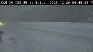
Just east of BGM on I88.
-

26th-27th event, coming at us like a wounded duck.
Sey-Mour Snow replied to Go Kart Mozart's topic in New England
hasn't started yet -

Boxing Night Snow/Sleet/Ice Dec 26-27 Storm Thread/Obs.
anthonyweather replied to Mikeymac5306's topic in Philadelphia Region
Might need those ice storm warnings over here… . -

26th-27th event, coming at us like a wounded duck.
codfishsnowman replied to Go Kart Mozart's topic in New England
Agree with you about NWS. They used to be so good. I always have their forecasts more weight. These point and clicks are for the birds. -

Boxing Night Snow/Sleet/Ice Dec 26-27 Storm Thread/Obs.
Ralph Wiggum replied to Mikeymac5306's topic in Philadelphia Region
Pure freezing rain now 25F -
Gfs
.thumb.png.15e0fbade81aa3fa3f323b5e18e87c20.png)
-
We've been cheated on this one.
-
Moderate Sleet 25/12
-
26th-27th event, coming at us like a wounded duck.
TalcottWx replied to Go Kart Mozart's topic in New England
Beginning to seem like confidence has increased substantially east of river. Did NYC end up with much of anything? -

Boxing Night Snow/Sleet/Ice Dec 26-27 Storm Thread/Obs.
JSharp replied to Mikeymac5306's topic in Philadelphia Region
Had a mixture sleet and frzg rain here in far western Delaware County. Temp is 28. Looks like most models are busting too warm with the sfc temps. -
26th-27th event, coming at us like a wounded duck.
codfishsnowman replied to Go Kart Mozart's topic in New England
Lol post of the day for sure -

26th-27th event, coming at us like a wounded duck.
weatherwiz replied to Go Kart Mozart's topic in New England
the is a well defined warm front. this along with the fronto has to yield encouragement for along and EOR.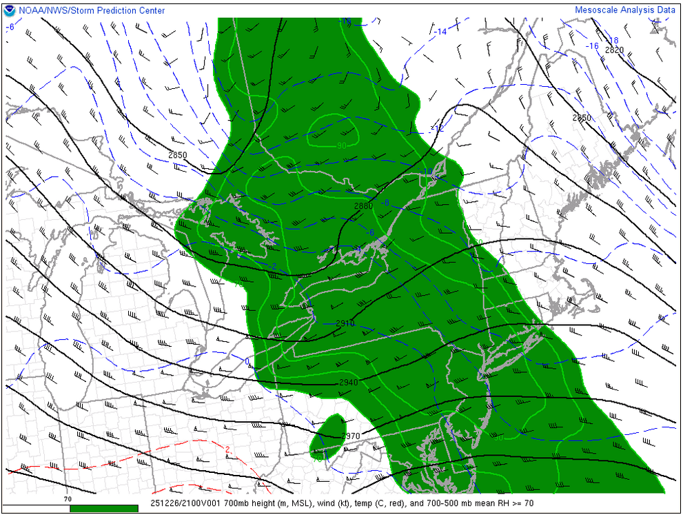
-
23 with a dewpt.of 9. No flakes here yet. Let’s see what the dewpt will be when it starts.
-
First flakes here


.png.ef2967afe00aebae978a5a352d3e4189.png)


