All Activity
- Past hour
-
I'm sensing the non-zero probability that the blizzard was the last storm we'll see. Low probability for now, but the thought popped in there when saw that this impending pattern change that others are attempting to psycho-babble erode the significance of..., appears to be surging in a little earlier than the 10th - which was the previous index suggestion. Yesterday this this earlier notion started happening, and it probably led to those couple of GFS runs that through an icing event along the BUF-BOS transit... 6z is gone, and the wave producing that has been repositioned N-W ...it's all an homage to what the hemisphere wants to do. May have to wait out a warm burst and see if there's a later month blue-bonnet spring special. Otherwise, these indexes and operational tenors, et al, are signaling the end. Note, I'm not discussing the magnitude of the warm up... It's a recognition of the pattern foot and realism for March being a transition month with hot sun (hello). Which is unfortunately for the winter fans gathering around old man's winter bed is bad pattern timing.
-
he made a youtube video, as we thought...F storm everythings too high by 10-20"
-

"Don’t do it" 2026 Blizzard obs, updates and pictures.
dendrite replied to Ginx snewx's topic in New England
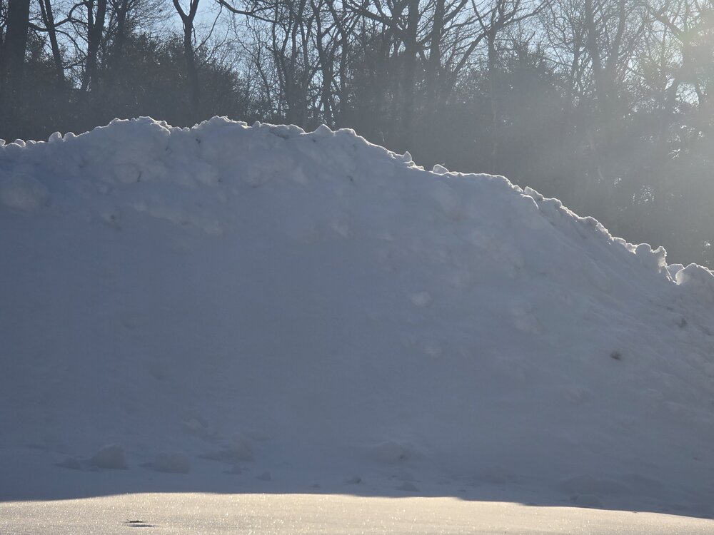
PVD depth is 31” this morning…so they’ve lost 11” since near the end of the peak of the storm. -
"Don’t do it" 2026 Blizzard obs, updates and pictures.
dendrite replied to Ginx snewx's topic in New England
Those rates were large enough that there was a period where they were racking up high ratio snows. Compaction is real especially with big totals like that. I think it’s a little insulting to assume everyone in that 30”+ zone doesn’t know how to measure new snowfall…especially paid, trained observers at PVD. -
with the snow and ice on waterway and oceans cold I doubt anyone NYC north and east sees 70's
-
Thanks working on an update now, somehow i feel it wont be the last lol
-
(002).thumb.png.6e3d9d46bca5fe41aab7a74871dd8af8.png)
Central PA Winter 25/26 Discussion and Obs
ChescoWx replied to MAG5035's topic in Upstate New York/Pennsylvania
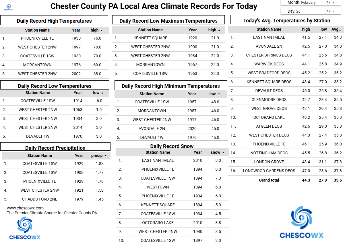
Today will be our 41st consecutive day with snow cover. This is now the 9th longest stretch and 12th overall streak since 1894. We could see some flurries late today across more southern areas. High temperatures today are a few degrees below normal around 40 degrees but a nice warm up on the way both Friday and especially Saturday with highs in the mid 50's. A strong cold front slides through on Saturday night and we will turn sharply colder by Sunday with highs back down into the 30's. Snow chances look to increase early next week but timing and amounts way too early to nail down.

-
E PA/NJ/DE Winter 2025-26 Obs/Discussion
ChescoWx replied to LVblizzard's topic in Philadelphia Region
Today will be our 41st consecutive day with snow cover. This is now the 9th longest stretch and 12th overall streak since 1894. We could see some flurries late today across more southern areas. High temperatures today are a few degrees below normal around 40 degrees but a nice warm up on the way both Friday and especially Saturday with highs in the mid 50's. A strong cold front slides through on Saturday night and we will turn sharply colder by Sunday with highs back down into the 30's. Snow chances look to increase early next week but timing and amounts way too early to nail down.
-
Definitely over done. Look at the Tug Hill and Adirondacks. They definitely aren't getting into the 60's and 70's. It hardly gets the warm there in July lol
-
Looks pretty bleak right now....though the 06z Euro did hit us on Mar 3-4 with a solid advisory/low end warning type event. But we need a lot more agreement on that.
-
27⁰ ice palace not exactly my kind of spring
-
Can't remember the last time our winter obs thread reached 100 pages. Anyway... A significant warm up followed by more below freezing temps later in March would be bad for the trees. Junk & stuff would start to bloom only to be damaged by a return to winter-like temps. I'd rather do a slow and steady warm up as March progresses, but we know that's not how things work around here.
-
No winter related Will posts in March for several consecutive days. I know that really weakens his ACATT resolve.
-
I'll never ever like dews unless there's a big rare severe threat
-

"Don’t do it" 2026 Blizzard obs, updates and pictures.
Cold Miser replied to Ginx snewx's topic in New England
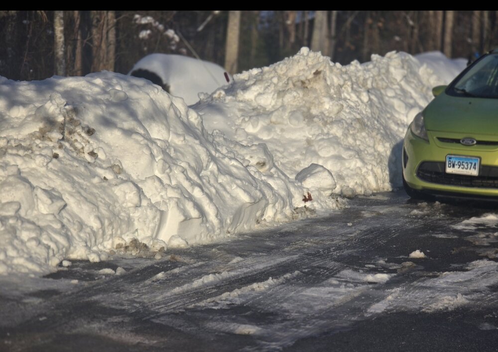
Well, You have to hand it to @TheSnowman, he talked the talk and walked the walk and did his post blizzard tour. It is interesting that not one 30" measurement, or even 24" measurement is seen, 12 and 24 hours later. No one thinks there's some crazy conspiracy theory, but measuring through old crusty snow or in drifts may have happened at some of the locations. Side note, It must be nice to have that kind of time to take those snow measuring tours. He's lucky this storm didn't happen on Grammy Award weekend. -
My family bought two couches from Jordans..... AI says the chances are between 2-6%
-
its never as warm as they predict; though 1998 was ridiculously warm, and windy...it will be less than ideal; mud season begins in days....
-

Is we back? February discussion thread
Damage In Tolland replied to mahk_webstah's topic in New England
You’re getting older . Dews are your friend. You’ll see -
for two more days. met spring is sunday right?
-
If there was no pack now I’d be all gypsy moth all the time . With feet OTG and a few more events coming over the next week or so , I’m not there yet . But yes, the loins are tingly
-
Looks a bit overdone IMO... upper 70s seems a bit of a reach the way this winter has gone re temperatures in the LR. But I will take 60s
-
So good. Welcome back, even if it was for one soul.
-

-
It was two storms ...otherwise, the same plight as y'all up there. Just two - I maintain my philosophical approach to this winter, that both are true. We were cold enough, most of the time.. We had snow on ground, most of the time, but, the winter under performed, relative to those environmental verifying circumstances - particularly the cold enough aspect. Know one's asking, but I feel pretty strongly that the pattern(s) required to sustain the cold, is the culprit for only two storms...otherwise, suppression reigns. I would be willing to venture the idea that any cold patterns are intrinsically limiting organized storm success. Basically ...the two we got punched through the limitations by other means - and I know what those were in each case. People of this particular social media engagement definitely don't want THIS explanation for why cold patterns are limiting snow. The background warming world is causing enhanced gradient, whenever the jets dip. This leads to anomalously fast basal flow velocities in the geostrophic ambiance. It's a limiting factor. It's not a preclusive factor. Speed in the flow, out side of S/W spaces, lowers the absolute value of the d(vorticity) in the means. Lower d(PVA) results. What remains doesn't have enough time to trigger all the necessary cyclone cross section responses, before the disturbance has moved off any given region, The Jan 25 overrunning on 'roids was a planetary correction event. It was really the only successful MJO wave signature penetrating as far east as the Americas I've seen since ... a long while actually. The wholesale lower latitude mass fields surged N with an actual STJ response, and ran headlong into an imposing polar index scenario, on-going. At those scales, speed's easily overcome. It's there, but the whole thing isn't needing jet responses in a cyclone machinery/necessity... It was a flop over isentropic lift event, at very very large scale. This recent blizzard actually saddled into a temporal window whence the flow relaxed. I noticed this the week prior to the event, that the GFS was bulging the PNA heights out west toward the E, and the heights over the Gulf o Mex were 4-6 dm lower in that window, the preset velocities 30 to 35kt at mid levels. That's a receptive environment and when the trough arrived it was able to mechanize a bomb.
-
I think the models are having trouble right now trying to determine exactly how far south the cold air will settle and stall - this will determine the boundary zone where the LP will move west to east