All Activity
- Past hour
-
2025-2026 ENSO
so_whats_happening replied to 40/70 Benchmark's topic in Weather Forecasting and Discussion
I applaud you for taking the advice and using a single source for both. I still don't like the SSTA-Global map but that is of my own. Do you happen to have the site to see the depth of the warmth within this region or is that just a twitter thing? I do find this year interesting even though we are in the Nina like atmospheric pattern/ base state it is not typical for us to see systems (in this particular pattern) going up the coast with little affect from a SER feature especially since we are entering mid to late January. This would and should be a time period where we see systems running right into the lakes almost similar to the a few days ago but over the next week and change we look to have this Nino like pattern evolve something is just off about this year so far. The -PDO is 100% responsible still for the lack of precip in the east and SE how long that lasts will another interesting thing to watch over the next couple months. I personally would have thought by now we would at least be touching near average monthly precip totals. -
2015... We'd only got an inch in January before the February onslaught of which didn't start until the 13th. Totalled about 33" that Month at my place in Jonesville then. Northern Section of Lee County Totalled over 40" . Higher Eles 50" for the Month !
-
-
Always a shot out to @stormtrackerfor running this shit show. @psuhoffmanfor his insight. I been a part of this community since the old eastern days so been posting with a lot of you for over 20 years it’s kinda like a small family. Wish we still had conferences or at least can plan a get together with a part of the group that would be interested.
-

First Legit Storm Potential of the Season Upon Us
SouthCoastMA replied to 40/70 Benchmark's topic in New England
Yeah if its raining outside here, I can live vicariously through the Pats game. -
Berkshire East has $39 tickets available on certain dates if you are willing to take a gamble and order them ahead
-
First Legit Storm Potential of the Season Upon Us
Kitz Craver replied to 40/70 Benchmark's topic in New England
Looks like the whole thing is about to go neggy -

Storm potential January 17th-18th
LVblizzard replied to WeatherGeek2025's topic in New York City Metro
The RGEM also nailed that snow/sleet fiasco 3 weeks ago. It’s the best of the short range models IMO. -

First Legit Storm Potential of the Season Upon Us
CoastalWx replied to 40/70 Benchmark's topic in New England
yeah definitely some white rain here at the start. Honestly though I’d prefer 3” of paste vs 6” of fluff. -
And now the 12z runs(esp. short term models) have bumped up the snow for tomorrow morning. Maybe 2-3” for us inland folks.
-
First Legit Storm Potential of the Season Upon Us
Typhoon Tip replied to 40/70 Benchmark's topic in New England
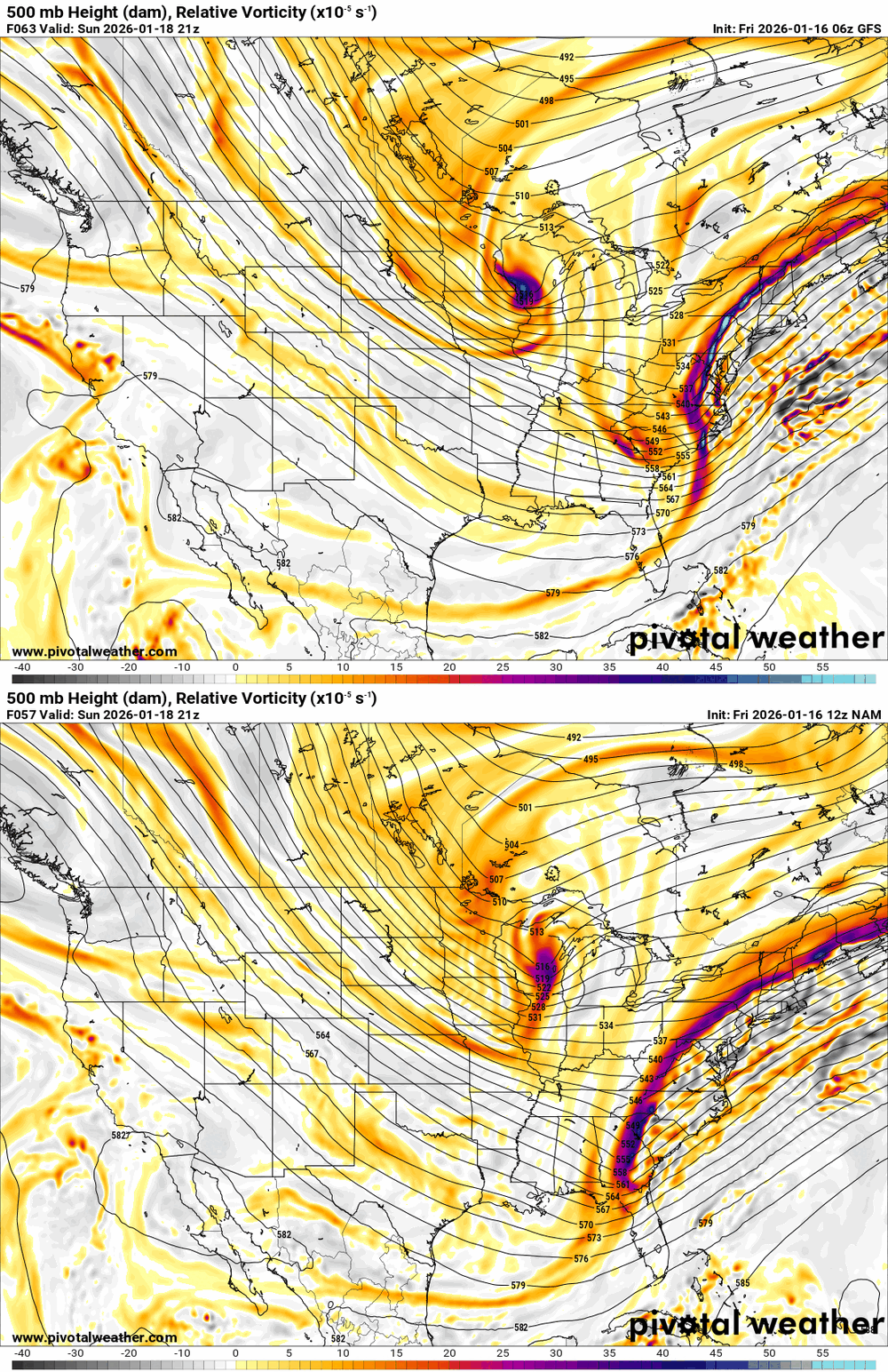
that's probably why, yeah. the gfs' synoptic forcing overcomes to the convection, and since the nam's deep layer kinematics are weak...the convection takes over. why not -

First Legit Storm Potential of the Season Upon Us
HoarfrostHubb replied to 40/70 Benchmark's topic in New England
Been a long time since that model scored a coup -
First Legit Storm Potential of the Season Upon Us
ariof replied to 40/70 Benchmark's topic in New England
If Reggie verifies that's a nice snowy Pats game. -

First Legit Storm Potential of the Season Upon Us
dendrite replied to 40/70 Benchmark's topic in New England
-
The forecast for the New England game now includes "snow likely."
-
Storm potential January 17th-18th
hudsonvalley21 replied to WeatherGeek2025's topic in New York City Metro
Yup they bumped up esp. inland. -
First Legit Storm Potential of the Season Upon Us
Go Kart Mozart replied to 40/70 Benchmark's topic in New England
A little bit less WOR, a tad better Emass. Predecessor looking decent. -
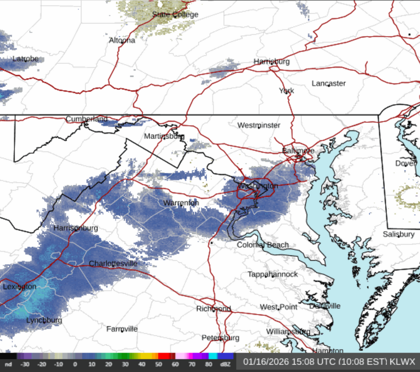
You start with mostly cloudy skies and cold, northwest flow for a day or two. Around mid afternoon on day three, warm air moves in aloft and starts precip as freezing rain. It then flips to steady, moderate snow overnight. Precipitation falls without the benefit of sunshine to melt it off overnight, and road crews were unable to put pretreatment down due to rain. The snow encapsulates power lines and trees overnight, leading to over 250,000 outages across the DC - Baltimore region. Gusty NW winds of around 20 mph occur after the storm exits around sunrise. Early sunshine fades behind a cirrus shield the next day as a potent clipper system dives south into Kentucky. An additional 4" - 8" of fluffy snow occurs during the afternoon and evening.
-
-

Central PA Winter 25/26 Discussion and Obs
Mount Joy Snowman replied to MAG5035's topic in Upstate New York/Pennsylvania
Most of the guidance I've looked at has a 6-10ish type timeframe for the main swath. Some show a separate batch breaking out ahead of the morning slug sometime during the overnight hours, but early morning seems the best bet for seeing accumulating flakes. -

First Legit Storm Potential of the Season Upon Us
Sey-Mour Snow replied to 40/70 Benchmark's topic in New England
Ya IF this storm even happens for us, it looks like paste, temps are borderline.. -

First Legit Storm Potential of the Season Upon Us
RUNNAWAYICEBERG replied to 40/70 Benchmark's topic in New England
Reggie a tic juiced this cycle. -
First Legit Storm Potential of the Season Upon Us
Typhoon Tip replied to 40/70 Benchmark's topic in New England
12z nam's doing that the 06z gfs left the conv alone and relies entirely on the synoptic q-g forcing not sure which is right -

Storm potential January 17th-18th
vegan_edible replied to WeatherGeek2025's topic in New York City Metro
reggie was the only model that sniffed out the surprise 4-7" storm that just hit the detroit. i think it has some merit in this game. euro is garbage, gfs worse. -

First Legit Storm Potential of the Season Upon Us
SouthCoastMA replied to 40/70 Benchmark's topic in New England
RGEM is warm here..rain ending as 1-2". woof NAM/ICON are the two models you'd want to be eastern outliers at least.


(002).thumb.png.6e3d9d46bca5fe41aab7a74871dd8af8.png)


