All Activity
- Past hour
-
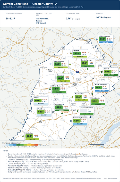
That was about a mile from me. It was def rain wrapped when it came through here. Rainfall was so intense. Sun is out now
-
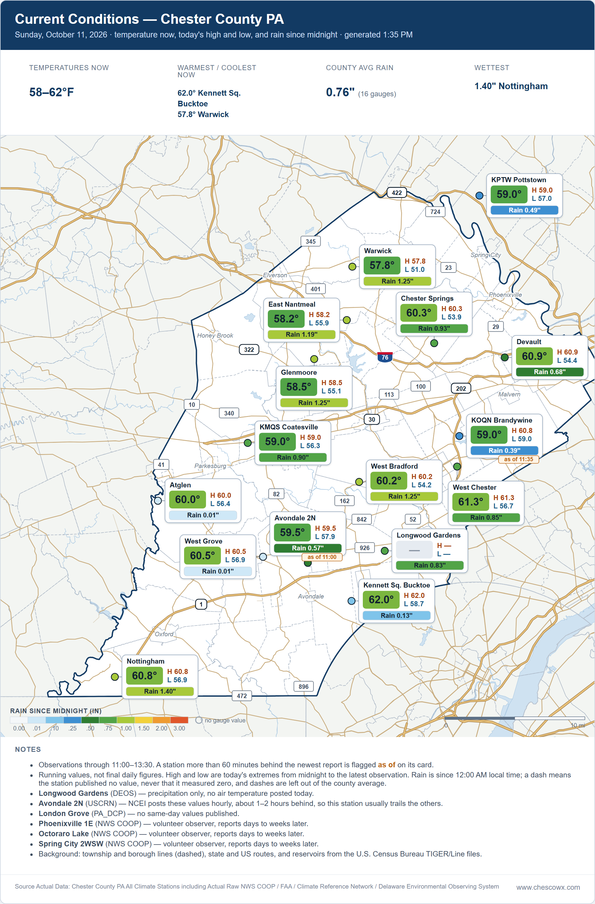
.7” and counting. Lit the wood stove for the first time this season.
-
 Toprol xl dosage guidelines: metocardiorx - Lopressor side effects list
 -
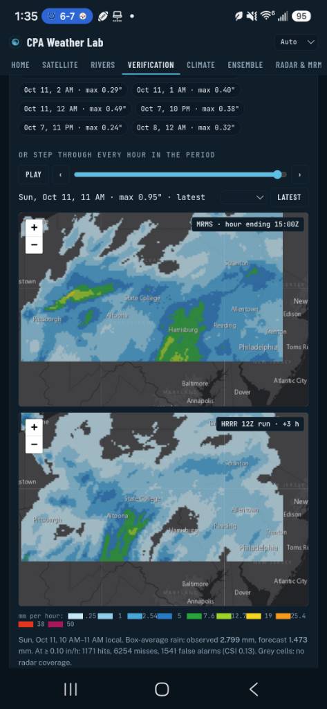
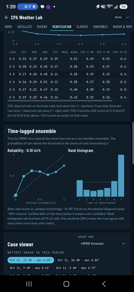
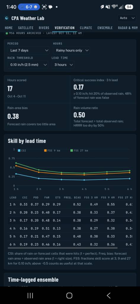
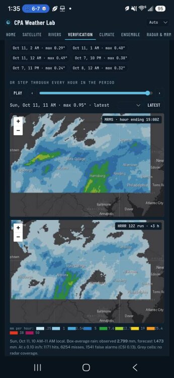
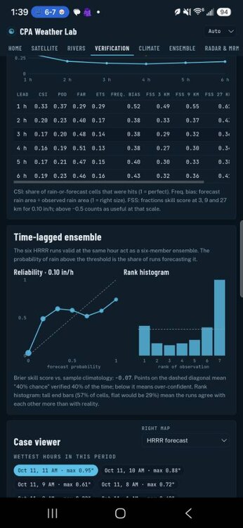
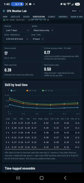
the hrrr is getting absolutely wrecked Sent from my SM-S731U using Tapatalk
-
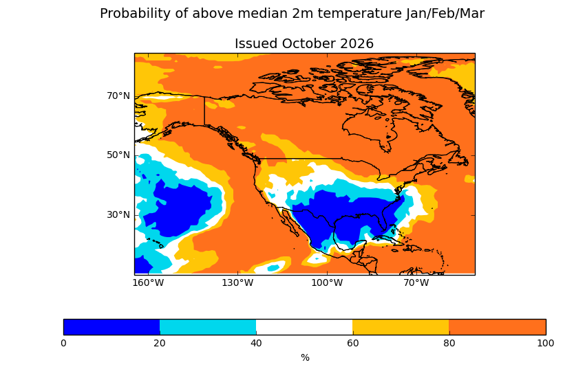
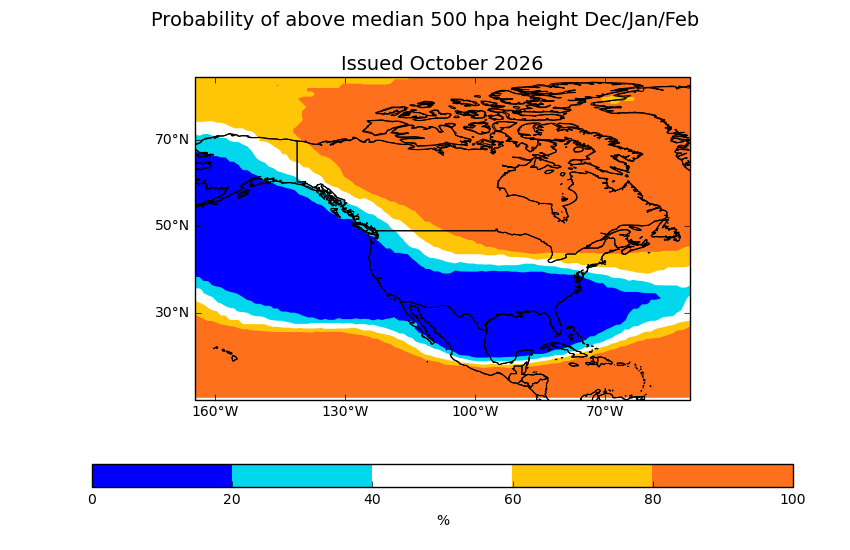
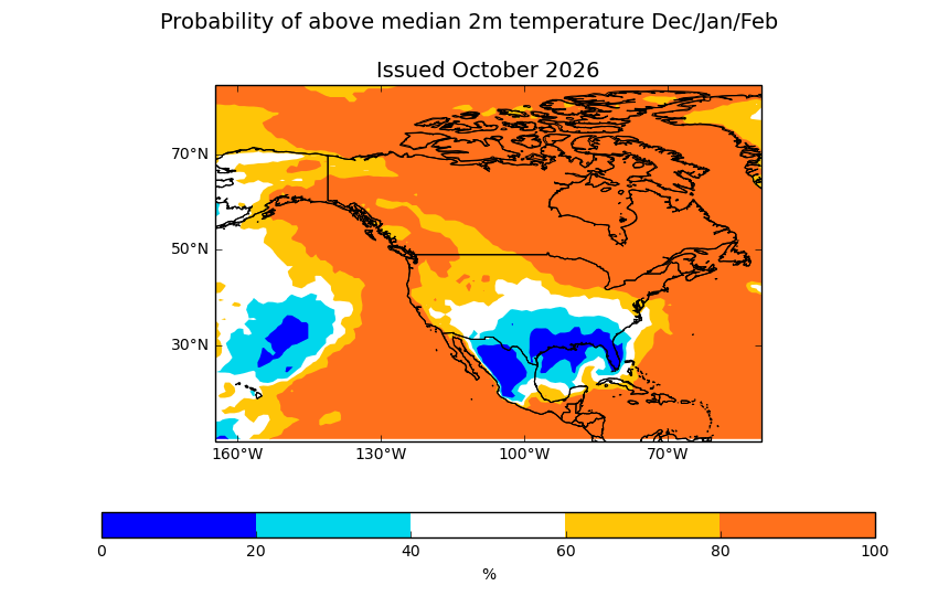
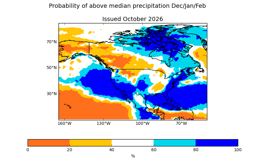
UKMET Update DJF 500mb 2m Temp Precip JFM 2m Temps
-
2.85" and still raining.
-
Radar debris signature....Touchdown SW of Louisburg
-
(002).thumb.png.6e3d9d46bca5fe41aab7a74871dd8af8.png)
E PA/NJ/DE Autumn 2026 Obs/Discussion
ChescoWx replied to PhiEaglesfan712's topic in Philadelphia Region
-
Meanwhile, the remnants of Isaias are directly responsible for tornadoes today in NC, including a damaging one in Fayetteville and several others in the Triangle region! This is serious stuff and is the 2nd day in a row of this.
-
Storm looks to be cycling SW of louisburg
-
1.9” so far
-
The rain seems to be mixing with and changing to leaves.
-
2.54". That may be it for now, at least.
-
Think it was that Memorial Day weekend event?
-
There have been at least 4 different confirmed tornadoes in NC so far
-
new confirmed tornado Wake NC-Johnston NC- 129 PM EDT Sun Oct 11 2026 ...A TORNADO WARNING REMAINS IN EFFECT UNTIL 200 PM EDT FOR EAST CENTRAL WAKE AND NORTHEASTERN JOHNSTON COUNTIES... At 129 PM EDT, a confirmed tornado was located 7 miles south of Zebulon, or 13 miles north of Smithfield, moving northeast at 35 mph. HAZARD...Damaging tornado. SOURCE...Radar confirmed tornado.
-
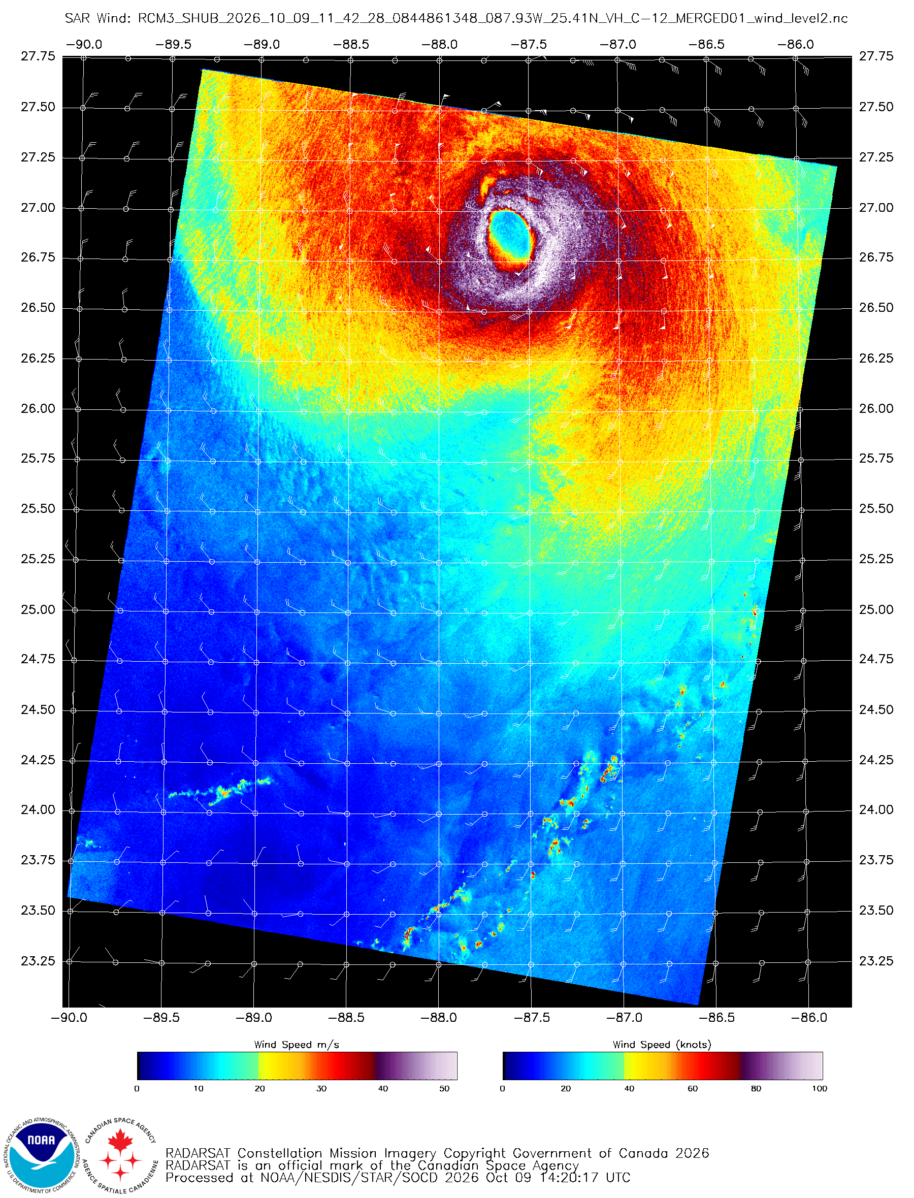
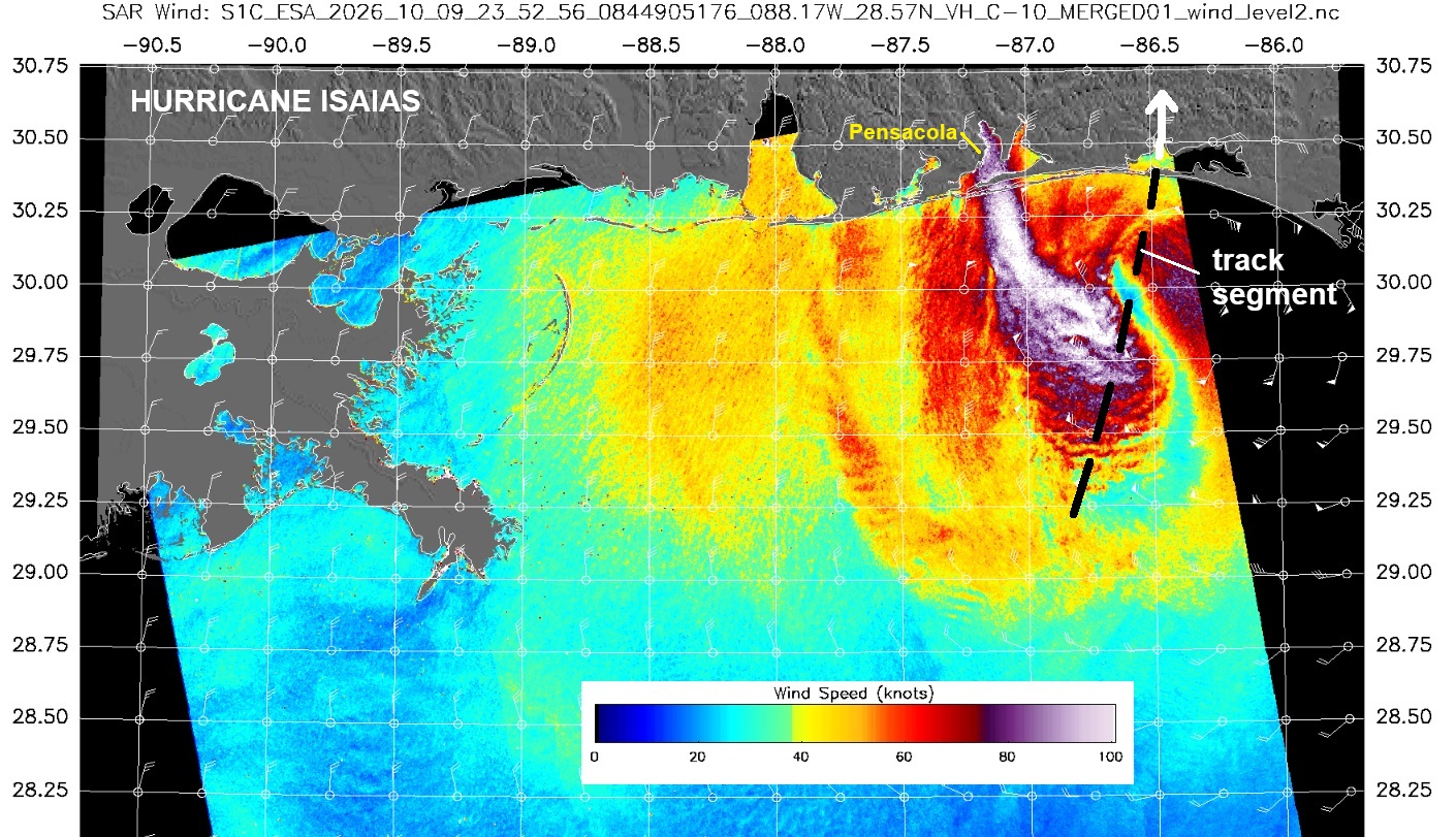
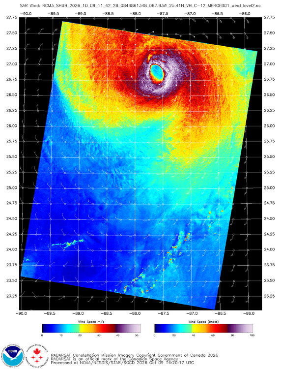
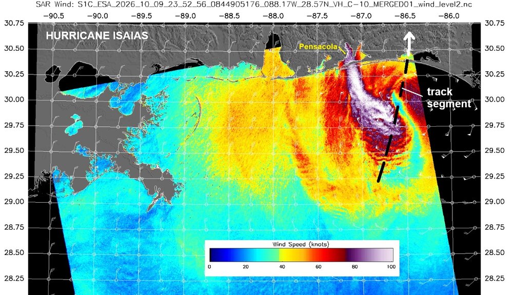
I was looking back at SAR imagery for Isaias. Look at the difference in structure only 12 hr apart!
-
When was the last time the region had widespread 1”+ rainfall?
-

2026-2027 Record-breaking El Nino
EasternLI replied to Stormchaserchuck1's topic in Weather Forecasting and Discussion
And growing.. -
Lifted but man that was not a good look for the south side of rolesville that was a legit debris ball
-
Lol….ya that’s only if it’s accumulating snow…flakes in the air doesn’t count.
-
PDS now
-
WTF!!!! I watch Elliot kick the game winning field goal. Great! I got $hit to do. Turn off the TV, grab the keys, get in the car, turn on the radio to listen to the post game show and the fookin’ Jaggywires win the game??? It’s not even October 15 and I’m already looking forward to the 2027 NFL and NHL drafts.
-
Significant tornado OTG going into rolesville
-
PDS TORNADO ...A TORNADO WARNING REMAINS IN EFFECT UNTIL 200 PM EDT FOR NORTHEASTERN WAKE AND SOUTHWESTERN FRANKLIN COUNTIES... At 123 PM EDT, a confirmed large and extremely dangerous tornado was located near Wake Forest, or 11 miles northeast of Raleigh, moving northeast at 30 mph. This is a PARTICULARLY DANGEROUS SITUATION. TAKE COVER NOW! HAZARD...Damaging tornado. SOURCE...Radar confirmed tornado. IMPACT...You are in a life-threatening situation. Flying debris may be deadly to those caught without shelter. Mobile homes will be destroyed. Considerable damage to homes, businesses, and vehicles is likely and complete destruction is possible.