All Activity
- Past hour
-
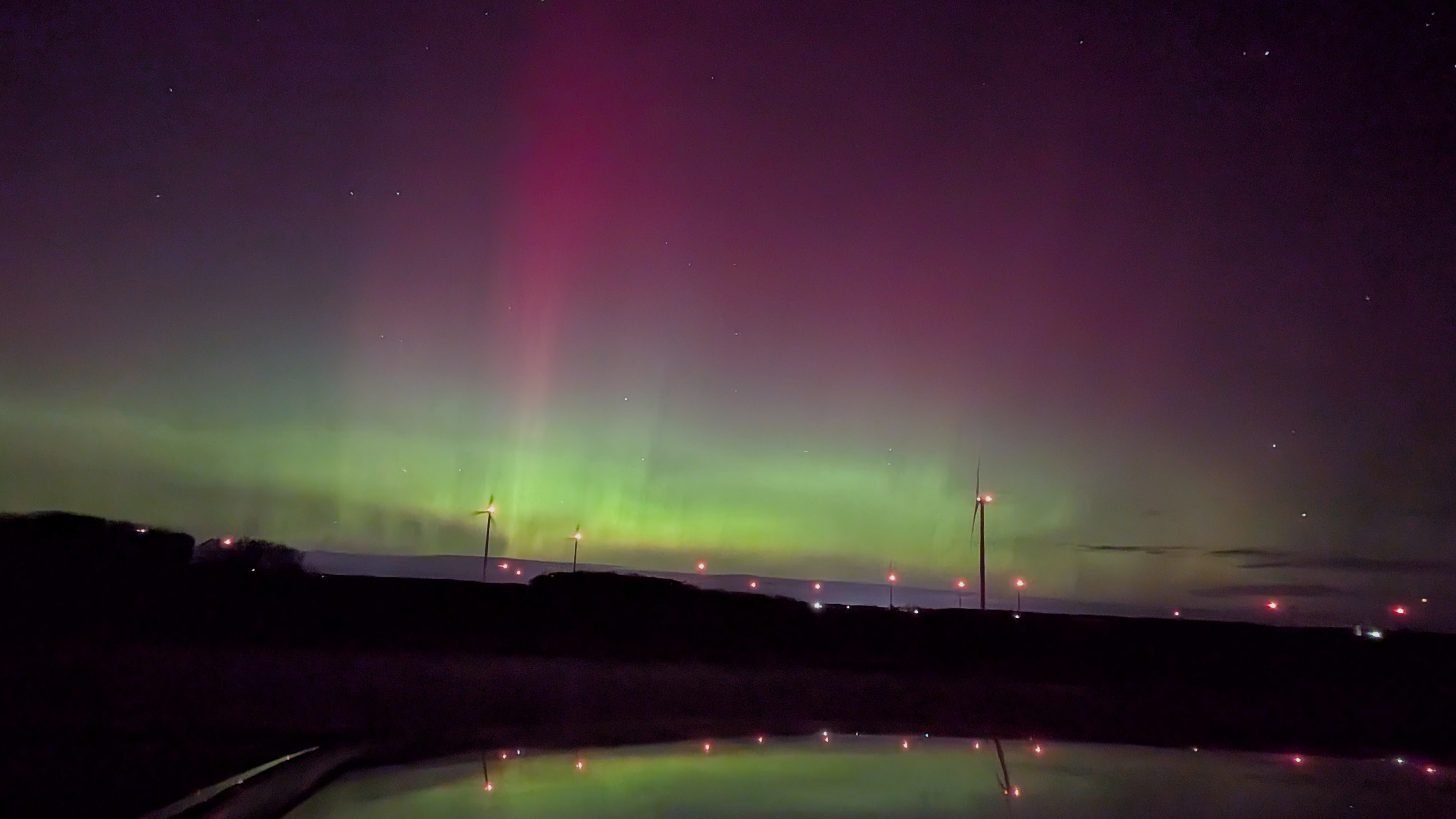
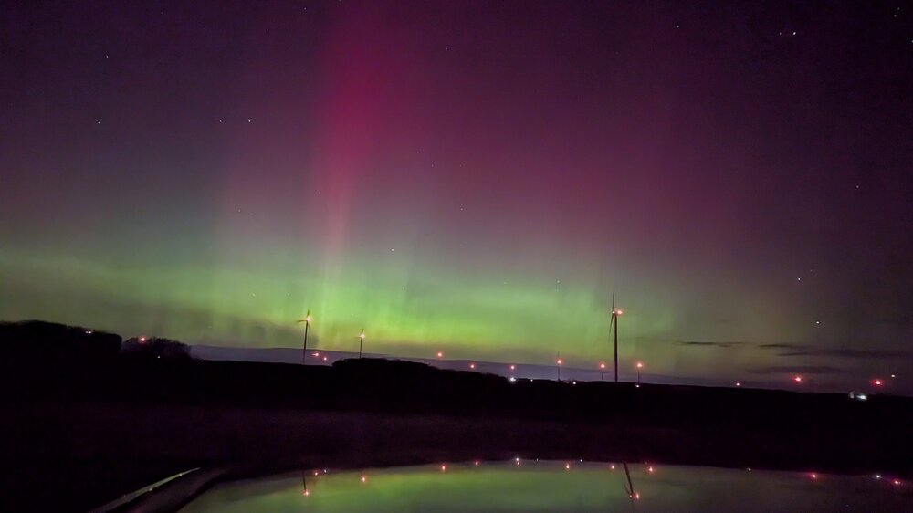
 How fun was that !!! Yee Foc’ing haw!
 -
out of the 6 auroral events i've caught, this was probably 2nd (maybe 1st?) compared to october 10th of last year. Either way, really awesome experience, and i'm glad the clouds cooperated more than Tuesday night.
-
-
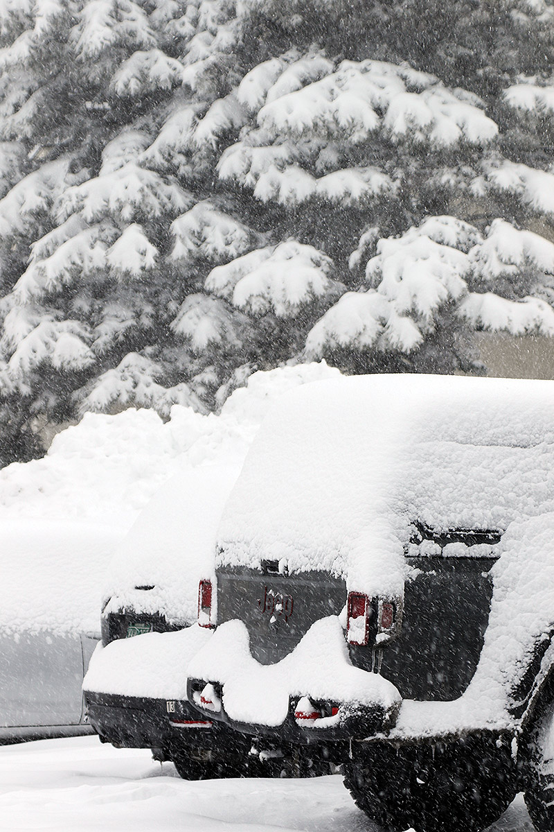
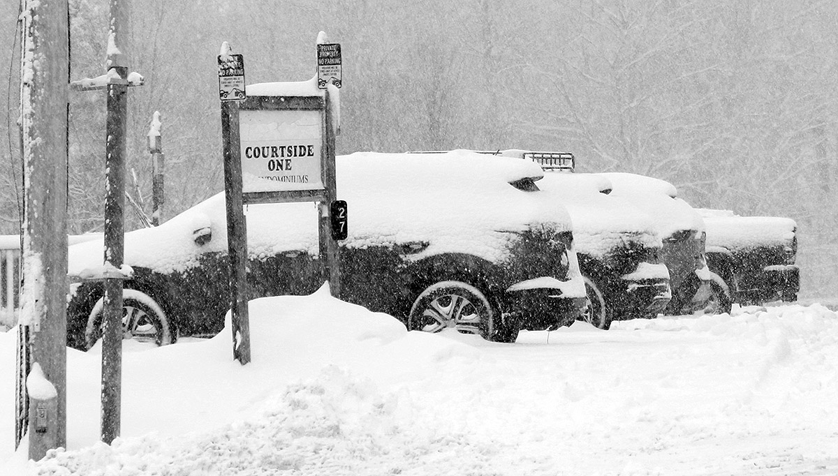
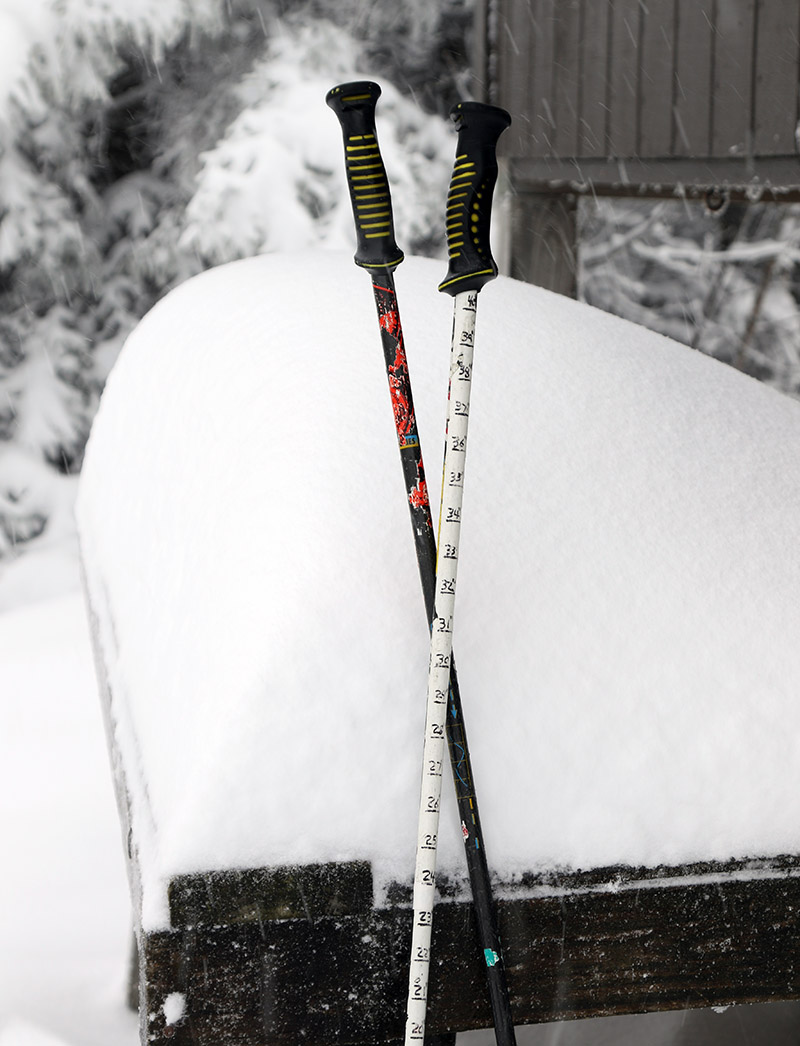
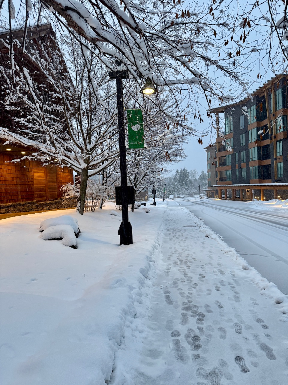
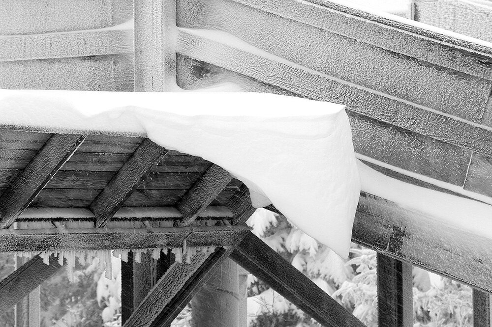
Our current winter storm began affecting the area yesterday, and it’s been hitting us with a decent stream of moisture in the form of snow and some rain/snow in the lower elevations. We picked up less than an inch of additional snow overnight at our site in the Winooski Valley, and the total precipitation Id recorded from the event was less than ¼” as of this morning’s CoCoRaHS submission. So, I had no idea that we’d been clobbered with snow in the higher elevations until I saw PF’s post of the accumulation at the Stowe snow cam. I immediately checked the Bolton Valley Base Area Webcam, and although I couldn’t get a good sense for how much snow had fallen there, the scene was solidly white, and in general if Stowe has done well with snowfall, then Bolton Valley has seen something similar. Snow cover was getting patchy this morning in many of the lower valleys, with marginal temperatures and a wet snow/rain mix, and that’s the way things stood at the base of the Bolton Valley Access Road when I headed up. Snow depths really started to pick up above 1,000’ though, and I found 6-9” of snow at the Timberline Base at 1,500’. Up in the Village at 2,000’, snow depths were in the 10-14” range, and there was steady moderate to heavy snowfall. I was able to tour up to the Wilderness Summit at ~3,150’, where I measured total snow depths in the 15-24” range. That’s not all from this current system of course, but with the existing snowpack below and this fresh snow on top, it’s set up some very nice skiing. Steep terrain is certainly in play with the amount of snow out there right now, and Bolton Outlaw was in really good shape. I was on mid-fats, since I wasn’t sure of how much snow there was going to be, but if I’d known just how much was out there, and how good the coverage was in general, I would have gone with fatter skis. At least on piste as of this morning, fats were the way to go. The powder out there isn’t quite as dry as what fell from the November 5th storm, but the quality is quite good, and it has a lot of substance to it. With underlying base in place and this new medium to high density snow on top of it, there is absolutely some great coverage out there. Below is the total snow depth profile I observed this morning for various elevations in the Bolton Valley area. As usual, it’s getting harder to probe the full depth of the snow in the higher elevations where the snowpack is becoming more consolidated. 340’: T-2”” 500’: 1-2” 1,000’: 2-4” 1,500’: 6-9” 2,000’: 10-14” 2,500’: 12-15” 3,000’: 15-24” It should be interesting to see where the snowpack depth comes in with the next update from the Mt. Mansfield Stake. This system looks like it should continue to deliver snow right through the end of the week, with 8-14” of additional snow shown in the forecasts. And, temperatures are expected to cool down a bit and bring snow levels back down to the lower valleys, so if the snow density drops it could set up some excellent right-side-up powder conditions.


-

November 2025 general discussions and probable topic derailings ...
rcostell replied to Typhoon Tip's topic in New England
Sorry for delay... It snows at lot there...1860 foot elevation at foot of Whiteface- not like the Green Mountain Spine- but just keeps chugging along. Last year was a good year for duration- basically no rain from early Dec- Mar. Was damn deep in the woods! -
Fun?
-

November 2025 general discussions and probable topic derailings ...
powderfreak replied to Typhoon Tip's topic in New England
Here it’s like 2 miles and you’re out of it. Last night’s and today’s snows were above 1,100 feet mainly. Wetter 2-3” depth in town compared to like 6-8” fully caked at 1500ft. -

November 2025 general discussions and probable topic derailings ...
alex replied to Typhoon Tip's topic in New England
Same here. But the difference between here and Whitefield is pretty amazing. My backyard above, and 10 miles away in Whitefield below.
-

November 2025 general discussions and probable topic derailings ...
dendrite replied to Typhoon Tip's topic in New England
Ironically we currently have a rain/snow shower. 37.6° -
FWIW, here’s what the SPV “expert” thinks of what may or may not happen:
-
November 2025 general discussions and probable topic derailings ...
powderfreak replied to Typhoon Tip's topic in New England
Just keeps snowing.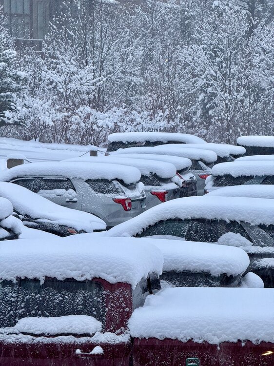

-
Replaced by Bam Weather. Old habits die hard.
-
above normal temps, below normal snow. ez call
-
November 2025 general discussions and probable topic derailings ...
dendrite replied to Typhoon Tip's topic in New England
Seems equivalent to when the sun comes out here for 30 seconds at sunset in late April after 3 weeks of clouds. -
Not that simple. My understanding is that the slowing current hasn’t had a meaningful impact on temps yet
-
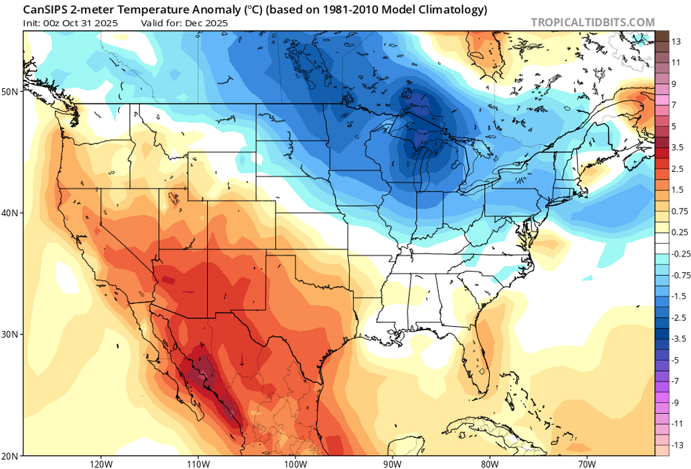
Cansips run this month for December not far off all things considered.
-

E PA/NJ/DE Autumn 2025 Obs/Discussion
Mikeymac5306 replied to PhiEaglesfan712's topic in Philadelphia Region
You're full of good news. -
What was fun about a light rain mix exactly?
-
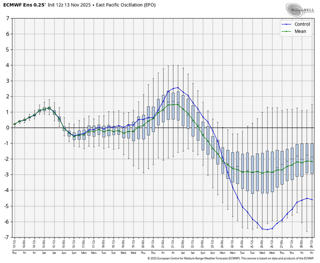
Here is the epo on the eps
-
Despite the cold snap, November is almost guaranteed to finish above average
-

Central PA Fall Discussions and Obs
mahantango#1 replied to ChescoWx's topic in Upstate New York/Pennsylvania
Had a wind gust of 46mph this afternoon. -
WTTTE
- Today
-
Sounds like a very easy, canonical call!
-


-
Also, I would add Weeklies is based on 0z data. There were noticeable 12z changes on EPS, GEFS, GEPS. Ridge not ridge gone on GEPS & less prevalent on EPS & GEFS than it was on 0z for the 11-15 day. It will be interesting to see the early period on tomorrow's Weeklies update.
.thumb.jpg.ad3a2e31d30aff035044689b311a0540.jpg)