All Activity
- Past hour
-
Saturday night/Sunday 12/13-12/14 Jawn
MGorse replied to Ralph Wiggum's topic in Philadelphia Region
Yup, although it is possible it starts as a rain/snow mix here. If that does occur, hopefully it will be brief. -
Beutius to the maximus! Thanks for the pictures. I've been lucky in my area of SNE vs most. Your pics make me miss my snowmobiling days
-

Saturday night/Sunday 12/13-12/14 Jawn
penndotguy replied to Ralph Wiggum's topic in Philadelphia Region
And not a messy slop fest that we’ve come to expect. Snow from start to finish for a change. -
Both the Euro and GFS do suggest we might have the potential for light snow Monday afternoon especially north of I 70
-
Little Christmas miracle on the EURO. 1 to 3 inches, however, in any event not warm.
-
December 14th - Snow showers or Plowable snow?
UnitedWx replied to Sey-Mour Snow's topic in New England
Looking forward to the YouTube videos Ryan. I hope it works out well, seeing as 80 percent of what i watch is there... and lacking serious meteorologists -
December 14th - Snow showers or Plowable snow?
Shaun Curry replied to Sey-Mour Snow's topic in New England
You can almost put a pin on my house on the line between 2-4" and 4-7" at the top of Point Judith Pond in South Kingstown, RI. -

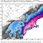
Moderate snowfall 12/14/2025 WWA up for most of the area
psv88 replied to WeatherGeek2025's topic in New York City Metro
Long Island still shows 3-5” -
If my post about the -NAO was part of the issue, I'm sorry if you took it the wrong way. I wasn't trying to deny the fact it would warm up for the East Coast later in the month, I was just trying to figure out why models might be trending slightly colder for that period.
-

12/14: Sunday funday? Will the south win again?
Solution Man replied to TSSN+'s topic in Mid Atlantic
Yeah, not ours…good luck north -

December 14th - Snow showers or Plowable snow?
UnitedWx replied to Sey-Mour Snow's topic in New England
Very light snow / flurries in Westfield the last half hour -
Moderate snowfall 12/14/2025 WWA up for most of the area
David-LI replied to WeatherGeek2025's topic in New York City Metro
any1 got 12z euro snow totals map? -

December 14th - Snow showers or Plowable snow?
CoastalWx replied to Sey-Mour Snow's topic in New England
Euro seems to hint at drier air near pike. Hope it stays north. -
Boston's record stretch with < 4" and < 5" daily snowfall ended at 1,028 days on December 19, 2024. Boston currently has a 1,387-day streak with < 6" of daily snowfall, which is the second longest such streak. The record is 1,772 consecutive days.
-
Seems to be consensus NE of us but our area changes every run it feels like. My final call for my backyard is 0.9"
-

Central PA Winter 25/26 Discussion and Obs
Itstrainingtime replied to MAG5035's topic in Upstate New York/Pennsylvania
5" in 24 hours? I think? -

Saturday night/Sunday 12/13-12/14 Jawn
MGorse replied to Ralph Wiggum's topic in Philadelphia Region
I hear there is accumulating snow on the way. -
Most of the fun of tracking is model runs and its been horrendous for us
-

December 14th - Snow showers or Plowable snow?
weatherwiz replied to Sey-Mour Snow's topic in New England
flurries falling -

Saturday night/Sunday 12/13-12/14 Jawn
kickingupastorm replied to Ralph Wiggum's topic in Philadelphia Region
4 inches a good bet for Ardmore. I’ll be walking home in it #nightcrew. We take. -
Watching from afar. Looks almost like a squall like scenario. Definitely would feel better in northeast md for this one, but looks like an advisory event incoming at least. Once I get this sunny and 70 weather (completely opposite weather pattern in Vegas) out of my system I’ll be ready for a snowstorm lol. Good luck to the Frederick crew…would be happy to see that area get on the board with something other than a cartopper. 3 hrs behind here so I’ll prob peep the radar later.
-
large section of -25F temps in Saskatchewan, also large section of -15F in Minnesota
-

December 14th - Snow showers or Plowable snow?
CT Rain replied to Sey-Mour Snow's topic in New England
Midday video update if anyone's interested lol https://www.youtube.com/watch?v=F45qrarkeBY -

December 14th - Snow showers or Plowable snow?
weatherwiz replied to Sey-Mour Snow's topic in New England
Getting flurries -
INL would absolutely be great. Even during winter 2011-12, which was horrendous for nearly all of us, INL still had continuous snow cover for 3.5 months. Think about that. The most pathetic winter in our parts still ended up with more days with snow cover than Chicago’s best winter on record (1978-79). That drives me crazy, the huge winter gradient over a relatively short distance. So close, yet so far. I feel even worse for winter lovers in STL or southern IL, where they essentially have no winter…and it’s not really that far away from here. The big issue for me is the volatility. The down periods of winter are so bad, that they overwhelm any good periods. No matter how good it has been from late November through December 10 (which then got dropped down several notches due to the ridiculous snow melt event from a few days ago), there looks to be very little snow over the next 3 weeks. What should happen is, even in the down periods, there’s at least 3” of snow every 7-10 days. It’s horrible to go 2-3 weeks without any snow cover and cold. To sum everything up - we supposedly had a great winter period, but then ORD ends up with no snow cover at the end of the supposed good period. How does that happen? The bad period hasn’t even started yet! Winter is supposed to feature certain things, so it sucks when it doesn’t, no matter where you live and regardless of what climo says.

