All Activity
- Past hour
-

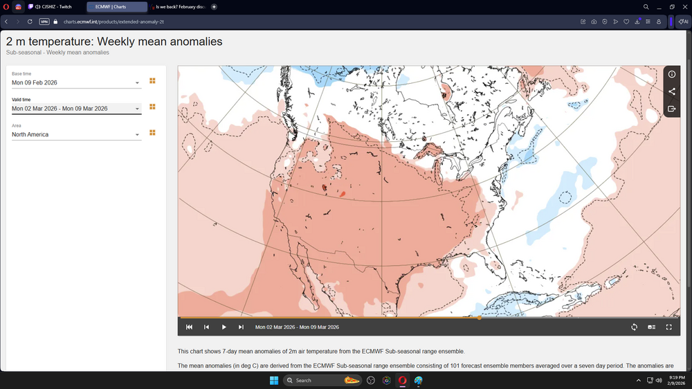
Feb 10-11 Mid Week Minor Event - Ride the hot hand?
Sey-Mour Snow replied to HoarfrostHubb's topic in New England
Everything coming in warmer for most of CT. Looks like mostly sleet/freezing rain/rain. Snow northern tier of state. -

Feb 10-11 Mid Week Minor Event - Ride the hot hand?
ORH_wxman replied to HoarfrostHubb's topic in New England
I think 1-3” is prob the best forecast at the moment down in the pike region. We are relying on like 3 hours of WAA precip. -

February 2026 OBS & Discussion
coastalplainsnowman replied to Stormlover74's topic in New York City Metro
Took this pic from Jersey City looking across the Hudson. Actually been checking over the past week and was disappointed to see not much ice. But today there was, and tomorrow will probably look better.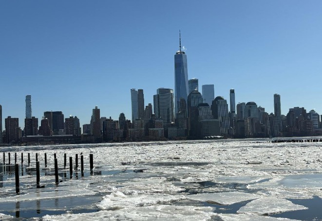
-
Great another cold and dreary spring.
-
Of course warmest will outpace coldest with global land areas averaging 3F warmer than where the avg was in 1900. If you were to subtract 3F from recent years of records, wouldn’t cold anomalies be on par with warm anomalies?
-

Feb 10-11 Mid Week Minor Event - Ride the hot hand?
40/70 Benchmark replied to HoarfrostHubb's topic in New England
I would err on the side of caution with H5 so far north. -
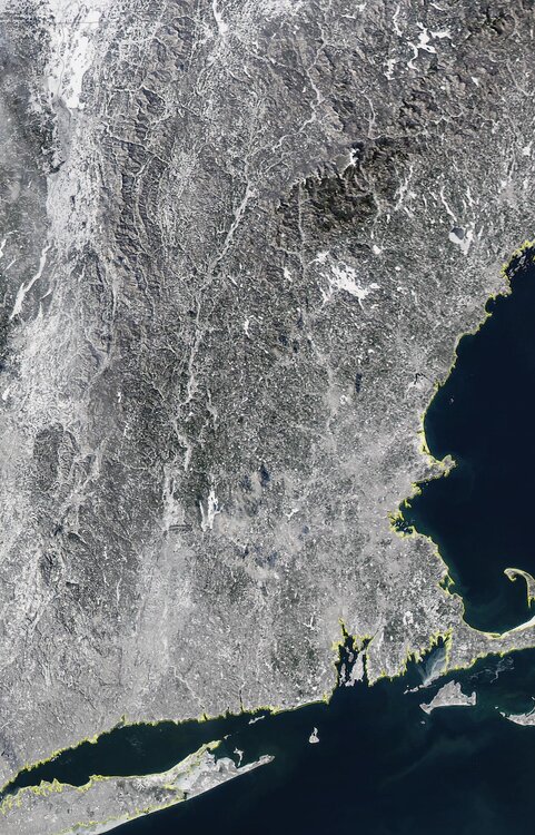
As I was driving past Little Neck Bay today I was amazed to see the whole thing frozen. I havent seen that in years. And then I was floored to see it frozen thru the Throgs Neck Bridge. I have never seen that! Over the past few weeks I have been playing whack a mole with frozen pipes. I dont want warmth yet but normal 30s day 20s night will feel…good
-
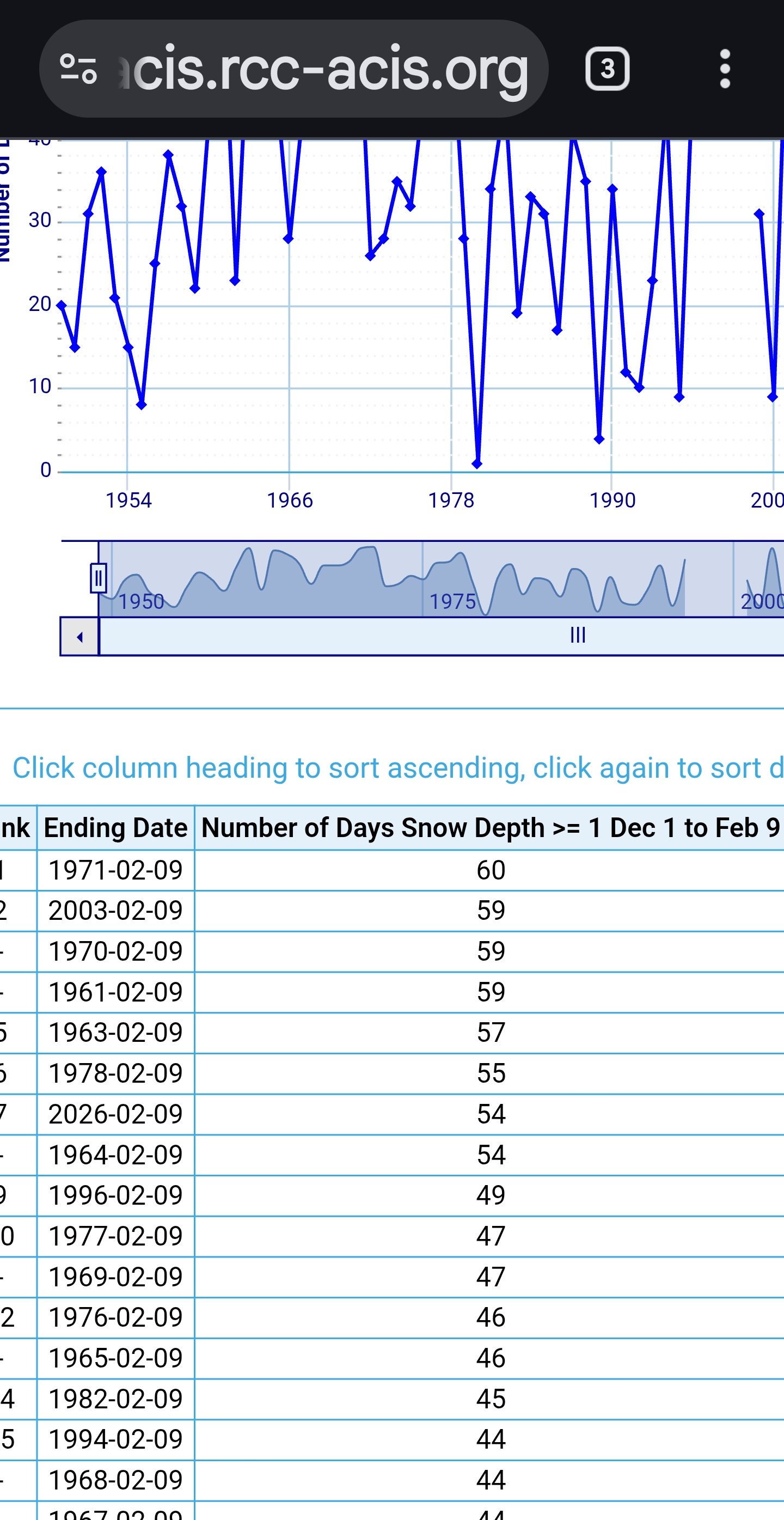
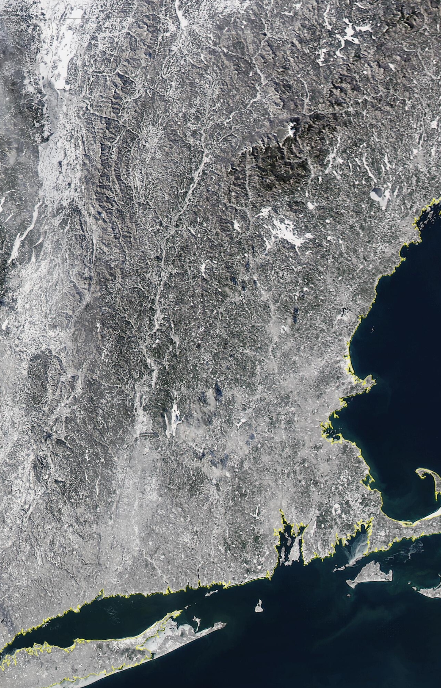
 Snow cover days
-
week later
-

Central PA Winter 25/26 Discussion and Obs
SnowPlowGuy88 replied to MAG5035's topic in Upstate New York/Pennsylvania
Absolutely. GFS is wintry to start and then flips to rain. CMC and Icon are pretty good for our area. Euro can’t seem to make its mind up. Plenty of time for adjustments. I’m rooting for this one to give a nice 3”-6” on top of what’s left after the “thaw” that is this week. Even though highs have been below freezing, that sun angle is doin numbers on my southern exposure. I have liquid runoff almost every day it gets full sun -
Feb 10-11 Mid Week Minor Event - Ride the hot hand?
40/70 Benchmark replied to HoarfrostHubb's topic in New England
Only shot of 4" is up by like Amesbury. -
this is false?
-
You havent been paying attention since 2015 then hahaha. All kidding aside, my gut (and a long range forecast) tells me the bulk of winter is behind us
-
Both 2003-2004 and 2002-2003 were about 0.4F behind at this point. Still quite cold but tied for 23rd while this year is tied for 17th
-

Feb 10-11 Mid Week Minor Event - Ride the hot hand?
HoarfrostHubb replied to HoarfrostHubb's topic in New England
Yeah. It’s zonked up near you. But I sorta agree with it there. any idea how it determines ratios in that version? -

Feb 10-11 Mid Week Minor Event - Ride the hot hand?
CoastalWx replied to HoarfrostHubb's topic in New England
Yeah Nam more like 2-4” where it was like 3-5” -

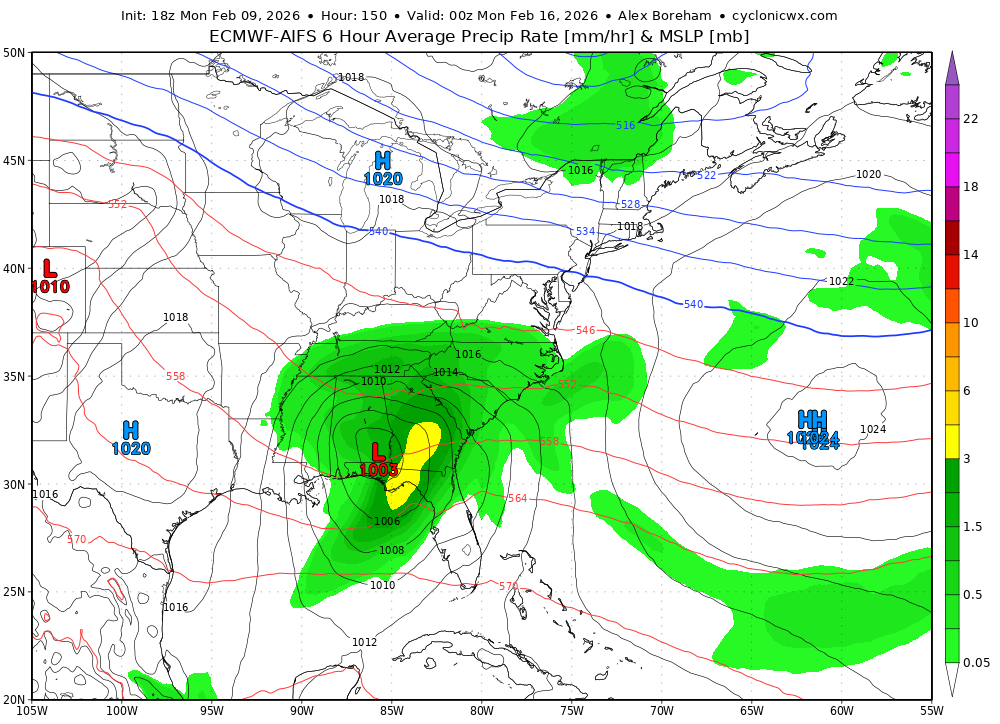
Feb 10-11 Mid Week Minor Event - Ride the hot hand?
dendrite replied to HoarfrostHubb's topic in New England
HRRR modeled snowfall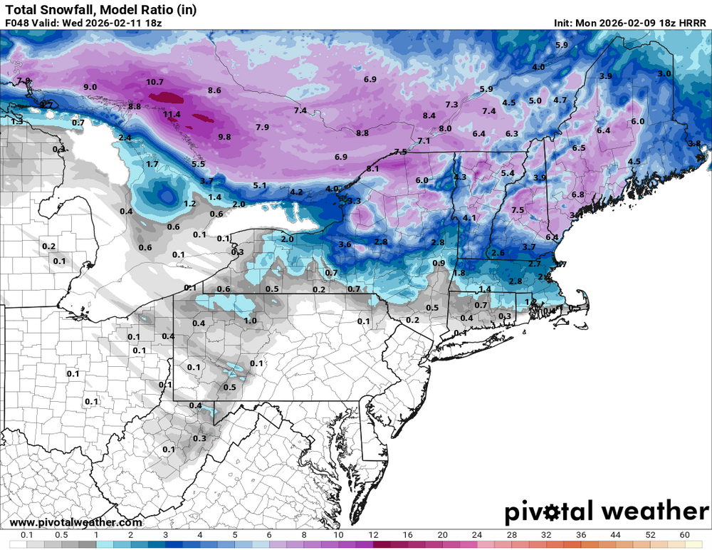
-
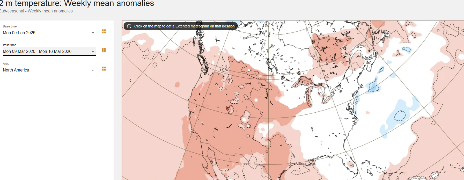
 What we don't want to see in the long range is that -PNA ridge pinching off NW to cutoff over Russia, while a low comes underneath of it in western Canada and Alaska.. could flood US with warm air down the road if it evolves like this. Earlier it was looking like the Pac ridge was wanting to eventually go polar, but this is how models have trended the last few days.. Possibly if the MJO were to stay strong, it would support this pattern, going through Phases 3-6
 -

Feb 10-11 Mid Week Minor Event - Ride the hot hand?
ineedsnow replied to HoarfrostHubb's topic in New England
Nam came back down a bit at 0z -
Feb 10-11 Mid Week Minor Event - Ride the hot hand?
Ginx snewx replied to HoarfrostHubb's topic in New England
Watch the mesos. I bet you hit 4 to 6 easy -
 Any company that invents carbon recapture will be a full port of my portfolio! Til then…
 -

Winter 2025-26 Medium/Long Range Discussion
frostfern replied to michsnowfreak's topic in Lakes/Ohio Valley
Severe or snow? -

Central PA Winter 25/26 Discussion and Obs
Blizzard of 93 replied to MAG5035's topic in Upstate New York/Pennsylvania
Way too soon for that. Lots of options are still on the table. -
Just frozen solid.
-
The perfect track just no cold air. Back to our regularly scheduled programing I suppose