All Activity
- Past hour
-

December 2025 regional war/obs/disco thread
ma blizzard replied to Torch Tiger's topic in New England
yeah thats a straight rip and read of how much QPF falls as rain with temps below 32, not how much will actually accrete -
Definitely more Tool than any of the tools in my garage
-
Disappeared after getting 5 posted.
-

December 2025 regional war/obs/disco thread
HoarfrostHubb replied to Torch Tiger's topic in New England
Those are typically overdone by a ton -
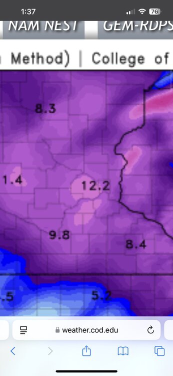
18z hrrr is really bullish for our entire area. .
-

Wounded Duck Strikes Back: Dec 26 & 27th Winter Storm Obs
WxWatcher007 replied to WxWatcher007's topic in New England
A grade forecast here. Very proud of it, though annoyed I didn't call the 5pm start time in western CT. Glad we didn't take the numbers up yesterday when the models kept ramping up. Wish we put more of New London in our 4-8 zone. -

December 2025 regional war/obs/disco thread
Chrisrotary12 replied to Torch Tiger's topic in New England
Oh hell nah. Pass. -
Props to you. I take Christmas down mid-January and then leave the 'winter' vibe items out until...basically calendar spring. Winter is my favorite season IF it cooperates.
-
I must have missed something and it's been better for the pace of conversations but what happened to LibertyBell
-
Thanks for posting data like this. 25 mean temp in 1876 is wild.
-
I took my shit down this morning while it was warm..lol SHORT TERM... (Rest of today through Sunday) Issued at 1100 AM CST Sat Dec 27 2025 After an intensely foggy morning, it`s cloudy and very muggy out there. Temperatures have warmed into the low 60s so far and will make at run at 70 by this afternoon. The remainder of today will be cloudy and dry as the ridge responsible for our spell of above- normal warmth finally shifts to our east. Behind the exiting ridge will come a fairly strong upper low that will push a strong cold front through Middle TN Sunday night. Ahead of the frontal passage, flow aloft will transition out of the southwest, drawing anomalously high moisture into the area. Looking at soundings, instability overall is very limited with less than 100 J/kg and profiles are totally saturated. With that being said, a 60 kt low- level jet will be in place as this line moves through, and if any of that wind can mix down, there will be a chance for a gusts up to 40-50 mph with the line. With regards to any tornado potential, the threat is very, very low. Low-level helicities and shear are more than sufficient, but limited instability and weak lapse rates will make tor development very difficult. The most likely scenario is that a narrow band of heavy rain and gusty winds will move through tomorrow night between 7pm-1am. Non-thunderstorm gradient winds will be gusty tomorrow as the surface low moves across our north. There will be a steady breeze with gusts up to 35 mph at times. Here`s your notice now to get those outdoor Christmas decorations down!
-
Looks nice there but. Surface maps can be a bit misleading lol
-

January 2026 regional war/obs/disco thread
Go Kart Mozart replied to Baroclinic Zone's topic in New England
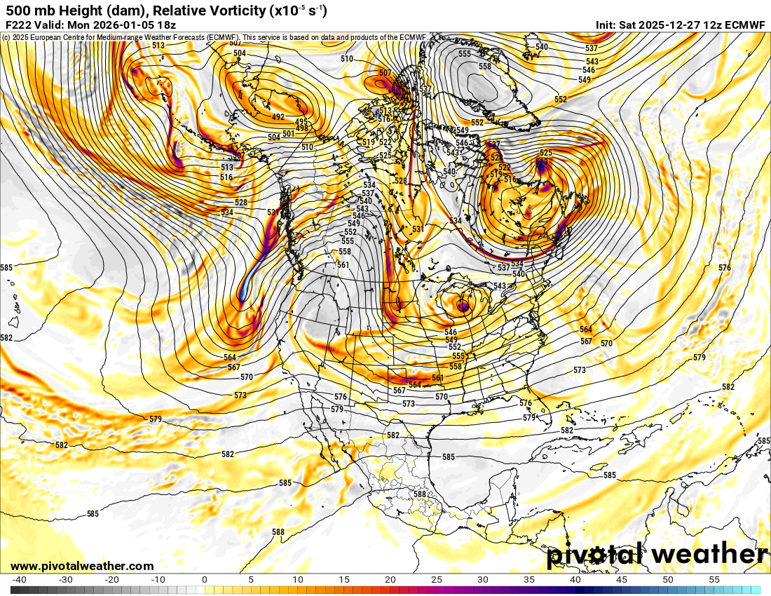
I love the cold beef injection diving through the Dakotas: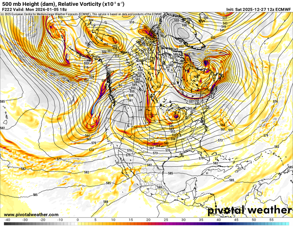
-

January 2026 regional war/obs/disco thread
Typhoon Tip replied to Baroclinic Zone's topic in New England
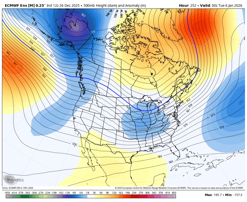
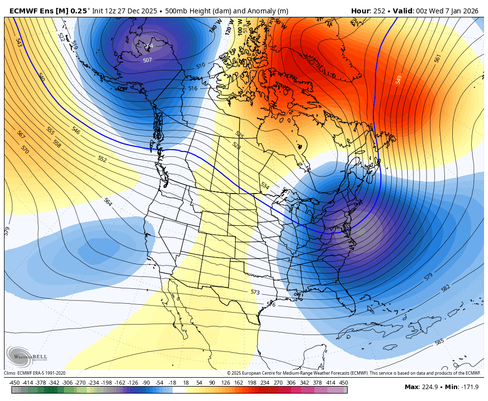
probably different reasoning vectors converging on the same idea... Breakdown of the Pac and introduction of +PNA is an H.A. signal in the gross sense but we're seeing it already in ensemble clusters The EPS with an impressive spread at 240+ hours is getting above the 95th %tile for this long of a lead. The GEFs still lag tho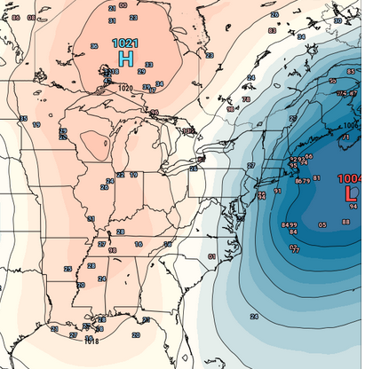
-
Just looking at the 8 cases that were during -ENSO (16, 22, 26, 33, 42, 44, 95, 10), the Jan SN mean/median rises to 12.8”/9.9”.
-
yeah, legitimately exciting... that -NAO is uptrending, too. the 5-7th is our first legit shot at a larger region-wide storm. pattern becomes even more favorable after that, too

-
.thumb.png.4150b06c63a21f61052e47a612bf1818.png)
December 2025 regional war/obs/disco thread
HIPPYVALLEY replied to Torch Tiger's topic in New England
You must be mistaken? DIT says everyone is down with damaging ice events. -

January 2026 regional war/obs/disco thread
brooklynwx99 replied to Baroclinic Zone's topic in New England
this poses some promise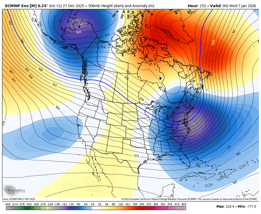
-
yeah, starting to get excited. that's legit and the pattern is only becoming more favorable as the PNA rises and EPO drops
-

Boxing Night Snow/Sleet/Ice Dec 26-27 Storm Thread/Obs.
Birds~69 replied to Mikeymac5306's topic in Philadelphia Region
As fun as that sounds my initial reaction this morning was I wished I had a early 1970s boat LTD (RWD) w/a V8 429cubic inch, empty/clear parking lot and/a handle of spiked Eggnog.....fun morning indeed. 31F/partly cloudy/sunny -
January 2026 regional war/obs/disco thread
Go Kart Mozart replied to Baroclinic Zone's topic in New England
I was just going to comment on that. Forget the weird solution for sensible weather, the set up is loaded...right out of the KU book. -

Wounded Duck Strikes Back: Dec 26 & 27th Winter Storm Obs
Amped replied to WxWatcher007's topic in New England
Just helped shovel some of 7-8" we had in Wesport. It felt pretty heavy for that amount. Not surprised given the small flake size, ratios were so-so. Best event Ive had in several years though. -
Looks like another windy period Monday night and Tuesday. Gusts to 40+
-
If December ended today, it would be Juneau's coldest on record.
-
3.8 jersey city. More than half of that fell after 11 PM