All Activity
- Past hour
-
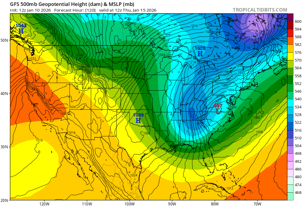
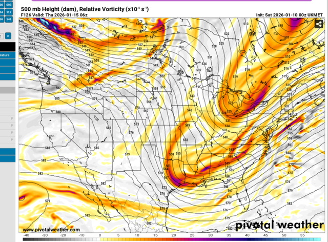
GFS leading the fookin way! (or probably not lol).
-
Ukmet not doing it this run but h5 is a marked improvement over 0z. Trends
-

January 2026 regional war/obs/disco thread
jbenedet replied to Baroclinic Zone's topic in New England
The 12z GEFS looks much more like the other guidance than the 12z op GFS..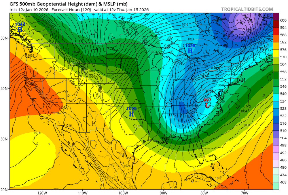
-
It’s better as compared to nothing on it last night. I would say it’s trying to join the GFS camp
-
Close to a moderate event.

-

Mid-Long Range Discussion 2026
WinstonSalemArlington replied to BooneWX's topic in Southeastern States
-
i agree. Gotta like the fact we have two shots at a decent dog. Hopefully, the entire viewing area can get at least to seasonal climo snow totals before February. Might be too much to ask...but suddenly the ceiling is there.
-
I really think it will be interesting to see if modeling is onto something with the vigor of storm 1. That’s been off and on various models the last couple of days.
-

January 2026 regional war/obs/disco thread
WinterWolf replied to Baroclinic Zone's topic in New England
It can’t get any worse for you…that would be staying the same. You ain’t got shit now, and you’ll have no shit going forward if the next couple systems fail. So it’s the same. Wallow in the shit Brett….you at rock bottom bro..it doesn’t get any worse if you want snow. -

2025-2026 Fall/Winter Mountain Thread
Sw NC weather replied to Buckethead's topic in Southeastern States
Boarder counties are smoked by both systems. 12”+ rest of the mountains are in the 6-12” range.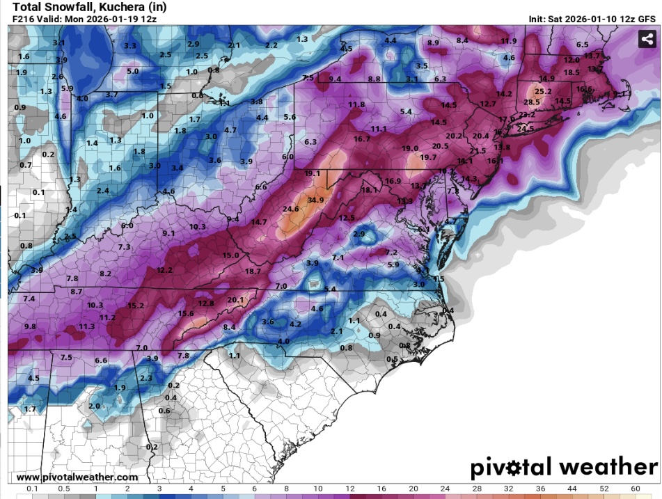
-

January 2026 regional war/obs/disco thread
Spanks45 replied to Baroclinic Zone's topic in New England
If the GFS somehow found a nut this one time, the next 10 days worth of snowfall would beat any of the last 4 season's snowfall totals....perspective I guess at this point -
Looks like there's a kicker that's bee-lining it down from Canada stealing it's breathing room.
-

January 2026 regional war/obs/disco thread
brooklynwx99 replied to Baroclinic Zone's topic in New England
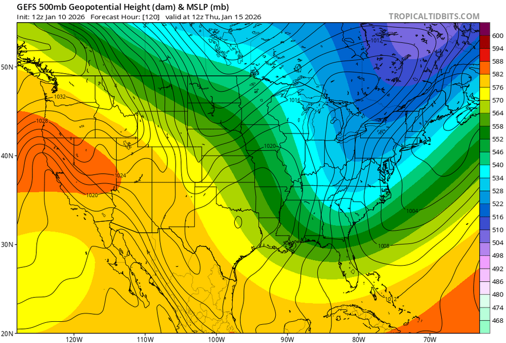
OP is obv on the more amped side of its own ensemble (though they're more or less different models at this point after the GFS got upgraded) the GEFS itself is more amped compared to its 06z run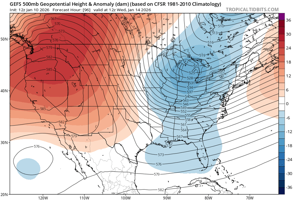
-
I’ll allow it……. I think I’m equally impressed that those two storms hit the entire state with 9”+, except for the far NW corner
-
It is something but I wouldn’t say good
-

Central PA Winter 25/26 Discussion and Obs
paweather replied to MAG5035's topic in Upstate New York/Pennsylvania
Good call Blizz something to look forward to! -
Much less exciting outcomes on the Canadian and ICON so far. Who’d a thunk?
-
Well I certainly like the trends this run. Steps in the right direction.
-
West Virginia is up to 47” at 232. @tnweathernuthas 26” of snow to this point.
-

January 2026 regional war/obs/disco thread
TauntonBlizzard2013 replied to Baroclinic Zone's topic in New England
I’m not sure this is necessarily true lol. If we miss that 15-20th period, the final third of the month has hinted at warming up, or at minimum, riding the boundary. It can always get worse lol -
January 2026 regional war/obs/disco thread
WinterWolf replied to Baroclinic Zone's topic in New England
As has been said, I think if a system can come together, it’ll be one system(the Thursday /Fri one), or the Sunday/Monday one, not both. -
Yea its good.
-
Actually, Canadian might end up better than I thought. Let's see.
-

January 2026 regional war/obs/disco thread
dendrite replied to Baroclinic Zone's topic in New England
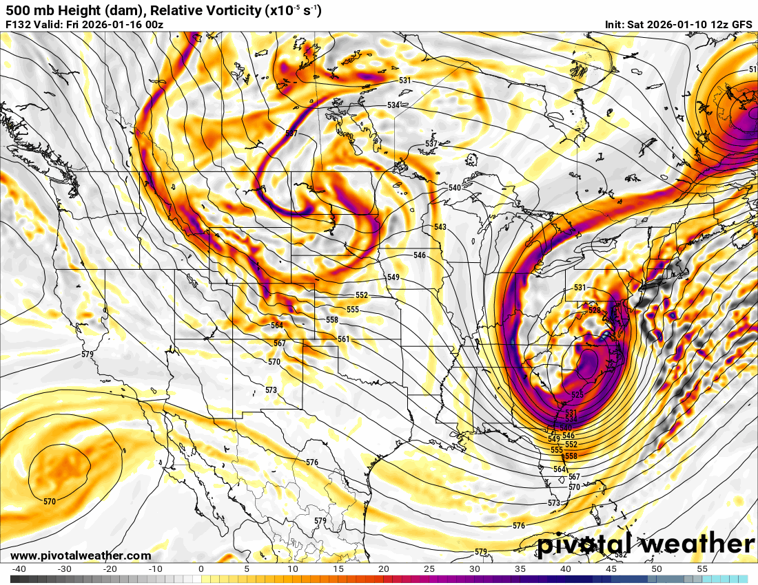
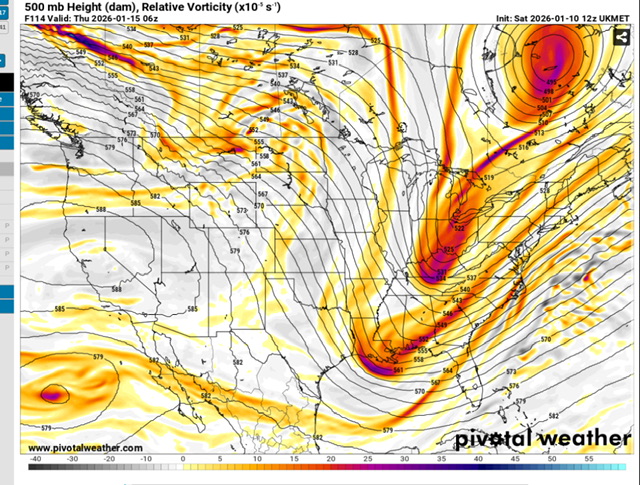
We still have more of the 12z suite to go, but there’s some really large differences still. Don’t fall in love with any one solution yet.
-
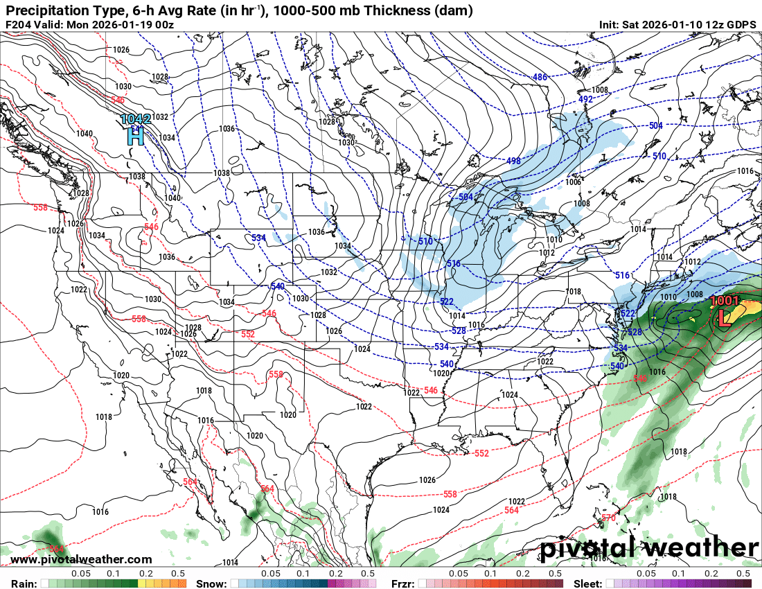
Storm one is a 24 to 28 hour deal.. precip begins Thursday morning around 1 AM