All Activity
- Past hour
-

Spring 2025 Medium/Long Range Discussion
Spartman replied to Chicago Storm's topic in Lakes/Ohio Valley
8-14 day: Lookin' wet 12z Euro: 18z GFS: -
I didn’t see any significant reported damage in the area though there was a house reported to have been hit by lightning on Skidaway Island. The lightning was pretty frequent with 1-2 CTG strikes nearby. The wind never was high and there was no hail. The rain had the largest impact with a pretty long period (~2 hours) of moderate to heavy though no street flooding was noted. I had only a minimal amount of water coming into the garage mainly on the side nearest to the storage room. Fortunately, I’ve had modifications and repairs done to the area at/near the garage door since last autumn. Those likely helped. The total rainfall in the area has been generous over the last 3 days combined, which is very beneficial considering being in a drought.
-
The best!
-
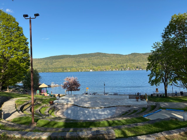
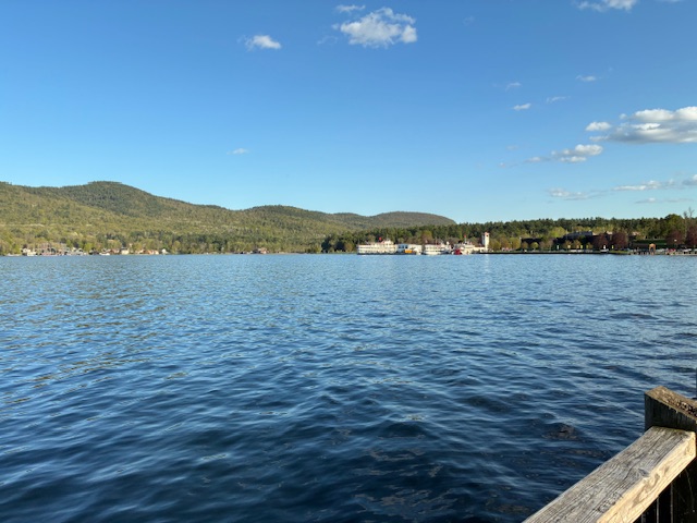
We drove SW and found sun and blue skies. Lake George was beautiful. I did not spot @qg_omegathough.
-
Nahh. Just enjoying my daily couple hours of heat before free AC.
-
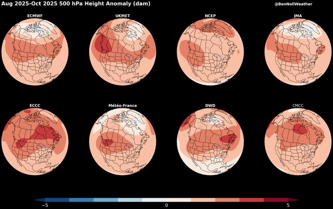
High pressure to the North on many models this Summer into the Fall can help guide hurricanes to landfall in the SE this summer/fall on a higher probability scale.
-
Summer rainfall above average possibly.
-

Spring 2025 Medium/Long Range Discussion
A-L-E-K replied to Chicago Storm's topic in Lakes/Ohio Valley
Looking good - Today
-
78 was the high today.
-

2025-2026 ENSO
40/70 Benchmark replied to 40/70 Benchmark's topic in Weather Forecasting and Discussion
I interpret that as only really having much utility at all for February, which isn't much of a news flash that February will have shitty climo if we repeat cool ENSO. I guess I don't interpret this as being as telling as you and Chris do. But like I said, with you lock-step on the NAO. That said, I won't be shocked if next season is RNA....so not necessarily arguing against that. I do think we are in for more PNA moving forward, though....regardless of what happens next year. -
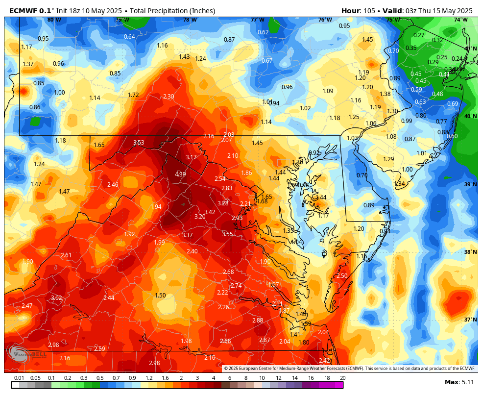
WB 18Z EURO...rain moves in after sunset on Monday. Total through Wed.

-
I see Central Park is in summer mode lol
-
See if the warm spots can get 80 tomorrow and Monday - otherwise looks gorgeous mid / upper 70s tomorrow - touch warmer than today.
-
Highs: EWR: 76 ISP: 74 JFK: 74 New Brnswck: 74 PHL: 74 ACY: 74 TTN: 73 BLM: 73 TEB: 73 LGA: 73 NYC: 72
-
BULLETIN - EAS ACTIVATION REQUESTED TORNADO WARNING NATIONAL WEATHER SERVICE CHARLESTON SC 758 PM EDT SAT MAY 10 2025 THE NATIONAL WEATHER SERVICE IN CHARLESTON HAS ISSUED A * TORNADO WARNING FOR PORTIONS OF... CHATHAM COUNTY IN SOUTHEASTERN GEORGIA... * UNTIL 845 PM EDT. * AT 758 PM EDT, A SEVERE THUNDERSTORM CAPABLE OF PRODUCING A TORNADO WAS LOCATED NEAR MONTGOMERY, MOVING NORTH AT 15 MPH. HAZARD...TORNADO. SOURCE...RADAR INDICATED ROTATION. IMPACT...FLYING DEBRIS WILL BE DANGEROUS TO THOSE CAUGHT WITHOUT SHELTER. MOBILE HOMES WILL BE DAMAGED OR DESTROYED. DAMAGE TO ROOFS, WINDOWS AND VEHICLES WILL OCCUR. TREE DAMAGE IS LIKELY. * LOCATIONS IMPACTED INCLUDE... MIDTOWN SAVANNAH, COFFEE BLUFF, WINDSOR FOREST, WILMINGTON ISLAND, HUNTER ARMY AIRFIELD, DOWNTOWN SAVANNAH, MONTGOMERY, VERNONBURG, SKIDAWAY ISLAND AND ISLE OF HOPE.
- Yesterday
-
2025-2026 ENSO
40/70 Benchmark replied to 40/70 Benchmark's topic in Weather Forecasting and Discussion
Yea, I think once we get beyond 2026, its becomes less hostile for -NAO, but +NAO still favored until we hit the min early next decade. The ascending portion of the cycle is best for -NAO. -
Was able to get a mow in
-
Tomorrow through much of Tuesday will be dry and pleasant days. Tempertures will generally top out in the lower 70s. Some showers are possible Tuesday night into Wednesday. The extended guidance has grown cooler for the second half of May than it had been. Both the CFSv2 and ECMWF weekly guidance are now in good agreement that the second half of the month could average near normal overall. The ENSO Region 1+2 anomaly was +0.1°C and the Region 3.4 anomaly was -0.1°C for the week centered around April 30. For the past six weeks, the ENSO Region 1+2 anomaly has averaged +0.68°C and the ENSO Region 3.4 anomaly has averaged -0.05°C. Neutral ENSO conditions will likely continue through at least early summer. Early indications are that summer 2025 will be warmer than normal in the New York City and Philadelphia areas. The potential exists for a much warmer than normal summer (more than 1° above normal). The SOI was -16.68 today. The preliminary Arctic Oscillation (AO) was +1.412 today. Based on sensitivity analysis applied to the latest guidance, there is an implied near 78% probability that New York City will have a warmer than normal May (1991-2020 normal). May will likely finish with a mean temperature near 65.8° (2.6° above normal). That would tie 2025 with 1975 as the 10th warmest May on record.
-
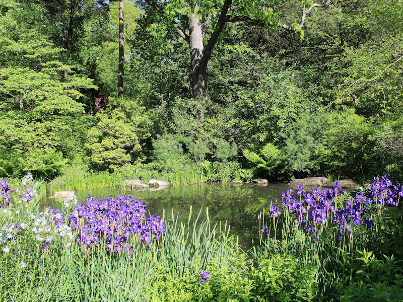
After a morning low of 50°, NYC topped out at a sunny 71°. Even as the rain washed down a lot of the blossoms at the New York Botanical Garden, there were still some picturesque scenes.

-
Forecasting with the desired vibes instead of models sometimes does work out. More often in the summer than winter, haha.
-
At times there’s too much model reliance and not enough forecast what actually should happen . Even AEMATT got some sun
-
Sun broke out up here too… I will say these evenings feel 10x better after two shitty days. Definitely enjoy the last couple hours of daylight outside today. I was wrong too. The models 48 hours ago were lingering the system much later. Definitely leaned nicer on the fringes as we got closer.
-

E PA/NJ/DE Spring 2025 Obs/Discussion
MGorse replied to PhiEaglesfan712's topic in Philadelphia Region
Ended up with a whopping 0.16 inches of rain yesterday. Unreal! -
you new to spring in chicago?
-
Beautiful day. 75 was the high and th breeze made it feel cooler. Next weekend looks like summer hits hard with humidity.