All Activity
- Past hour
-
Os are so pathetic. That first inning is like a microcosm of the entire season. Elias has fucked up this roster so bad.
-
BC built a new softball/baseball complex behind the Seminary on Lake St a few years ago. Really nice fields too as they just hosted the ACC Softball championship. The softball program isn't that great, but they try hard and it's a fun watch for an impressionable 10u player. We're supposed to play at Cold Spring Sunday, but that field takes a while to dry out, so we'll see. Oh yeah back on topic. 64* with clear skies and it's less humid out. Didn't seem smoky around the moon, but we'll see tomorrow?
-

2025 Lawns & Gardens Thread. Making Lawns Great Again
tunafish replied to Damage In Tolland's topic in New England
I did last year. Ineffective against both moles and groundhogs, ha. -
High of 92. Picked up 1.21" total from 2 storms today.
-
Alot of rain seems to have fallen south of 64 the last 24 hours , southern Augusta / Stuarts Draft into Rockbridge.. Which seems to be the convective pattern down here the last 3 years - hence the crushing spring - mid summer Valley droughts the last couple years have been Waynesboro northward.... .09 last 24 hours here... Another cluster just popped in the same area... Thankfully the large synoptic events this spring have been a nice change...
-
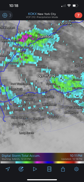
From RadarScope. Darker gray is 0.5-1”, Blue is roughly 1”+, green is 1.5”+. The purple dots are 2”.
- Today
-

June 2025 discussion-obs: Summerlike
LongBeachSurfFreak replied to wdrag's topic in New York City Metro
Was just going to ask the same. Had to have been close to an inch here in SW Nassua that fell in less then 30min -
Yeah it was light here until that brief downpour
-
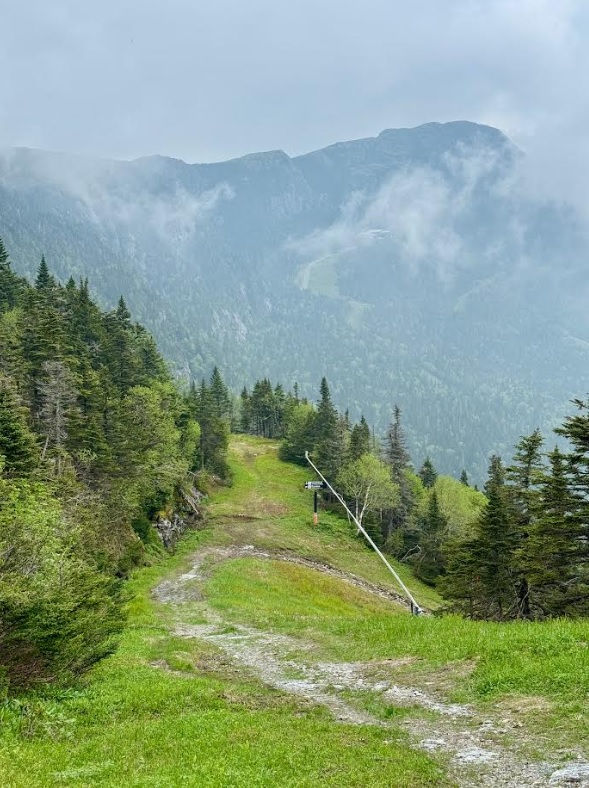
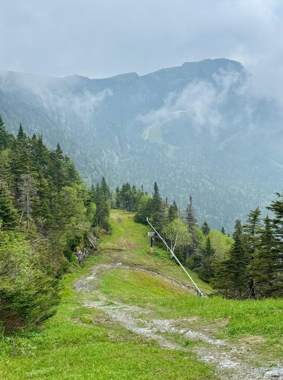
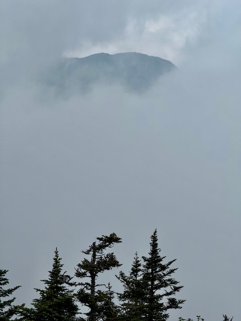
It was a smoky blue tint hazy day. There were some clouds around the mountain, but the view was smoggy. The Mansfield ridgeline is 2 miles long from above where I'm standing to the high spot across there, and even that view was hazy. The 5-6 mile visibility seemed about right. Eventually the clouds filled in.
-
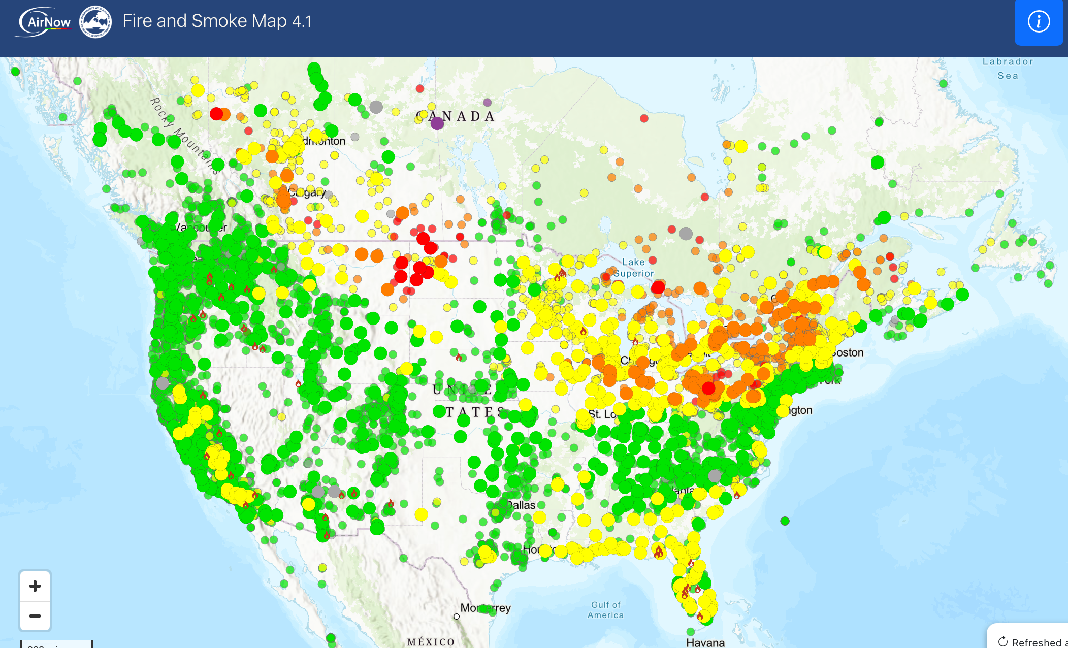
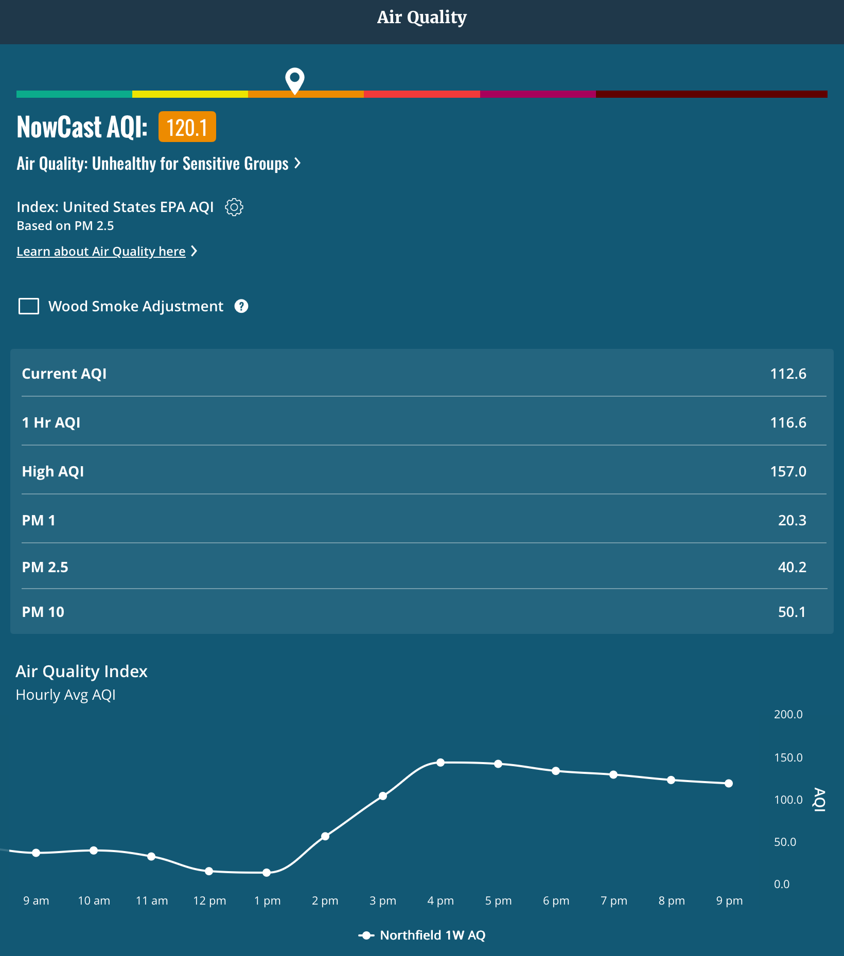
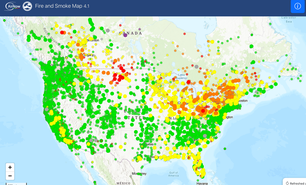
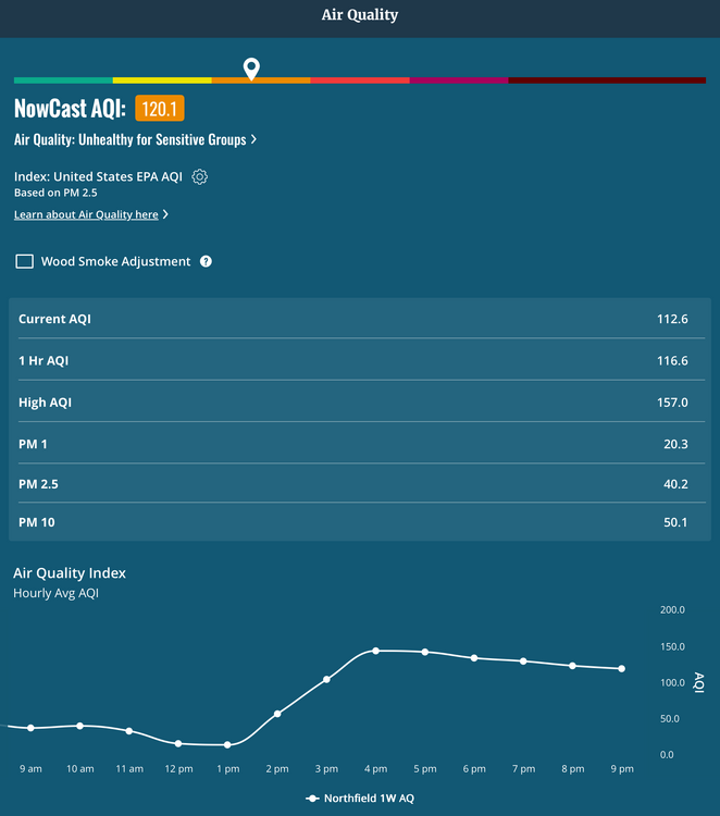
AQI clown map. Let’s pump those numbers up. It’s been pretty high here on my sensor as well.
-
1.20” of rain here. The drive back from basketball was wet, lots of flooding on area roads.
-
Days and days of steamy pavement, smoke, and moist plumbers cracks..ya love to see it!
-
We are firmly in splotchy season now.
-
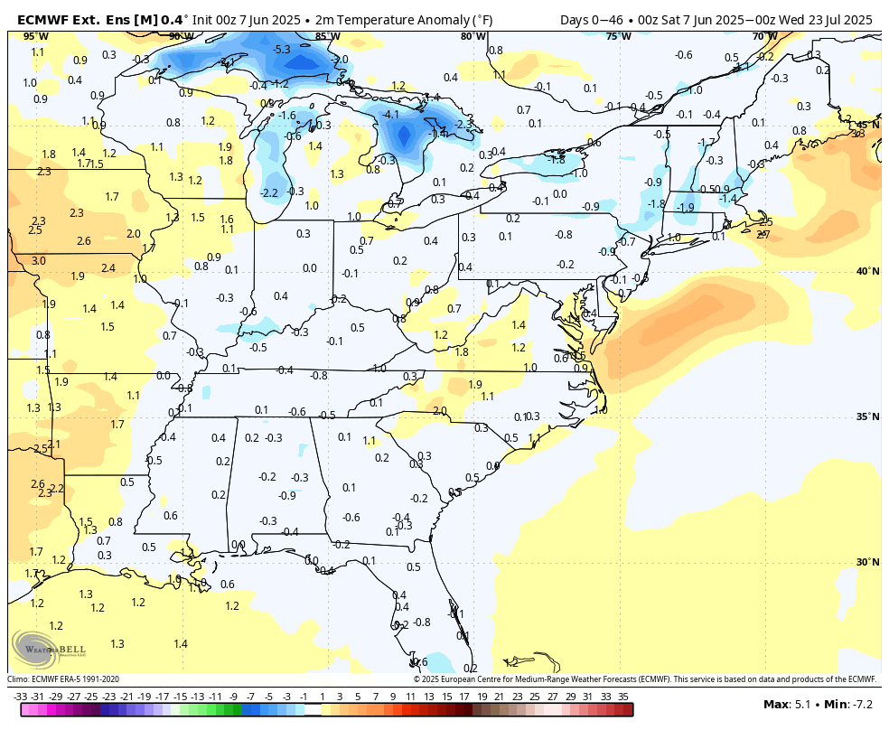
The early season modeling that predicted the worse of the heat being out West is holding true in the very early phase of JJA. Seems that the High pressure tendencies that started many summers ago is present again Northeast of us allowing a more humid airmass, but not extreme heat. Temps may be skewed by higher overnight lows.
-
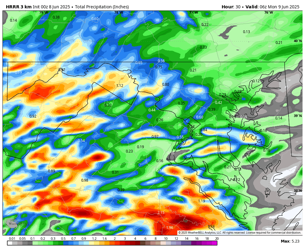
WB 0Z HRRR for Sunday.

-
Can you post the map you're using?
-
Looks like about 1.2-1.4” here. A few 2” pixels SW of me.
-
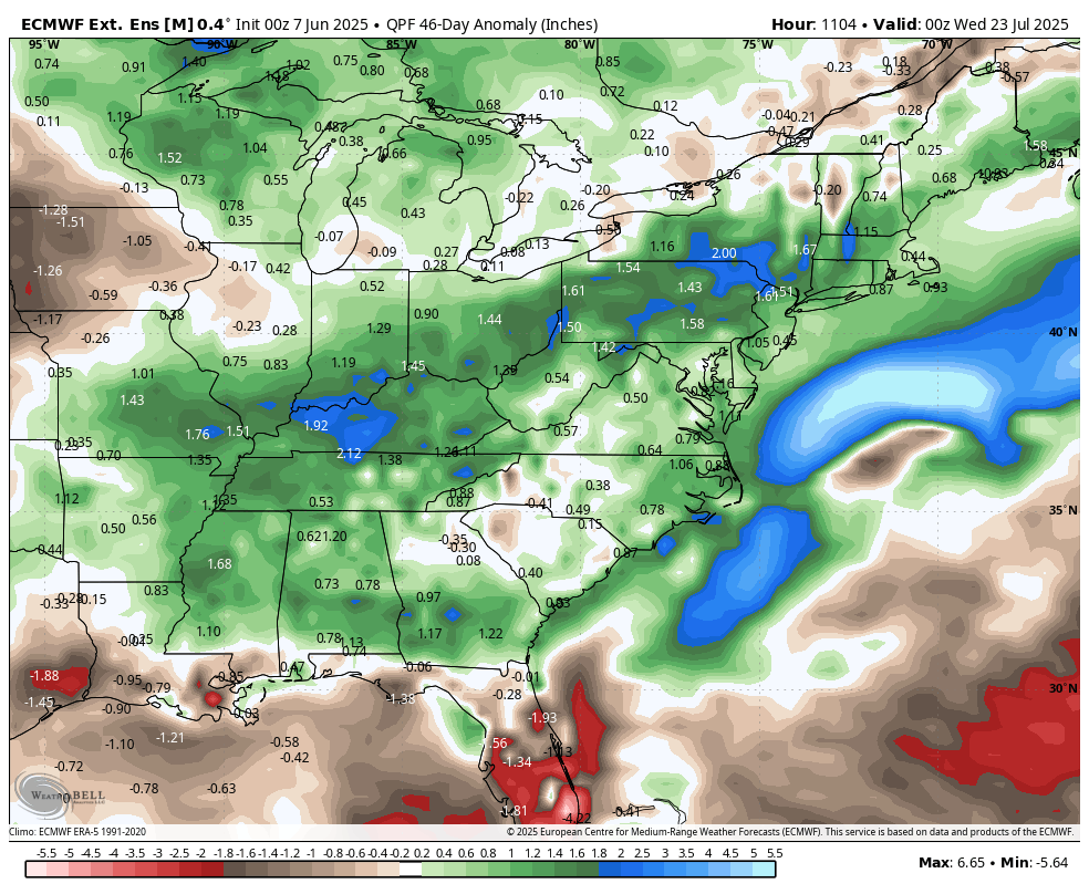
WB latest EPS extended through July 22: no extreme heat; average to slightly above precipitation.


-
I got only 0.12" here today. The early afternoon rain was moderate for a little while.
-
Nice dry evening outside, enjoy it
-
Highs: EWR: 82 New Brnswck: 81 PHL: 81 TEB: 81 LGA: 79 TTN: 78 BLM: 78 ACY: 78 ISP: 77 NYC: 76 JFK: 75
-
1.11” in Syosset & .42 in Muttontown. Looks like just E of Syosset totals go up to close to 2” by Dix Hills.
-
Glad it was shit day everywhere but in Billerica where the Fed Ex truck read 88 on rt 129.
-
Very hazy this evening from the fires I presume.
-
That was 2 summers ago but there’s new fires breaking out daily up there I read . This will last much of summer depending on wind flow