All Activity
- Past hour
-
You stole my bedroom temperature.
-
Stunning out there this morning .
-
 South facing walkway... Not a hint of melting!
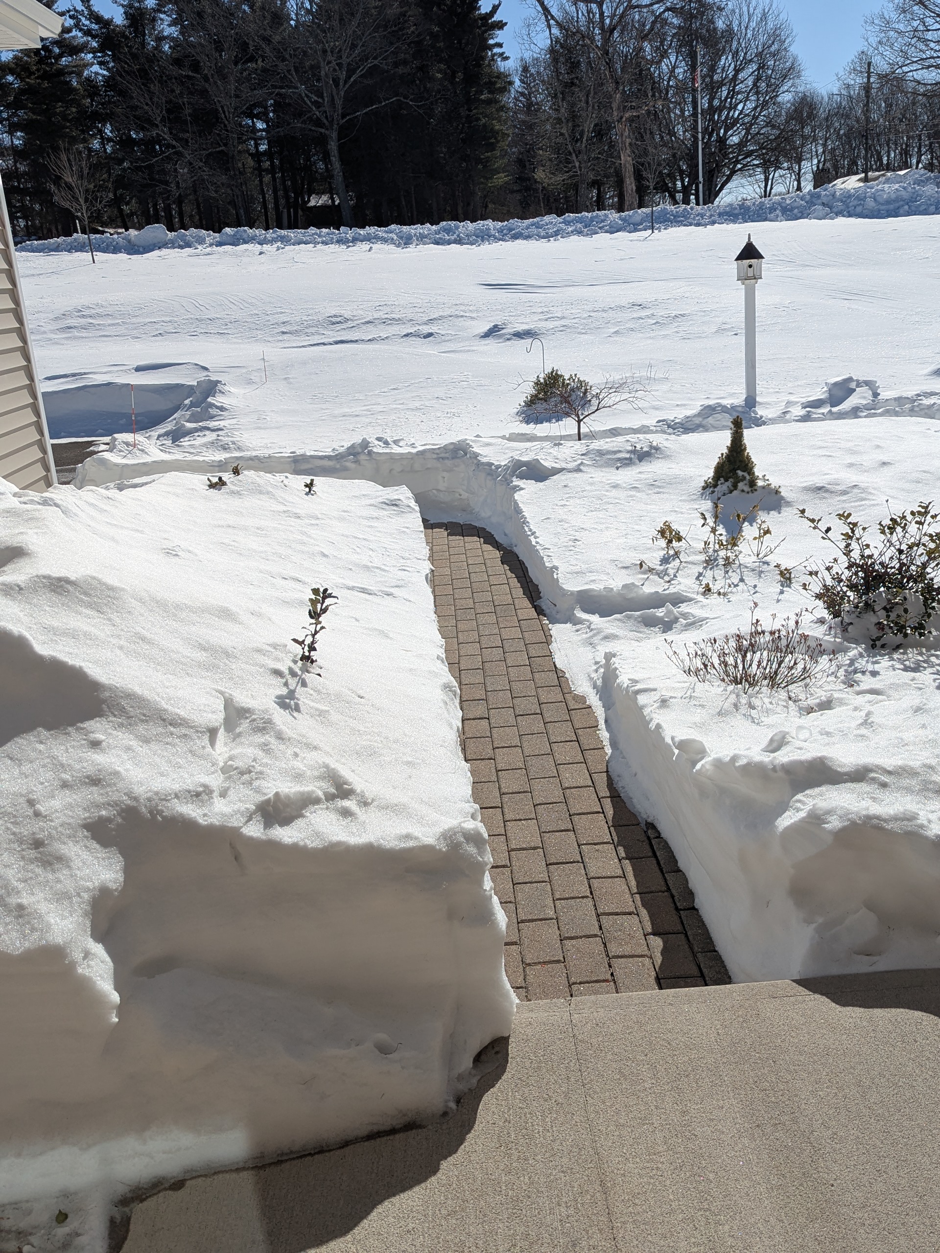
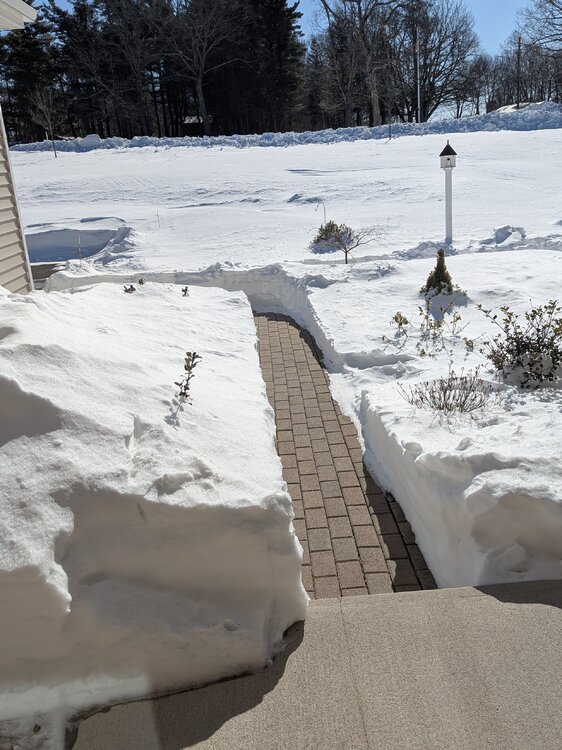
-
At least the NAM gets us SOMETHING.. But these kids need to go back to school. My liver needs a break
-

WxUSAF's weak ass frontal passage thing.
SnowenOutThere replied to dailylurker's topic in Mid Atlantic
I'm up to over 281 degrees* outside! * Degrees Kelvin -

Is we back? February discussion thread
40/70 Benchmark replied to mahk_webstah's topic in New England
Coastal Wx likes this!!! -
He was a little too a tall…could have used a few pounds…..
-
Not 67?
-

Winter cancelled/uncancelled banter 25/26
NorthShoreWx replied to Rjay's topic in New York City Metro
With the hard crust on top of the snow, it really stands out how much the deer crap everywhere here. -
 Almost forgot what it was like being below zero for 1 night....-2.7⁰ again this morning
 -

February 2026 Medium/ Long Range Discussion: Buckle Up!
yoda replied to Weather Will's topic in Mid Atlantic
-
I'm not sure what to make of this Wednesday evening - Thursday morning event. The GFS is printing out crazy totals for the Hickory area now. Cold chasing moisture doesn't ever seem to work out here, so I'm not really expecting anything, but it's hard to ignore what the models are showing.
-
Ain’t it funny how the moves.
-

February 2026 Medium/ Long Range Discussion: Buckle Up!
stormtracker replied to Weather Will's topic in Mid Atlantic
Yeah, after a period of rain, they go to heavy snow. lol. This movie is on repeat. -

February 2026 Medium/ Long Range Discussion: Buckle Up!
snowfan replied to Weather Will's topic in Mid Atlantic
Its not extreme, but well below normal and WCs will be cold. -

WxUSAF's weak ass frontal passage thing.
Solution Man replied to dailylurker's topic in Mid Atlantic
69 here -

February 2026 Medium/ Long Range Discussion: Buckle Up!
bncho replied to Weather Will's topic in Mid Atlantic
slop storm on the GFS, but it's a strong slop storm -

Richmond Metro/Hampton Roads Area Discussion
wasnow215 replied to RIC Airport's topic in Mid Atlantic
Midday models weak sauce. Please do not mention HRRR or I will scream lol -
February 2026 Medium/ Long Range Discussion: Buckle Up!
SnowenOutThere replied to Weather Will's topic in Mid Atlantic
To illustrate PSU's point the 12z GFS gives another fine addition to this collection -
Idea is there on the 12z GFS for something mid-month as many have mentioned
-
WxUSAF's weak ass frontal passage thing.
stormtracker replied to dailylurker's topic in Mid Atlantic
Damn, I'm up to 71 now. -
 This is by far the longest I’ve held onto higher end snowpack in a while.
 -

February 2026 Medium/ Long Range Discussion: Buckle Up!
Weather Will replied to Weather Will's topic in Mid Atlantic
WB 12Z GFS: I take it as a positive that it shifted to the coast. 12 days for it to move northwest! -
WxUSAF's weak ass frontal passage thing.
SnowenOutThere replied to dailylurker's topic in Mid Atlantic
In fairness some of our best snowstorms come after a torch. If anything this is just making me more optimistic, after all, warm air will help sublimate/evaporate the snow and increase our atmospheric moisture to juice up the system. Basically, this warm air is going to cause a Jan 2000 style bust. -

E PA/NJ/DE Winter 2025-26 Obs/Discussion
PhiEaglesfan712 replied to LVblizzard's topic in Philadelphia Region
I'm just skeptical of the prospect of record 70+ degree warmth in the middle of the month. I would love for it to happen, but with how cold it has been for most of the winter and the beginning of this month, I just don't see it happening.


.thumb.png.4150b06c63a21f61052e47a612bf1818.png)
