All Activity
- Past hour
-
First Winter Storm to kickoff 2025-26 Winter season
Typhoon Tip replied to Baroclinic Zone's topic in New England
This system would have to snow at 4"/hr rates to load those numbers. I dunno. just sayn' -
I'll sign. Would like to see the 1" line close to I-95, but this is decent for 12/1, IMO.
-

First Winter Storm to kickoff 2025-26 Winter season
CoastalWx replied to Baroclinic Zone's topic in New England
I don’t see that happening one bit. -

Nov 28-30th Post Turkey Day Winter Storm
Chambana replied to Chicago Storm's topic in Lakes/Ohio Valley
Finished with 8.3” and a peak wind gust of 43mph, just an awesome awesome storm! -
Mount Holly for my area late week. Brrr Thursday Night Partly cloudy, with a low around 19. Friday Partly sunny, with a high near 33. Friday Night A chance of snow. Cloudy, with a low around 26. Chance of precipitation is 50%.
-

First Winter Storm to kickoff 2025-26 Winter season
dendrite replied to Baroclinic Zone's topic in New England
-

Central PA Fall Discussions and Obs
WmsptWx replied to ChescoWx's topic in Upstate New York/Pennsylvania
Question is: Does the night shift dick at CTP pull the trigger or do they wait until the virga starts moistening up? -
NWS local forecast for Columbia on Friday is some sun, hi 33. Good start for the weekend.
-
Happy hour is T-2” for next weekend for many
-
Dare I say GFS looks reasonable?
-
Man that would be the snowiest December in a a decade down here in Baltimore County.
-

First Winter Storm to kickoff 2025-26 Winter season
DavisStraight replied to Baroclinic Zone's topic in New England
You should cash in, looks like you're in the sweet spot. -

First Winter Storm to kickoff 2025-26 Winter season
Damage In Tolland replied to Baroclinic Zone's topic in New England
You’ll get more than here -

First Winter Storm to kickoff 2025-26 Winter season
HoarfrostHubb replied to Baroclinic Zone's topic in New England
Euro should be similar to 12z maybe some wiggle that's basically noise -

First Winter Storm to kickoff 2025-26 Winter season
CT Valley Snowman replied to Baroclinic Zone's topic in New England
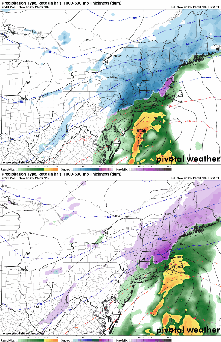
Really close call here. GFS pivotal maps have like 8" here and 2" in Ellington. Surface temps on most modeling get up to around 33 with the 850 O line right over my fanny at the height of the storm. I would prefer to be about 10-15 miles NW. I'm going with a cautious 2-4"here in this part of the valley as a first estimate. -

First Winter Storm to kickoff 2025-26 Winter season
AstronomyEnjoyer replied to Baroclinic Zone's topic in New England
-

First Winter Storm to kickoff 2025-26 Winter season
H2Otown_WX replied to Baroclinic Zone's topic in New England
I won't. That thing is dead nuts. -
-

December 2025 Short/Medium Range Forecast Thread
Carvers Gap replied to John1122's topic in Tennessee Valley
Just looking through modeling and catching up some(yes, I was at that abomination of a ball game yesterday...but still enjoyed being with my family!), there are some really close calls in the medium range. IF modeling is incorrect about the strength of the cold incoming, areas north of I40 could see some frozen precip. This is something that will have to monitored with each event. Seems like we have a Gulf system in that window where systems are lost. Let's see if it reappears. -
I keep checking bluesky to see whether HM ( aka Anthony M. ) posted any updats regarding his December weather thoughts. Not seeing anything. I know someone posted a while back he was enthused for this Jan.
-
Looks like a good thump of snow for 6-8 hours or so before turning over. I'd take it.
-

First Winter Storm to kickoff 2025-26 Winter season
ineedsnow replied to Baroclinic Zone's topic in New England
I'll be shocked if the EURO doesnt move a bit at 18z -
18Z GFS still holding on for Friday.
-
Based on major snowfalls at RDU, CLT, and ATL, the requirement of a -NAO at the time of the storms is often exaggerated. The existence of a +PNA has been much more important.
-

E PA/NJ/DE Winter 2025-26 Obs/Discussion
RedSky replied to LVblizzard's topic in Philadelphia Region
Grill cover is light gray it acts like a snow board


