All Activity
- Past hour
-
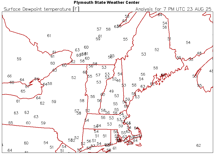
These dews are just the chefs kiss on the day.
-
That’s why so many people are moving out to the Desert Southwest. Many people are OK with the extreme summer heat and drought. Then they can take weekend ski trips during the winter to get their fill of snow and cold.
-
We do?
-
That’s a really good point. As I saw it the two big killers right now would have been vorticity stretching and the drier air/SAL. So far 99L has held on. Would’ve been much harder to do if it wasn’t so organized. Now that’s interesting. GEFS have very little, if any, signal.
-
had a yard work day, wasn’t expecting to see 90. I’m toast
-
Not to brag, well maybe just a little, but it has been a good summer for moisture up here. I closed out July with 2.3”. It has been a bit dry in mid August but have picked up .4” recently and I am rather optimistic for more over the next few days.
-
We’re going to pay dearly for this pleasant weather in Sept and Oct aren’t we?
-
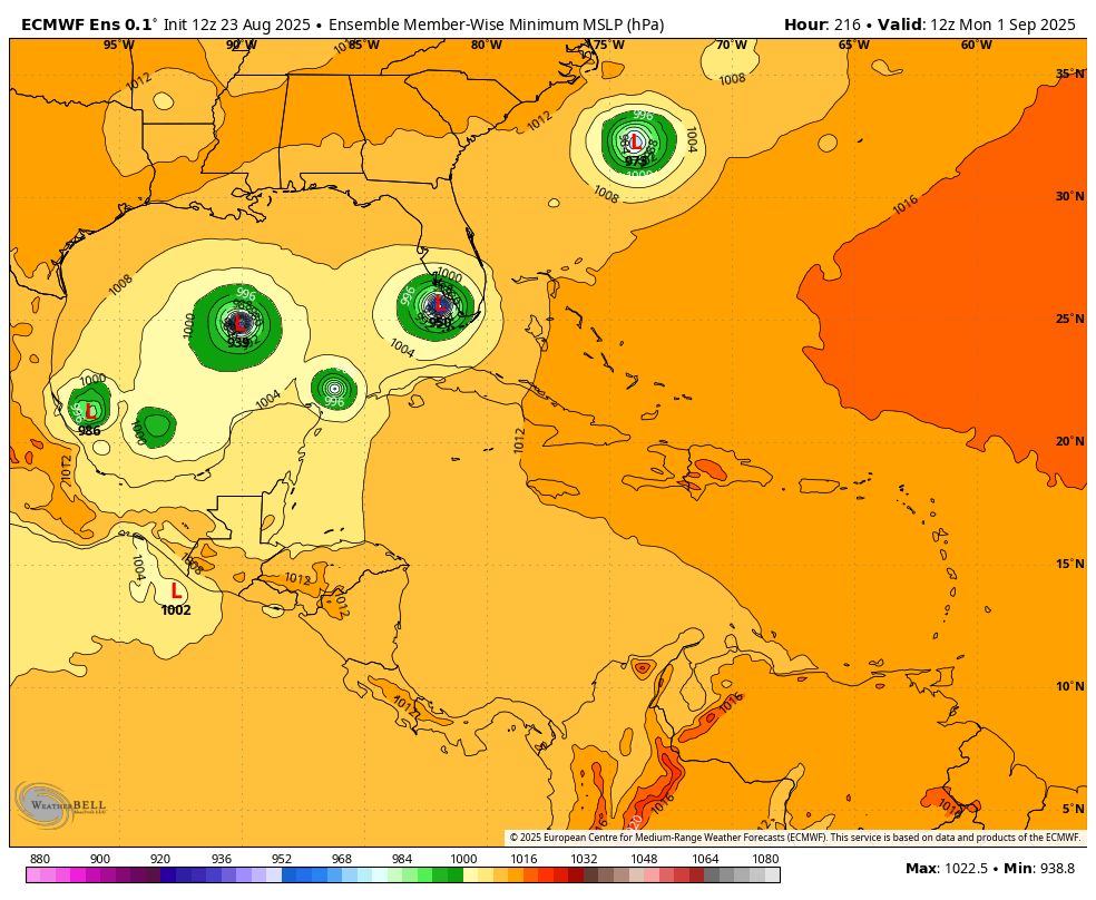
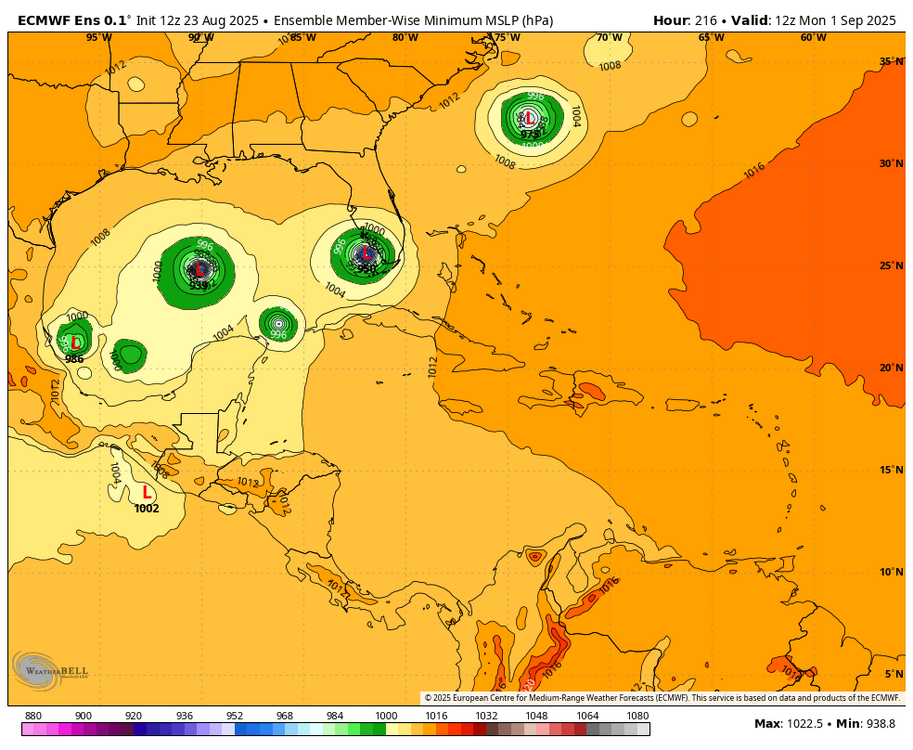
In addition to the 12Z Icon being still another of its runs developing this in the W Caribbean, the 12Z Euro ens is significantly more active:
-

Occasional Thoughts on Climate Change
donsutherland1 replied to donsutherland1's topic in Climate Change
So far, the ECMWF is an outlier in terms of a return to extreme heat, but the period looks abnormally warm. We'll see what the 12z ECMWF shows. I agree with you about the changes in climate classifications. The warming is ongoing and fairly dramatic. At least one episode of extreme heat has become a fairly regular occurrence. The number of hot days has increased markedly. -
 83 / 54 great day
 -
https://x.com/convchronicles/status/1959276496687903012?s=46&t=nTdsbQZkQMPkUI3zGjAXJg convective chronicles is planning on uploading a case study on the may 31st 1985 tornado outbreak i figured that yall would be interested looking back on it with the case study
- Today
-

Central PA Summer 2025
Mount Joy Snowman replied to Voyager's topic in Upstate New York/Pennsylvania
Just mowed, what a phenomenal day. Time for some libations and grilling. Next week is going to be heavenly. -
yes this looks pretty good. Still firing deep convection which is the most important thing. This def was a TD/TS a few days back which might speak to why it’s still holding together so well now
-
We march toward fall.
-
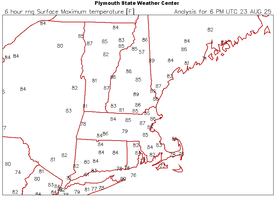
NNE cooking again. Deep summer day near 90°
-
I take it ultra warm winters like 11-12, 15-16, 19-20, 22-23, 23-24 were more or less unprecedented before this era no? It's not just that though. 21-22 and 24-25 were decently cold/seasonable, we just can't buy a big storm or frequent moderate storms anymore :/. Sucks and makes me want to move up north to VT or something.
-
This was posted on IND's fb page. Make of it what you will.

-
TS likely per NHC. Euro really struggled with its TC genesis signal here (and 99L surviving this long). Southwestern Atlantic (AL90): Satellite images and Air Force Reserve aircraft reconnaissance data indicate that an area of low pressure about 400 miles south- southeast of Bermuda continues to get better-defined, and recent satellite-derived winds indicate that the low pressure area has gale-force winds east of the center. This system is expected to become a tropical storm this afternoon or evening, with further intensification likely through Sunday while the low moves northward at 10 to 15 mph over the southwestern Atlantic. Interests in Bermuda should monitor the progress of this system, though the threat to that island appears to be less than yesterday. For additional information, including gale warnings, please see High Seas Forecasts issued by the National Weather Service. * Formation chance through 48 hours...high...near 100 percent. * Formation chance through 7 days...high...near 100 percent.
-
 This. I think we're cooked until the western pac stops boiling. Has there been a single extreme -pdo type winter that ended up good for us??
 -

2025-2026 ENSO
PhiEaglesfan712 replied to 40/70 Benchmark's topic in Weather Forecasting and Discussion
The only one I'd really take is 17-18. That's probably the closest thing to a great winter all-around since 13-14 and 14-15. I know we had the record warm February, but that was an outlier compared to the other months (December, January, March, and April), which were all below average. 15-16 and 16-17 were high variance winters, especially 15-16, which was dependent on one storm that skewed the entire season. Areas that missed the storm had record low snow totals. The greater frequency of warmer winters. You could start to see it as early as 2011-12. The great seasons of 2013-14 and 2014-15 interrupted the pattern. But after the mid-2010s el nino ended, you can definitely start to see a pattern change. -
1:51pm on an August 23rd. Thread bump time. Fourteen years ago at this moment was a fun time!
-
Whatever needs to happen to give us a mild/snowless winter is pretty much guaranteed to happen.
-
He was the editor-in-chief for the now defunct predatory journal Environment Pollution & Climate Change owned by OMICS. OMICS, subsidiaries, and personnel were investigated for academic fraud in 2016 and were found to have run as many 700 predatory journals and deceived numerous article authors. A judge ordered the India based company to pay $50 million in damages. Viterito defended his involvement with the predatory journal he ran. And his "scientific" positions defy credulity. He allowed an article that stated that the greenhouse effect cannot be real because the atmosphere does not have a roof like a real greenhouse. Even the most predatory of predatory journals would usually reject that kind nonsense. So this must have been a whole new level of ineptitude. If Viterito isn't a climate troll then he is doing everything he possibly can to convince everyone that he is. Why? I have no idea.
-
Any reasons you think the pattern has turned to levels of garbage for snowfall literally never seen before? After 2018-2019 it seems like something changed abruptly. Since then the only good winter month snow-wise for nyc was february 2021.