All Activity
- Past hour
-
 It almost feels like a front just crashed through here. It's clearing up, breezy, and I'm down to 69 from a high of 81 and the dewpoint has also dropped from 72 to 64.
 -

July 2025 Obs/Disco ... possible historic month for heat
weatherwiz replied to Typhoon Tip's topic in New England
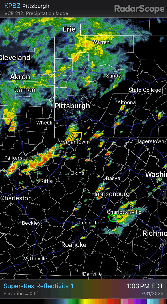
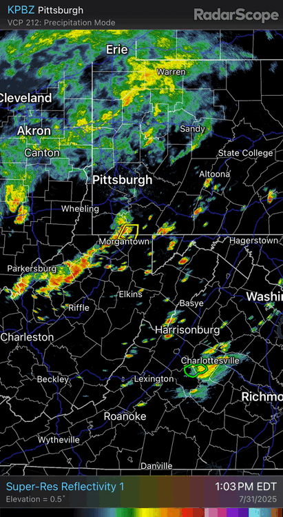
that actually may be a few scans away from a TOR -
July 2025 Obs/Disco ... possible historic month for heat
weatherwiz replied to Typhoon Tip's topic in New England
interesting looking cell headed towards EWR -
93/66 with a Dew of 80. Severe Thunderstorm Watch and Flood Watch. Seeing all the stuff pop to my S and E and guessing this may be yet another day of being under watches and not seeing a drop. Got back from what we thought would be a beat the humidity at the barn this morning. No such luck. I don’t even know why I took a shower this morning. All I could keep thinking is only about 12 more hours of this and then will be bowing down to the Canadian’s for pushing their cool air in.
-
GFS hinting at a homegrown spin up tucking into NC/VA coast next week? Probably a phantom.
-

July 2025 Obs/Disco ... possible historic month for heat
WinterSnow replied to Typhoon Tip's topic in New England
I'm in CT and where's the flipping rain? Seems like it's allergic to CT and wants to stay off to the west/northwest. -
Nary a drop in Maytown...
-

E PA/NJ/DE Summer 2025 Obs/Discussion
donsutherland1 replied to Hurricane Agnes's topic in Philadelphia Region
In the past hour, Reading picked up 2.47" (62.7 mm) of rain. That sets a new July hourly mark and is the third highest hourly figure on record. Reading's daily total of 2.67" (67.8 mm) breaks the July 31 daily mark of 2.56" (65.0 mm) set way back in 1887. -
 Rumbling at the new office in Berkeley Heights.
 -
Got a half inch in Tamaqua, but everything seems to have now consolidated southeast from Allentown on south.
-
Watch up till 8pm
-

Central PA Summer 2025
Mount Joy Snowman replied to Voyager's topic in Upstate New York/Pennsylvania
Yeah I'm right in the thick of it and the dreaded back-building keeps happening every time I think the back edge is near. Over an inch and a half now. Developing.... -
 So close… going to slide just south of me
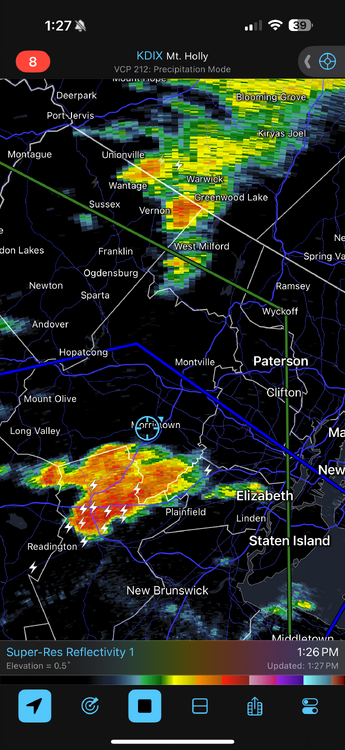
-
 Just had some random lightning strike here in New Providence from that storm near the Rt78/287 interchange. Was just out cleaning the gutters real quick and probably would have crapped myself if I was up on the ladder. lol Edit: and a second one. No rain or anything to speak of yet.
 -
brief pop up shower here with more all around
-
 Slight risk for South Jersey Alley.
 -
Several factors have me betting the under today. This is just a gut instinct. Storms just fired a bit to the east of the metros now moving away - leaving cloud cover. To the west I see activity but it would really need to generate. Id be more excited if we had bright sun at 1:25 pm. Not to be a Debbie but I am taking the under today for the widespread flooding. I have not looked at a model sounding - I've just lived here most of my life. Disclaimer: I do not have a red met tag.
-
 Yeah.. same here in Rockaway Mall/Borough area.
 -
Hoping that stuff in WV can hold together for later.
-
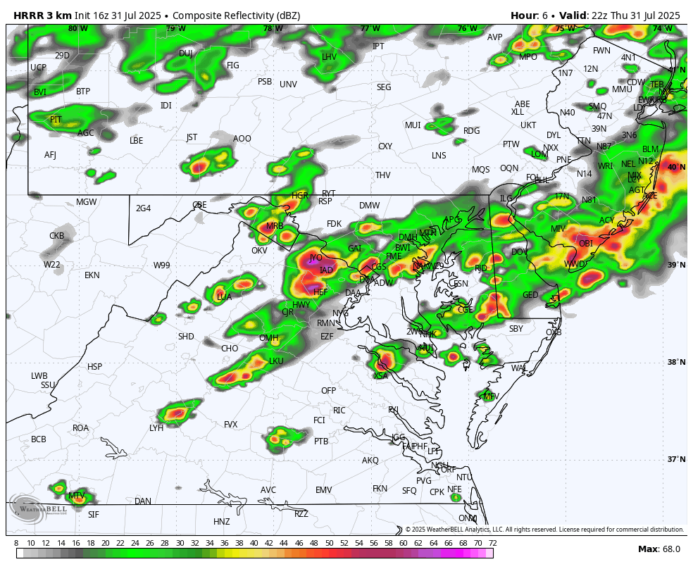
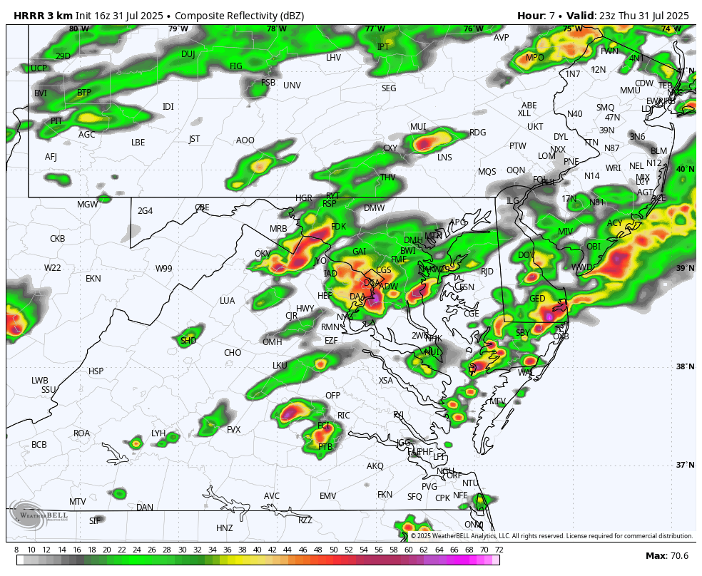
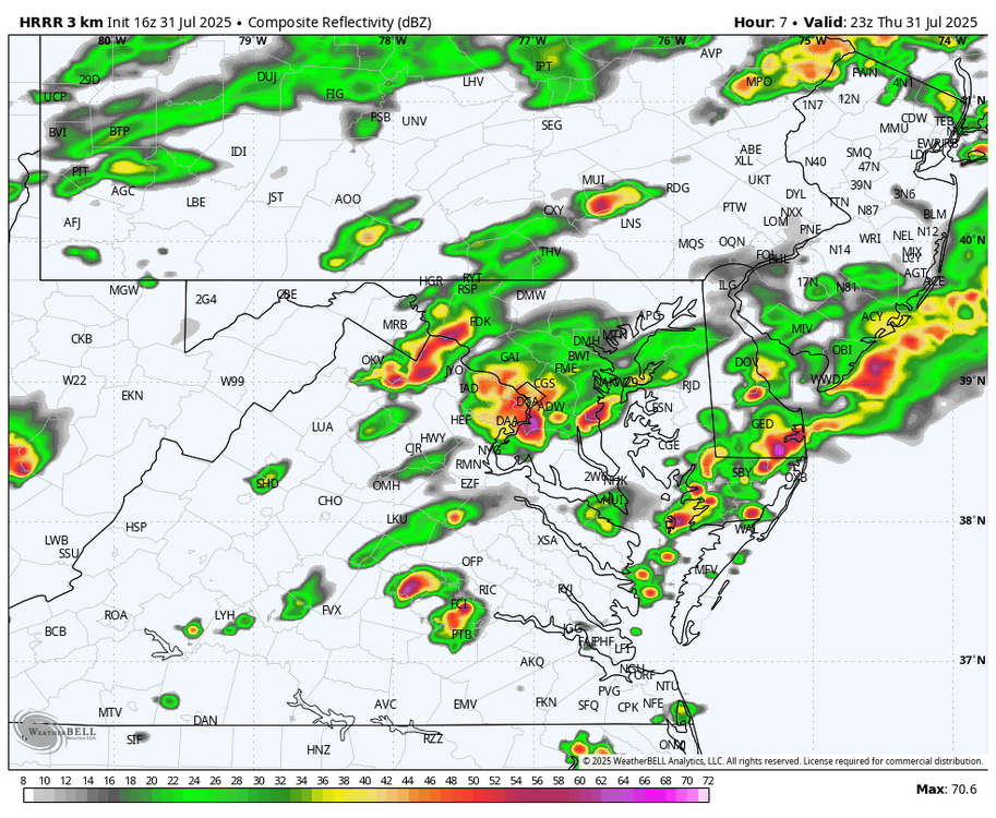
WB 16Z HRRR has heavier storms in western zones by 6pm.

-
The NWS just posted instructions on how to bake a lasagna in your mailbox
-

July 2025 Obs/Disco ... possible historic month for heat
Hailstoned replied to Typhoon Tip's topic in New England
That's a queer choir you're preaching to. -
July 2025 Obs/Disco ... possible historic month for heat
weatherwiz replied to Typhoon Tip's topic in New England
I'd watch the potential for a tornado or two across the Connecticut shoreline and especially Long Island. -
 Severe Thunderstorm watch issued for much of the area
-
Severe Thunderstorm Watch up east of the mountains.