All Activity
- Past hour
-
Gfs looks mixy down there but decent QPF
-
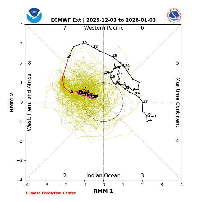
Anthony absolutely did but at least he’s not denying it. And he’s absolutely right about it being forecasted (several times in fact). Here’s one of several Euro-ext runs forecasting a 30+ straight day phase 8: this one had it at 32 days (12/3-1/3) and on top of that showing no sign of it ending on 1/3
-
Are we making this a legit thread? Would be nice. Winter ain't over yet, but the NFL is.
-
Only 38.6 here
-
Would def rather roll the dice.
-
Rainmen??
-
I’m in nyc. Can’t wait to get home and build rainmen
-
Ends up pushing SE, but the 23rd is still the time frame for something. Maybe the last shot.

-
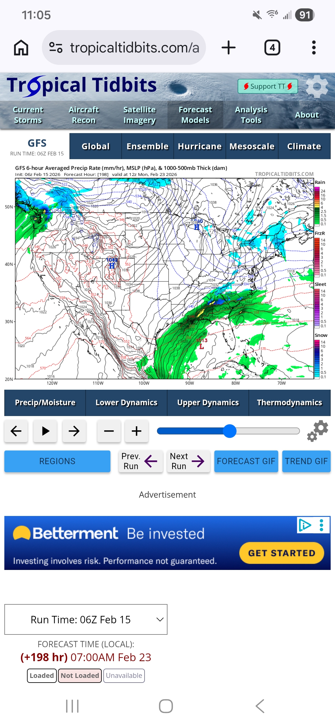
GFS nice hit . Let's do that
-
Where are these trolls coming from? What's funny about our entire Chesapeake Bay watershed being destroyed? The word poop, maybe. I guess poop is funny when your super low IQ and don't understand anything beyond the funny word, poop.
-

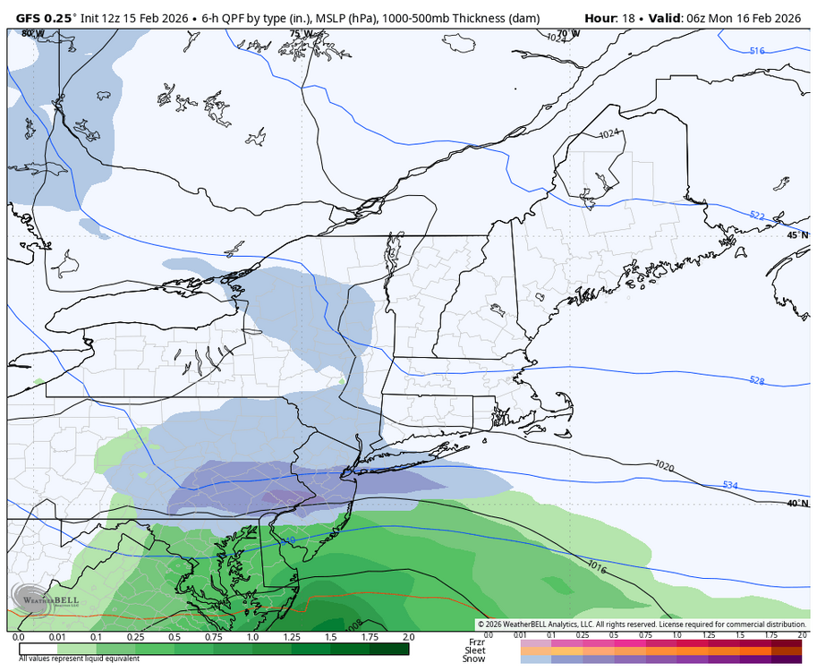
Early Monday morning 2/16 last minute event OBS/Discussion
JTA66 replied to The Iceman's topic in Philadelphia Region
Looks like the 12z GFS just bulls eyed you and Kamu -
Looking good. With lots of ice floating around the W side of L Superior, the temps over the Lake will be colder with warmer air running over the top (WAA) during the early part of the stm. Dry air might be an issue to start tho. Always do well along the shoreline with these conditions. Inland should do really well with oro lifting along the ridges. Strong E winds at the surface with strong SE winds at the mid level. LP weakens with a trough lingering, and a new LP moving in to the S sub, will keep an ENE to NE flow off the Lake, so lighter snows should linger thru Friday. Possible LES banding is in the mix then, and wherever they form could be a significant hit.
-

Central PA Winter 25/26 Discussion and Obs
canderson replied to MAG5035's topic in Upstate New York/Pennsylvania
Man this morning might the be last below 32 temp in Harrisburg over the next 9-10 days. -
Late winter storms are the best. Snow, followed by AN temps typically meaning melt off is fast and residual ice is rarely a problem. Longer days also meaning less work at night.
-
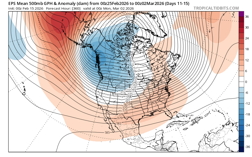
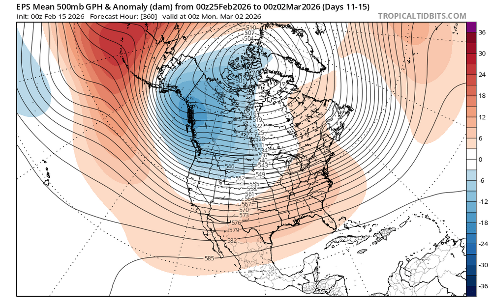
If we want to make a run late month or early March I’d like for this to change.
-
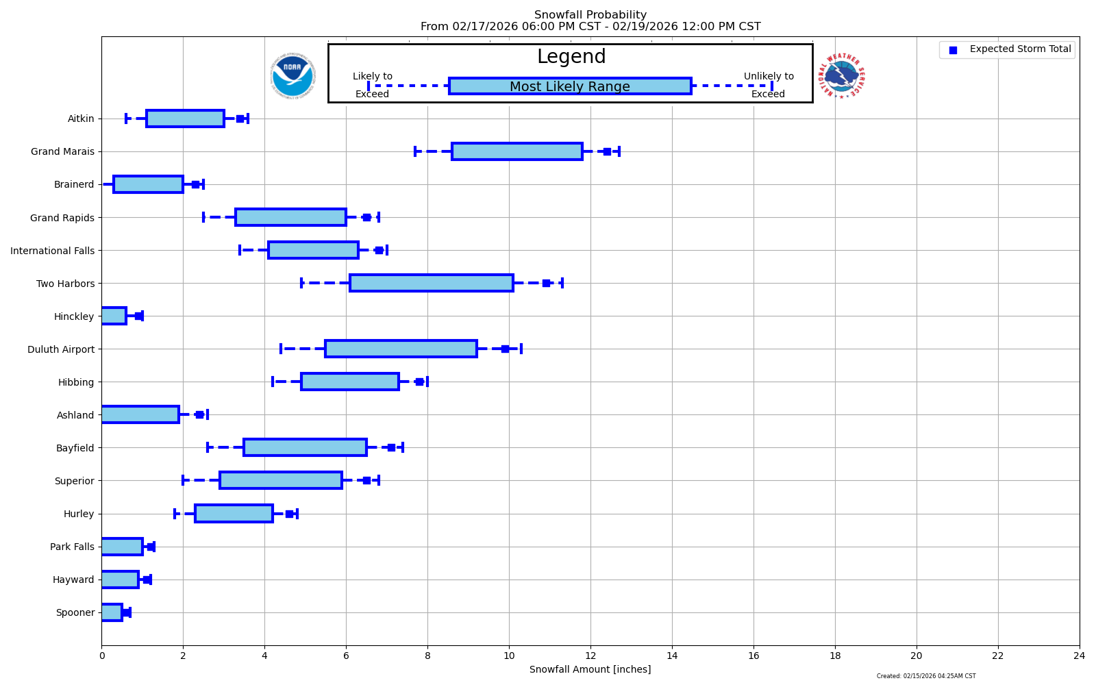
Snow depth 12 with 2.68 w/e
-
Central PA Winter 25/26 Discussion and Obs
canderson replied to MAG5035's topic in Upstate New York/Pennsylvania
I did use a growler to store the mix lol -
Early Monday morning 2/16 last minute event OBS/Discussion
JTA66 replied to The Iceman's topic in Philadelphia Region
We win some, we lose most—life of a Philly weenie. Still, it’s snow on snow, so I’ll cling to that. 41F/DP 30F -
Oh look, it's dry here. I'm shocked.
-

Central PA Winter 25/26 Discussion and Obs
Blizzard of 93 replied to MAG5035's topic in Upstate New York/Pennsylvania
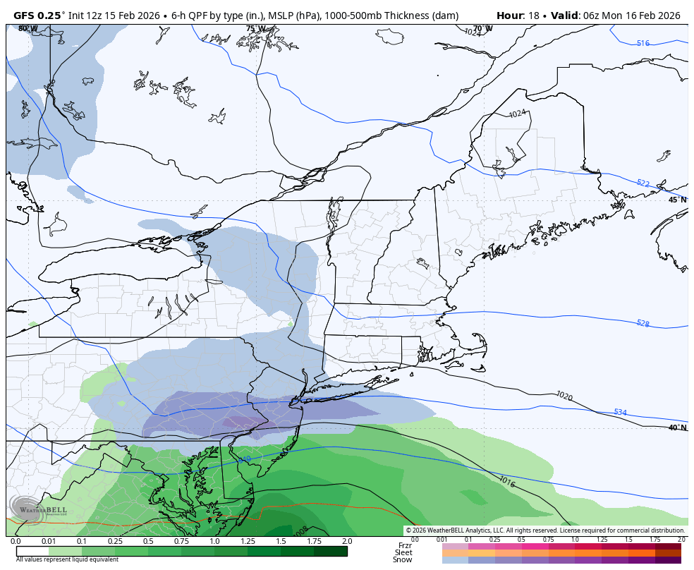
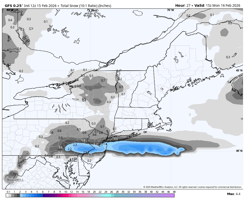
12z GFS still is showing 1 to 2 inches of snow tonight for the LSV.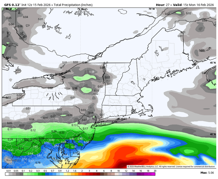

-
But the warmer pattern means more chances so we’ll roll the dice.
-
I'm glad to see that the models stopped the trend of lowering amounts and beefed it back up slightly. Looks like a nice little 1 to 2 inch snowfall for this area tonight. At least it means we won't be shut out for February.
-
One things for sure... this is the best winter we've had in awhile! More chances coming this week.. we take
-
Thanks. Note that the new CANSIPS run’s SST anoms look pretty similar to those on the run posted above predicting Modoki for 23-4 in most locations worldwide fwiw.
-
Just hit 40. Awaiting carwashocalypse.


.thumb.jpg.f0d4bc69c0baaceecd7d96541f839c25.jpg)