All Activity
- Past hour
-
Eric posted the record breaking temperature gradient a few months ago. It’s a little stronger than in 2022 which was the last year we finished below 100 ACE. So perhaps seasonal forecasts will incorporate this data during their July updates in the future when we get to the -4 to -5 sigma range.
-
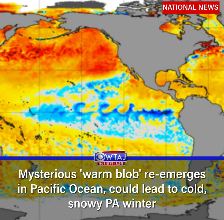
Looking forward. CBS affiliate for true center just posted this on their socials today.
-
I always hope when it dries out like this that the mosquitoes won't be as bad as when it's wet. It never works out that way They're still so bad I have to wear pants and long sleeves in my yard.
-
Great movie! It actually looks less rainy than Apple weather shows - just showers here or there Copenhagen where we’ll be for 5 days first will be a bit warmer - mid 60s.
-
Just non-stop CoC everywhere.
-

Invest 92L--50% two day, 90% five day odds
GaWx replied to WxWatcher007's topic in Tropical Headquarters
12Z JMA completed (fwiw): Although the 72 hour map had it recurving NW seemingly way out in safe recurve land, it then turned W through 144 getting it to 21N, 62W (similar to Icon). Then it does a recurve WNW and then NW ending at 25N, 70W. -
The 30th top-10 day in a row.
-
Congrats on getting more than here
-
-

September 2025 OBS-Discussion centered NYC subforum
bluewave replied to wdrag's topic in New York City Metro
This year has been defined by the sharp cutoffs to the heavy rainfall. The aerial coverage from most events hasn’t been very good. So this allowed MPO to go up 13.00” this year on the precipitation over FWN. Time Series Summary for SUSSEX AIRPORT, NJ Click column heading to sort ascending, click again to sort descending. 2025-09-15 20.02 17 Time Series Summary for Mount Pocono Area, PA (ThreadEx) Click column heading to sort ascending, click again to sort descending. 1 2025-09-15 33.40 1 -
I know that area very well - my parents had a home in Bethany in a development directly across Coastal Highway on the inland side. I also have a lot of extended family that live in Lewes and Rehoboth. Pretty much my 2nd home growing up. I love the area between Dewey and Bethany in particular.
-
They read this forum and listened to everyone complaining about them naming every cloud lol. Looking at this system it appears fully non-tropical. Corbina and Nags head are now gusting over 50mph at the moment, very impressive for a non tropical low. Would not shock me to see some gusts into the 60’s if the system keeps tightening up. Name or no name, the OBX are experiencing mid tier TS impacts
-
Leaving tomorrow. You all be good to one another. Here is Stockholm’s weather we will experience.
-
That 72 degree water temp at Duck is none too impressive.
-

September 2025 OBS-Discussion centered NYC subforum
Picard replied to wdrag's topic in New York City Metro
Look how much lower Sussex is compared to Mt. Pocono for YTD and 2024, which is probably only about 40-50 miles as the crow flies. Impressive difference. -
Sounds like I picked a good week to travel to Syracuse. No rain threat until Friday up there
-
This is lol for a d16 ens run
-
September 2025 OBS-Discussion centered NYC subforum
bluewave replied to wdrag's topic in New York City Metro
Quite a big departure spread this month. The cooler spots have a shot at finishing the month with a small cold departure. But the warmer stations like EWR, HPN, and ISP could finish with a small warm departure. ISP….-1.2 HPN….-1.4 EWR…..-1.4 NYC…..-2.3 BDR……-2.5 LGA……-2.9 - Today
-
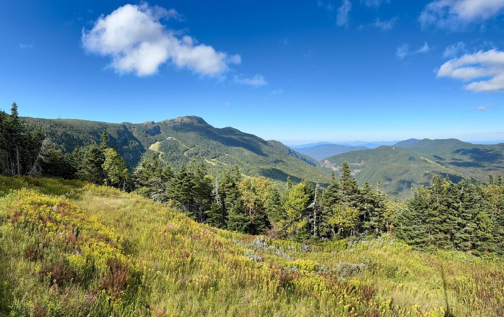
Any opinions on the Mount Ellen part of Sugarbush? Our daughter can get a college pass there for $199 for the season... not sure if it is worth it
-

2025-2026 ENSO
PhiEaglesfan712 replied to 40/70 Benchmark's topic in Weather Forecasting and Discussion
I'm pretty sure this 2-year ACE record is going to stand for a very long time. 6 2004 226.94 1 2005 247.65 Even in this era of more storms, we've only had 2 hyperactive ACE seasons post-2005: 8 2017 224.8775 11 2020 180.3725 -

September 2025 OBS-Discussion centered NYC subforum
SACRUS replied to wdrag's topic in New York City Metro
79 / 57 here -
September 2025 OBS-Discussion centered NYC subforum
SACRUS replied to wdrag's topic in New York City Metro
We had a period of warmer SST vs normal in the late Jun - late July period then Erin caused tremendous upwelling and the recent easterly barrage has created the current cool pool anomaly. -

Invest 92L--50% two day, 90% five day odds
WxWatcher007 replied to WxWatcher007's topic in Tropical Headquarters
Models are quite robust once 92L gets north of the islands. -

September 2025 OBS-Discussion centered NYC subforum
Big Jims Videos replied to wdrag's topic in New York City Metro
What was nice this summer was unlike in 2024, when upwelling kept water temps in the 50s most of the summer, this year it was 70s from June through now yet. -
Saw him post Duck, NC with 51 mph sustained winds with gusts to 59


