All Activity
- Past hour
-
I think they started blooming very end of Morch .
-
Models that are wetter for midweek are showing a quicker northern and southern phase. We know how that normally plays out in winter for us but we will know in a few days....
-
We fairly frequently get snowpack with 1-2" water content but rarely more than that. The most water content i can recall was 2014 with about 4-5" water content by late Feb.
-
Yikes. Hope this doesn't pan out.
-
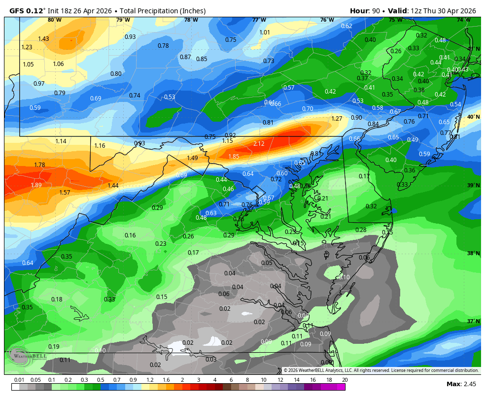
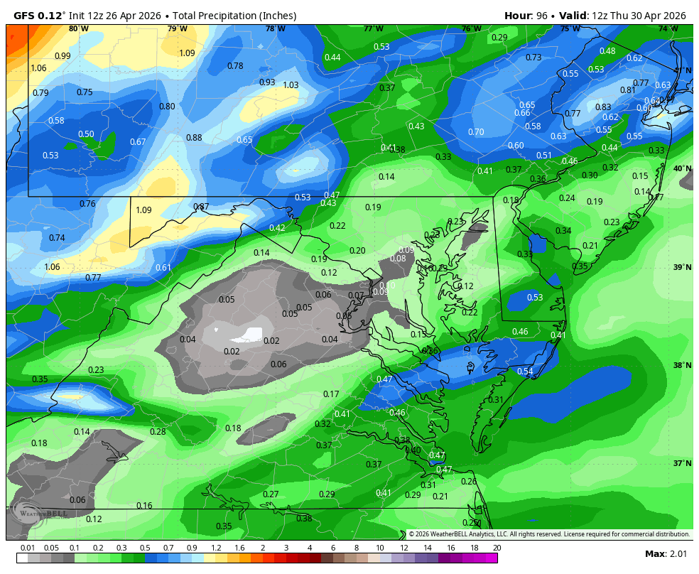
WB 18Z GFS is wetter this run compared to 12Z; mid week watch continues.

-
Is there a potential frost on tap next weekend? Can't think of a worse time for farmers who have been hit hard this spring.

-
Not a chance. It will be the same crickets as during the cold winter. Unless the west continues to bake.
-

2026-2027 El Nino
Stormchaserchuck1 replied to Stormchaserchuck1's topic in Weather Forecasting and Discussion
2 days of strong -SOI, moving the 30-day average to the lowest since 23-24 El Nino 26 Apr 2026 1010.40 1011.90 -28.05 -9.61 3.89 25 Apr 2026 1010.94 1012.50 -28.48 -9.08 4.09 -

E PA/NJ/DE Spring 2026 Obs/Discussion
RedSky replied to PhiEaglesfan712's topic in Philadelphia Region
Frost advisory -
Bob Ryan came into my shop on Saturday. Nice guy!
-
I'll take it. With the race at Indy coming a bit early this year a cool to chilly May makes for crazy fast cars!
-
Could be a blip but 18z gfs looks better midweek for many. I don’t know anything about the RDPS but the gfs kind of has the same look of what Will posted earlier
- Today
-
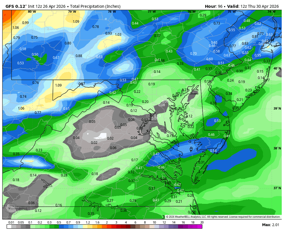
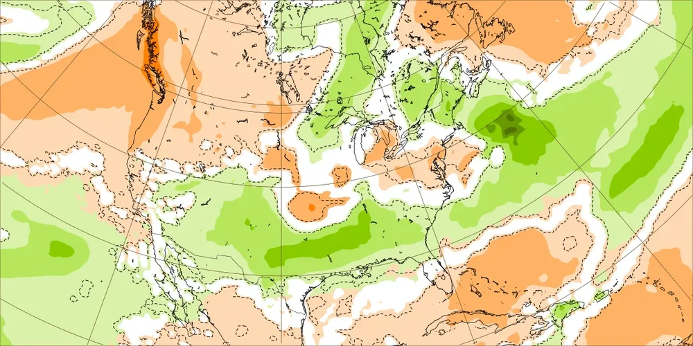
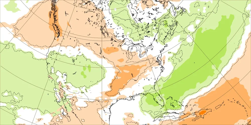
Today’s EW rainfall next 2 weeks: 4/27-5/3: AN to NN SE; ATL 1.5-1.75” 5/4-10: NN in SE (ATL 0.75”); wetter FL
-
Got over an inch in the southern mtns. Rained hard and steady for about 8 hours. Still well below normal
-
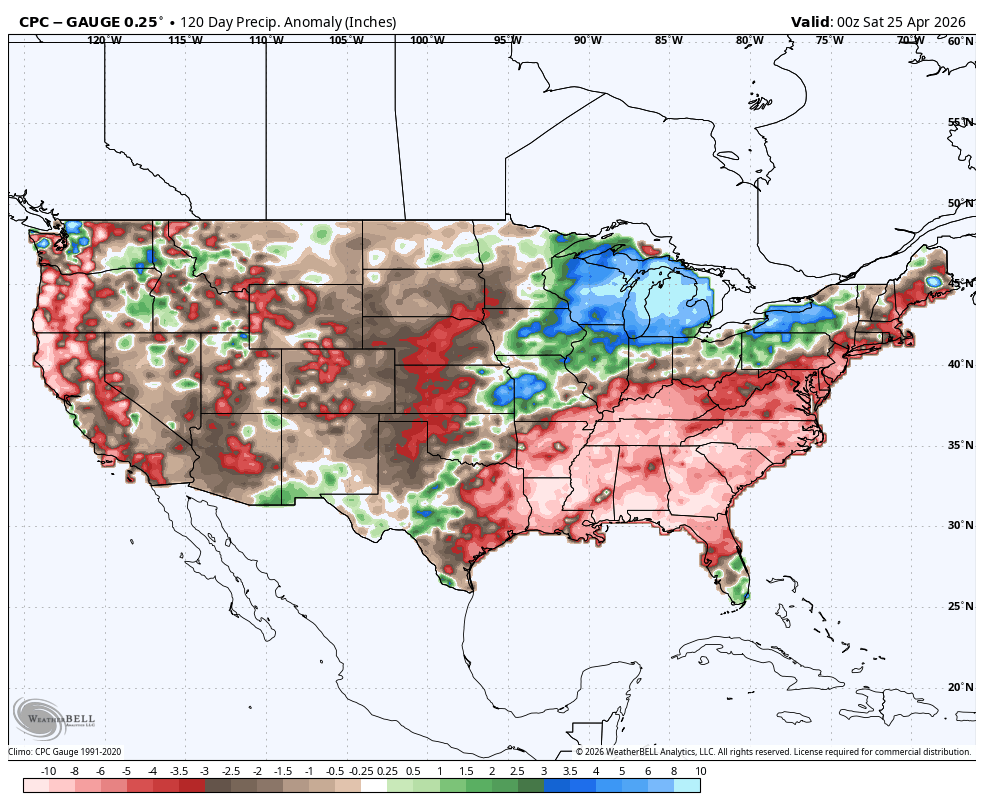
The recent rain delivered 0.50"-1.50" of rain to the region, along with some locally higher figures. Rainfall amounts included: Bridgeport: 0.89" Islip: 1.31" New Haven: 0.74" New York City-Central Park: 1.39" New York City-JFK Airport: 1.49" New York City-LaGuardia Airport: 1.45" Newark: 1.64" Philadelphia: 0.51" White Plains: 1.07" Tomorrow through Wednesday will be somewhat warmer with highs reaching the lower and middle 60s. However, another shot of rain followed by cooler temperatures will arrive during the middle of the week. A general 0.50"-1.00" rainfall appears likely for Wednesday into Thursday. May could also open with cooler than normal conditions. The ENSO Region 1+2 anomaly was +1.8°C and the Region 3.4 anomaly was +0.5°C for the week centered around April 15. For the past six weeks, the ENSO Region 1+2 anomaly has averaged +1.43°C and the ENSO Region 3.4 anomaly has averaged +0.15°C. El Niño conditions will likely develop during late spring or early summer. The SOI was -28.05 today. The preliminary Arctic Oscillation (AO) was -0.960 today. Based on sensitivity analysis applied to the latest guidance, there is an implied near 98% probability that New York City will have a warmer than normal April (1991-2020 normal). April will likely finish with a mean temperature near 55.2° (1.5° above normal). Supplemental Information: The projected mean would be 2.2° above the 1981-2010 normal monthly value.
-
Mine are still going strong, too....I don't recall a year when the bloom has been this long and strong.
-
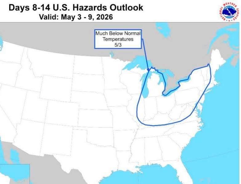
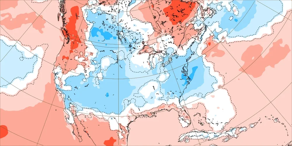
Today’s Euro Weeklies continue to have BN next 2 weeks averaged out! 4/27-5/3: 5/4-10: We can thank this H5 for cool 5/4-10
-

2026-2027 El Nino
michsnowfreak replied to Stormchaserchuck1's topic in Weather Forecasting and Discussion
Im taking a stab in the dark, but i think snowman is going with a super nino. -
They should acknowledge their forecast bust. It was certainly noteworthy.
-
The forsythia have been “in bloom” for 3-4 weeks . Crazy how long they’ve stayed flowered with greens mixed in

-
Mount Holly AFD KEY MESSAGE 2...Additional chances for much-needed rain arrive during the middle of this week. A brief period of high pressure on Monday, potentially lingering into Tuesday. A weak frontal boundary then approaches the region late Tuesday, bringing a chance for light rain. The chances for meaningful rainfall with this system appear to be decreasing with high pressure staying close by and the frontal boundary largely washing out across the region. Another stronger low is still expected to arrive late Wednesday into early Thursday that is expected to bring more widespread showers and perhaps an isolated thunderstorm across the region.
-
Getting our best rains (and just about our only rains of note) since April 5th’s nearly 1/2”. Currently have a band of heavy thunderstorms coming through with some rumbles. I haven’t watered since 4/22 and this will allow me to go further without going back to watering.
-
Love it when the temp is still climbing past 5pm. Up to 61 now. Great afternoon.
-
65 here as well with plenty of sun. Not a bad weekend overall, hit 57 with some breaks of sun yesterday and the light rain held off until evening.
-
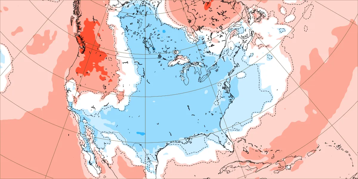
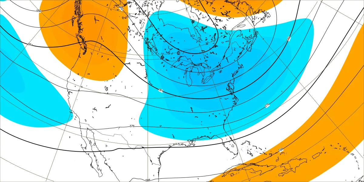
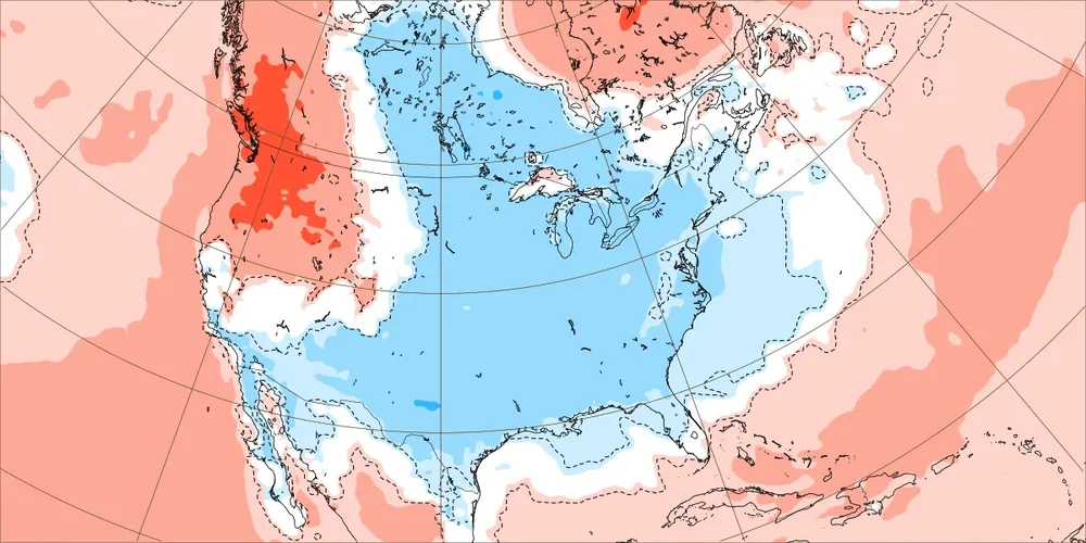
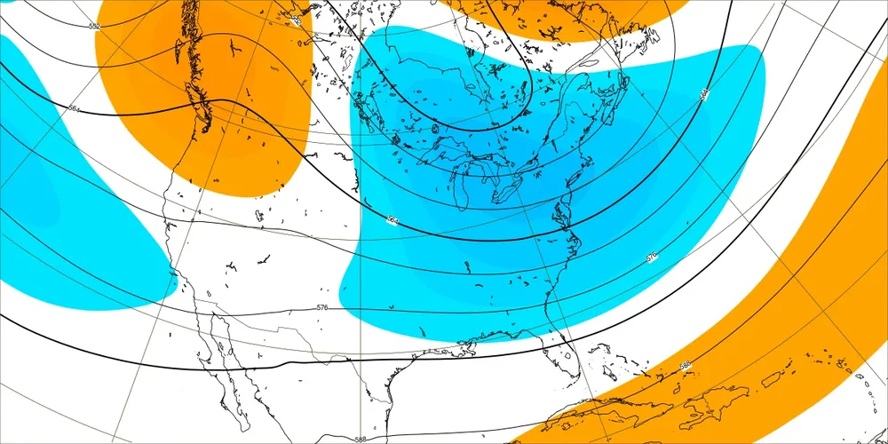
Pretty much sums up the Nina precip pattern.