All Activity
- Past hour
-
Yeah not surprised by the choice. I also expect others to follow suit
-
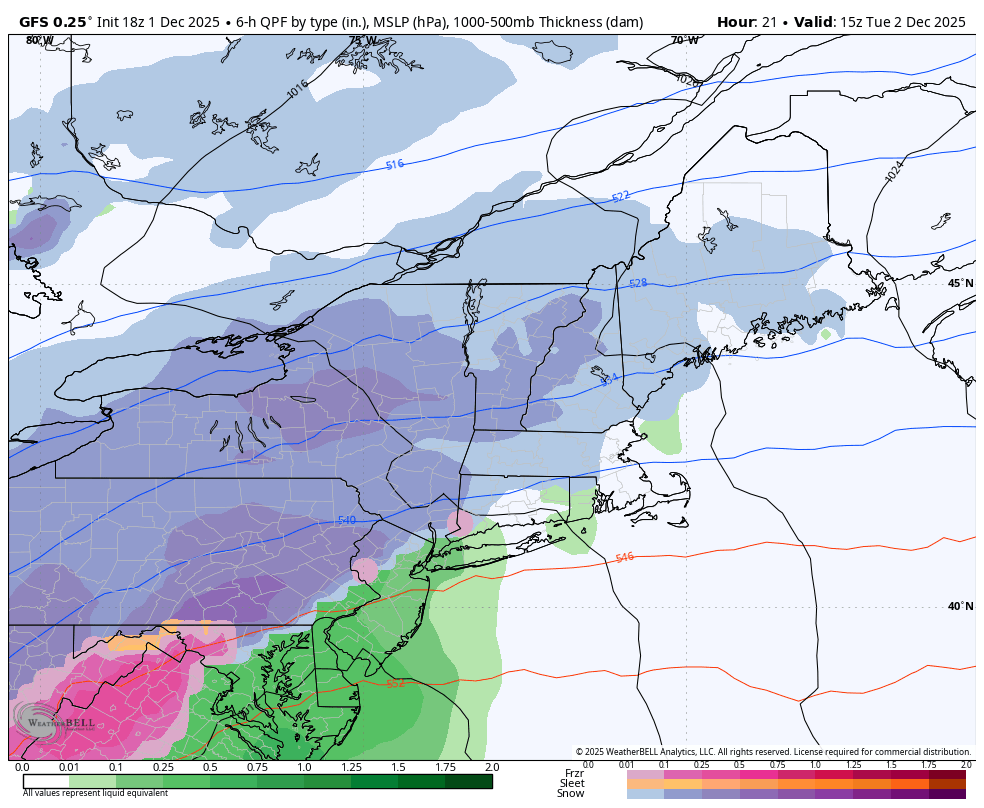
18z GFS gets the precip in to late. The cold is gone taken verbatim for the Friday storm.
-

Central PA Fall Discussions and Obs
Blizzard of 93 replied to ChescoWx's topic in Upstate New York/Pennsylvania
The 18z GFS says hello!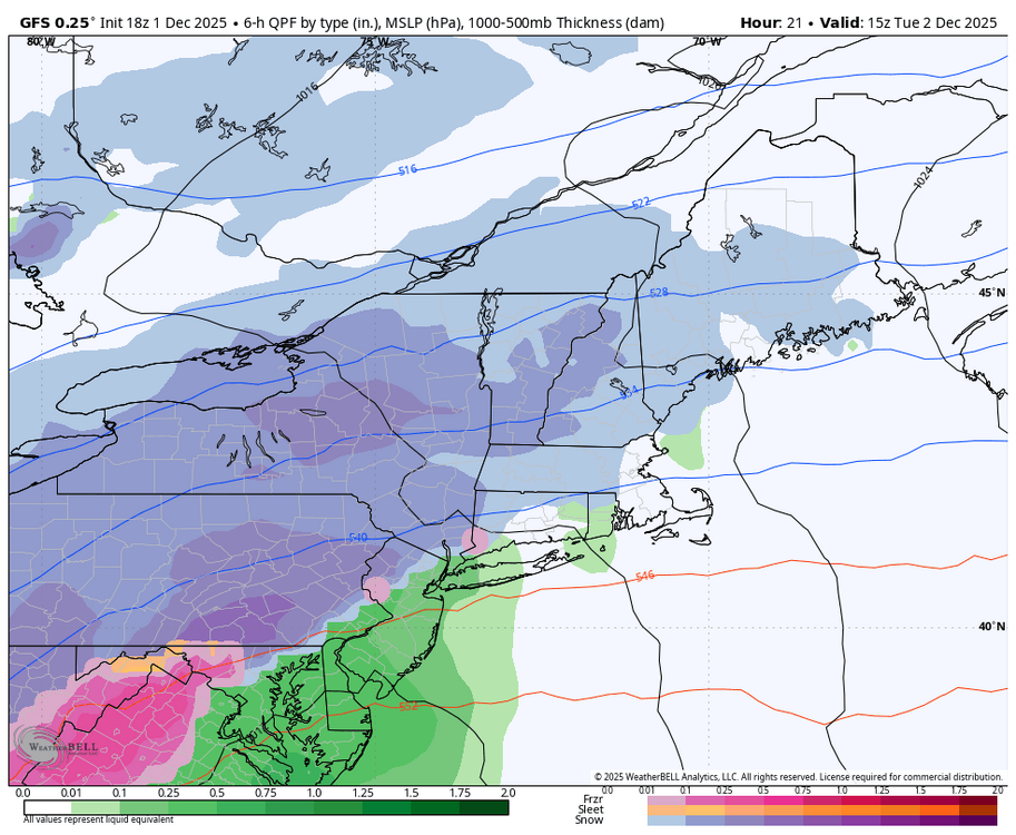
-

December 2025 OBS and Discussion
coastalplainsnowman replied to wdrag's topic in New York City Metro
So you're tellin' me there's a chance? -
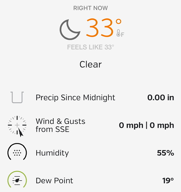
43.5 for the high 42 at 4pm 39.5 at 5pm
-

12/3 Snow/Sleet/Mix Bag of Everything Discussion/OBS
Newman replied to Mikeymac5306's topic in Philadelphia Region
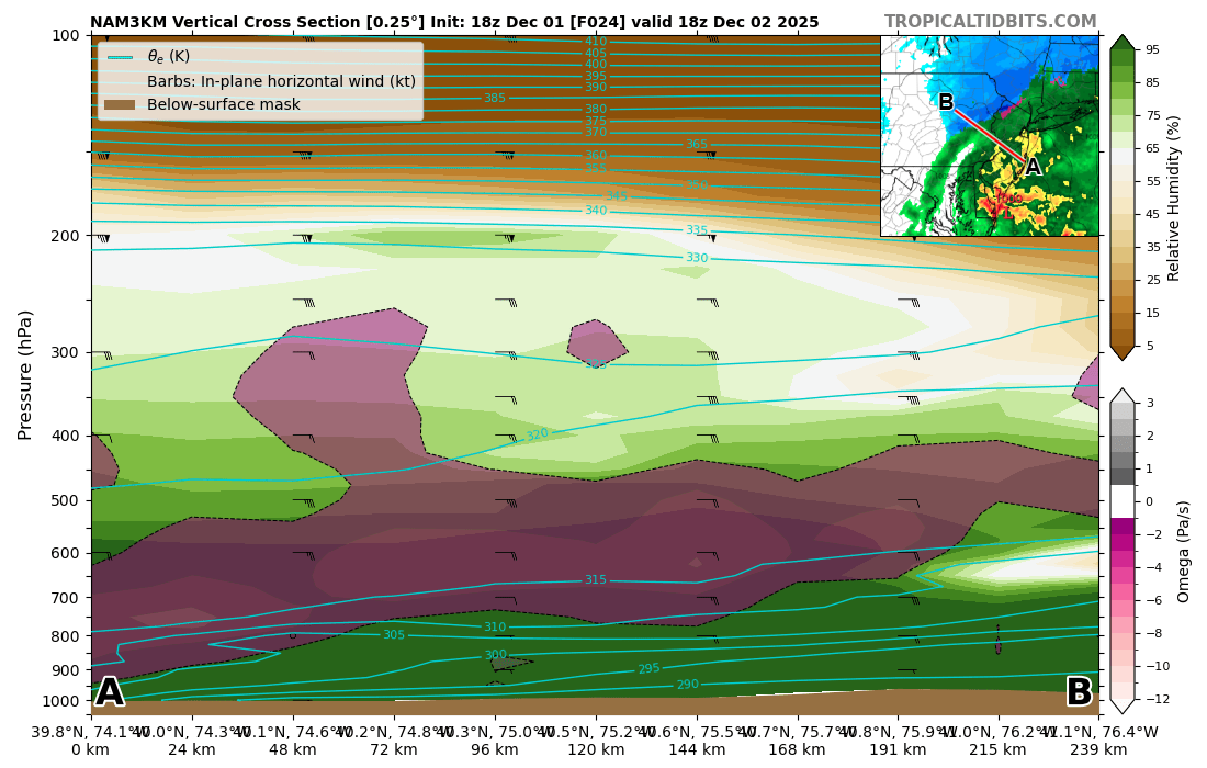
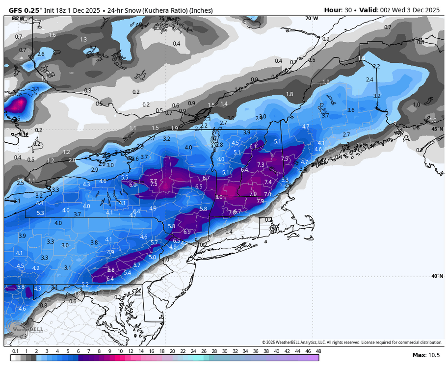
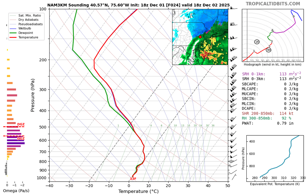
3k actually never gets KABE above freezing at 850s (though it's close), but does sneak to 33 at 925 down to the surface. At 1-2pm tomorrow, the 3k shows rain BUT some deep lift just below the DGZ and even stretching into the DGZ. The DGZ is pretty high up in the atmosphere, but as you can see in the skew-T the sounding is marginally above freezing. If you can get some deep lift and rates to increase within a backside band as the storm departs, you could potentially finish with some heavy snow and fat dendrites if the column cools isothermally back to freezing. Of course, all of this could be for nothing and if 1.) The mesos are correctly handling temperatures and 2.) The rates aren't heavy enough to cool the column then we'll definitely see the lower end of snow totals materialize. Just wanted to point out a way that you could potentially see higher end (3-4" totals) materialize along the I-78 corridor which is currently the 90 percentile from the NWS.
-
Central PA Fall Discussions and Obs
Blizzard of 93 replied to ChescoWx's topic in Upstate New York/Pennsylvania
I’ll be sleeping because it is not supposed to start until closer to 6 am, Lol! -
Ya think!
-
 Gotta lower my expectations for MBY....2-4" ain't gonna happen. Now thinking along the lines of 1" with maybe a bit more if this over performs. at my elevation but not expecting much more than 1" at this point.
 -
Which probably means all the dominoes are going to fall. In their defense, start time is tricky and 2 hour delays are “free”
-
I didn't realize several people were talking about Harford when I said this was off topic Good luck to those in the game for a bit o' snow. I'll be on first flake watch.
-
35/22 IMBY Station
-
You’re in cville now? UVA?
-
Well, it was better as in it has precip reach into central VA but it is all rain so its a wash (literally). Though the next wave for the 8th does look much improved and more like the Euro.
-
Well hopefully this helps..
-
Far NW Harford could get an inch or two
-
https://x.com/commoditywx/status/1995575448089309449?s=19
-
You’d have to call and ask them
-
It’s even better than this time last year.
-
i think this will not verify for midtown
-
39/23. It's still clear.
-
With what the models are showing for that area?
-
On topic, bumping this post up. Off topic, I see there's now a Harford station, in Abingdon. Nice!
-
Solid SN here with vis down to 1/2 mile. Nice weenie band approaching
-
I'm on the FAR southeast edge to be involved in this forum but it is a nice place to chill....I have to say. The main thread is like the movie Groundhog Day. I feel like I'm reliving Winter 2024-25 all over again with the usual suspects taking their usual stance and "weenie tags" flying all over the place. That being said my 2-4" forecast for MBY is slipping away...I'm now thinking 1" or maybe 2" if I'm lucky and this over performs.