All Activity
- Past hour
-
That's from 7am lol
-
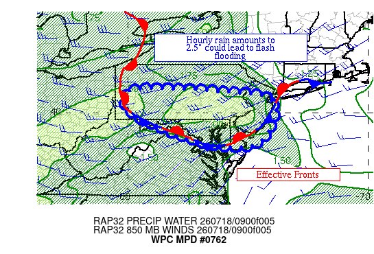
North side of a stationary front can mean
-
Narrative artwork for this morning: AQI: 196 (parts of the NYC area are above 200).

-
 Hope so...2.89" since June 1. Tuesday may be somewhat better at this range.
 -
Not at home but heard my Capital Weather lightning detected near my location go off this morning at 4:15. Looked at radar to see my house getting hit with a very nice robust cell followed by another one. Picked up .61” from that early morning round. A
-
Some showers and storms moving through already
-

2026-2027 Super El Nino
michsnowfreak replied to Stormchaserchuck1's topic in Weather Forecasting and Discussion
There was lots of snow left in the mountains when I went to Alaska last month! The last flakes of the season at Detroit were May 2nd. So if we can squeeze out early flakes in October, there will only be 3 calendar months in 2026 I don't see snow of some kind. -
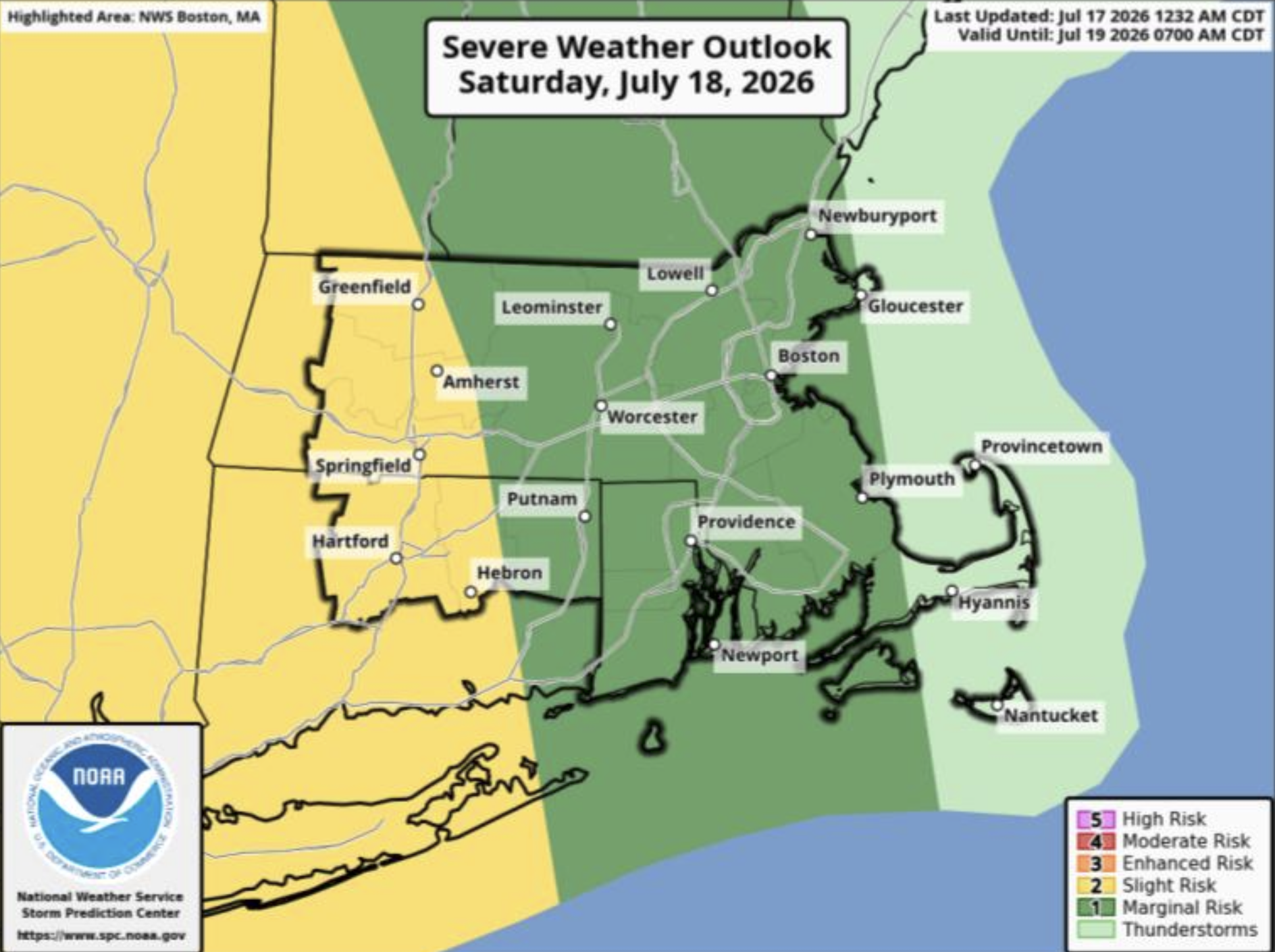
Saturday, July 18, 2026 Thunderstorm/Severe Weather Potential
wx_observer replied to weatherwiz's topic in New England
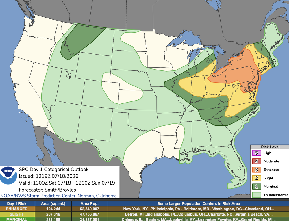
SPC moved the severe threat a bit further east on update: Update: Previous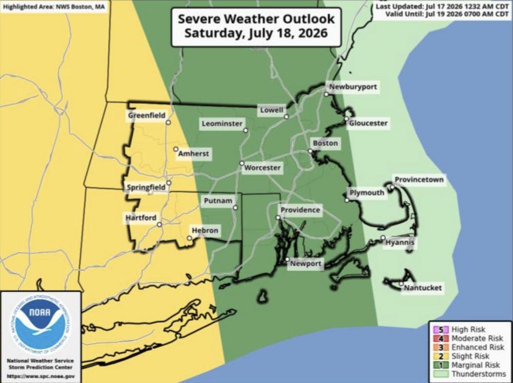
-
good luck
-
I'm about 3 miles into my hike here in Crownsville. When i first started about 80 minutes ago I could smell it and it looked nasty. Now the sun is breaking out and the smoke is thinning out.

-
Fine by me. The 4th of July storms did enough damage in my area
-

Central PA Summer 2026 Discussion/Obs Thread
Voyager replied to Voyager's topic in Upstate New York/Pennsylvania
We are getting a straight up downpour at the moment, so the first shot has been made. -
Thanks! We have season passes and always walk through Zoo America to say hi to the animals
-
probably downpours are the biggest threat with this....
-

E PA/NJ/DE Summer 2026 Obs/Discussion
JTA66 replied to PhiEaglesfan712's topic in Philadelphia Region
Hearing thunder already from a cell just off to my west. -
I personally think it won't be anything too significant. Lots of cloud cover in place. Destabilizing activity moving in now. Most enhanced or higher risks tend to disappoint for whatever reason
-
Air quality back to 182 here. Hopefully it ends soon because i want to take my kid out.
-

Central PA Summer 2026 Discussion/Obs Thread
Mount Joy Snowman replied to Voyager's topic in Upstate New York/Pennsylvania
Low of 68. Not entirely sure what to expect today as there’s quite a difference with the models in terms of timing/location/intensity. Just hoping no one suffers any damage. At least we get the smoke out of here this afternoon. -
 Pour découvrir des conseils utiles, vous pouvez voir https://servicesdepharmacie.icu/#.
 -
The rain that fell last week around DC wasn’t enough to keep up with climo. DCA now -7.44” ytd.
-
-
So much hype already on social media
-
Have fun, check out the road runners in the zoo!
-
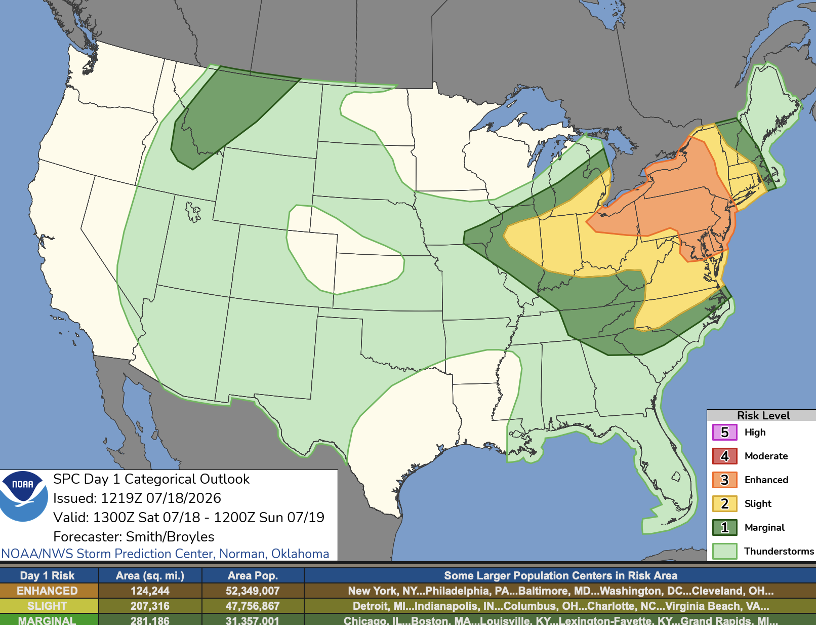
SPC AC 181219 Day 1 Convective Outlook NWS Storm Prediction Center Norman OK 0719 AM CDT Sat Jul 18 2026 Valid 181300Z - 191200Z ...THERE IS AN ENHANCED RISK OF SEVERE THUNDERSTORMS OVER PORTIONS OF THE NORTHEAST...MID ATLANTIC AND LOWER GREAT LAKES... ...SUMMARY... Severe thunderstorms are expected across portions of the Ohio Valley and Lower Great Lakes into the Mid-Atlantic and Northeast this afternoon and evening. Damaging gusts will be the primary threat, but a few tornadoes are possible, including perhaps a strong tornado. ...OH Valley and Great Lakes to the Mid Atlantic and Northeast... Water-vapor imagery this morning shows a potent mid-level shortwave trough moving southeast over the Upper Great Lakes towards the Northeast during the period. The primary upper vorticity max will rotate through the base of the larger-scale trough and through the St. Lawrence Valley, before an upstream disturbance west of James Bay this morning pivots southeast and reaches Maine/eastern Quebec by early Sunday. Surface analysis this morning places a 1004-mb low north of Georgian Bay and a cold front extending west-southwestward into northern IA. An attendant warm front arching southeastward through the Lower Great Lakes and draped over the Mid-Atlantic states will advance northward as the cyclone develops east towards northern Maine by late evening. Concurrently, the cold front will push southeast across much of Great Lakes into the OH Valley. South of the boundary, a very moist air mass was sampled this morning by 12 UTC raobs and surface observations (i.e., upper 60s to lower 70s F dewpoints). A few thunderstorm clusters this morning have developed near the warm frontal zone from the Lower Great Lakes into the Mid-Atlantic states. The early day storm activity will likely be limited in storm vigor, due in part to initially widespread cloud cover inhibiting strong heating in the areas downstream over parts of PA/NY. Gradual dissipation of clouds and heating coupled with the northeastward advancement of the warm sector will promote a broad area to become moderately to strongly unstable later today (1000-3000 J/kg MLCAPE) from the OH Valley eastward into the Mid-Atlantic and parts of the Northeast. A belt of westerly 30-45 kt 700-mb flow from northern VA into the Northeast will aid in storm organization and severe potential this afternoon and evening. Models differ substantially regarding evolution/timing of possible bands of storms and clusters with embedded cells. Regardless of specific details, it seems plausible several multicellular bands of storms will develop during peak heating and organize as these bands move east. Some of the more intense cells will potentially become supercellular posing an all-hazards severe risk. Have largely unchanged the previous outlook given the inherent thunderstorm evolution-based uncertainties. Potentially widespread damaging gusts [50-60 mph, locally stronger (55-70 mph) perhaps paralleling the I-95 corridor from Chesapeake Bay into southern New England]. A few tornadoes are possible both from linear and cellular storm structures given some low-level hodograph enlargement and moist low levels.