All Activity
- Past hour
-

2026-2027 Super El Nino
40/70 Benchmark replied to Stormchaserchuck1's topic in Weather Forecasting and Discussion
Yea, I highly doubt we see as much MC interference as 2023, and while I am not yet convinced that there will be less than 2015, I am certainly open to the idea. -

2026-2027 Super El Nino
LakePaste25 replied to Stormchaserchuck1's topic in Weather Forecasting and Discussion
It already is in South America. Chile is getting slammed in the short-medium range models. -
 I know you cannot be this dense . That doesn’t mean cool and dry . I mean wow
 -
July 15 1980: Straight-line winds of nearly 100 mph cause enormous damage, mainly in Dakota County. 43 million dollars in damage is reported and 100 thousand people lose power. For Wednesday, July 15, 2026 1916 - A dying South Atlantic Coast storm produced torrential rains in the southern Appalachian Mountains. Altapass, NC, was drenched with more than 22 inches of rain, a 24 hour rainfall record for the state. Flooding resulted in considerable damage, particularly to railroads. (David Ludlum) 1954 - The temperature at Balcony Falls, VA, soared to 110 degrees to establish a state record. (The Weather Channel) 1983 - The Big Thompson Creek in Colorado flooded for the second time in seven years, claiming three lives, and filling the town of Estes Park with eight to ten feet of water. (The Weather Channel) 1987 - Unseasonably cool weather spread into the south central and eastern U.S. Fifteen cities reported record low temperatures for the date, including Houghton Lake, MI, with a reading of 37 degrees. The high temperature for the date of 58 degrees at Flint, MI, was their coolest of record for July. Thunderstorms spawned several tornadoes in Illinois and Indiana, injuring a cow near Donovan, IL. (The National Weather Summary) (Storm Data) 1988 - Twenty-six cities east of the Mississippi River reported record high temperatures for the date. Charleston, WV, established an all-time record high with a reading of 103 degrees, and Chicago, IL, reported a record fifth day of 100 degree heat for the year. A severe thunderstorm moving across Omaha, NE, and the Council Bluffs area of west central Iowa spawned three tornadoes which injured 88 persons, and also produced high winds which injured 18 others. Winds at the Omaha Eppley Airport reached 92 mph. Damage from the storm was estimated at 43 million dollars. (Storm Data) (The National Weather Summary) 1989 - Thunderstorms drenched Kansas City, MO, with 4.16 inches of rain, a record for the date. Two and a half inches of rain deluged the city between Noon and 1 PM. Afternoon thunderstorms in South Carolina deluged Williamstown with six inches of rain in ninety minutes, including four inches in little more than half an hour. (The National Weather Summary)(Storm Data) Observances: 15 Wed National Hot Dog Day 15 Wed National Give Something Away Day 15 Wed National Clean Beauty Day 15 Wed Blackcurrant Day 15 Wed Celebration of the Horse Day 15 Wed Developmental Disability Professionals Day 15 Wed National Be A Dork Day 15 Wed National Gummi Worm Day 15 Wed National I Love Horses Day 15 Wed National Pet Fire Safety Day 15 Wed National Tapioca Pudding Day 15 Wed Orange Chicken Day 15 Wed World Youth Skills Day
-
I remember a summer trip to visit a large, midwestern city in 1983 as a school age child. The air was so polluted from coal fired industry my eyes would tear after only a few minutes outside. This was certainly a man made phenomenon. If there was wildfire smoke in that era, I don't know how you could tell. I do believe on balance the air is monumentally cleaner today as a baseline, but it's hard to argue that wildfires spawned by lightning strikes are somehow a new thing.
-

E PA/NJ/DE Summer 2026 Obs/Discussion
JTA66 replied to PhiEaglesfan712's topic in Philadelphia Region
Earlier in the week my forecast high for today was 100F. It's been scaled back to 96F. Wonder if the haze from the wild fires is a factor? 84F/DP 72F -
 Has the Canada smoke always been “a thing” around these parts? It’s like I never even heard of the phenomenon until a few years ago?
 -
2026-2027 Super El Nino
40/70 Benchmark replied to Stormchaserchuck1's topic in Weather Forecasting and Discussion
Yea, it's clearly BOSS in the tropics...just need to get that into the mid latitudes, which it ultimately will with any luck. -
Smoke is nasty here too. Had to get up very early, and shut the windows. What a rude awakening. Temps in the 70's today tho.
-

2026-2027 Super El Nino
snowman19 replied to Stormchaserchuck1's topic in Weather Forecasting and Discussion
We have broken the 1997 record for Peru’s (next to region 1+2) highest air temperate record It doesn’t get more El Niño than this, clearly defined El Niño convective standing wave/forcing: This is likely to be a record-breaking EPAC TC season -
 Its July 15th
 -
 So dark I may have to put a light on. Its super spooky out...makes me want to go out, carve a pumpkin and sit it on my desk
 -
-
86 / 70 heating up quick smoke still mainly north of NJ
-
I do recall something
-
 wasn’t there a high risk in the Plains some years back that busted badly and was attributed to wildfire smoke?
 -
I would have to imagine we see significant improvement on tomorrow's drought update across NC and SC with the potential of both D4 areas to be removed
-
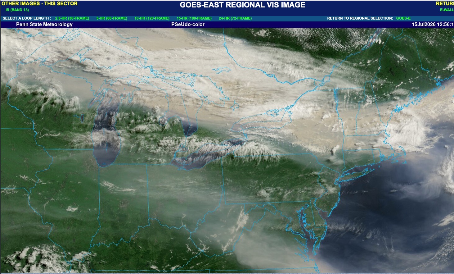
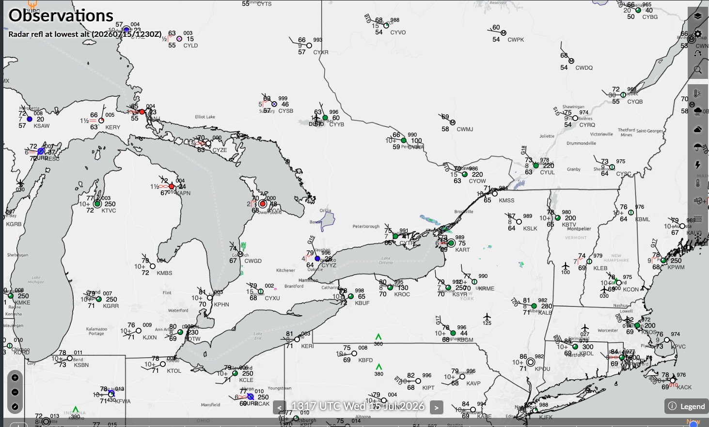
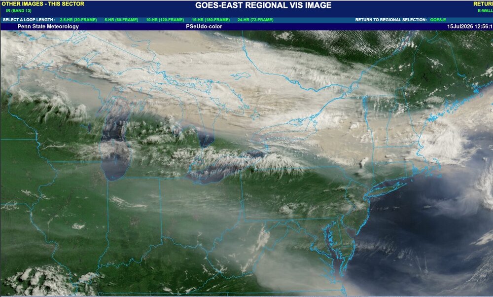
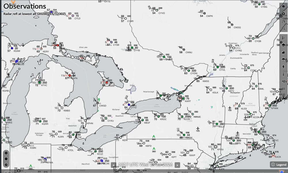
That is a nasty smoke plume shifting slowly south from New England. Visibilities not being affected significantly until you get into the Great Lakes area. Some reports there of 1-2 miles. At a minimum the skies will turn "dirty" looking again later today. Click to enlarge maps.
-
-
Quickly yo 86 here.
-
 Yeah it looks like no relief. Continued and muggy.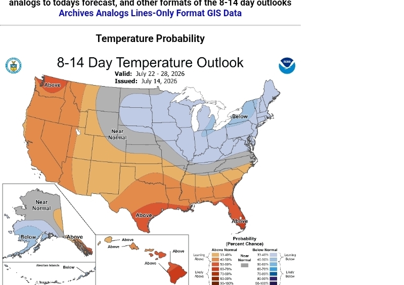
-
This could be the best case scenario from a helping reduce the SE drought perspective. A not too strong TC that provides beneficial rains (hopefully not flooding obviously).
-
yeah and those values are absolutely nuts. Off the scale that pivotal has lol
-
2026-2027 Super El Nino
40/70 Benchmark replied to Stormchaserchuck1's topic in Weather Forecasting and Discussion
Hey @Stormchaserchuck1, what is the calculation of your NAO index right now? -
Feels like we just woke up in a bowl of urine this morn. When I woke at dawn and saw pure darkness I knew this was going to be bad.