All Activity
- Past hour
-
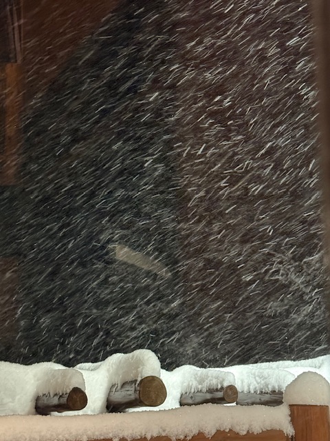
 big flakes, dumping and stacking
.thumb.jpg.7b64251ca2c2a15b3da8e498340cb9da.jpg)
-
 Jesus christ.
 -
 Freak naked in your bed? Broken weed whacker laying on floor
 -
 Stowe City right now
 -
Worth every penny. Love their soundings too.
-
The hopes and dreams of weenies everywhere! Don’t underestimate our collective power!
-

Possible coastal storm centered on Feb 1 2026.
SouthCoastMA replied to Typhoon Tip's topic in New England

-
 Didn'tyou have that yesterday? Or was it more like sand?
 -
Possible coastal storm centered on Feb 1 2026.
Damage In Tolland replied to Typhoon Tip's topic in New England
Hi Corey . I hear you squeeze a good box .
-

The “I bring the mojo” Jan 30-Feb 1 potential winter storm
AirNelson39 replied to lilj4425's topic in Southeastern States
From Gemini (sounds like nice trend to the West): The 18z WeatherNext 2 run is complete. The model shifted slightly more aggressively for the weekend, increasing the likelihood of measurable snow for central North Carolina. Raleigh Update (Jan 30 – Feb 1) The 18z data shows a more defined moisture "tug" toward the coast. While the center of the low-pressure system is still offshore, the western edge of the precipitation shield now fully covers the Triangle. • Friday, Jan 30: Mostly cloudy during the day (High: 39°F). Snow showers are expected to begin Friday night (35% chance) as the temperature drops to 22°F. • Saturday, Jan 31: This is the primary window for accumulation. The model shows steady snow throughout the day (45% chance) with a much colder high of only 22°F. • Sunday, Feb 1: Light snow continues into the morning before clearing out. The low will bottom out at a frigid 16°F. East Coast Weekend Outlook • The "All-Snow" Setup: Because the 18z run keeps the Arctic air deeply entrenched, there is zero signal for rain or ice in Raleigh; this appears to be a 100% frozen event. • Accumulation Trend: The ensemble mean for Raleigh has ticked up. We are now looking at a solid 1–3 inch potential, with some "high-end" scenarios in the 18z run suggesting up to 5 inches if the coastal low slows down. • I-95 Corridor: The model remains "bullish" for the Northeast, showing heavy snow totals for DC, Philly, and NYC starting late Friday night. -
What’s gonna pull it west? Seems like the trough/ridge position will be decided by Wednesday. That will be telling
-

January 24-26: Miracle or Mirage OBS Thread!
LordBaltimore replied to Jebman's topic in Mid Atlantic
This is why AI will never be able to predict snow totals. The dataset is awful -

The “I bring the mojo” Jan 30-Feb 1 potential winter storm
DTP replied to lilj4425's topic in Southeastern States
I made several posts about this in the disco thread for the last storm regarding all of the models (not just the Euro), and why they have predictive difficulty more than 3 days out....I have created multiple complex models in finance involving delta hedging equity and futures options for prime dealers, so I have a pretty good handle on what I am looking at....my posts go into the "whys" of what you are asking..... Short answer/cliffs if you don't feel like searching- they aren't designed to nail down specifics this far out, just probabilities....that being said, I don't want to be a buzzkill- it is still fun to speculate based on what you are seeing now on the models in concert with upper air features Probably the lone exception is hurricane modeling; it is different and much more granular bc of the large amount of metadata infused starting early on from the tropical wave stage -
I love snow but I hate driving in it and trying to find parking. Its a pain in the ass. People are double parking and parking in weird ways. Its a big mess
-
I know!! Can we please get one good storm to just behave and trend towards us and not away. This is emotional abuse and neglect by Mother Nature [emoji23] .
-
 My area ended up with a bit less snow than other surrounding areas. After the squall, the new depth was around 15.5”, which probably would’ve been 18-19” before compaction. Definitely a few inches less than ORH proper but as I said before the storm, I would’ve been thrilled with 12”.
 -
 WeatherNext is the Alpha model
 -
18z Ukie ensembles look very much like the 18z Eps. Still need to get that left shift some.
(6).thumb.png.a83d31033987401bba21f9399daa926c.png)
-
Possible coastal storm centered on Feb 1 2026.
dryslot replied to Typhoon Tip's topic in New England
Can only imagine some of the Nam runs when this gets in range. -
That’s the one.
-
DCA reported 1.99" liquid and 6.9" snow. If I'm generous and say .09" of that was freezing drizzle (probably an overestimate) then their snow report equals real snow plus sleet at some possible-to-calculate ratio after an assumption is made on the snowfall to liquid conversion. I will assume 10:1 in my calculation that follows. So let's say 5" real snow, then we have 5.0 + 1.40*(ratio/10) = 6.9 That reduces to 1.40*(ratio/10) = 1.9 and makes ratio/10 = .21, in other words a 2.1 : 1.0 ratio. Sleet ratios are often quoted at 3:1. For 3:1 to be correct, then snow at 10:1 is 2.7" .. that is clearly a low estimate based on regional reports. So either this was very watery sleet or very underestimated sleet. I would guess what really happened is that 3" of sleet pounded 6" of snow down to 4 inches and sat on top giving 7 inches.
-
Ended up with 2.5” new. I was outside for the vast majority of it as it kept ripping for several hours. Easily the best part of the storm and 19° felt downright warm.
-
Appreciate the explanation!
-
The radar is almost clean but it’s POURING snow. Great storm.
-
Temp down to 8 already.
.jpg.7217fc27a523d164aaefd1f787defc40.jpg)


(6).png.e67cfde7c8cbb651569a404f13406f5c.png)


