All Activity
- Past hour
-
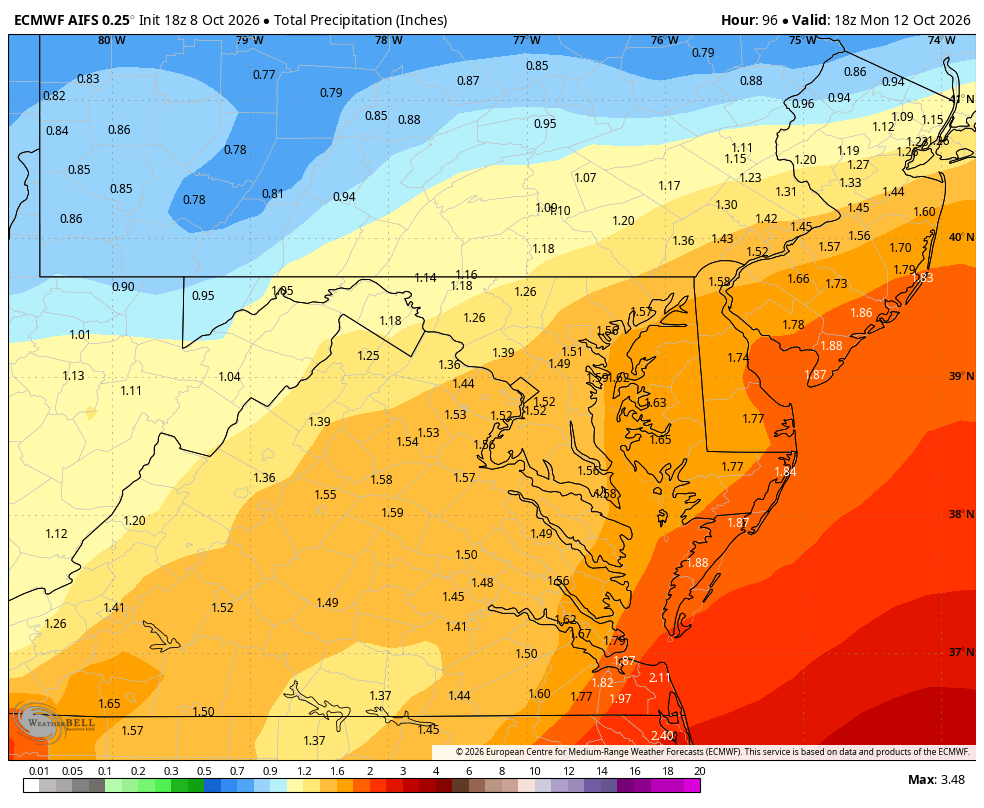
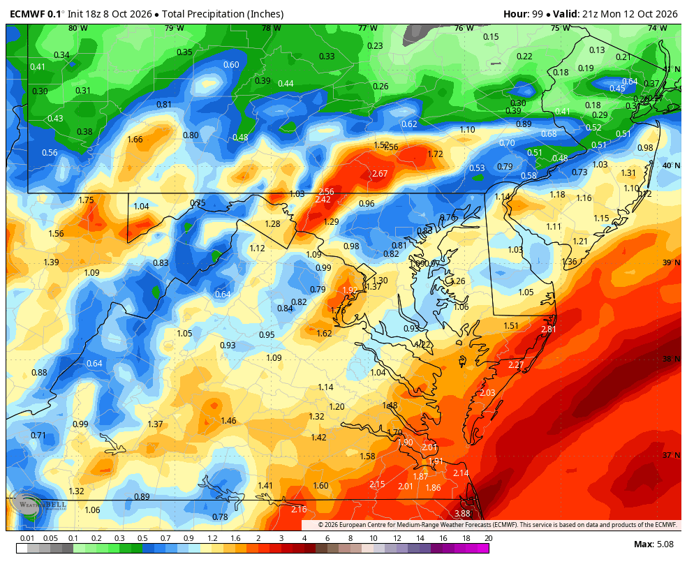
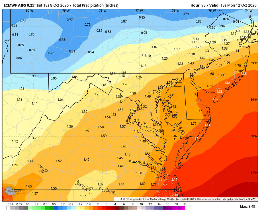
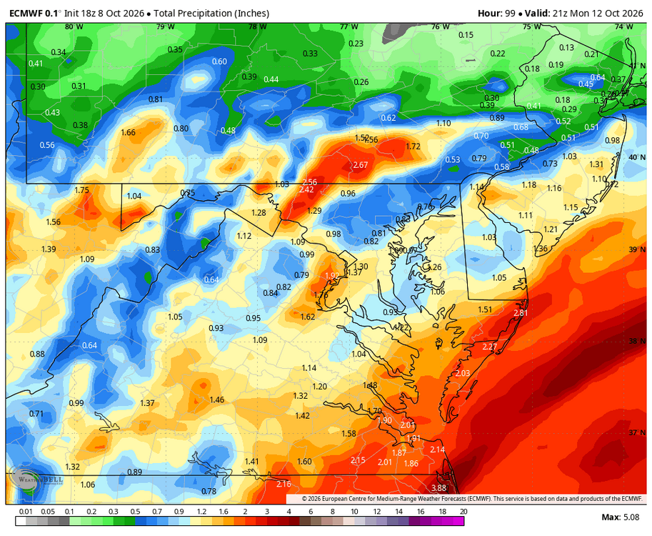
WB 18Z EURO AI and EURO
-
Info I’m on fire Ricky Bobby!
-

2026-2027 Record-breaking El Nino
GaWx replied to Stormchaserchuck1's topic in Weather Forecasting and Discussion
I cannot overemphasize how important what I bolded above is. This idea is well explained at the link below, which I recently posted: Significant Increase in Sea Surface Temperature at the Genesis of Tropical Mesoscale Convective Systems Using satellite observations and a high-resolution global climate model, we show that this threshold has undergone a significant warming trend during the past several decades and will continue to increase in the future. This warming trend is closely related to the changes in the tropical mean SST. A constant relationship between the SST threshold and upper-tropospheric temperature is found in both the current climate and a warming climate, which corroborates the argument that tropospheric temperatures in the tropics approximately follow a moist adiabatic adjustment. https://agupubs.onlinelibrary.wiley.com/doi/full/10.1029/2022GL101950 -
Starting to show its new eye wall. .
-
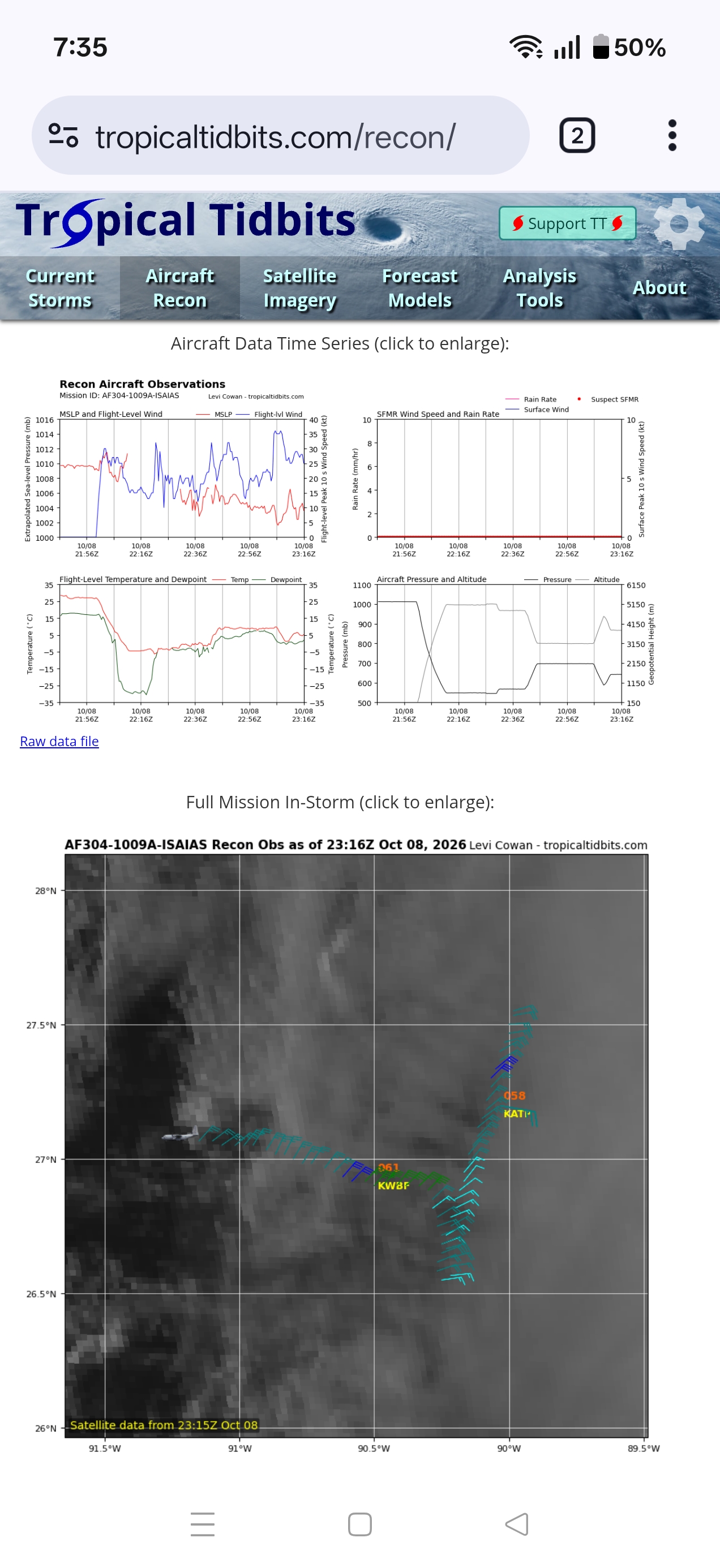
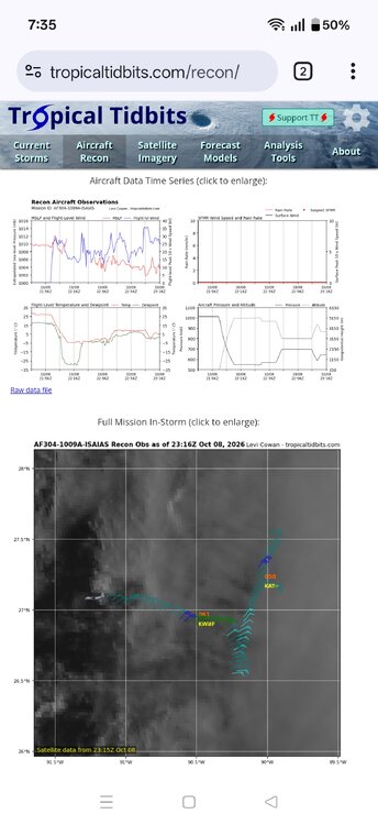
Anyone know what's up with the recon plane? Going in weird directions and altitude is all over the place
-
I have to say, the weather today was amazing. We laid my father to rest, and it felt like he wanted all of us to be in comfort. Just a wonderfully pleasant day at least weather wise.
-
Amazing outflow sunset in the W FL Panhandle tonight! .
-

2026-2027 Record-breaking El Nino
ensonerd1233e343 replied to Stormchaserchuck1's topic in Weather Forecasting and Discussion
No, Cpc uses roni instead of oni because climate change was interfering with the enso signal they made a purposeful effort to remove cc. In fact climate change probably weakened this el nino by keeping the wpac warmer then it normally would be during this strong of a nino that likely prevented as strong ( even if its still be very strong and in many ways record breaking) of a eastward shift in deep convection which has thus meant that while the trade winds have been extremely weak or reversed they are running only slightly ahead of 1997 despite nino 3.4 itself running much higher. Now did climate change raise nino 3.4 sst sure, but because the tropics have warmed the sst threshold for deep convection ( and thus heat distribution thru latent heating) has gone up meaning cc does not mean more heat is being disturbed in the main way enso actually impacts our weather. -
I mean the noreaster last week looked far better than this does
-
Fall 2026 Medium/Long Range Pattern Thread
Daniel Boone replied to John1122's topic in Tennessee Valley
First average Freeze in Pennington gap used to be the 13th pre 2000. First frost was first week of October. Earliest Frost September 4 1954(I think that was the Year). Since then was September 15, '76. First Freeze : September 21, 1989. -
Milder weather has now returned to the region. Tomorrow through Monday will see the mercury top out to the upper 60s and lower 70s across the region. The week will also be dry. The next chance for precipitation could be Sunday or Monday. The moisture could be enhanced by the remnants of Isaiah. The ENSO Region 1+2 anomaly was +5.3°C and the Region 3.4 anomaly was +3.2°C for the week centered around September 30. For the past six weeks, the ENSO Region 1+2 anomaly has averaged +4.63°C and the ENSO Region 3.4 anomaly has averaged +2.92°C. Both ENSO regions have set new all-time records. The ongoing strong El Niño, will continue to strengthen through the mid-fall. The SOI was -22.63 today. The preliminary Arctic Oscillation (AO) was +0.722 today. Based on sensitivity analysis applied to the latest guidance, there is an implied near 55% probability that New York City will have a warmer than normal October (1991-2020 normal). October will likely finish with a mean temperature near 58.4° (0.5° above normal). Supplemental Information: The projected mean would be 1.5° above the 1981-2010 normal monthly value.
-
I guess it's possible to believe that, if you've bought into all the brown lobby talking points perhaps you should consider looking under the hood more at the whole story
-
It might look like a Nor'easter by landfall.
-
Ugliest looking cat 2 ever. El-Nino is a true hurricane killer.
-

Central PA Autumn 2026
Mount Joy Snowman replied to canderson's topic in Upstate New York/Pennsylvania
Good luck pal. Stay strong grinding through that therapy! -
 foreign online pharmacy: OmniRxDirect - medstore online pharmacy
 -
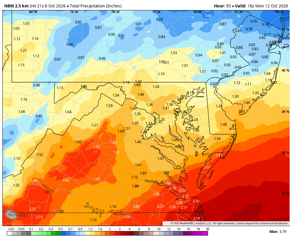
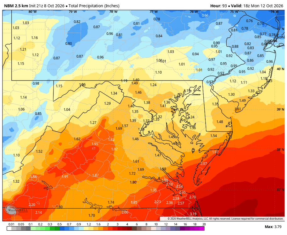
WB 21Z NBM storm totals.
-
Looked at the soundings and I think we should have a great Hurricane sunrise/set tomorrow! HRRR shows high clouds over the region by sunrise with soundings seemingly there to support it. Same story but a thicker layer is there for the evening/night. Would love to get some Met feedback to back up by hunch before I set an alarm for 6:00am! @WxUSAF@Eskimo Joe@Rhino16 @CAPE
-
I think it will show some three footers this year if it is not...
- Today
-
Exhibit A as to why it's being retired.
-
How are we looking for latter October? Trying to get a feel for whether or not we can get away with doing my 7 yr old's Bday outdoors....looks kind of seasonable-ish?
-
Got a new station up at Pit2. Sitting at the top of the rocks that drops off to the water. Sited about 25 feet above the water at low tide. With open water for two miles to the north, a mile to the east, and 2 miles to the southeast it should be really good for wind speeds during coastals. south to west will come in really meh. https://www.wunderground.com/dashboard/pws/KMEBATH53?cm_ven=localwx_pwsdash
-

October 2026 General Discussion
OrdIowPitMsp replied to SchaumburgStormer's topic in Lakes/Ohio Valley
We have a chance to tie the record for latest 90 on record at MSP on Saturday. Crazy change from the last month of tranquil wx. -
Smuggs will need to invest in lift infrastructure. Lifts are ancient there. Burke at least has some newer infrastructure as does Catamount.
-
Doubt it...my call from yesterday still looks good...110mph peak overnight before a Destin, FL LF early Sat at 90mph. Famous last words....lol