All Activity
- Past hour
-
Nice event out here. Sat at 34 degrees for 11 straight hours and still got over 6". Have some branches down. Current temp is 29 with flurries. Most snow I've seen since Jan 2022.
-

December 14th - Snow showers or Plowable snow?
TauntonBlizzard2013 replied to Sey-Mour Snow's topic in New England
1.25” final -
Heavy wet snow! Was wild shoveling it. Big piles woukd glisten blue hues like you see in glaciers. Even with it compacted down, still had 5" on most flat surfaces.
-
Upton with 7.3” checks
-
Anything to keep any torch short-lived rather than long-lived would be a win for me. Considering that the SE will have had a very enjoyably cold dominated 11/27-12/16: the SE can somehow manage for 12/17-31 to be only slightly warmer than normal thanks largely to cool wedges, I’ll consider it a win. Models are already significantly colder than they were just a couple of days ago for this weekend (12/20-1), which is continuing the trend of them being mainly too warm since ~Nov 20th. Is this going to extend this to warm trend through 12/21? If so, can we even trust the longer range of the ensembles?
-
We need a forum wide crusher. This have and have not shit is getting irritating.
-
@mappy: Norrisville slantsticker reported 7.1”
-
Preliminary Local Storm Report National Weather Service New York NY 157 PM EST Sun Dec 14 2025 ..TIME... ...EVENT... ...CITY LOCATION... ...LAT.LON... ..DATE... ....MAG.... ..COUNTY LOCATION..ST.. ...SOURCE.... ..REMARKS.. 0100 PM Snow Central Park 40.78N 73.97W 12/14/2025 M2.7 Inch New York (ManhattanNY Official NWS Obs Central Park Conservancy. 0100 PM Snow Islip Airport 40.79N 73.10W 12/14/2025 M5.8 Inch Suffolk NY Official NWS Obs 0100 PM Snow NYC/JFK 40.64N 73.76W 12/14/2025 M4.6 Inch Queens NY Official NWS Obs 0100 PM Snow NYC/La Guardia 40.78N 73.88W 12/14/2025 M2.6 Inch Queens NY Official NWS Obs 0100 PM Snow Newark Airport 40.68N 74.17W 12/14/2025 M4.1 Inch Union NJ Official NWS Obs 0100 PM Snow Upton (NWS Office) 40.87N 72.86W 12/14/2025 M7.3 Inch Suffolk
-
So beautiful this morning. From the jackpot zone just Reisterstown area. 4 + inches in my yard .
-
Can yall just wait till I get back from FL on the 2nd. Never missed a snowstorm due to travel and I already told my bf I would be sick in FL (of all Godforsaken places) if I missed. I'm breaking my never travel in winter rule for him. If I miss a storm, I told him to have his shit packed when we get back.
-

December 14th - Snow showers or Plowable snow?
moneypitmike replied to Sey-Mour Snow's topic in New England
Based on my drive home, you must be getting rocked. Congrats! -

December 14th - Snow showers or Plowable snow?
Kitz Craver replied to Sey-Mour Snow's topic in New England
Bout 2.75” of sticky snow -

December 14th - Snow showers or Plowable snow?
Great Snow 1717 replied to Sey-Mour Snow's topic in New England
Final total from Rainthuen-3/4 of an inch -
Ridiculous. Gaslighting the fans like we are dumb fucks and cant see what's actually happening.
-

12/14: Sunday funday? Will the south win again?
stormtracker replied to TSSN+'s topic in Mid Atlantic
And you know they would. I was up during the heavy bands and was surprised how quick the sidewalks caved down here. Even started to accumulated on my street, which is a secondary thoroughfare. We fell short, but at least we were in the game this time. -
Walt. I for one and I suspect most here will l miss your threads and very insightful and detailed posts. Have followed your AFD's since you were up at KBOX. I might have even saved some in a box somewhere. Many of them were meteorological masterpieces. Learned so much from you. Truly a treasure to have your insights here on these boards over all these years. You are 100% correct that health and family come first. I wish you all the best at Christmas, in the New Year and always! Please drop in here as you can even if just to post obs. THANK YOU !
-

December 2025 regional war/obs/disco thread
weathafella replied to Torch Tiger's topic in New England
The ensembles in the 8-15 range are much more favorable bs the ops. It seems silly get tall wrapped up in op forecasts in a difficult pattern on clown range. -

Saturday night/Sunday 12/13-12/14 Jawn
Albedoman replied to Ralph Wiggum's topic in Philadelphia Region
Thats what physical geography can do with the South Mountain Range to the SE and the Blue Mt to the north. Adiabatic winds in banding snows is just like t- storms in the summer coming over the mts and hills and getting blown apart too. Sorry for your loss. SE Lehigh County and much of northern and central Chester Montgomery Bucks Counties was the jackpot area where the heavier band stayed together near the downslope side of S. Mtn and dropped additional precip. Northern Lehigh County had only 3-5 inches because of the way this storm traveled too. I am sure the final snow map from Mt Holly will clearly demonstrate this too -
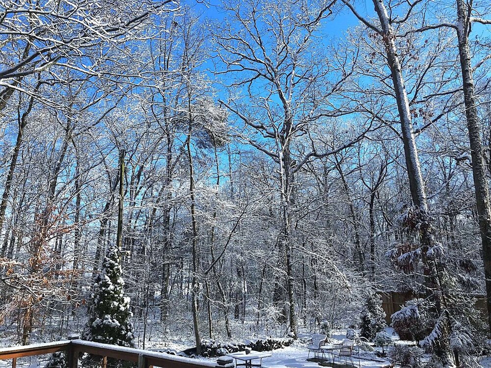
Trees look even more incredible against the blue skies. Branches still snow covered with the cold temps and weak sun.
-

Moderate snowfall 12/14/2025 WWA up for most of the area
mob1 replied to WeatherGeek2025's topic in New York City Metro
NYC finished with 2.7", though Newark and JFK both finished with over 4". -

December 14th - Snow showers or Plowable snow?
bristolri_wx replied to Sey-Mour Snow's topic in New England
Models were a pinch overdone here all the heavier AM snow bands stayed south and east. 1.75” final tally. Oh so close to being closer to 3-6” band by 25-50 miles… -
Thanks for your contributions. You will be missed. Hopefully you still post a good amount
-

December 14th - Snow showers or Plowable snow?
Lava Rock replied to Sey-Mour Snow's topic in New England
2". Festive looking at least for now. 24f. Sent from my SM-S921U using Tapatalk -

December 14th - Snow showers or Plowable snow?
Cold Miser replied to Sey-Mour Snow's topic in New England
Ended up with about 1.25” -
December 14th - Snow showers or Plowable snow?
Cold Miser replied to Sey-Mour Snow's topic in New England
Even when you’re not supposed to get something from a southern deal you manage to pull through. Unreal