All Activity
- Past hour
-

Winter Storm Threat *Technical* Discussion. No Op Run PBP or Snow maps
CAPE replied to CAPE's topic in Mid Atlantic
We still rely on model guidance itt, but no snow map hugging, and no bitching and complaining after every 'bad' op run. -
March can be a dry and windy month so we need all the rain we can get.
-
i wouldn't as long as that was the expectation going in
-
Well it’s the same here in this case for this year. It wants to stay cold…if the Euro is showing that, then whatever. If the GFS was showing that, the same thing. I mean we are only in 2nd week of February, the cold should win out overall for at least another month. …not the extreme that we’ve had, but cold nonetheless. I’m not taking the Euro at face value…but if it’s right, then at least it WS correct in that regard.
-
That mindset is so foolish...no wonder some are always disappointed, too worried about what somewhat else got instead of enjoying what they got.
-
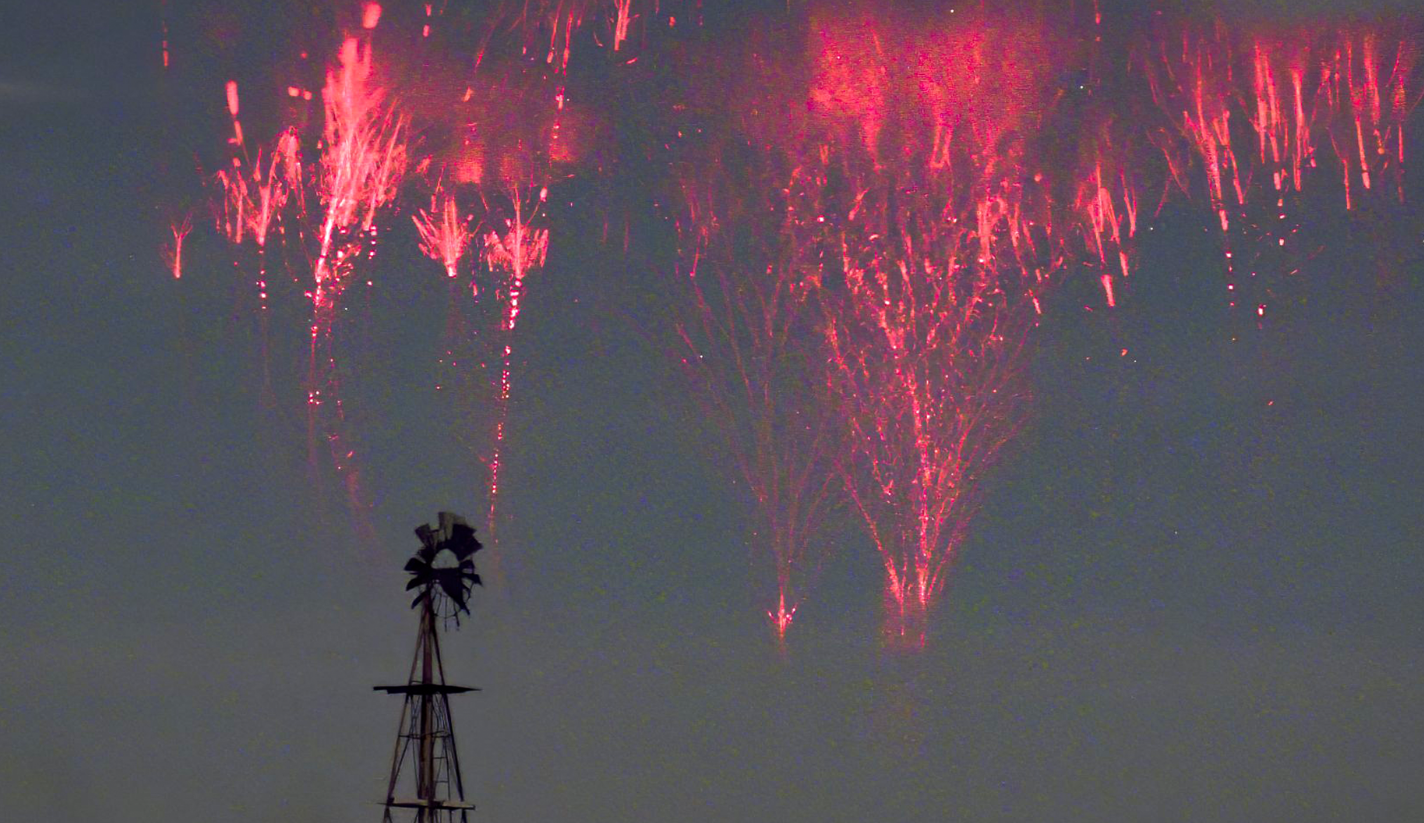
Never seen in person but would very much *love* to see - sprites:

-
Well, there’s one in the Merrimack Valley that would turn down 15 inches of snow if I got 25 inches.
-

Central PA Winter 25/26 Discussion and Obs
Itstrainingtime replied to MAG5035's topic in Upstate New York/Pennsylvania
MU on the upcoming weekend: During the second half of the weekend, there has been more unwarranted "hype" in recent days regarding a potential winter storm. The odds of that actually happening are very low. Instead, a developing storm system over the southern Plains on Saturday will likely track due east through Sunday and exit into the Atlantic somewhere between South Carolina and northern Florida. Either way, that's too far south for any precipitation to reach northern MD or southern PA, and Sunday will likely just turn out partly-to-mostly cloudy and dry with highs in the 40s. Behind the system, early next week should turn out equally as nice with mostly sunny skies accompanying an even bigger moderating trend. Essentially, the weather is going to be a "snoozefest" for at least the next week, and our moderate-to-extreme drought conditions are only going to worsen. -
You didn't have your AC on?.
-
I would not.
-
Man it's scorching outside. I can literally wear a fleece jacket without freezing my ass off.
-

Feb 10-11 Mid Week Minor Event - Ride the hot hand?
CoastalWx replied to HoarfrostHubb's topic in New England
Hrrr looks terrible lol -

February 2026 OBS & Discussion
batmansascientist replied to Stormlover74's topic in New York City Metro
Strange question, but this seems like the group to answer. I follow the hourly temps from NOAA for Central Park, and the other day, there were a few readings of major precipitation (about 1.12" total for the day . This data was clearly incorrect and fixed for the daily results. When this kind of thing happens, is there an explanation for what happened? Just curious because I saw it and I was confused where the data was originating. Feb 7, 12:51 pm 12 -9 37 -7 NW 22G39 10.00 FEW039 FEW055 OVC070 1006.50 29.57 29.74 0.60 1.12 20 11 Feb 7, 11:51 am 12 -9 37 -3 WNW 13G33 10.00 OVC060 1006.40 29.57 29.74 0.52 Feb 7, 10:51 am 12 -10 36 10.00 OVC060 1006.70 29.58 29.75 Feb 7, 9:51 am 11 -8 41 -8 NW 21G38 10.00 OVC060 1006.20 29.56 29.73 Feb 7, 8:51 am 14 -6 40 -5 WNW 23G40 10.00 OVC065 1005.20 29.54 29.71 Feb 7, 7:51 am 17 -4 38 2 WNW 16G35 10.00 OVC065 1004.10 29.51 29.67 Feb 7, 6:51 am 20 -1 39 6 WNW 15G33 10.00 OVC060 1003.00 29.48 29.64 0.48 0.64 27 20 Feb 7, 5:51 am 25 8 48 14 WNW 12G31 10.00 OVC070 1001.10 29.43 29.59 0.04 Feb 7, 4:51 am 27 20 74 18 WNW 9G21 3.00 Haze FEW023 FEW030 OVC055 999.90 29.39 29.55 0.06 Feb 7, 3:51 am 26 21 81 18 WNW 8 4.00 Haze BKN055 OVC085 999.70 29.38 29.54 0.17 0.38 Feb 7, 2:51 am 26 20 77 22 3 5.00 Haze OVC070 999.80 29.39 29.55 0.13 Feb 7, 1:51 am 26 21 81 22 3 3.00 Haze FEW013 OVC040 1000.40 29.40 29.56 0.08 Feb 7, 12:51 am 26 21 81 16 WSW 10G16 1.00 Lt snow BKN014 OVC027 1000.80 29.42 29.58 0.07 0.16 30 26 Feb 6, 11:51 pm 27 21 78 22 5 4.00 Lt snow FEW014 BKN047 OVC100 1001.20 29.43 29.59 0.08 33 23 Feb 6, 10:51 pm 26 21 81 18 W 7 2.50 Lt snow SCT017 OVC037 1001.70 29.44 29.60 0.01 Feb 6, 9:51 pm 27 21 78 18 W 9 1.50 Lt snow OVC029 1002.10 29.46 29.62 T T Feb 6, 8:51 pm 28 18 65 19 WSW 9 7.00 OVC047 1002.50 29.47 29.63 Feb 6, 7:51 pm 30 16 55 24 6 10.00 SCT034 BKN055 OVC085 1002.60 29.47 29.63 -
Feb 10-11 Mid Week Minor Event - Ride the hot hand?
CoastalWx replied to HoarfrostHubb's topic in New England
Moon visible in Tolland. -
Interesting phenomenon….how many western peeps would turn down 10” of snow on top of their current pack so they wouldn’t have to watch eastern folks get 30”?
-
42.4, pack still looks pretty good. Some dirt/grass is showing in a few more areas but nonetheless very white.
-
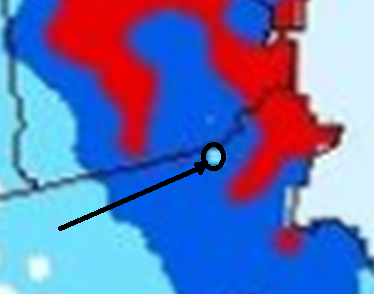
I think that is, by far, the largest area of 30+ red shading ive seen on any NESIS map, including Feb 13 which has like almost nothing above 30". Is that not overly conservative for once?
-
Central PA Winter 25/26 Discussion and Obs
Itstrainingtime replied to MAG5035's topic in Upstate New York/Pennsylvania
Isn't sleet wonderful? I know it can be demoralizing when we change over, but my goodness it can do absolute wonders for a snowpack. Outside of February 2010, all of our long-lasting packs have had a lot of sleet/freezing rain embedded in it. 10" of snow with a ton of sleet will last so much longer than 24" of cold powder. We've reaped the benefit of those hours of sleet we had back on 1/25. Even with the cold temps we've had since, the ground would look far different today without that sleet. -
Jones Beach water temp today is 33. That would explain an actual seabreeze today on the barrier islands. Sheesh. Mid to upper 30s in northern Nassau, around 32 in Long Beach.
-
Disgusting.
-
No thx
-
47 degrees, and other than on rooves, its having very little impact on the snow pack. No water on the edges of piles along driveways and roads. Still the same 5" depth we started the day with.
-

Feb 10-11 Mid Week Minor Event - Ride the hot hand?
NoCORH4L replied to HoarfrostHubb's topic in New England
I thought everything was juicing down? Surprising. Thought a SWS would cover it. -
April
-

Feb 10-11 Mid Week Minor Event - Ride the hot hand?
CT Valley Snowman replied to HoarfrostHubb's topic in New England
18z Hrrr is meh.