All Activity
- Past hour
-
This is nuts
-

3/16/26 Severe Weather Event Thread (Day 2 MOD Risk)
WeatherShak replied to Kmlwx's topic in Mid Atlantic
You’ve inspired me. I think we will do Panera! Here’s a picture of the hundred plus foot trees around my house -

3/16/26 Severe Weather Event Thread (Day 2 MOD Risk)
LeesburgWx replied to Kmlwx's topic in Mid Atlantic
tornadogenesis time for a new screen name -

3/16/26 Severe Weather Event Thread (Day 2 MOD Risk)
NorthArlington101 replied to Kmlwx's topic in Mid Atlantic
I’ve thought about telling my family to do something similar but will wait til the line actually forms. At least head to the Starbucks lol. -
Won't see many ZFPs like these in our region Zone Forecast Product National Weather Service Baltimore MD/Washington DC 415 PM EDT Sun Mar 15 2026 DCZ001-160000- District of Columbia- Including the city of Washington 415 PM EDT Sun Mar 15 2026 .REST OF THIS AFTERNOON...Mostly cloudy. Highs around 60. Southeast winds around 15 mph with gusts up to 30 mph. .TONIGHT...Showers in the evening, then showers likely with a slight chance of thunderstorms after midnight. Lows in the mid 50s. Southeast winds 10 to 15 mph with gusts up to 30 mph. Chance of rain 90 percent. .MONDAY...Showers likely with a slight chance of thunderstorms in the morning, then showers with thunderstorms likely in the afternoon. Some thunderstorms may be severe with damaging winds and tornadoes in the afternoon. Highs in the lower 70s. South winds 15 to 20 mph with gusts up to 35 mph. Chance of rain 90 percent. .MONDAY NIGHT...Rain showers with thunderstorms likely in the evening, then rain showers likely after midnight. Some thunderstorms may be severe with damaging winds and tornadoes. Much cooler with lows around 30. West winds 15 to 20 mph with gusts up to 35 mph. Chance of rain near 100 percent. .TUESDAY...Mostly sunny. Much cooler with highs in the lower 40s. West winds 10 to 15 mph with gusts up to 25 mph. .TUESDAY NIGHT...Mostly clear. Lows in the mid 20s.
-
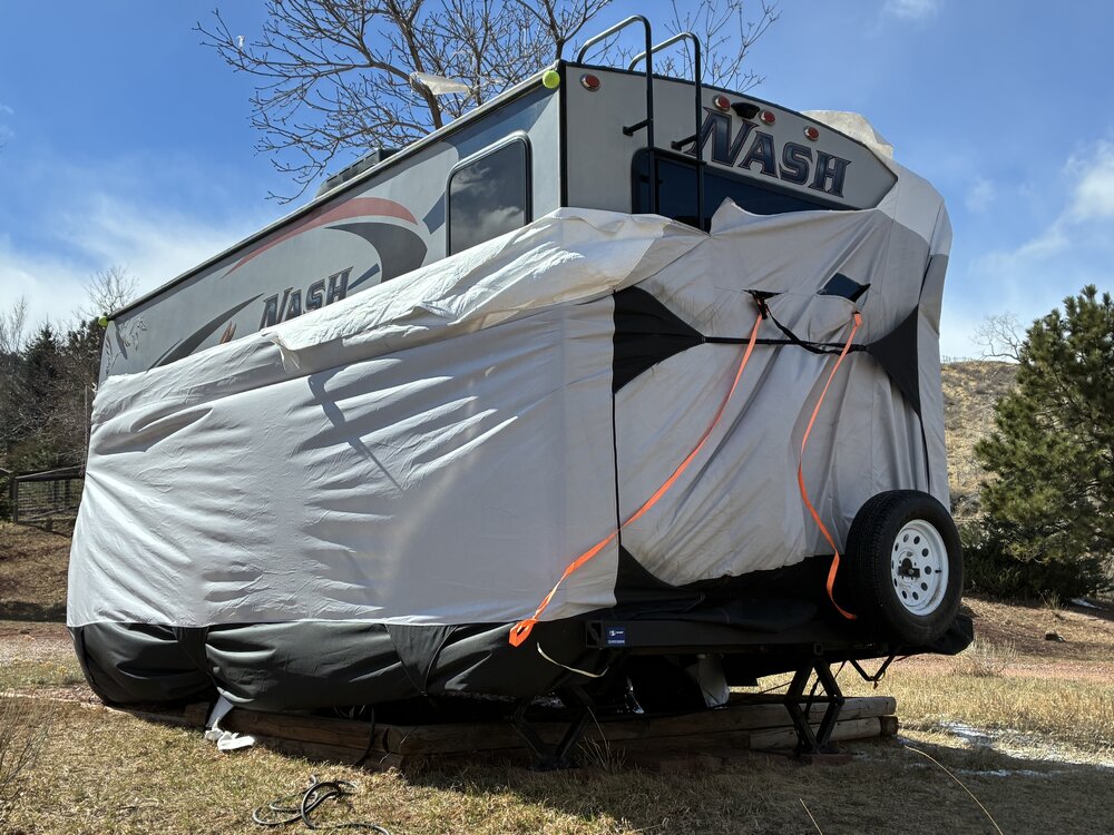
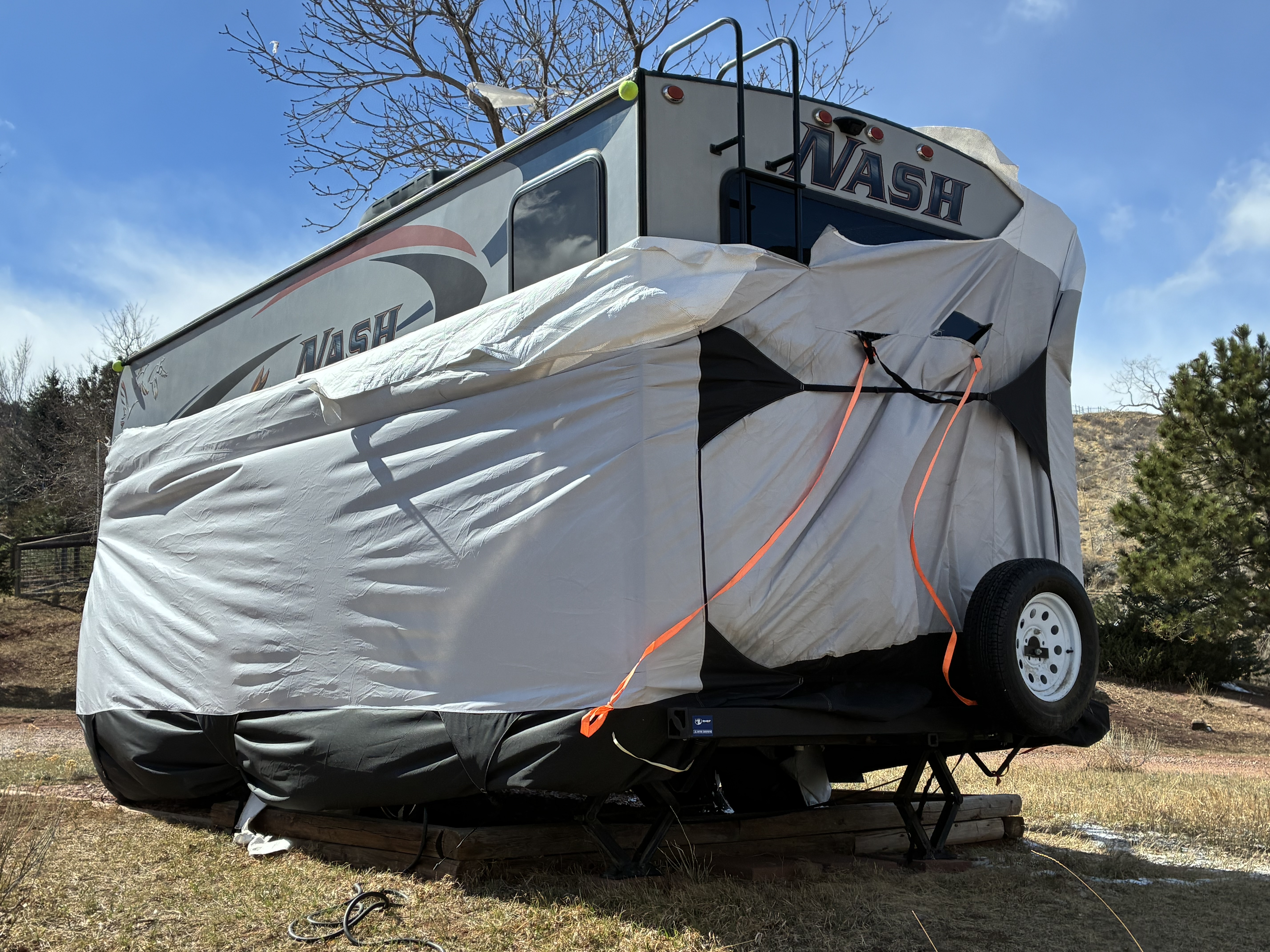
We live in the foothills west of Fort Collins and you can add about 5 mph to what Fort Collins had. It kinda tore up our trailer cover, that had previously survived fierce winds the past several years. Oh well the damage could have been worse - our house and trailer are still standing .
-
3/16/26 Severe Weather Event Thread (Day 2 MOD Risk)
WeatherShak replied to Kmlwx's topic in Mid Atlantic
Agreed. Currently surrounded by 4 - 100 year old white oaks near the GW Parkway. Considering taking family to library for when the line passes. My wife thinks I’m overreacting. -
The irony is that we could have a 20" pack in place on April 1st ...
-
Fake news.
-
I'd be having a mental breakdown. lol
-
Still some deeper patches, big piles, and pond frozen at my folks. Amazing what radiating will do. Local pond in Weymouth pretty much ice free now except for a smaller area.
-
Back to snow here after a brief dry slot
-

3/16/26 Severe Weather Event Thread (Day 2 MOD Risk)
EstorilM replied to Kmlwx's topic in Mid Atlantic
Good point - that was such an unusual day, I remember following the line from the moment I woke up, all the way through the work day, then that evening when it actually arrived. -
MSP was at 8.5” as of 1pm.
-
DTW had a trace of light snow early this morning. It was 40° at 11am and has shot up to 70° at 4pm
-
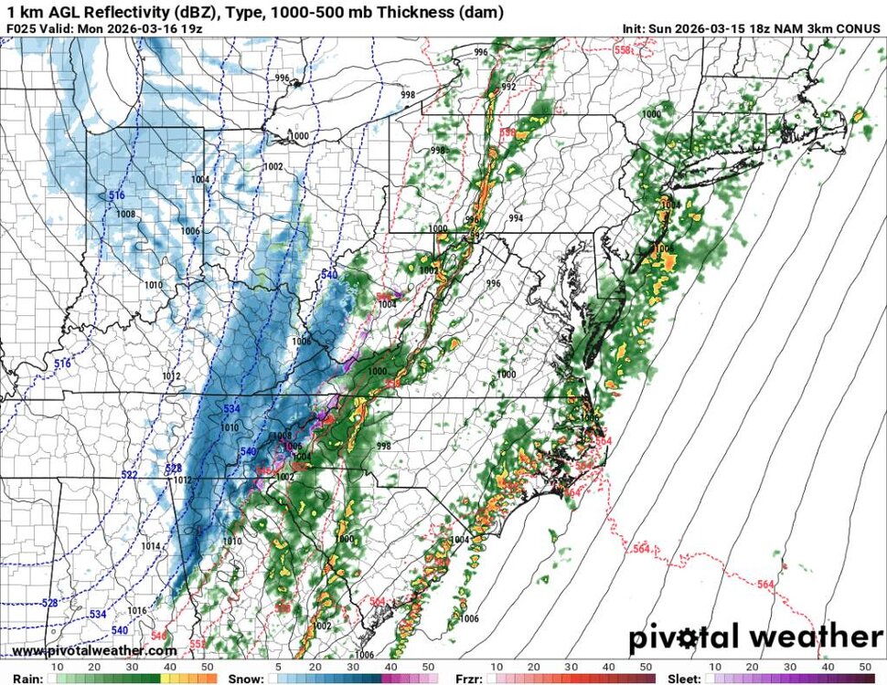
Subtle upticks in accumulations further east.
-
View from their house in WI this morning. The trees are maybe 100 yards from the window.
-
Down to 37, bottom really fell out fast
-
Also the wind is going to be cranking tomorrow afternoon into tomorrow night. We will probably see temps crash fast as the front blows through. Could see some dramatic temperature drops all at once with temps heading to the single digits and teens.
-
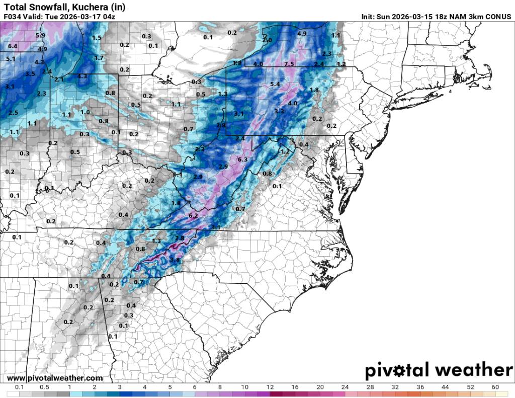
NAM 3k showing some very heavy snowfall tomorrow afternoon around the area as the low blows up over us. This could make for some fun times. Sent from my SM-G998U using Tapatalk
.thumb.jpg.5e80ec7bbdfd1854d1e7de1c81243492.jpg)
.thumb.jpg.72fc3829eaff57e6aa8cba020fe02542.jpg)

-
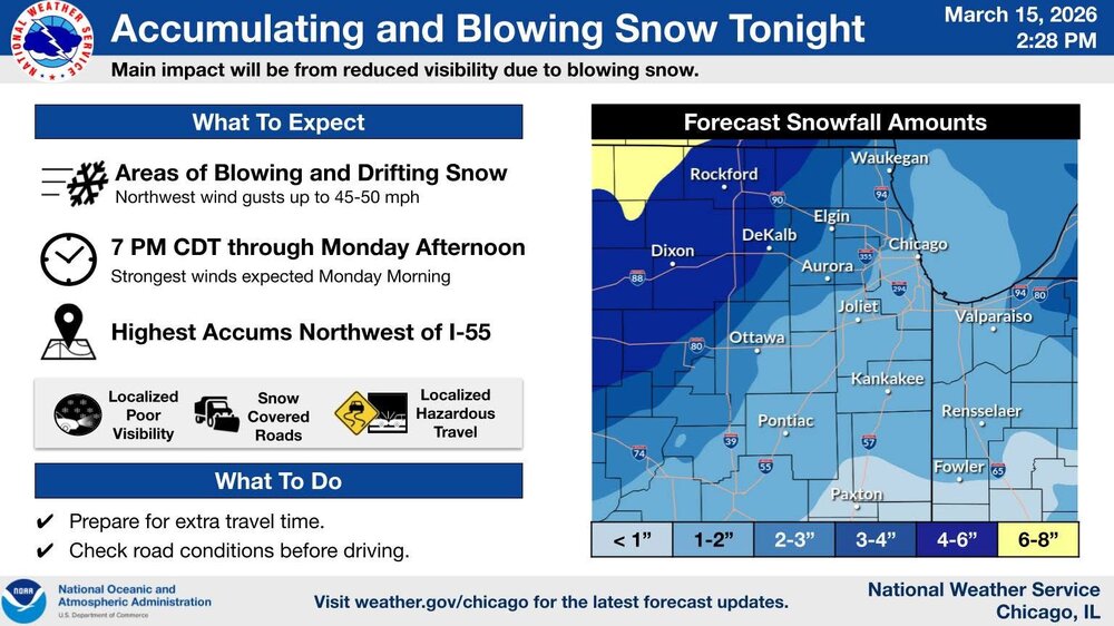
LOT sticking with their guns, smart move imo.
-

3/16/26 Severe Weather Event Thread (Day 2 MOD Risk)
pazzo83 replied to Kmlwx's topic in Mid Atlantic
yeah - these were more fun when I lived in a condo building in downtown DC lol -
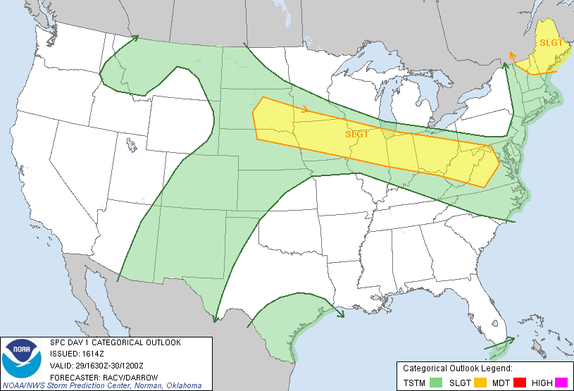
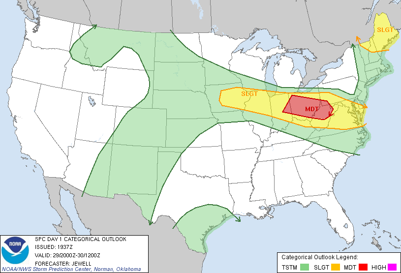
Was not well forecasted at all. This was the outlooks for that day

-
Lfg
-
Big thunderstorm ongoing here. Our cat has made her scurry behind the couch for protection.


.jpg.0b810301aadee02e295e6d2c61de9e6d.jpg)
.jpg.f5c12fd8f09739786a78b2c1412fbe7c.jpg)