All Activity
- Past hour
-
 buy cytotec online fast delivery: cytotec online or buy cytotec
 -
Rock-steady
-
ORD had a low temp of 76° yesterday, which broke the record high min temp for the date of 74°(1971/1960).
-

Chicago Weather Records Tracking
Chicago Storm replied to Chicago Storm's topic in Lakes/Ohio Valley
Chicago/O'Hare had a low temperature of 76° on September 4th, which broke the record high minimum temperature for the date of 74°(1971/1960). -
Maxed at 93° at both ORD and MDW yesterday. ...2026 90°+ Day Tally... 17 - MDW 16 - ORD 16 - RFD 15 - ARR 14 - PWK 14 - LOT 13 - UGN 12 - DPA
-
Hello again DMV! Yet another day of rain for ya! Welcome to the Record El Nino of 2026-27!
-
Just under 0.50 of rain here last month...nothing this month. What is with all these storms hammering greensboro then falling apart as they approach wake co? It has happend numerous times this summer. It's strange.
-

2026-2027 Record-breaking El Nino
LakePaste25 replied to Stormchaserchuck1's topic in Weather Forecasting and Discussion
It’s basically just leaning into a stronger signal for a canonical Nino pattern because the Nino itself is progged to be much stronger than 23-24. -
.thumb.gif.f92b16c631a1d15d405ed77b33f0710d.gif)
Septorcher 2026 Discussion - Endless Summer
Torch Tiger replied to Damage In Tolland's topic in New England
Nasty day. Coc! -

2026-2027 Record-breaking El Nino
GaWx replied to Stormchaserchuck1's topic in Weather Forecasting and Discussion
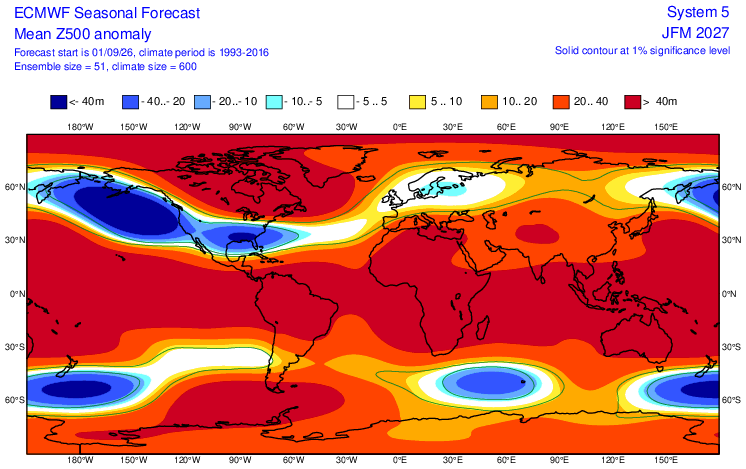
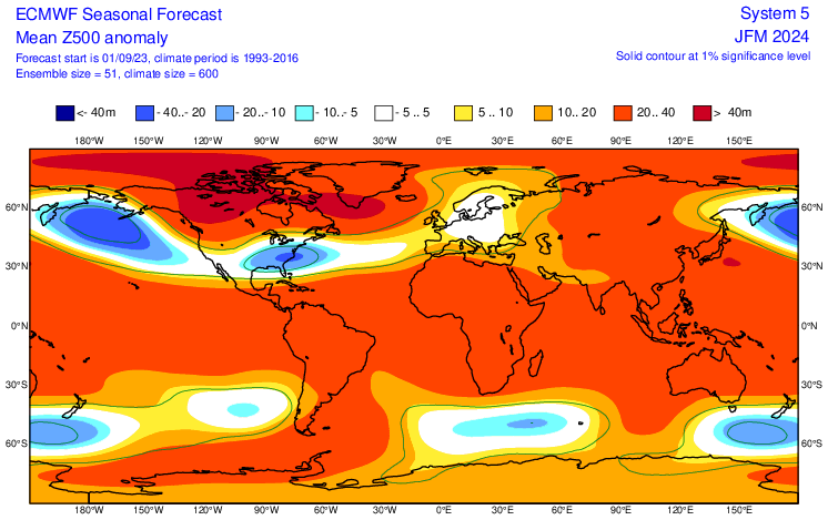
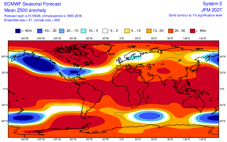
H5 comparisons Euro Sep fcasts for JFM ‘27 vs ‘24: larger contrasts worldwide/E US! ‘24: very little >40m (<5% of the globe) and no <-40m ‘27: much more >40m (~1/2 the globe) and sig. more <-40m (3 areas vs none in ‘24)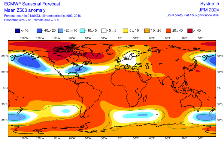
-
large MCS/MCC overnight. This particular radar image looks like a smiley face. This place just keeps getting wet
-
H5 comparisons Euro Sep fcasts for JFM ‘27 vs ‘24: larger contrasts worldwide/E US! ‘24: very little >40m (<5% of the globe) and no <-40m ‘27: much more >40m (~1/2 the globe) and sig. more <-40m (3 areas vs none in ‘24)
-
Euro blew chunks with the 23/24 forecast thru the fall of 2023. Interestingly, Cfs2 forecast starting mid 9/23 was warm and not canonical Niño. https://www.cpc.ncep.noaa.gov/products/CFSv2/cfsv2_fcst_history/202309/htmls/usT2me3Mon.html
-

2026-2027 Fall/Winter Mountain Thread
Maggie Valley Steve replied to BlueRidgeFolklore's topic in Southeastern States
First shower of the day is falling in the Valley. I'm getting some early leaf fall as well with black cherry and poplar trees around the house. -
-
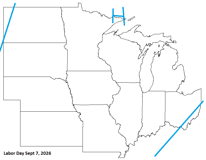
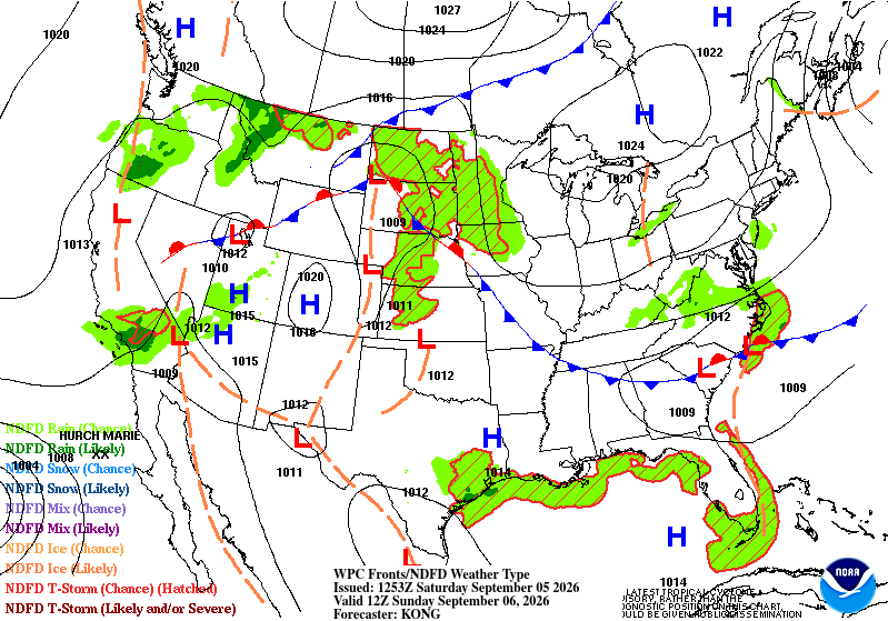
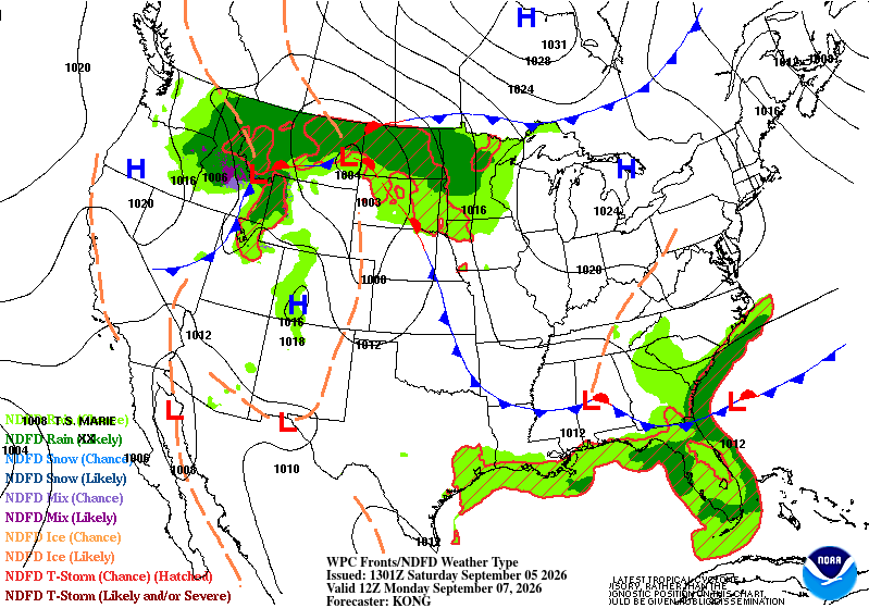
Some wet wx across the SE sub, and NW sub. Other than that, a pretty decent holiday weekend for most.
-

Septorcher 2026 Discussion - Endless Summer
dendrite replied to Damage In Tolland's topic in New England

-
As depicted its a bit warmer, but it wasn't cold on last month's edition either. I think we have a pretty good idea of how this winter will go. Need a -AO and or EPO to bring some colder air close enough to work with for a time.
-

2026-2027 Record-breaking El Nino
forkyfork replied to Stormchaserchuck1's topic in Weather Forecasting and Discussion
what does this have to do with el nino -
Overcast morning again. Clouds are suppose to clear this aftrn. If so, the temps should bump into the 70's briefly.
- Today
-
2026-2027 Record-breaking El Nino
GaWx replied to Stormchaserchuck1's topic in Weather Forecasting and Discussion
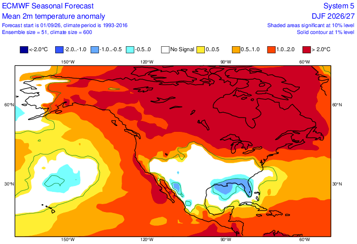
Comparison of Sept ‘23 Euro for DJF 23-4 and Sept ‘26 for DJF 26-7: ~twice the contrast N to S ‘26-7 vs ‘23-4 in E US ’23: ‘26: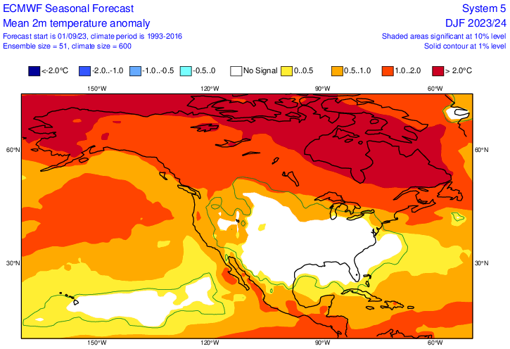
-
If I knew we were actually going to only be +1C for DJF, I'd be pretty bullish for snow. Perhaps even more so if you can wag that December makes up most of that + anomaly and JF are near normal or even a touch below. But that's all weenie-casting right now.
-
.25" rain from 10:30 - 11:40 The Graf model from 5 am was exactly right with 100% rainfall while NWS was only 30%. At less than 12 hrs. it seems that Graf is more accurate than NWS.
-
September 5 1990: Nine inches of rain falls in Duluth by the end of the following day, washing out $1,000,000 worth of roads. 1982: 77 mph winds are reported in Anoka County. For Saturday, September 5, 2026 1925 - The temperature at Centerville, AL, soars to 112 degrees to establish a state record. Every reporting station in Alabama was 100 degrees or above that afternoon. (The Weather Channel) 1933 - A hurricane hit Brownsville, TX, killing forty persons and causing 12 million dollars damage. (David Ludlum) 1950 - Hurricane Easy produced the greatest 24 hour rainfall in U.S. weather records. The hurricane deluged Yankeetown, on the upper west coast of Florida, with 38.7 inches of rain. (David Ludlum) 1975 - Strong winds reduced visibilities to near zero in blowing dust resulting in a 22-car chain reaction accident on Interstate 10 near Toltec AZ. Two persons were killed, and 14 others were injured. (The Weather Channel) 1987 - Thunderstorms over the Southern and Middle Atlantic Coast States drenched Charleston, SC, with 5.50 inches of rain, and a total of 13.50 inches in two days, flooding homes, and leaving roads and bridges under water. (The National Weather Summary) A tropical storm which formed off the South Atlantic coast was responsible for torrential rains over coastal regions of South Carolina. Between the 30th of August and the 8th of September, Charleston SC received 18.44 inches of rain. The heavy rains caused extensive flooding around the city of Charleston, seriously damaged cotton crops in the eastern part of the state, and resulted in an unusually high number of mosquitos. (Storm Data) 1988 - Five days of heavy rain commenced in west central Florida. Up to 20 inches of rain in four days resulted in extensive urban flooding, and evacuation of 1000 homes. Flooding claimed four lives, and caused more than five million dollars proprty damage. (The National Weather Summary)(Storm Data) 1989 - Thunderstorms produced six to ten inches of rain in south central Kansas between 6 AM and Noon. Serious flooding was reported around Wichita, with water four feet deep along some roads. A cold front crossing the Northern High Plains Region produced wind gusts to 63 mph at Sheridan WY. (Storm Data) (The National Weather Summary) Observances: 5 Sat World Beard Day 5 Sat National Cheese Pizza Day 5 Sat World Samosa Day 5 Sat National Be Late For Something Day 5 Sat National Act Dumb Day 5 Sat National Cellulite Day 5 Sat National Shrink Day 5 Sat International Day of Charity
-
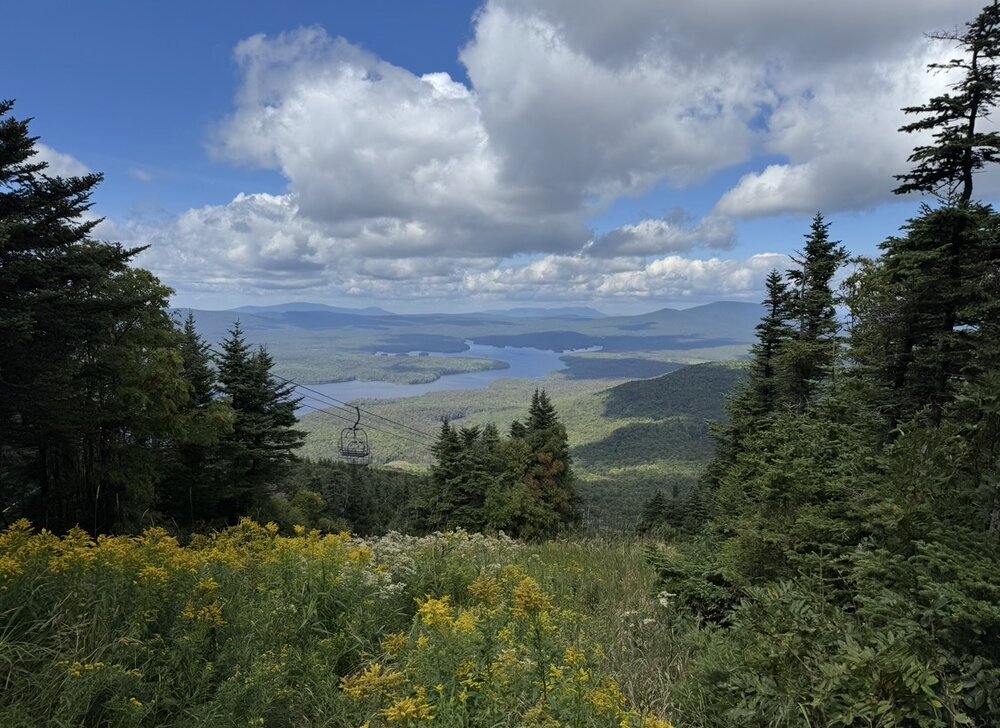
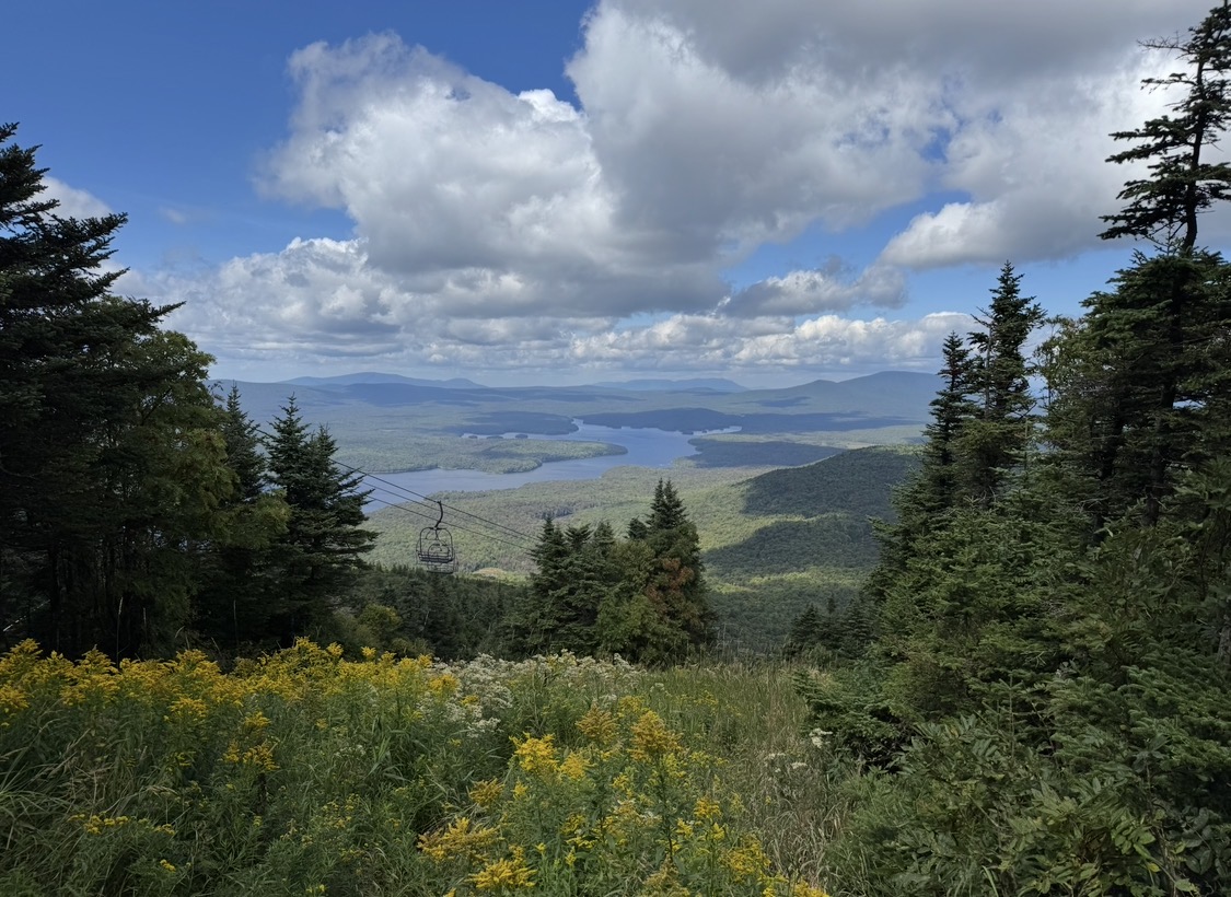
From the top of Mount Snow yesterday