All Activity
- Past hour
-

2026-2027 Super El Nino
LakePaste25 replied to Stormchaserchuck1's topic in Weather Forecasting and Discussion
1972-1973 is the only super Nino analog we have of the -PDO not flipping into winter. However, the RONI peaked at +2.3 and we are potentially going much higher than that this time around, so it could be such an overwhelming force that it flips to + -
Been lucking out overnight near Berlin, Md. with very little to no rain since arriving Sunday. Excellent beach day on Sunday. Mostly overcast and humid this morning with a few peaks of sun, but dry so far. Hazardous weather statements locally for 3’-5’ waves, rough surf and rip currents.
-
2.3”
-
3+ more inches for the lawn, hoping that means the end of irrigation season (fingers crossed)
-

Augdewst 2026: Summer's Last Stand
Sey-Mour Snow replied to Prismshine Productions's topic in New England
There’s stuff all the way in the Delmarva headed this way , we will have rounds of downpours through this evening -

Augdewst 2026: Summer's Last Stand
HoarfrostHubb replied to Prismshine Productions's topic in New England
2.13” here so far this morning. A little thunder Did not want -

2026-2027 Super El Nino
bluewave replied to Stormchaserchuck1's topic in Weather Forecasting and Discussion
I am starting to wonder if we are seeing some lingering influence from the stratospheric disruption which occurred so much earlier than usual back in late November. The 500 mb low north of Alaska has been near the strongest on record since the spring. Almost like a rebound off the great blocking pattern we had last winter. This pattern has coincided with the record mid-latitude ridging driving the -PDO and +AMO. -

Augdewst 2026: Summer's Last Stand
Damage In Tolland replied to Prismshine Productions's topic in New England
Seems like that’s it for rain after this moves out unless the front has any activity -

Augdewst 2026: Summer's Last Stand
WxWatcher007 replied to Prismshine Productions's topic in New England
Yep whoever got in on the training got smoked. Yeah. In all seriousness, I knew my area wasn’t going to jack but it picked up the zone of heaviest morning rain nicely. -
Storm out there again this morning. Really gross, no wind,.just rain. Rain gauge looks to have over 2" in it but I'll have to measure properly once it stops raining.
-

Augdewst 2026: Summer's Last Stand
SJonesWX replied to Prismshine Productions's topic in New England
beer for breakfast? lol I saw the earlier post and I was like WTF is this guy talking about-sprinkles??? -

E PA/NJ/DE Summer 2026 Obs/Discussion
LVLion77 replied to PhiEaglesfan712's topic in Philadelphia Region
1.15 here since yesterday evening. -
2026-2027 Super El Nino
LakePaste25 replied to Stormchaserchuck1's topic in Weather Forecasting and Discussion
Are there really weenies out there that think a -PDO will “counteract El Niño and make it colder and snowier?” That is such a baseless take. -PDO interferes in a way that makes it warmer, not colder. You WANT it to flip +PDO. I think the sad part is, some of these accounts know this but they’re lying and giving out doses of hopium to the less informed weenies just for money. -

Augdewst 2026: Summer's Last Stand
CT Valley Snowman replied to Prismshine Productions's topic in New England
There are some stations within a radius of a few miles from here that are up around 4". Others are closer to 3". -
Pushing 3 inches here, got soaked overnight. I hope the storm chances this week flop, at least up this way. Had more than enough rain the past few weeks.
-
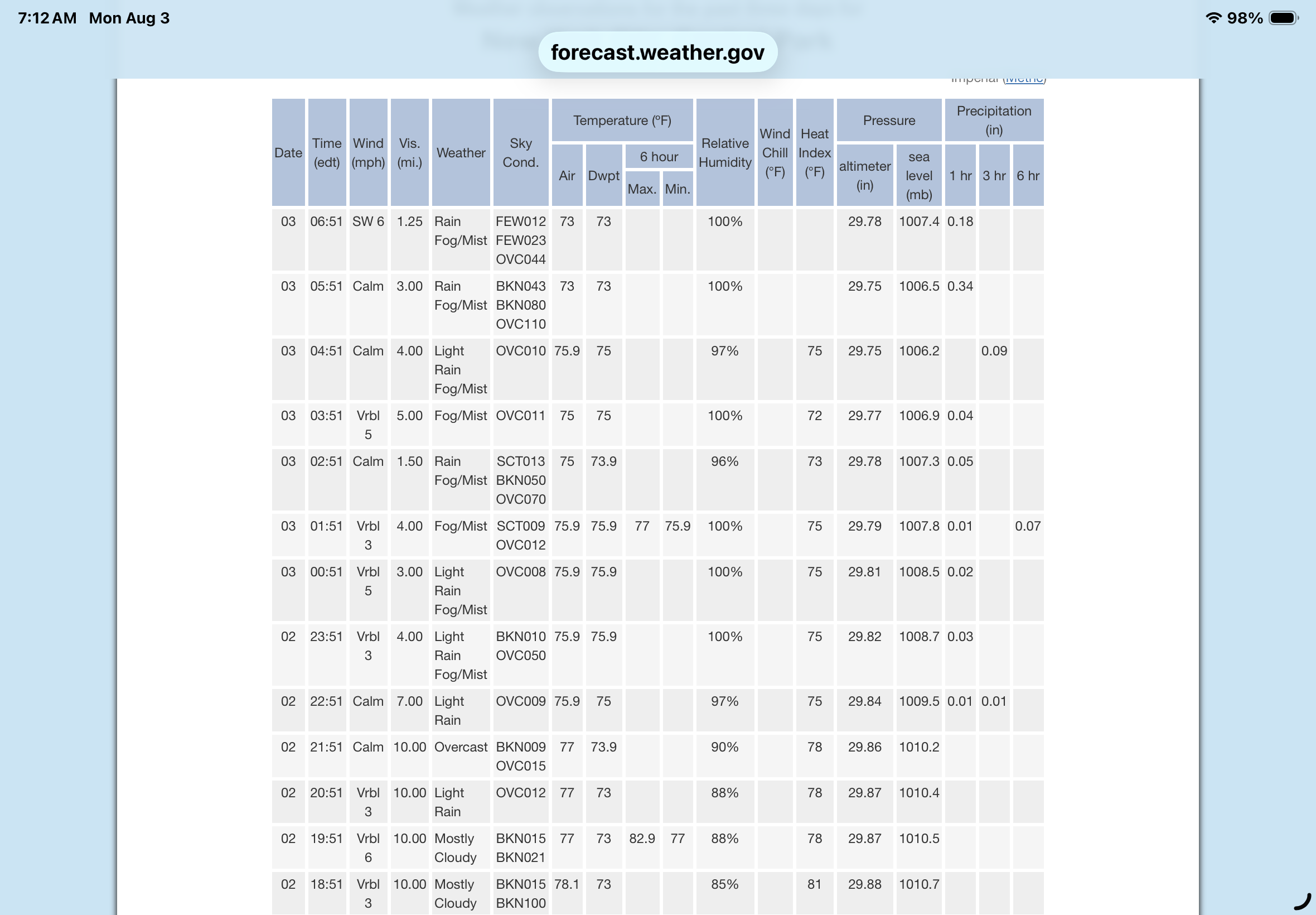
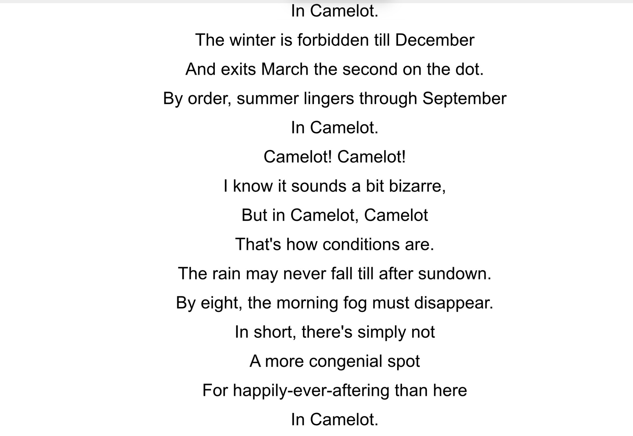
A fun SNL skit could have NWS Meteorologists surrounding the ASOS and singing The Camelot lyrics substituting Central Park for Camelot. As always …..
-

Augdewst 2026: Summer's Last Stand
HIPPYVALLEY replied to Prismshine Productions's topic in New England
Fortunately heaviest is East of Greenfield towards Orange/Gardnet area. -

E PA/NJ/DE Summer 2026 Obs/Discussion
Hurricane Agnes replied to PhiEaglesfan712's topic in Philadelphia Region
As a 2-day event total update, I had 0.42" total yesterday after overnight rain, and along with this morning's round, with another band over me right now ticking me up to 1.07", have 1.49" for 2 days. Temp 76/dp 75. -

Augdewst 2026: Summer's Last Stand
CoastalWx replied to Prismshine Productions's topic in New England
Hrrr did pretty good with this overall. -
Augdewst 2026: Summer's Last Stand
Damage In Tolland replied to Prismshine Productions's topic in New England
Big winds just ripped thru . Wow -
Augdewst 2026: Summer's Last Stand
Sey-Mour Snow replied to Prismshine Productions's topic in New England
Radar estimates 4.72” on CT,MA border -
Augdewst 2026: Summer's Last Stand
CT Valley Snowman replied to Prismshine Productions's topic in New England
Thankfully there is some movement and not a complete stall. Already up around 3" in this area. -
Augdewst 2026: Summer's Last Stand
CoastalWx replied to Prismshine Productions's topic in New England
That area from Springfield to Southern New Hampshire is going to get absolutely slapped. -
1.38 for me thus far. Might add a bit more but the bulk looks over. Good riddance. Rain begone
-
Doesn't rain, doesn't snow... never too hot, never too cold at Central Park. Incredible.