All Activity
- Past hour
-
I think besides that localized deluge a week or so ago, storms have been drying up before they hit the coast. My area in Somerset Co storms have been splitting a little drier here.
-
Im all in on a snowy winter given the active STJ.
-
Which means get your snowblowers ready
-
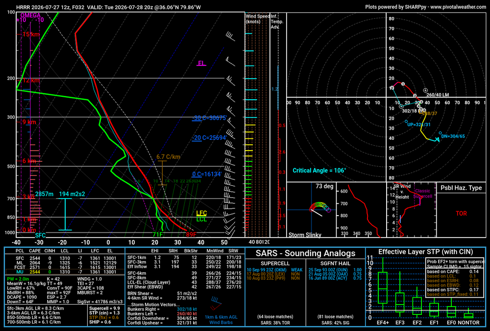
HRRR sounding in the triad Tuesday evening. I do kinda wonder if upper level wildfire smoke will tamp down the potential somewhat
-
surprised you could get it under 20% moisture with those dews.
-
 I wonder if we can muster up a sunrise surprise setup across Long Island or coastal CT/RI early Wednesday morning
 -
It’s Oregon smoke now. Different terroir
-
-
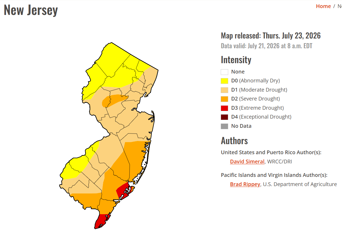
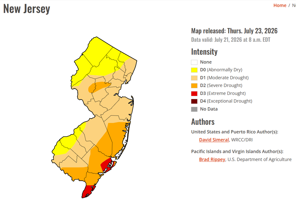
Interesting to see SE jersey that dry-they are usually a hotbed of T-storm activity in the summer
-
To be expected. They got their eyes/ears and funding slashed.
-
-
the spc is so bad.
-
keep this negativity out of my thread.
-
Sounds about right. There's scattered tree damage throughout the neighborhood, and a few people lost some siding. Nothing too crazy, but certainly the most wind we've had from a storm this year.
-

2026-2027 Super El Nino
40/70 Benchmark replied to Stormchaserchuck1's topic in Weather Forecasting and Discussion
Actually viewing the data that you're using is overrated. -
 I did notice traces of webbed hands at the lake last week.
 -
 A, wrong ... the whole region averages a multi-seasonal on-going deficit. This may be obscured by recency, but as usual in this particular social media space ...the constituency divorces that sort of longer term awareness/reality from whatever recency has done to form their immediate impression. So "need" as an objective empirical data is still there, despite that fallacy. B, correct ... 4 straight days is miserable for most sane people. Sure. However, if it is any consolation, at least "I" don't believe the blend of the available/dependable guidance really signals 4 straight days of rain. It's more - most likely ... an over billed front wall of what will likely turn out to be less, followed by unstable showery weather, but not raining all the time. It won't be sunny mind you. Per se. But it'll be gradually improving through Friday. Even if this scenarios figures out how to initially rain more than what it can ( lol ), it still likely a non-inundating decay.
 -
I think too alot of how this evolves is tied into how the convective scenario evolves today within the Great Lakes/Ohio Valley which remains quite complex
-
Cutoff lows with training convection are a pretty good signal for more flash flooding. Parts of the area are already 10.00+ for July. So the wettest month here in over a year. If this keeps up next few months, then it could be a sign of the longer term drought since September 2024 is beginning to relax. We’ll see more gradual improvement when the drought monitor and soil moisture updates this week. Last week the CT Shoreline experienced extreme rainfall rates. Many spots recorded more than 3.00 inches in one hour and 1.00 inch + in only 15 minutes.This lead to the rapid runoff from the land to the sea carving out 5-foot canyons through the beach. Locals have never seen this before in the area. Monthly Data for July 2026 for Upton NY NWS CWA Click column heading to sort ascending, click again to sort descending. CT OAKDALE 2.6 WNW CoCoRaHS 11.98 CT NORTHFORD 0.8 SW CoCoRaHS 11.66 CT BETHEL 0.5 E CoCoRaHS 11.60 CT SALEM 3.6 SE CoCoRaHS 11.42 CT DANBURY COOP 10.70 NY PEEKSKILL 2.8 NNE CoCoRaHS 10.59 CT NEWTOWN 5.3 S CoCoRaHS 10.54 CT BETHEL 3.5 NNE CoCoRaHS 10.35 CT CHESTER CENTER 2.7 WNW CoCoRaHS 10.20 CT NEWTOWN 4.6 SE CoCoRaHS 10.11
-
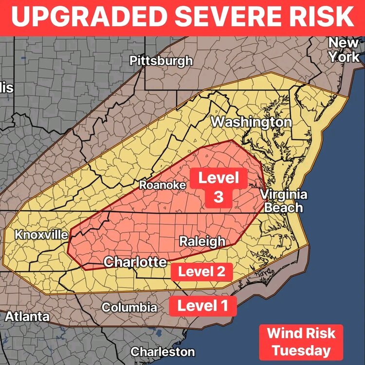
I will be chasing this tomorrow.
-
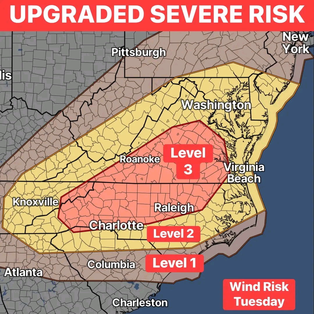
Severe outbreak in late July?
-
Rare for late July level 3 risk tomorrow
-
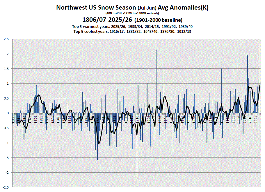
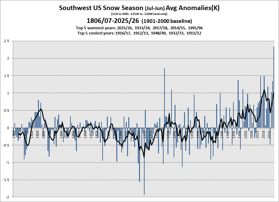
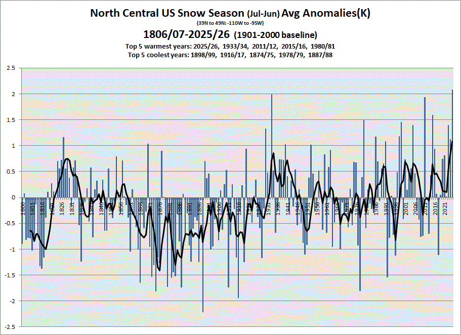
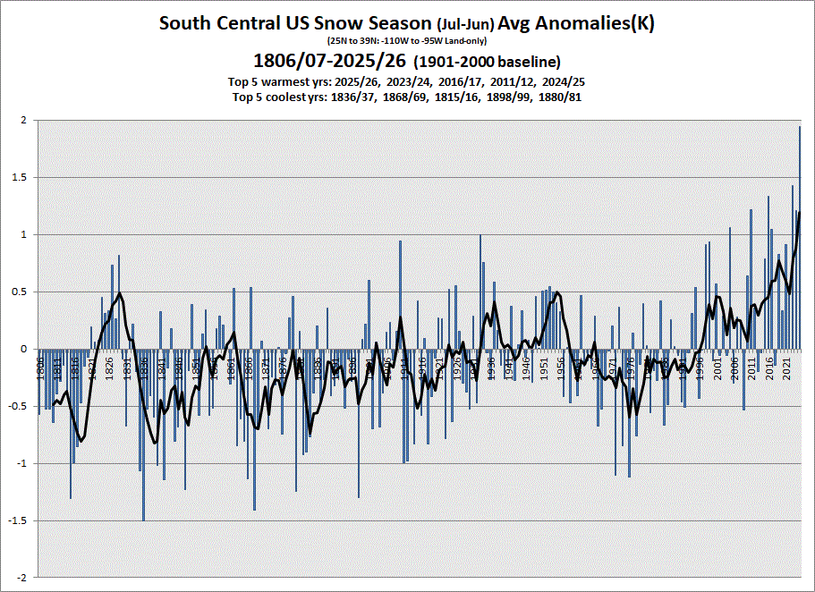
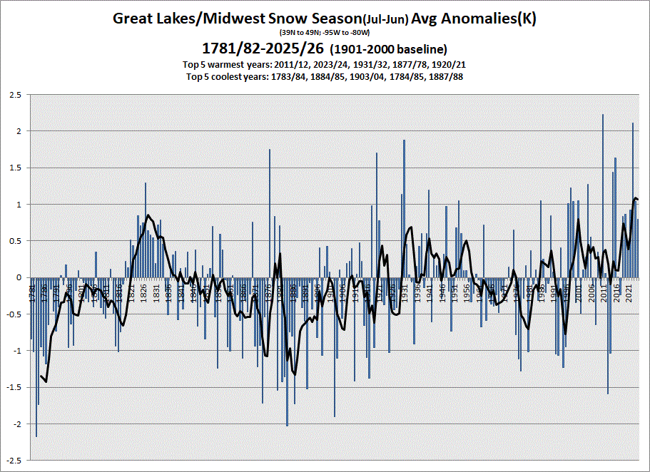
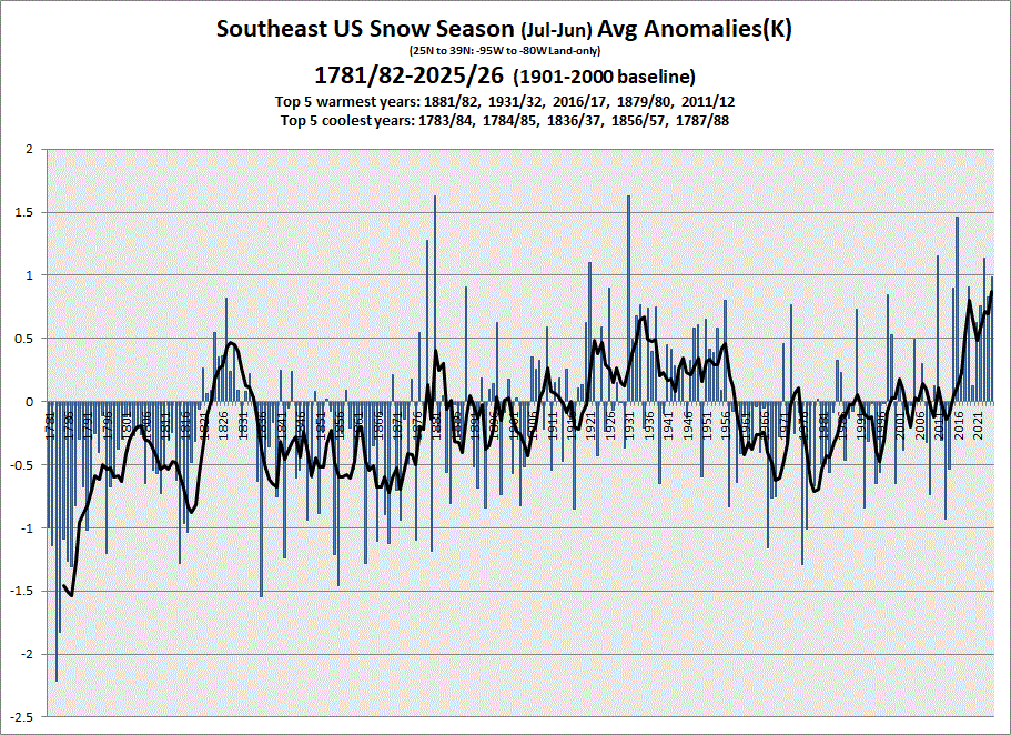
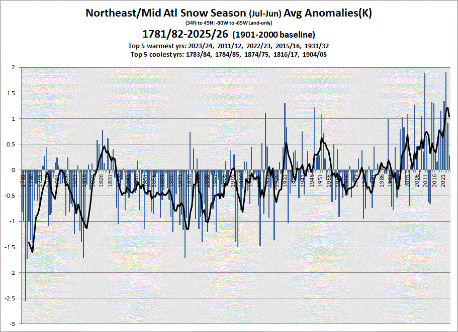
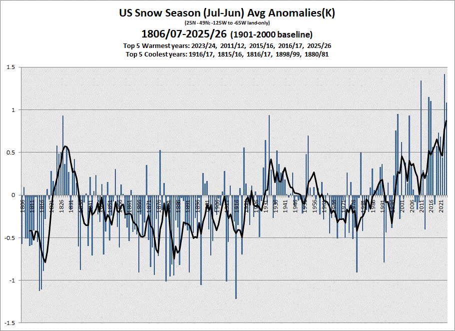
Finished up updating datasets. I have charting for different sections of the US. Since we ended the 25/26 snow season, I'm posting the snow season charts for the 7 sections of the US plus the US as a whole. Only have data back 1806 for the western half of the country, so the US chart starts there, also.
-
Ah, the power of a decimal point
-
 Most folks don’t need it . Certainly not 4 straight days of it which many will get especially EMA up into Maine