All Activity
- Past hour
-
PDS now
-
WTF!!!! I watch Elliot kick the game winning field goal. Great! I got $hit to do. Turn off the TV, grab the keys, get in the car, turn on the radio to listen to the post game show and the fookin’ Jaggywires win the game??? It’s not even October 15 and I’m already looking forward to the 2027 NFL and NHL drafts.
-
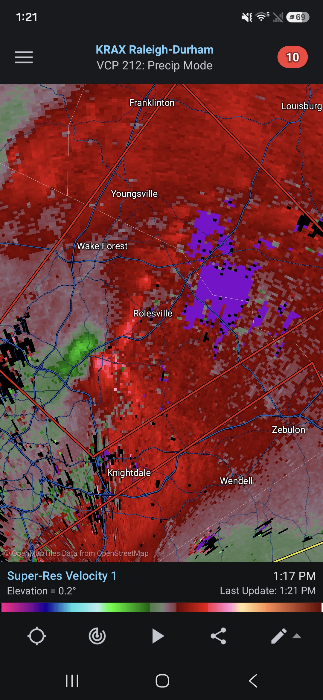
Significant tornado OTG going into rolesville
-
PDS TORNADO ...A TORNADO WARNING REMAINS IN EFFECT UNTIL 200 PM EDT FOR NORTHEASTERN WAKE AND SOUTHWESTERN FRANKLIN COUNTIES... At 123 PM EDT, a confirmed large and extremely dangerous tornado was located near Wake Forest, or 11 miles northeast of Raleigh, moving northeast at 30 mph. This is a PARTICULARLY DANGEROUS SITUATION. TAKE COVER NOW! HAZARD...Damaging tornado. SOURCE...Radar confirmed tornado. IMPACT...You are in a life-threatening situation. Flying debris may be deadly to those caught without shelter. Mobile homes will be destroyed. Considerable damage to homes, businesses, and vehicles is likely and complete destruction is possible.
-
Confirmed tornado approaching Rolesville
-
Donald Trump is toying with the idea of renaming the Atlantic Ocean the Trump Ocean. No, I’m not making this up: https://nypost.com/2026/10/11/us-news/president-trump-toys-with-renaming-atlantic-and-pacific-trump-ocean/ Now, I don’t know if he’s serious, of course. I suspect he’s really just trolling. But he has already changed the name of two bodies of water. Can you imagine if he were to actually do this? -The title for next year’s Atlantic thread may need to be “The Trump Hurricane Season”. -NHC TWOs will then start out as: “The tropical weather outlook for the North Trump...Caribbean Sea and the Gulf of America:” -Instead of saying you live on the Atlantic coast, you’d then be saying you live on the Trump coast. -The Middle Atlantic states would then become known as the Middle Trump states -The ACC would change to the TCC. -He wasn’t able to make Canada the 51st state. But the Atlantic provinces of Canada would become the Trump provinces of Canada. Good enough for him and maybe even better. -Atlantic City? No more as the new name would be Trump City. -Atlantic Standard Time’s new name? Trump Standard Time
-
Jacksonville did all they could to lose too.
-
Just northeast of I540 in Raleigh area, big CC drop.
-
Just large winter rain shield
-
A blowhard who should not be quoted in this forum
-
I had around 4 inches. The Vantage Vue said 3.8 inches, but I’m not exactly sure on the total amount, as a leaf got stuck in the Vue yesterday afternoon and caused me to miss some of the accumulation.
-
confirmed tornado ...TORNADO WARNING REMAINS IN EFFECT UNTIL 130 PM EDT FOR SOUTHEASTERN BLADEN AND NORTHWESTERN PENDER COUNTIES... At 103 PM EDT, a tornado producing storm was located over Kelly, or 21 miles northwest of Leland, moving northeast at 35 mph. HAZARD...Damaging tornado. SOURCE...Radar confirmed tornado. IMPACT...Flying debris will be dangerous to those caught without shelter. Mobile homes will be damaged or destroyed. Damage to roofs, windows and vehicles will occur. Tree damage is likely.
-
Heaviest rain of the day here. Over 2.5” and adding up quickly now.
-
2.48 rain so far today
-
2.11” of rain so far. Hrrr had me getting another 1-2” we shall see.
-
tornado warning south of Raleigh (Clayton, Smithfield)
-
Another CC drop on an unwarned storm near Creedmoor
-
 metoprolol succinate name brand: metocardiorx - lopressor dosage guideline renal impairment
 -
Over 1.5”
-
Well that’s what we get in October anyway…it’s mid October not mid December. A trough in the east is not pacific/zonal flow. And Vortex95 said just the opposite.
-
47 minutes ago- tornado damage near Fayetteville Airport
-

2026-2027 Record-breaking El Nino
mitchnick replied to Stormchaserchuck1's topic in Weather Forecasting and Discussion
Yes, but if you use the slide function to put the forecast in motion, the cooler waters are making a bee-line east. Should they continue after the end of the forecast period (7/27), you'd probably at least end up with a La Nada next winter, if not a weak Niña imho. I guess the question then is why wouldn't the cooler waters continue east? https://www.tropicaltidbits.com/analysis/models/?model=cfs-mon®ion=global&pkg=ssta&runtime=2026101100&fh=1 -
Four tornado warnings in NC
-
Looks like it’s OTG again just northwest of RDU on 540