All Activity
- Past hour
-
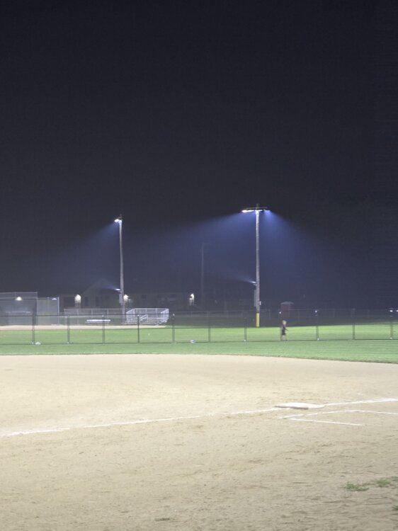
Mine is 285, by far the highest I've ever seen. Looking out in the pitch I see what looks like fog particles and falling, but its likely another 3 let word. WUN keeps getting got that there is rain nearby or that its possible - its picking up the radar artifacts from the ash up in the sky. God help us if it actually rains.
-

2026-2027 Super El Nino
George001 replied to Stormchaserchuck1's topic in Weather Forecasting and Discussion
I’m skeptical that we don’t get a major La Niña snap back after a Godzilla El Niño. There is a good chance this El Niño becomes the strongest event since the industrial era. -
 GOES-19 is down indefinitely, aka the only way I know of via satellite to follow where the smoke is. Go figure lol
 - Today
-

2026-2027 Super El Nino
snowman19 replied to Stormchaserchuck1's topic in Weather Forecasting and Discussion
This is a decidedly east-based (EP) event. If anything, the 30C isotherm east of the dateline supports an extremely east-based event like 1997 was. The difference is that this one is going to be stronger than 1997-98….In fact, likely the strongest one in history @LakePaste25 -
-

2026-2027 Super El Nino
Jebman replied to Stormchaserchuck1's topic in Weather Forecasting and Discussion
CSNavyWx, are you saying here that this particular Nino event is now getting stronger than the 97-98 Nino? I remember N VA getting so damn much rain that winter! What could this possibly mean for south central Texas? Man WE ARE ALREADY 33 INCHES FOR THE YEAR! This is only mid-July! Aren't Nino summers supposed to be hot and dry, especially in Texas? I'd be fairly quick to run for the Mountains, but Record Mega Nino-induced orographic rains are NOT THE ANSWER! Although the rains may not be the problem this winter in the mountains, especially the high Sierra. Places like Mammoth Ski Resort may get completely buried ALIVE in meters and meters and meters of wet Sierra Cement! Even the gondola pylons may be buried under about 200 feet of snow. -
AQI is 483 right now in Minneapolis.
-

2026-2027 Super El Nino
Stormchaserchuck1 replied to Stormchaserchuck1's topic in Weather Forecasting and Discussion
Biggest difference I see is in the central-subsurface. That could mean two things: 1) The event trends more basin wide than east-based going forward (which seasonal models have) 2) There may not be a major La Nina snap-back for 27-28 -
 Here you go.
-
.thumb.gif.f92b16c631a1d15d405ed77b33f0710d.gif) better than snow, really adds some depth and substance to the summer. and it pleases the acatt crowd. Win-win
better than snow, really adds some depth and substance to the summer. and it pleases the acatt crowd. Win-win -

2026-2027 Super El Nino
GaWx replied to Stormchaserchuck1's topic in Weather Forecasting and Discussion
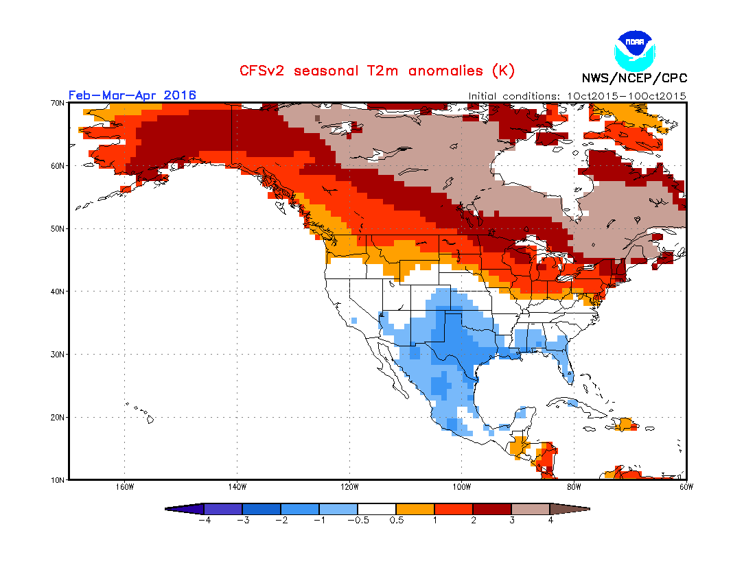
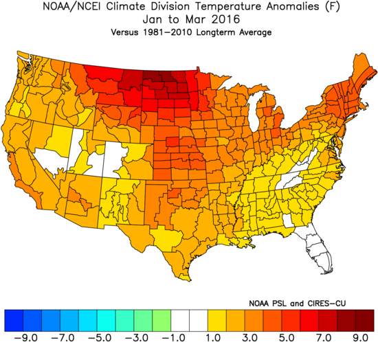
CFS Oct 1-10 mean prog for JFM ‘16: Actual: fairly close N tier but too cold S 1/2: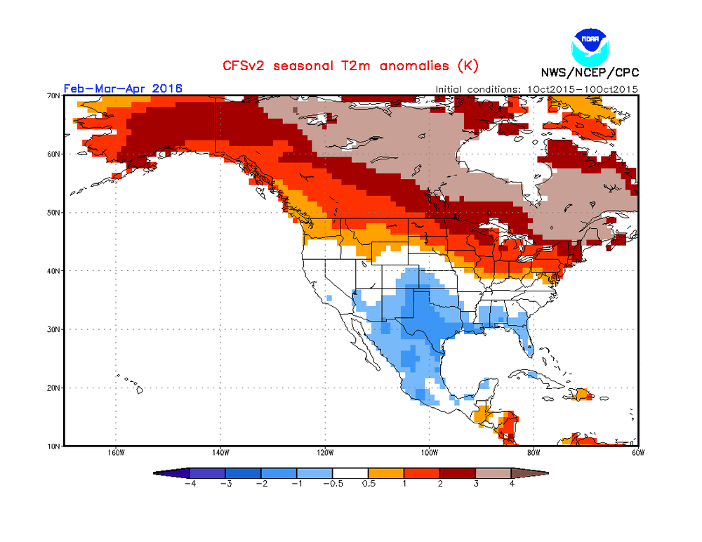
-
Still squeaking by with only upper air smoke here now but it is coming.
-
I like Messi but I must root for Spain.
-

2026 Spring/Summer Mountain Thread
Tyler Penland replied to Buckethead's topic in Southeastern States
Aight one day of heat back and I'm already over it. Bring on fall/winter. Heading to the North Wilkesboro races this weekend and the trucks are at 12:30 on Saturday afternoon. -
Smoke is quickly moving into far NE IL, as this back-door front moves in/through.
-
Hi 95 here, but not as obnoxious as the July 3 event with DP about 8 points lower.
-
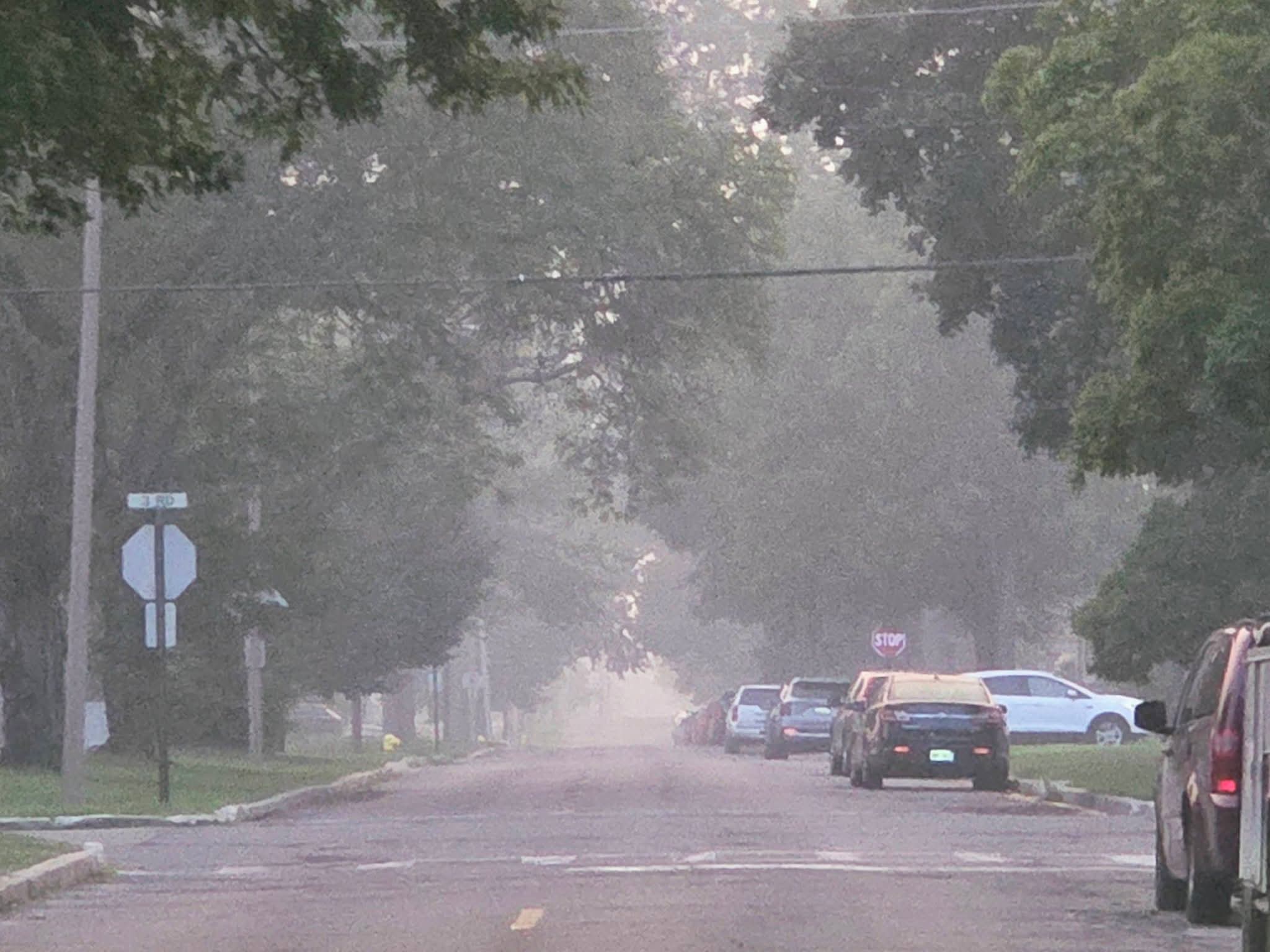
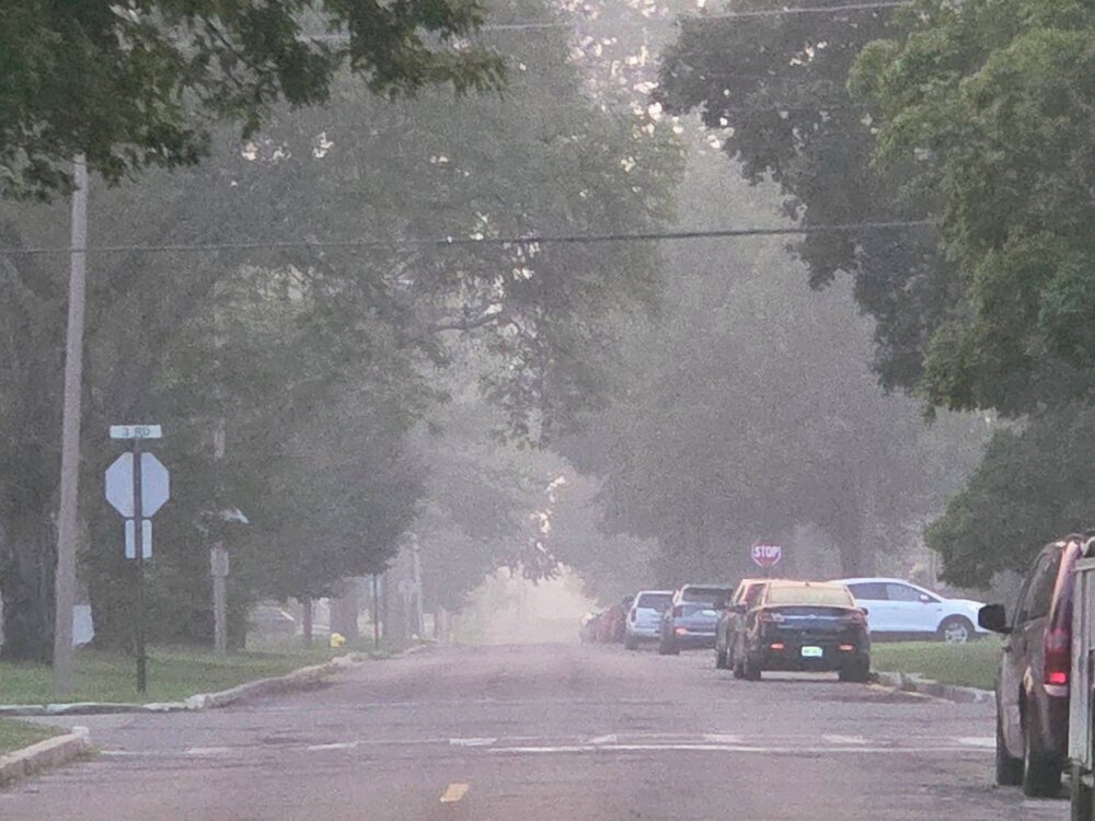
Air absolutely choked with smoke. The smell is shockingly intense.
-
2026-2027 Super El Nino
snowman19 replied to Stormchaserchuck1's topic in Weather Forecasting and Discussion
1997 is the best analog for this event, by far. It’s uncanny. This Nino is going to be stronger however -
Ive been flying all afternoon and evening and that narrow line of storms that stretched across city back to Penn was absolutely fascinating. It existed in a long narrow band, and as of 945pm is still off the coast with tops to 50,000 feet. Needless to say that is unusual. That combined with the smoke that rapidly moved in around 4 pm has made it an interesting flying day.
-
Fun times in Detroit. Strong to severe cap busters on top of wildfire smoke...
-

2026 Spring/Summer Mountain Thread
Maggie Valley Steve replied to Buckethead's topic in Southeastern States
It was good to see the Sun today! Clouds built in around lunch time and kept temperatures in the upper 70's. Not bad for the middle of July. -

2026-2027 Super El Nino
PhiEaglesfan712 replied to Stormchaserchuck1's topic in Weather Forecasting and Discussion
Do you have the September or October 2015 prediction for JFM 2016? That JFM 2014 prediction was spot on, lol. -

2026 Atlantic Hurricane Season
WxWatcher007 replied to Stormchaserchuck1's topic in Tropical Headquarters
Yeah not sure there’s going to be enough time for TC genesis, but nothing set in stone yet. -
Death band of FU+
-
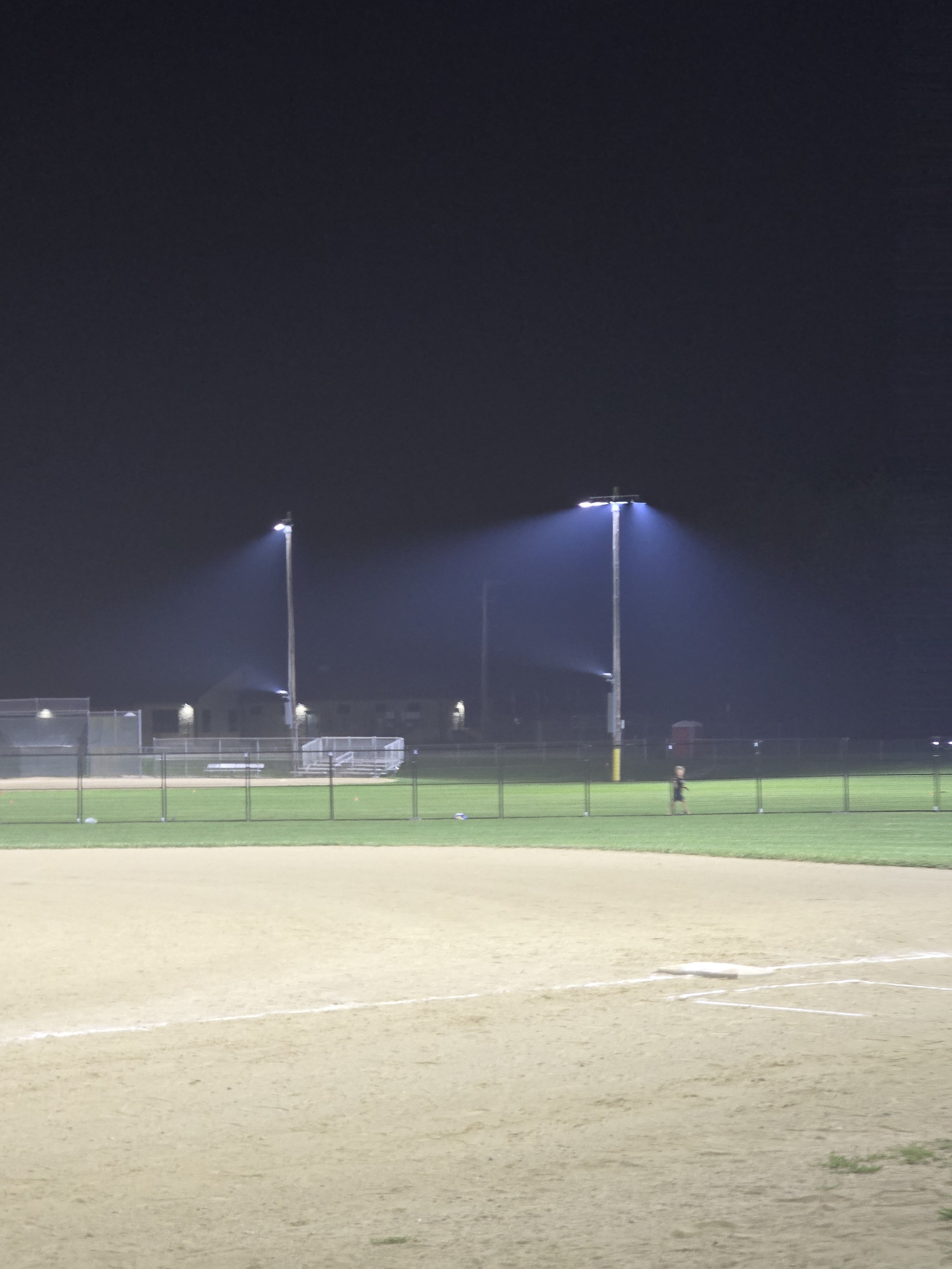
 Smokey Women's all star softball night