All Activity
- Past hour
-

11/8-11/10 First Snow and Lake Effect Event
migratingwx replied to Geoboy645's topic in Lakes/Ohio Valley
That last band was really nice, winding down now and the sky is clearing as I look to my northwest. -

2025-2026 ENSO
40/70 Benchmark replied to 40/70 Benchmark's topic in Weather Forecasting and Discussion
Here is my outlook. -

11/8-11/10 First Snow and Lake Effect Event
vortex replied to Geoboy645's topic in Lakes/Ohio Valley
From a friend who lives between Kankakee and Momence.

-
Snow-globe in Davis this morning
-
Here is the abridged version, but I do encourage you all to take the deeper dive as time permits. https://easternmassweather.blogspot.com/2025/11/winter-2025-2026-offers-return-to.html Winter 2025-2026 DM Forecast Primary Sensible Weather Winter Analogs (*Denotes Strongest Analog): 2024-2025, 2021-2022, 2017-2018, *2000-2001, 1970-1971 *All seasonal anomalies will be measured against 1991-2020 climatology base, regardless of which period is utilized in the composites.* The proverbial "silver bullet" of seasonal forecasting is to identify the most prominent atmospheric drivers amid a planet replete with atmospheric and oceanic oscillations that are all vying for proxy. Winter 2025-2026 will actually be quite unique in that ENSO, the North Pacific and polar domain will all be constructively interfering with one another to collectively facilitate the return of some bonafide intervals of wintry weather on the east coast the likes of which have not been experienced in several years. However, the dilemma is that the west Pacific warm pool will represent the lone voice of dissent, and also the loudest in the hemispheric room. This is likely to prevent what would have been a truly severe winter even a decade or two ago. Be that as it may, a major mid-season thaw not withstanding, the -EPO predominate north Pacific regime will mitigate the modern potent Pacific jet enough to reacclimatize the east coast population centers to something resembling climatological levels if not somewhat more severe. This regime is also consistent with cool La Niña seasons that ultimately transition to warm ENSO the next year, which is likely to happen in 2026, as it did in 1967 and 2008, given the previously referenced subsurface warm pool building on the western flank of ENSO. While the winter may be remembered as "harsh" for the layman that lie in wait to be desensitized to something remotely resembling a normal winter, snow dependent industries along coastal plane will be granted a stay of execution from Mother Nature, while northern New England, the deep interior and higher terrain winter enthusiasts/industries rejoice. The season should finish near normal, anywhere from -1F to +1F degrees above average over northern New England, near normal to +2F across southern New England and the northern mid Atlantic (tristate area), and +1F to +3F over the central and southern mid Atlantic (Philadelphia, Baltimore, DC). Precipitation should finish below normal with the exception of potentially far Western and northern New England being closer to normal. Snowfall will near normal across Northern New England and below average elsewhere. Precipitation will be above normal across New England, near normal over the northern mid Atlantic, and below normal across the central and southern mid Atlantic. Miller B redevelopments and interior primary tracks will be common, with southwest flow events and overrunning events. Any major Miller B winter storms will be focused over New England and perhaps impact the northern mid Atlantic to a degree. Balance of November-December 2025 Outlook December Analogs: 2021, 2017,2008, 2007, 2000, 1981, 1970 Here is how the analog composite fared versus reality for the month of October: And versus current seasonal guidance for November (CFS): The MJO is currently crossing from phase 5 into phase 6, which is triggering the abrupt transition to a much blockier and colder weather pattern that is currently underway. The progress of the wave is then forecast to stagnate as it approaches phase 7 and essentially decays around mid-month. While the cold will moderate for a time, however, the pattern will remain stormier than average, with the first snowfall likely across the higher terrain of northern New England next weekend. High latitude blocking will be consistent as the polar vortex remains weak throughout the balance of November into early December, as the arctic high regime will be prevalent. Arctic High Regime Courtesy Lee et al (2019) Here is the December composite data versus the latest CFS temperature anomaly forecast: Expect this sale style of deviation from the MC forcing during the early portion of the season. December 2017-January 2018: December 2024-January 2025: An official SSW as defined by the reversal of the mean H85mb zonal westerly winds is unlikely, however, there is a low probability of one as suggested both by the minority of guidance, and the December 4, 1981 analog. Should there be a reversal of the H85mb zonal winds, December 4th is a good estimation of the when the PV will reach its weakest point before the recovery begins. The polar vortex should be have consolidated back to at least climatological levels prior to Christmas (18th-24th) and continue to strengthen with moderating temperatures in the east, per research conducted Lee et al (2019), which indicates that the arctic high regime is favored for less than 20 days following a weak PV. This is also consistent with the onset of a reflection event on December 21,1981, just over two weeks after the December 4th SSW. There is a slight chance of Ku event between the first and 15th of the month. The PNA should be variable throughout what will be active month, with numerous SWFE and overrunning events commencing by approximately the 10th. The probability for a White Christmas is above climatological levels given the active pattern and at least seasonable cold throughout the first half of the month, but it remains dubious for the coastal plane given the milder turn prior to the holidays. A Pacific trough should begin to evolve towards the end of the month in conjunction with a rather stout PV, as a mild pattern ensues to ring in 2026. The month of December will average anywhere near normal, anywhere to -1F to +2F, except near normal to +2F across the middle Atlantic. January 2026 Outlook January Analogs: 2025, 2018, 2014, 2002, 2001, 1971 The month will average within a range of +1F to +3F, with the warmth form the first half outweighing the cold departures from the second half. A tale of two months, indeed. The month of January will be a period of tremendous flux that will average mild in the mean. The arctic low regime will be well represented in addition to the Pacific trough pattern throughout the first half of the month. Arctic Low Regime Courtesy of Lee et al (2019) Pacific Trough Regime However, this very mild pattern will also be planting the seeds of its own demise in a truly insidious manner, which will belie what will take place during the second half of a winter that will in no way resemble the canonical La Niña ending of which we have all become accustomed. A stratospheric reflection event will commence over Siberia during mid month, or by the end of the second week, which will trigger the transition back to a colder +TNH type of pattern. January 10-13 January 13-16 January 18-21 Ridge Over CONUS & Southern Canada Retrogrades Towards Alaska January 23-26 January 28-31 Early February Ridge Sits Over Alaska & Amplifies As Strong +PNA Develops This is a transition that is supported on the seasonal European guidance. The cold is likely to initially focus over the plains, causing some consternation amongst weather weenies on the east coast that have been inflicted with warm pool-PTSD over the past ten years, but rest assured, winter will return as the PNA shifts strongly positive. This will be the lone +PNA month of the winter. The pattern will remain active, with inland runners that will produce front-end snowfall over northern New England and rain along the coastal plain during the first half of the month, and then a succession of light-to-moderate overrunning and SWFEs throughout the second half in to early February. February 2026 Outlook February Analogs: 2024, 2022, 2018, 2014,2008, 2002, 2001, 1971 The Alaskan ridge will rule this month, along with -PNA and +NAO. Some -NAO blocking could develop late if stratospheric warming gets underway early enough, but it likely holds off. Alaskan Ridge Regime Courtesy Lee et al (2019) The polar vortex should begin the month fairly strong, but will be weakening rapidly, as a SSW is likely by mid-month. The January-February 2001 transition from reflection event to SSW may be a reasonable expectation, in terms of progression, as RNA pattern resumes and refocuses the cold west prior to any SSW. The interior will continue to be favored for snowfall as the storm track remains either inland or hugs the coast. While not prohibitively warm, this will largely canonical La Niña month with average to below average snowfall on the coastal plane, and average to above average snowfall across the interior. Should the SSW develop in the earlier portion of the 1/17 to 2/17 window, the the second half of the month may change that due to the development of high latitude blocking, however, it is more likely not to occur until mid-month, as previously alluded to. The month will finish between +1F and +3F over New England and +2F to +4F over the mid Atlantic. March 2026 Outlook March Analogs: 2023, 2022, 2018, 2014 2013, 2008, 2006, 2001, 1996, 1971 March should have a -NAO oriented MC deviation similar to that of March 2023, albeit with a less pronounded RNA, which may prove more favorable for a major east coast winter storm. Perhaps something more akin to March 2018: However, the relentless modern Pacific jet will need to be tempered somewhat in order to rival this month in terms of snowfall. Regardless, any February SSW should herald in the return of the Arctic High regime at least to some degree during the month of March. Arctic High Regime Courtesy Lee et al (2019) The month of March should feature the return of the Arctic High pattern, with Greenland blocking and an RNA pattern. The best window of the season for a bonafide KU event will be from March 1-15th, however, the interior may still be favored dependent on just how deep the RNA is out west. The Pacific jet sabotaging any phase attempt is also in play, but the potential is there for a well above normal snowfall month across the region. Temperatures departures should be anywhere from -2F to near normal. The "bust" potential to the forecast obviously grows larger at this lead time, and the primary risk is that the stratospheric warming and subsequent blocking does not materialize and the month is warmer. This is also a risk of the break down of the PV occurs in January instead of February, so the risk here is warmer. December-March 2025-2026 Snowfall Outlook Graphic Courtesy Ben Noll City Predicted Snowfall for 2025-2026 Actual Forecast Error Boston, MA 44-54" ? ? NewYork, NY(Central Park) 19-29" ? ? Philadelphia, PA 14-24" ? ? Baltimore, MD 8-18" ? ? Washington, DC 6-16" ? ? Albany, NY 64-74" ? ? Hartford, CT 44-54" ? ? Providence, RI 33-43" ? ? Worcester, MA 70-80" ? ? Tolland, CT 55-65" ? ? Methuen, MA 60-70" ? ? Hyannis, MA 10-20" ? ? Burlington, VT 96-106" ? ? Portland, ME 81-91" ? ? Concord, NH 67-77" ? ? December-March 2025-2026 Teleconnection Forecast Index Value Predicted '25-'26 DM Value Range Actual '25-'26 DM Value Forecast Error Pacific Decadal Oscillation (PDO) -1.46 to -1.76 ? ? Perennial North American Pattern (PNA) -.08 to -.38 ? ? ENSO OND -0.7 to -0.9 ONI EMI: -.4 to -.6 (Mixed-Type) ? ? (J-M) East Pacific Oscillation (EPO)/DM West Pacific Oscillation (WPO) -.20 to -.50 JM EPO +.02 to +.32 DM WPO ? ? Arctic Oscillation (AO) -.14 to -.44 ? ? North Atlantic Oscillation (NAO) +.04 to +.34 ? ?
-
BTV agrees
-
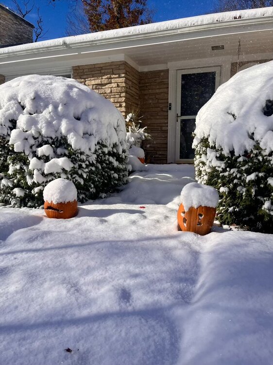
I-75 about 8 miles from me.
-

2025-2026 Fall/Winter Mountain Thread
Maggie Valley Steve replied to Buckethead's topic in Southeastern States
Looking upstream there a bubbly cumulus building ahead of the potent vort max that is diving SSE. It appears to be digging enough to put the SW Mountains in play this afternoon and evening for moderate to heavy snow. Clouds are beginning to build back in around the Valley and snow flurries have increased a bit. In a couple of hours we should begin to see more widespread reports coming in. -
Roundy’s plots look good for the tail end of this month into early-mid December. You won’t like what they show for mid-late December however. Stadiumwave mentioned that fact last week
-
Busted. N flow dominates. Some sn shwrs around the Lakes.
-

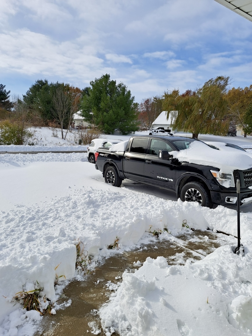
11/8-11/10 First Snow and Lake Effect Event
Jackstraw replied to Geoboy645's topic in Lakes/Ohio Valley
Leaves are covering the snow here. That's pretty funny. Snow plows and leaf blowers lol. Great Sat loop of the Great Lakes as the upper low recedes to the S revealing the extent of it's early season cover.... https://www.star.nesdis.noaa.gov/GOES/sector_band.php?sat=G19§or=cgl&band=GEOCOLOR&length=12 -
Big time snow shower creeping south but it may miss me to the East. Saw a video from around Jellico, it's essentially a white out and I-75 is covered. Someone said that vis was down to 200 feet in it.
-

November 2025 general discussions and probable topic derailings ...
Lava Rock replied to Typhoon Tip's topic in New England
overhyped? wasn't really following, but what happened to the supposed big totals? -
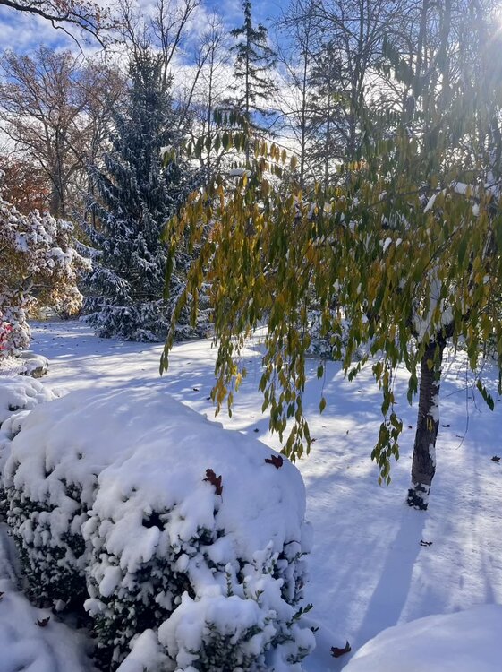
Flew my drone over Cumberland Cove this morning between Monterey and Crossville. Still some good fall colors surprisingly, mixed in with the snow. We are currently in a lull, and the sun was trying to peek out at times. 23 degrees.
-

11/8-11/10 First Snow and Lake Effect Event
MrFreeze6298 replied to Geoboy645's topic in Lakes/Ohio Valley
Hello everyone, apparently there has been 10" of snowfall in Winthrop Harbor (a northern suburb of Chicago)! -
We're so due for a legit winter. I hope we get a White Christmas. Just a solid 3" - 5" event that sticks around for a bit. That's all I'm asking.
-

2025-2026 Fall/Winter Mountain Thread
Buckethead replied to Buckethead's topic in Southeastern States
Pouring huge flakes now with over 2" on the board in Wolf! Sent from my SM-S908U using Tapatalk -
I guess the winds were supposed to be more NNE yesterday vs NE which would’ve put the band over the city.
-
Started and OBS thread, hopefully many of us get the opportunity to post in it this afternoon and evening.
-
We are getting a good snow shower in West Knoxville.
-

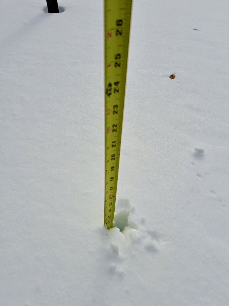
11/8-11/10 First Snow and Lake Effect Event
tuanis replied to Geoboy645's topic in Lakes/Ohio Valley
Ended up with about 6” of lake effect fluff here in Libertyville. Better not be our best storm of the winter
-
It started snowing yesterday evening, and I had around 1/2 inch overnight. Currently light snow and 28. Waiting on the slug of moisture with the S/W in Kentucky to rotate through this afternoon.
-
I like the fact, however, we finally have Roundy in our corner.
-

Pittsburgh PA Fall 2025 Thread
PghPirates27 replied to TheClimateChanger's topic in Upstate New York/Pennsylvania
And so it begins LOL
-
Just like anything else weather wise, the further out you go, the less meaningful they are.