All Activity
- Past hour
-
Extreme Cold, Snow & Sleet: SECS 1/24 - 1/26
RU848789 replied to TriPol's topic in New York City Metro
Just for giggles and the people I share weather info with on a Rutgers sports board, I put together the data set below for New Brunswick, as most posters there are alums and/or live reasonably close by, so NB can be a decent surrogate for much of CNJ and for 95 from Trenton to NYC. Anyway it's total QPF, snow QPF from the 10:1 maps and ZR QPF and sleet QPF, from subtracting the snow/ZR from the QPF (and sleet depth at 3:1). I'll be curious to see which model at 0Z tonight did best, since I'm just 5 miles NE of NB. Thinking my 10.4" snow/sleet prediction is decent (NWS was 11.9" last night when I made my guesstimate and is now 10.1") and I still think (have for a couple of days) 8-12" for CNJ/EPA between 78 and 276/195, as well as the 95 corridor from Philly to NYC is a good call. Have a great storm all. I might paste all the snowfall maps too if I get motivated more. HRRR: 1.5" QPF - 11.6" of snow (1.16" QPF) - 0.12" ZR = 0.22" QPF as sleet or 0.66" sleet (assumes 3:1 ratio) NAM: 1.4" QPF - 5.6" of snow (0.56" QPF) - 0.02" ZR = 0.82" QPF as sleet or 2.46" sleet (assumes 3:1 ratio) ICON: 1.5" QPF - 6.3" of snow (0.63" QPF) - 0.00" ZR = 0.87" QPF as sleet or 2.61" sleet (assumes 3:1 ratio) RRFSA (new NAM): 1.3" QPF - 12.4" of snow (1.24" QPF) - 0.06" ZR = 0.0" QPF as sleet or 0.0" sleet (assumes 3:1 ratio) GDPS (CMC): 1.8" QPF - 9.5" of snow (0.95" QPF) - 0.0" ZR = 0.85" QPF as sleet or 2.55" sleet (assumes 3:1 ratio) UK: 1.1" QPF - 10.2" of snow (1.02" QPF) - 0.0" ZR = 0.08" QPF as sleet or 0.24" sleet (assumes 3:1 ratio) Euro-AIFS: 1.3" QPF - 12.2" of snow (1.22" QPF) - 0.0" ZR = 0.08" QPF as sleet or 0.24" sleet (assumes 3:1 ratio) Euro: 1.2" QPF - 7.2" of snow (0.72" QPF) - 0.1" ZR (this was a guess as the Pivotal algo is suspect) = 0.38" QPF as sleet or 1.14" sleet (assumes 3:1 ratio) -
Was wondering when the virga was gonna go away...that's just little west of me in whitehall.
-

“Cory’s in LA! Let’s MECS!” Jan. 24-26 Disco
40/70 Benchmark replied to TheSnowman's topic in New England
This EURO run gets me to just about 2' on the Kutchie. -
Central PA Winter 25/26 Discussion and Obs
Homie J replied to MAG5035's topic in Upstate New York/Pennsylvania
Already got banding here in State College -
Knoxville's sister city is Atlanta holding steady at 32!
- 437 replies
-
- observations
- obs thread
-
(and 1 more)
Tagged with:
-
Oh I know that. We will carry snow for 12 hours after yall. Hate to do that to you. I am getting completely wrecked right now
-
Central PA Winter 25/26 Discussion and Obs
Ruin replied to MAG5035's topic in Upstate New York/Pennsylvania
Ah wow I just clicked updated forecast now says 6 to 8 lol -

Southern Crippler - Get well soon Jimbo Storm Obs
ForsythWx replied to BooneWX's topic in Southeastern States
It is 14 degrees in Winston-Salem, feels like 2… Lots of white outside from random mix of precip -
Extreme Cold, Snow & Sleet: SECS 1/24 - 1/26
WeatherGeek2025 replied to TriPol's topic in New York City Metro
i'll come back to this conversation by tomorrow night! -

“Cory’s in LA! Let’s MECS!” Jan. 24-26 Disco
40/70 Benchmark replied to TheSnowman's topic in New England
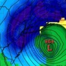
EURO QPF as compared to previous best run, 12z: -
Definitely moderate rates now in DC
-

Extreme Cold, Snow & Sleet: SECS 1/24 - 1/26
wthrmn654 replied to TriPol's topic in New York City Metro
That's about same as earlier total wise -
“Cory’s in LA! Let’s MECS!” Jan. 24-26 Disco
codfishsnowman replied to TheSnowman's topic in New England
I know its OT but I remember that day in July 1989 so well. I walked to worked that day in the early afternoon. The partly sunny sky had a strange look and there was constant low rolling thunder to the north and west. It was warm and humid but there was a nice Southerly breeze. I remember lots of thunder storms later that afternoon. Then when I got home it was all over the news about Bantam and Hamden and parts of New Haven. It sounded like they were all rain wrapped. The damage footage was pretty impressive for SNE. -
13.3/9.1. Here in 21057
-
Southern Crippler - Get well soon Jimbo Storm Obs
JSB99 replied to BooneWX's topic in Southeastern States
Around 28 now with a light glaze on cars (but enough to keep me from raising the wipers). It’s been mostly freezing drizzle since we went below freezing but looks like it’ll pick up here soon -

“Cory’s in LA! Let’s MECS!” Jan. 24-26 Disco
40/70 Benchmark replied to TheSnowman's topic in New England
For you guys to the south... -
Extreme Cold, Snow & Sleet: SECS 1/24 - 1/26
Noteaster101 replied to TriPol's topic in New York City Metro
Well, it’s pretty much now casting now and I’m just going on what the trend has been, don’t kill the messenger, believe me I want to be wrong, but you gotta tell it how it is when the models are showing how it’s gonna play out, that’s simple -

Southern Crippler - Get well soon Jimbo Storm Obs
btownheel replied to BooneWX's topic in Southeastern States
This pixie snow is wild. . -

January 24-26: Miracle or Mirage OBS Thread!
SnowenOutThere replied to Jebman's topic in Mid Atlantic
Hate to do this to you but those heavy returns are the mix line. Some good news is that the mix line itself has collapsed south a bit in the past 30 minutes! -
Hi-res models now in range thing that's ludicrous. .
-
First flakes here on the upper western shore! NE of Baltimore in Harford Co
-

Extreme Cold, Snow & Sleet: SECS 1/24 - 1/26
Snowlover11 replied to TriPol's topic in New York City Metro
Upton readvised their warnings, not good if you want all snow. 8-12 in the city/lower westchester 10-16 NW -
Extreme Cold, Snow & Sleet: SECS 1/24 - 1/26
Noteaster101 replied to TriPol's topic in New York City Metro
Nobody wants to be more wrong than me, but I’m just seeing what I’m seeing, that warm air seems to be very aggressive on pretty much all the models, I mean, I’m here in Rockland County. You think I would be in a sweet spot but even here we’re gonna get shafted, maybe 6 inches at best before the sleet comes in, the New York City area points south and east, looking a lot less -

Southern Crippler - Get well soon Jimbo Storm Obs
Coach McGuirk replied to BooneWX's topic in Southeastern States
22.5 and changed over to mainly sleet.


